Where the heck is White Oak Mountain?
It's a mountain, in North Georgia. It's hard to describe where it is though, exactly. Northwest of Horse Range, assuming that's not an equally obscure name... South of Pinnacle?... Go like you're going to the Raven Cliffs trail, and instead of parking in the lot, just keep going all the way up the road until it says you're not allowed to go any more. The mountain above and to the right is White Oak Mountain.
Why wander off to such a nondescript location?
I do that.
There's this Chattahoochee WMA Map that I found years ago, from 1980, and it shows the woods looking a bit different than it looks today. I'd already gone out in search of some of the other details, but the one that had my attention this past Sunday was how FS244 is shown leading all the way up to White Oak Gap. It's also shown as gated there, as if it might keep going. I'd been up 244 before, years ago, and it stopped well short of the gap. This past Sunday, I was going all the way.
I parked at the last little campsite, way up at the top of FS244.
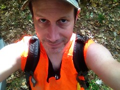
It was about 11 o'clock when I got started, but you never know. Firearms season started October 17th, so I pulled out the orange vest.
There was a maze of little roads up there. It seemed likely that continuing straight, in the most well-travelled-looking direction, and in the direction with the signs that specifically say don't-drive-here-but-it's-cool-to-walk-here, would be a good idea, so I tried that first.
There were indications that people go that way, at times. Right away I noticed this little makeshift shelter.
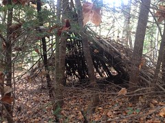
Funny how many of those I've seen in the last year.
And it looked like despite the signs to the contrary, somebody had driven up that way not terribly long ago. The trail was open, free of overgrowth and deadfall, and easy to follow. It seemed somewhat popular and even looked like it might be making a shape similar to the one on that old map.
But then it hung a left and ran directly up one of the spines of whatever unnamed knob that is between Windy and Walnut Gaps, to the very top of the knob. There was a little campsite there, and evidence of a trail leading north. I realized I wasn't at White Oak Gap, but for all I knew, the road went over the back, hung a right, and wound around to the gap. It didn't make all that much sense, I mean who would think to route the road like that? But I've seen stranger things, so I went with it.
Oh, how terribly wrong I was. The trail just bombed directly down another spine on the other side. A firebreak? Perhaps. It ended abruptly at Pleasant Branch (or Pheasant Branch depending on which map you read) and that was that.
Though the trail was uncomfortably steep and sketchy due to it being fall, with the leaves and all, it was also distractingly beautiful up there, what with it being fall, with the leaves and all.
I mean, look at that! And that's even with my iPhone washing the color out.
It was ironic that I'd ended up on Pleasant Branch because that morning, I'd debated whether to go for White Oak Gap or see if there was an old rail leading up Pleasant Branch. I'd opted for the former for some variety, but ended up on Pleasant Branch, just the same. What are the odds?
Across the creek there was what looked like an old skid. It looked like it ought to lead to FS240 and it did. I took the road and rummaged around Allison Ridge for a while without finding anything especially interesting.
I needed to get back up top though, and opted for what looked like a second firebreak, leading uphill from Pleasant Gap.
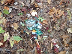
Somewhere in there I found the first mylar balloon of the day.
The firebreak turned out to be the WMA boundary as well.
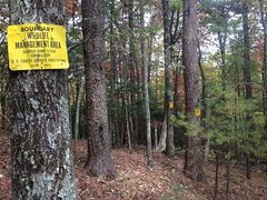
It looked like someone or something goes that way with some regularity too. The firebreak itself was old, unmaintained, sometimes overgrown, and occasionally choked with deadfall, but there was a clear path along or to either side of it, all the way up to the ridge.
The signs appeared to follow that path too, rather than adhering directly to the firebreak. In a few places, like in that photo above, it looked like somebody had maybe not seen a sign in a while, and hammered up a new one, not realizing that he was just standing behind the tree that the sign was on. There were at least two locations where signs were posted, one directly behind another.
At Slater Gap, the woods was really wide open and relatively free of underbrush. It was easy going for a while, but as I approached Double Head, the brush got super, super dense, and I sidehilled around to the north rather than push over the top.
It looked like I wasn't alone in that either. I kept finding game trails, all along the side there, that would run for a few hundred feet before petering out. Pigs? From the rooting, and the droppings, it appeared so. Huge, huge pigs.
Dropping down to White Oak Gap from Double Head was substantially more difficult than I expected. I emerged from the underbrush into a thicket of surprisingly tall Rhododendron. Not that ground-choking mangrove rhodo, but the kind with trunk-like branches that you can walk under. Fortunately, you can walk under it. Unfortunately, it blocks out all sunlight and nothing grows down there. The hillside was super steep, and super sketchy. I slipped once, kind-of sat down onto one hip to save it, but then kept sliding, and started picking up speed. Fortunately the rhodo was dense enough to grab on to, but that's what I had to do to keep from accelerating downhill. Sketchy, sketchy, sketchy.
There was just that once incident though. Other than that, everything went well, and I found the gap without any trouble.
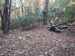
There was some kind of trash up there. Toilet paper, I think. It looked like a popular place.
It was a 4-way intersection too. There were trails leading in every direction. I knew that the one to the east would get me back to the car, so I figured I'd save that for later. It was the one to the west that held my interest. I had an idea where it would wind up, but there was only one way to find out.
The trail was wide open and the canopy was clear way above my head. One good way to tell who uses a trail is by the height and width of the canopy. Hikers like at least 7 feet of clearance and about three feet of width. Mountain bikers like the a little more height clearance but don't mind a little less width, as long as the brush is low enough for the bars to clear. Riders on horseback like a little more height still, and a little more width too. It felt like a horse trail but I didn't see a single track by man, machine or beast though, all the way down the mountain.
I did find a muffler though.

Really old one. If my brother hadn't had a muffler like that on his bike back in the day, I'm not sure I'd have known what it was. So, I guess that's another user. I hadn't actually considered motorcycles, so it was funny that the only evidence I found was from one of them.
It looked like somebody had once maintained the trail too, as a trail, not a road. There were really well constructed (though also very old and backfilled) water bars all over the place.
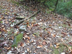
Hard to tell in that photo, but they were constructed of large chunks of rock. It reminded me of the ones up on Wagon Train.
I did eventually find two hoof prints too, and some droppings. One print in sand and another in mud. They looked pretty old though. The droppings looked equally old. Whoever rides up there hasn't in a while, and doesn't appear to very often.
The one trail eventually gave way to a maze of them, all equally well traveled and maintained. I didn't have time to explore them all, but I gave it a shot.
Someone had lost their jacket out there too.
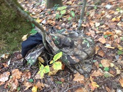
Man, what a drag. I hope they find it.
The topography was fairly complex down in there. More than once I realized that I wasn't where I thought I was, but eventually I figured it out, and when I saw this, it confirmed my suspicions.
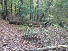
Back in the early 2000's, before USFS published its GIS data, before you could download a map of the forest, I'd find out where things were by driving around with the kids, then riding what I couldn't drive, and then hiking what I couldn't ride. Half the time, with the kids in tow. On one of those excursions, we ended up down FS57 as far as we could go. To that exact spot, in fact.
I recognized the extracted culvert.
I recognized the extraction site.
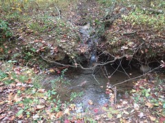
All right, I was on one of the lines that I already had on my map, right about where I thought I was.
I wandered around a bit down there, checking out the side trails in the immediate vicinity.
The weather was great. The trails were clean and open. The treetops were all bright and colorful.
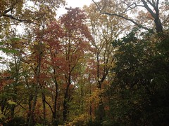
The only problem I had was hunger. Oh, man, it was definitely lunch time. That culvert from earlier seemed like a good spot to kick back on, so I sat up on it and had a bite to eat.
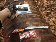
Yeah. That's Skittles and a beef stick, that I'd left in my pack from weeks earlier when I'd brought them along, but never got hungry. Good old sugar and preservatives. Do candy and processed beef even have expiration dates? At the time, I was betting on no.
Hunger sated, I pushed back up over the gap. The trail to the north must lead to FS244. I had a decent idea where even.
Somewhere up there I found the second mylar balloon of the day.
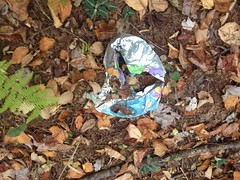
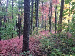
The trail was just as clear and the fall colors were just as spectacular on the east side of the ridge. Maple was red, hickory was yellow, and the oaks were still green.
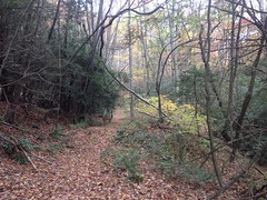
I found the road, just slightly downhill from my truck. Long ago, I'd drawn a little dotted line on my map. Turns out that dotted line was the route up to the gap.
I'd been keeping an eye on the time all day. I needed to get back to the truck by 4 so I could get home by 6, shower up for 6:30 and get to dinner by 7ish. The 24th was our anniversary, but there was a lot going on that evening, so it worked out better to go out for dinner and a movie on the 25th. To do this, I had to stay on schedule. I'd kept an eye on the time, didn't take any risks, timed everything perfectly, arrived back at the truck just prior to 4:00, got changed, jumped in the car, turned on the ignition, and read 5:04 on the clock.
FIVE o-four.
What the hell?
The hell is... My GPS is so old that it predates the 2005 daylight savings time changes. It had already fallen back. All day long, it had been an hour later than my GPS thought it was. I'd never looked at the time on my iPhone because I only pull it out to take pictures. If I'm on-trail, the GPS is almost always in my hand, set on the compass screen, and I'm constantly marking side trails. It seemed like the logical choice as a timepiece.
Damnit.
I could barely enjoy the still-gorgeous fall colors on the way down the mountain.
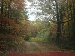
And then, on the way home, I don't think I even went within 10 miles an hour of the speed limit until I hit Highway 400 near Cumming.
Everybody heads home at the same time, on Sunday, it would seem.
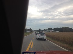
I'm usually getting out of the woods between 8 and 9, grabbing some dinner and getting home by 11 or 12. There's almost no traffic at that time of night.
Goodness!
It turned out all right though. I was home by 7. The Italian Oven is open 'til 10. We were eating by 8, and the movie didn't start until 9:30. It didn't go exactly as planned, but we ended up having plenty of time.
Ok! So! White Oak Mountain, I have discovered some of your secrets. It's likely that I will fix my mountain bike and ride it all over creation first, but I'm coming back! Eventually... to discover more.


No comments:
Post a Comment