My right bike shoe has been struggling for weeks now. The threads that hold the buckle to the side of the shoe have started to break, and tightening the buckle just makes more of them want to break. I shoe-gooed the heck out of it, and clamped it, this past Friday evening, and let it dry for a day and a half. It seemed pretty solid Sunday afternoon, so I figured I'd try it out at Pine Log.
When I got there, the parking lot was full, and there was a crane parked 90-degrees to the street, with a strap around a small house sitting on the back of a flatbed trailer. There were a few police parked nearby, with their lights on. It took me a second to figure out what the heck was going on.
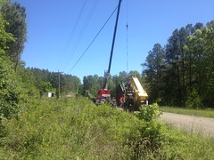
It was a movie shoot. I'd actually passed 2 signs for it near the highway, but I'd apparently taken a slightly different route to the trailhead than the crew, because I hadn't seen any more signs since those. If you zoom in, you can see the camera crew and the giant wind machine. They were about to start shooting as I was getting ready to ride out, but I didn't dally around to see how it would all go down. I had stuff to do, and also when I took that one photo, some lady told me to keep moving, so it didn't seem like they were too keen on spectators. As such, that was the best shot I could get of the goings on.
I passed some guys with bikes in the bed of their truck as I rode in. That would be only the second set of mountain bikers I'd ever seen there. Only the third set of riders of any kind, if you count the one lady on a horse I saw the last time. Not a super-popular place, I guess. This seemed funny to me at the time, given how much I'd been up there lately.
There was hardly anyone back in the woods either. No cars parked along the road. No one fishing by the Lewis Furnace. No one fishing by Grassy Meadow Road. No one hunting turkeys. My shoe hadn't fallen apart yet, on the ride in, so it seemed solid enough to ride on. I wondered if it would hold up to some hiking, so I took the opportunity to explore upper Stamp Creek. If the old mill was up that way, maybe I'd even find it.
Turned out there was a trail back in there. It didn't seem to be a "fishing trail" either, as it purposefully wound around in the woods, well away from the creek. It eventually led to a 4-star campsite on the creek...
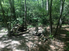
...and then petered out after a short run to the north.
So, I backtracked, picked up the bike, and headed up the road to the next group of campsites, which I'd put off checking out on previous outings because it had always been full. Turned out there were several sites down there, not just one, and there were trails leading up and down Stamp Creek as well. The downstream trail eventually led to a spot directly across from the 4-star campsite. I couldn't see it from the other side, but apparently if I'd crossed the creek through some rocks, I could have picked it up.
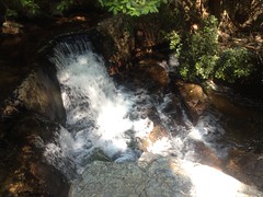
Upstream, the trail crossed a branch and eventually led to a terraced waterfall.
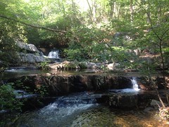
The whole area was ringed by cliffs. The cliffs to the west were fairly accessible.
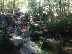
The rocks around the falls itself were like legos, and relatively easy to climb, even in bike shoes, so I got a good look at the upper cascade.
Above the falls, there were more cliffs to the east, but they were difficult to get a good look at this time of year.
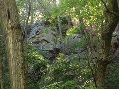
I'll have to come back in the fall or winter.
My shoe-fix was holding up well. One thing that can happen is, if you step next to a rock, then the buckle can catch on the rock and try to pry itself off of the side of the shoe. This happens, seemingly constantly. For some reason, it seems to happen more on my right shoe than left though. I'm not sure why, but it does. Though this continued to happen, the shoe-goo held up promisingly.
Yes, it seemed I had fixed my shoe. I was pleased.
I headed up to the top of the Main Road and followed some trails that I'd seen earlier for a while.
Coming down the Main Road is pretty tricky because it's super, super rutted. You kind of have to pick an island to ride and then deal with it somehow when you have to cross a rut. I was riding the island to the far right, and noticed a sprig of sumac hanging out over it.
Earlier, I had ridden into another such sprig of something else, which whacked the bridge of my nose unexpectedly hard before dragging across it. I didn't realize how badly it had cut me at the time, but it's pretty awesome now, and I suspect people have wondered who I got into a fight with at the various places I've been since then.
Seeing this sprig, I decided I'd rather not get whacked like I had earlier again, and right as I began to think about what I might do, my front wheel slid out from under me, into the rut to my left. I don't know if I touched the brakes, or if I got too close to it, or got too high up on the transition to my right, or what... Whatever it was, I was clearly paying too much attention to that branch and not enough to my line. I slammed on my right hip super hard, and it wracked my whole body.
Whooo.... Took me a second to shake it off. There was an upside though. I used to joke with Kathryn about this. When you crash, you subject your body to forces that you can't easily simulate without crashing, and I swear it does some good. I remember skateboarding, I'd slam dozens of times a day, and if I didn't skate for a week or two for some reason, my back, and neck, and ribs, and hips would get all sore and stiff, and after slamming a few times, I'd feel a lot looser and better. It was like some form of violent, inadvertent chiropractry.
Anyway, I'd had a crick in my neck for weeks, after lying about with that flu for so long, and post-crash it felt great.
Ha!
Upside.
I'm not sure it outweighs the downside though. I have a bruise the size of my hand just below my hip, and my right foot got jammed in between my bike and the side of the rut during the crash, grinding my shoe against it for a foot or two. This completely tore the shoe-goo'ed part of the buckle back off, and popped about 20% of the remaining threads. And, two days later I now see that I have a good bruise all the way across the top of that foot too. Fortunately it doesn't hurt when I walk, just if I press on it.
Oh! And! I lost my glasses. They were in my helmet, and I guess they just went flying. I didn't notice until like 20 minutes later. I must have jinxed it a few days earlier, because I was talking to Kathryn about how I only buy cheap glasses so it's no big loss if I lose them, which I used to do regularly, until I started buying cheap glasses. Now that I only buy cheap glasses, I don't seem to lose them very often. I guess I shouldn't have mentioned it.
Anyway, I shook it off and didn't have any trouble with the rest of the ruts. I did end up behind a guy with 2 kids in the back of his pickup, bouncing down the road like that's a safe thing to do. The kids didn't go flying out though, so I guess it was safe, actually. It's funny though. The only 2 times that I can remember seeing kids in the back of a pickup, since I was a kid myself, both happened recently, in that WMA.
My shoe seemed to be holding together, but it also seemed to have gotten some crap in it, so I stopped a bit later to fiddle with it. Turned out the sole had gotten partially detached and some pebbles had gotten between it and the body of the shoe.
Ha!
Rolling junk show.
Still though, it was good enough, so I climbed up over Pine Log Gap and checked out some side trails up there. With the buckle levered out to the side, my shoe was even more prone to catching rocks, but it held together, and I had duct tape in my pocket if it failed, so I wasn't too worried.
Actually, on the way up to the gap, I noticed an old mine cut across the road from some chunks of ore that I'd noticed during a prior trip. Seeing as Pine Log Gap Road didn't extend to the Sugar Hill area until well after it was shut down, but that it did lead right by the various furnaces to the south, I reasoned that this cut may have provided ore for those furnaces. There may well be more mine cuts on the south side of the WMA. Those furnaces ran for 20+ years. They must have gotten their ore from somewhere!
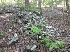
Closer to the gap, I checked out a side trail that I'd seen this past winter. Actually, I didn't see the trail, but rather saw a rock wall, which I presumed had been formed by the clearing of rock from the road.
If you hike the Dockery Lake Trail, or the Hightower Gap trail, or the really old route of Angel Drive in Alex Branch Cove, or probably a dozen other trails that don't immediately come to mind, you'll see that where they follow the fall-line, they are bordered on both sides by tons of chunky rock, which is sometimes dense enough to form little walls. Where they sidehill, they are sometimes bordered on the uphill side, or if they've managed to still get below grade, then sometimes on both sides. I presume that when the road was initially cut, any exposed rock was thrown to the side. To the uphill side, if there was one. To both sides if the road ran up the fall line. Then, as the road got eroded, and rocks got exposed enough to impede horses and/or wagons, people would dig them up and chuck them to the side. Being lazy, they didn't chuck them too far to the side. In either case, if the ground was sufficiently rocky, a nice little wall would form, from this discarded rock.
That is what I presumed was the case with this wall.
Down at the bottom end, it appeared to be so.
There was an old road, running up the fall line, bordered on both sides by rough piles of rock.
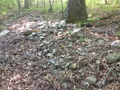
There were various breaks in the wall, and it looked generally haphazard.
Where the road began to sidehill, the wall seemed to continue exclusively to the uphill/east side.
But then the wall got a lot more organized and looked a lot more square than it had further downhill.
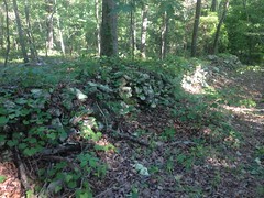
And then the old road bent away from the wall to the west, but the wall continued uphill, became rather bendy, and was composed of flatter rock, which was clearly stacked quite neatly.
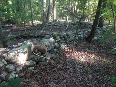
At its furthest extremity, the wall is very well organized, very square, and solid enough to walk on.
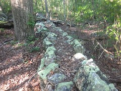
It doesn't hold up the roadbed, and it doesn't retain earth to one side of the roadbed. At the northern end, it kind of blends into a boulder field to the west.
It may have bounded someone's property. To the east of the wall, away from the road, the ground looks somewhat disturbed. There are a few rock piles, which I guess may have been footings or maybe collapsed chimneys. There's a weird, smaller rock wall that juts out to the east, about halfway up the main wall.
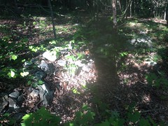
But it doesn't connect to the main wall.
I don't know. The whole thing is weird. There are several breaks in the walls, and it made me wonder if different walls had different purposes. Like the ones at the bottom end of the road were there for the reason I originally thought, and then the more organized wall further uphill bordered some property. I toyed with the idea that it was another mine of some kind, but I couldn't find any evidence of that.
No idea. It made me want to go back up later though, and explore the area more thoroughly.
After that, I headed up over the gap, and down into the Sugar Hill area again. There's a road leading up Little Log Creek that I'd been to the end of once, but that time, a guy had been parked down there, presumably hunting, so I didn't get a chance to see what was back there.
Turns out there are a couple of interesting things back there.
Someone had put together a makeshift blind.

Maybe that same guy I'd seen last time.
And then further back still, I found the ruins of a massive dam.
Tailings from the Cripple Creek Ore Bank line the west side of the road, and I wasn't sure at first that I wasn't just looking at more tailings, but a pair of creeks uphill of the dam had cut quite a gorge into the forest floor.
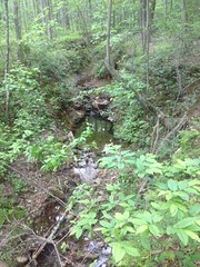
And down in one of them, I could see what was left of pipes that presumably once supplied water to the mining community.
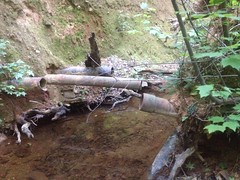
They were buried in the dam when it was built, and presumably buried to their current depth as the lake filled in.
The mine cuts uphill from this lake were much smaller than the cuts above the old lakes further downstream. So, presumably they didn't contribute as much sediment and this lake didn't get completely filled in. There are several channels in the face of the dam though, and it looks like maybe it had been overtopped in a few places before the creek finally settled on the rift it currently occupies. I wondered if it had failed catastrophically at some point. Maybe somebody knows.
It was getting late, and my shoe was feeling sketchy, so I headed out the north end of the system and took the roads back around to my car. Ahh, diversity of trail experience. One of my favorite things.
The movie crew was completely gone when I got back. As was every other car and truck. I'd seen a couple of guys on ATV's parked at Miller Chapel, for some reason, but it was otherwise a ghost town.
Another excellent day at Pine Log. It definitely qualified as Adventure, and I'd been a bit behind on my Adventure quota.
There's still more to see out there though. Maybe me and Billy can hit it up next weekend.


No comments:
Post a Comment