Two weeks into this past month, I was still on my multi-park kick, but felt like hitting some Paulding County trails this time.
First up - Mt. Tabor. My dad and I had ridden there in 2010 (I think), but the park was alleged to still exist, and appeared to even have a few more miles of trail than it had when I'd last been there.
The facilities were a little disappointing though. The men's room was straight-up locked. I have a pretty good idea why though. Reference my 2010 post on A. L. Burrus park some for insight into that, if you like. But it sucked for me because I needed to change, and I didn't want to change in my truck. So, I borrowed the ladies room, and none of the ladies present seemed to mind. One of them even smirked and nodded in a manner that I interpreted to mean something to the effect of: "Go ahead. The men's is locked. I think we both know why."
Ha!
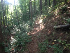
The trail was almost exactly how I remembered it.
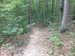
Diverse and fun. The back hill was very different though. Ten years ago it had been logged, and was subsequently choked with sumac. Nothing but sumac. This past ride, it had become a stand of pine. No trace of sumac remained. The pine was fairly mature too. You could see all the way down the hill through it.
I guess a lot can change in 10 years.
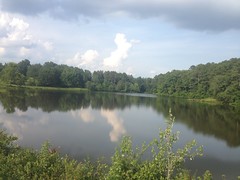
Speaking of things changing too, I rode the various older trails in the park, including the little paved trail that runs down by the lake, and noticed this dedication.
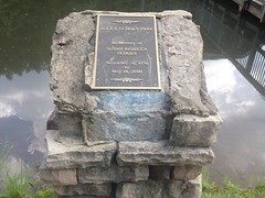
Apparently the park was once called Becky Echols Park. At least the section over by the lake was. The whole place feels very divided. Ball fields and a civic center to the left, lake and trails to the right. I imagine it was originally Becky Echols Park, and got renamed when it was expanded. I'd like to pick some local's brain about that someday.
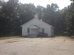
Riding away from the park, I passed Mt. Tabor Church proper, from which the road, and park get their names.
I was on the road for a while after that. The route was a little circuitous, and took me through some commercial areas, and neighborhoods.
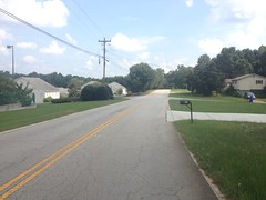
I eventually ended up at the Seaboard Road Lot...
...and picked up the Silver Comet Side Trail soon after.
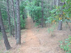
It turned out to be quite a slog. I was somewhat prepared for this, as it had been a slog 10 years ago too. The trail basically parallels the Silver Comet Trail. Considering that the Silver Comet is an old railbed, which was cut directly through every hill and filled every draw in its path, and any trail paralleling it would have to actually climb and descend said mentioned, it ought to be a pretty tough trail. It was, for those reasons, but also, we've had a lot of rain recently. The low-lying areas were soft and overgrown, and the climbs/descents were scoured and chunky.
There were plenty of clean sections, but they didn't look like they'd gotten a lot of traffic recently.
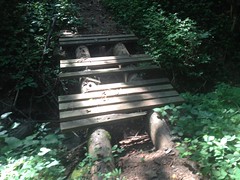
And, if invariably, if I ever did get cruising, I'd hit a ratty old bridge or something.
There were a couple of really nice bench-cut sidehills.
But, only a couple, and one was so choked with kudzu that I had to stop and cut it out of my rear derailleur.
East of the Rambo lot I could see the marker for where I was supposed to go, but after a hundred feet or less, I couldn't discern anything vaguely resembling the trail. I had to hike out, look through the woods for it, and then just walk back in to get back on it when it reappeared.
I'm certain I missed at least one section.
At the very end, it drops you down to some neighborhood, and there's no obvious continuation of the trail. I gave up eventually, took roads back to the Silver Comet, and then took it out to where I was ultimately headed.
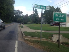
I think I took Mt. Olivett Road back into Dallas.
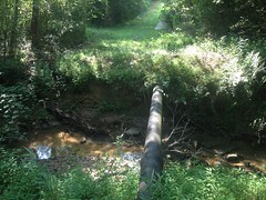
There was a lake out there somewhere.
From there I took main roads over to Sara Babb Park, which I'd never ridden before.
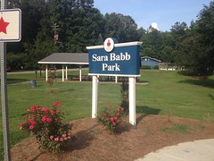
Forever ago, I had received GPS data for the trail system there, but when I looked at a modern map of the trail, it looked nothing at all like the GPS data that I had. I'd heard that the trail was supposed to be a "gateway trail" like the one at North Cooper Lake Park and Haw Creek Park. Wide, non-technical, and not too long. Fun for locals and beginners. Something to get them into the sport.
What I found bore no resemblance to that description.
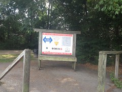
The entrance to the trail itself was as confusing is it gets. There were 2 parallel trails leading off into the woods, and no signs at all. I figured they'd join each other, but they didn't, they just paralleled each other for a while, before eventually diverging. "Ahh, ok, it must be a loop." I thought. But then another trail cross-cut both of them. It was signed "Connector Trail" which made even less sense.
On top of that, these warning signs were EVERYWHERE.
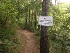
Were they intended to just warn me, or was I already on a trail I wasn't supposed to be on?
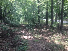
I finally found some red and blue markers indicating that I was on a valid trail, and tried to follow them.
My goodness. The trail was a relentless crawl. I barely had enough gear to climb it. It looked well traveled, but it was incredibly steep. Fortunately, at a point, there weren't any options, and I could easily tell where it was that I was supposed to go. But, then I ran into this:
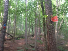
What the heck does that mean? The red and blue markers say "go this way" but the private property sign says "don't go this way." How am I supposed to interpret that? It it private, but you can still ride there? Is it no longer private, but the sign is still up?
No idea.
I was getting tired. I didn't feel like sorting out the maze, and I definitely didn't feel like trespassing, so I backtracked and headed out. When I got home and compared the GPS data to an actual trail map, it looked like I had gone the correct direction, and that if I'd continued, it would at least have followed the trail on the map. I'll have to go back there and sort out the system on foot or something. Maybe, after emailing the Sorba guys for some insight into it first.
Back on the road, it was a relatively short trip back to Mt. Tabor. I passed a guy on a road bike climbing up to the park.
"Hey, how's it going?"
"Not as good as it is for you! Man, I hate this hill."
"Ha! Yeah, it's tough."
I was out of energy at the top, but fortunately, the park was at the top, and I could just coast back to the car.
Whew! What a day. Palding County! Tons of fun.
Ironically, I have to go back out that way right now, to pick up some chairs for a play that Kathryn's working on. I'd better get to it!


No comments:
Post a Comment