A little less than a month ago I rode all around and over the southern end of Taylor Ridge.
I first rode the Pinhoti up on top, way back when I was scouting the TNGA. Unlike most of the rest of the route though, I didn't come back and explore every little side road and side trail. The Pinhoti up there is great, and I just went with it. There's a state park on the west side though, and old topo maps show a dozen little offshoots heading down from the ridge into the valley to the east. USFS GIS data reveals a couple of FS roads too.
It always seemed like it might be a fun place to explore, and I was happy that I'd finally gotten around to doing it.
I parked in the High Point Lot and headed north on whatever road that is.
Right away, I passed some odd little building. I took it for an abandoned old store at first, but after giving it a second look, I wasn't sure that it was a store, or even abandoned.
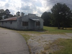
Maybe it was a club of some kind, once. Maybe it still is. No idea. The internet doesn't know either.
Up the road a ways I hung a right on Lick Skillet Road, and then onto Sloppy Floyd Lake road. There I discovered The Reynolds Barn, which looked like a rural-themed event venue kind-of place.

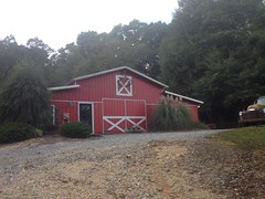

The internet later confirmed this. Looks like they have weddings and family reunions, and such there.
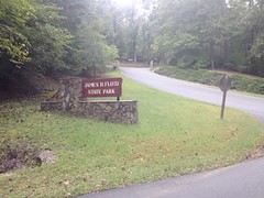
Slightly further up the road was Sloppy Floyd State Park proper.
I rode around the various access roads and campground roads, just generally checking the place out.
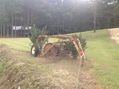
I ran into this poor little guy while doing that.
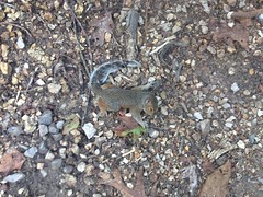
He wasn't quite dead. Every few seconds he'd lurch a bit. It made me really sad for a while, thinking about him.
There are a bunch of hiking trails in the park, including one that allegedly leads to an old marble mine. A pair of them lead up to and back down from the Pinhoti. I'd seen them before. It seemed like the kind of place me and Billy should go explore.
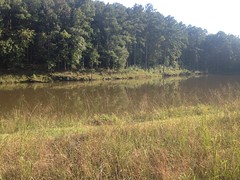
There are a pair of lakes in the park too. Both look popular for fishing. The upper lake is fed by Marble Springs, directly below it, according to old maps.
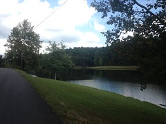
The road between the lakes runs across the dam that creates the upper lake. The lower lake is hemmed in by its own dam.
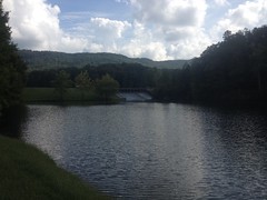
There's another lake (Wildlife Lake) below both of them, but I didn't see it that day. I'm not sure its even open to the public.
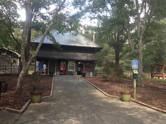
There's a park office/store at the north end of the dam, but I still had a long day ahead of me, so I didn't go in to check it out.
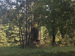
Just up the road from the park, I noticed an old chimney on the Hi-Lo Farms property.
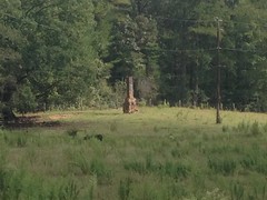
It's way back up off of the road. That's maximum zoom there, but you can see it from the road pretty easily.
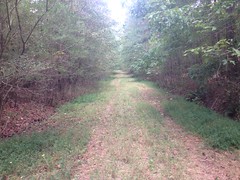
Just up the road from that, FS209 led up the mountain to the east. It was marked FS206 in the field, but FS206 proper is closer to Mack White Gap. I thought maybe they'd connect up, but they didn't.
Still, it was a scenic ride. I wish my phone didn't wash the colors out so badly.
Back up the main road a bit, I followed Wayside Church Road until it hit private property, and discovered some old abandoned rigs right on the side of the road there.
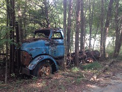
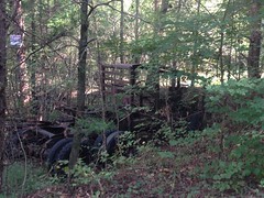
That second one looks like it might have been used in The Road Warrior.
On the way back, I noticed an old, overgrown well that I didn't see on the way in.
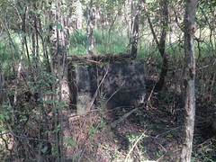
I guess that's what it is.
From there, I headed in the general direction of Mack White Gap. Taylor Ridge loomed above me, but the climb up to it wasn't bad at all.
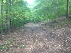
At Mack White Gap, I turned on to FS205 and rode it for as far as it went.
My map showed a dozen old roads leading down to the east, but most of them were completely overgrown. One or two looked passable, but only one or two. I marked them though, and maybe one day I'll come back and check them out on foot. I did find one trail leading east to the Pinhoti. There was a campsite at this end of it, and a really gross pond between the campsite and the road.
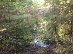
It looks like the construction of the road piled up enough dirt to hem the water in.
It was gross.
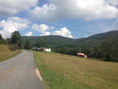
205 teed into 201, and I took it down to Silver Hill Road.
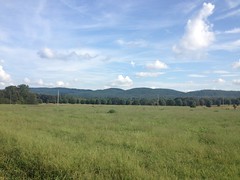
There are a bunch of farms down there, and you can see the surrounding ridges pretty well across their fields, from the road.
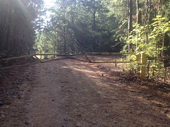
To get back to the truck, I had to climb over that ridge, through Tightsqueeze Gap. There's an old, unmarked dirt road at the bottom of the climb that I hoped would lead back up to FS201, but alas, it was gated a half-mile or so back.
The sign said "No Hunting" but didn't just say "Keep Out" or anything else. I half-considered checking it out, but then also half-considered that I might get shot for doing so, and figured I'd do a little research first.
Silver Hill Road led to Silver Springs Road. There was an old chimney, and a lake on that road.
And at its intersection with the main road, I passed the South Carolina Campground Cemetery.
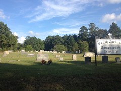
It's funny. You start the TNGA at the South Carolina line, and you almost couldn't be further from South Carolina when you pass that cemetery. People have joked about that in the past. I found a pdf detailing the history of the church online. Apparently many of the church's charter members were originally from South Carolina. Thus the name. The church itself burned down some time in the second half of the last century, but the cemetery remains.
And that was it for that Adventure, if you can call it that. Nothing especially crazy happened. It was kind-of heavy on pavement too, but also pretty heavy on points of interest, so I guess that's a good trade.


No comments:
Post a Comment