I'm presently in Louisiana for the Thanksgiving holidays, and though we've got enough family stuff planned to occupy us all week, I was able to get free for a few hours yesterday morning. I usually bring my road bike to Louisiana, but this time I did a little research and discovered that there are like 5 trails within a few hours of Baton Rouge that I'd never ridden before. The closest was the Bonnet Carré Spillway Trail.
Seemed like a good idea.
I got directions from the BRAMBA website, and they were good enough to get me there without incident. It helped that my parents lived in LaPlace when I was in college too, so I knew the area reasonably well.
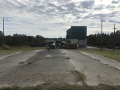
I parked at the singletrack trailhead and got right on the trail.
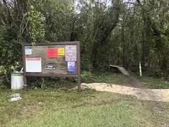
The kiosk called the trail the NOMAMBO BIKE TRAIL (all caps), and it took me a minute to figure out what that meant. "AMBO" was naggingly familiar. I quickly rememberd that the SORBA chapter local to Roswell is called RAMBO. For Roswell Area Mountain Bike Organization. So, maybe the AMBO part meant that. What would NOM be though. New Orleans is often referred to as NOLA (for New Orleans, LA), but I've never heard of it being called NOM. That nagged at me a bit, but at some point, New Orleans Metro came to mind. So, maybe it meant New Orleans Metro Area Mountain Bike Organization. Yep, the internet confirmed that when I got home.
Ha! I discovered your secret code.
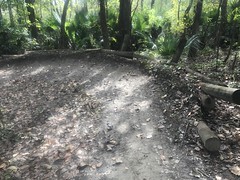
The trail was flowy, twisty, and fun. The soil was made of very fine, dark gray silt. It was wet in a few places and the mud was black. I got it all over my bike, and it was refreshingly different from the coarse, sandy North Georgia clay I've become so accustomed to.
There were bridges in various places. Some in good shape.
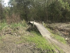
Others looked too dangerous to try, and others still were completely overgrown.
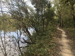
The trail roughly parallels one of the canals, and in a lot of spots, it gets very close to it.
It looks like the trail was originally a good bit shorter than it currently is. But, here and there, they rerouted it back on itself, over and over.
It was super twisty and fun.
There were signs here and there on the trees too. They looked like the road signs in downtown New Orleans. The first one I noticed had some strange word on it that I don't remember. The second said "Seinfeld." The third was the best though:
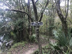
"Take bites of broken glass!"
My buddy Nick from high school was such a Seinfeld and Pantera fan that I wondered, just for a second, if he'd moved to New Orleans, and taken up mountain biking, without me finding out.
If you look up the Spillway Trail on the internet, it shows a photo of a guy railing a berm during some race they must have had there.
This is that berm.
I railed it too, but only because I saw it coming. That whole section is wild. It seemed like you'd have to be pretty familiar with it to be able to rail the whole thing. The berms seemed far away from each other. I guess they wouldn't if you were moving fast enough, but I'd have to ride it a few times to feel confident riding into it faster than I did.
There were some weird shelter ruins somewhere out there.
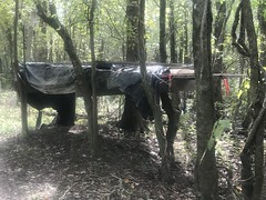
A blind?
A stand for some piece of equipment?
No idea.
When I got back to the lot, I figured I'd explore the local roads. Some of them had to be dirt, right?
There were a few cool things in the immediate vicinity.
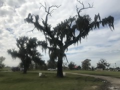
Some really scraggly, mossy oaks right there in the lot...
The canal I'd been paralleling earlier...
A Doppler Radar tower...

One of the many pumping stations in the area...
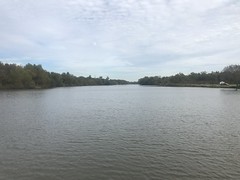
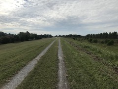
The spillway sits between the Mississippi River and Lake Ponchartrain. When the river gets too high for comfort, they open the floodgates and release water into the lake. There are "guide levees" on either side, running from the river to the lake, and at first glance, the "lower guide levee" looked legal to ride.
I rode south for a while, and eventually through an open gate, and only discovered that the road was closed when I looked back for an unrelated reason and happened to notice the sign posted on the gate itself, which was swung open so far that you could only see it from the opposite direction.
Come on! That's like a trap or something.
There's a causeway running across the spillway that splits it into northern and southern sections. The lot I was parked in was on the east end of the causeway. There were various other roads in the area, but none led into the northern section. I did find an ATV lot, and several ATV/motorcycle trails, but I couldn't tell if they were open to mountain bikes, and they looked pretty muddy too. A couple had just unloaded a 3-wheeler when I drove up. I hadn't seen a 3-wheeler since the '80's. I didn't even know any still existed.
On the south side of the causeway, the lower guide levee was open, all the way to the river.
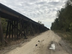
Two different railroads cross the spillway.
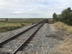
The I-10 causeway sits just offshore in Lake Ponchartrain, and there's a third railroad just onshore. So, 3 railroads, and 2 causeways. I could see a network of roads down on the actual spillway too. One of them had dumptrucks tear-assing back and forth the entire time I was riding.
To the east, the Norco refinery was cranking out whatever they crank out. Gasoline, I imagine. You can see the refinery from the causeway, driving into or out of New Orleans. It's especially visible at night. Looks like a robot city. I'd driven past it on Airline Hwy years back, but never thought I'd be as close to it as I was yesterday.
There were a bunch of pressure vessels up against the fence line.
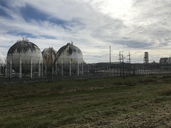
Futher down there were these 2 giant heat exchangers. One of them looked kind of busted up, but it was still working. Those things are so freaking primitive. Wood, cascading water, and a couple of gigantic cans. They always seem out of place to me. Like a box fan aimed at the back of a server rack.
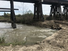
I finally got to the river, and got a look at the floodgates.
Wild! It holds back the river. The whole river. The Mississippi! That just seems impossible. Audacious. Amazing.
I should have taken the River Road to the upper guide levee, but instead, I backtracked to the lot I was parked in, and took Airline Hwy itself to the west side.
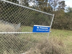
There was another boat ramp there, and it looked like there were a pair of trails leading north from it. I wondered if they led all the way to the lake or not, but there weren't any signs saying who was allowed on the trail. The bike trail specifically says "no horses", and the ATV trail specifically says "no off-road vehicles", so if you assume you can ride unless otherwise specified... No. Probably not a good idea. I should do a little research first.
I did check out the upper guide levee road though. It was similarly blocked toward the lake, but went all the way to the river to the south, just like the lower levee road had.
I followed various roads that spurred off of it, into the interior of the spillway too.
One led along whatever that northern railroad is.
The road had 2 super muddy spots on it, and I crashed after digging in to the bottom of a rut that turned out to be softer than I thought it would be. "Glad nobody saw that!", I thought to myself. Then, I noticed a truck way up the road. When I got to it I had to cross another wet spot, got bogged down, and had to step off. "Looks like fun!" said the guy in the truck. "Did you see me eat it back up the road?" "Yeah..." And we both laughed about it. "You know where you are?" "Yep." That was only kind of true. I knew how to get back to the main road, but I didn't know where I was in relation to much else. There was a gate there, and no side trail, so all I could do was turn around.
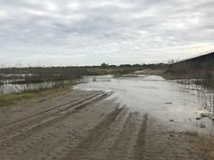
Water was blasting across the road there too.
It looks like there's always some amount of water being released from the Mississippi.
I ended up following the guy back out, and though he had a lot of trouble with that same bunch of ruts that I crashed in, he eventually made it through them.
Closer to the river, I followed another road into the interior, as far as I could.
There was more outflow crossing that road...
...which actually looked passable. I mean, I've crossed rougher looking currents in various North Georgia rivers. But there were signs specifically instructing me not to...
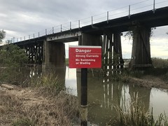
...so I took the conservative route.
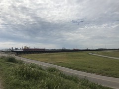
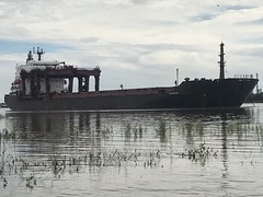
At the river, on that end, there was a road leading up over the Levee, directly into the river. You could literally drive into it if you wanted.
A couple of oil tankers were anchored there...
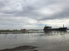
The closest being the Savannah Pearl.
There was a trail leading through the woods, down along the river, but it became overgrown after a short while. I imagine it gets flooded pretty regularly too.
And that was about it for my spillway adventure. I headed back on the road, and crossed the Airline Causeway again.
I needed to get back to Baton Rouge in time to meet some relatives for dinner, but I was also starving, and it was a bit past lunch time. Canes to the rescue.
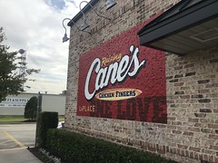
The 3-chicken strip combo was the exact right amount of food to tide me over 'till dinner.
Ca c'est bon, yeah!


No comments:
Post a Comment