Goodness, I don't hike enough any more. Too much TNGA-prep and not enough just walking around. I could feel my back and various leg joints getting softer and softer that whole time too. Fortunately not soft enough to prevent me from doing the ridiculous amount of walking I had to do, but softer than I like. It was even more tragic than that too. I'd bought new shoes a few months back, threw them on the floor of the basement, walked past them a hundred times, and never put them on.
No longer!
Old Cooper Gap Road!
If you climb FS80 a bit, there's an old, unmarked road off to the right. I noticed it the very first time I ever rode up there. Some years later, I rode out on it, only to find lots of downed trees and ripped-out culverts. The road had clearly been decommissioned and abandoned. At the time, I didn't know much about such things. In fact, it was one of the very first side-trails I'd ever explored. I did remember that it led way out to a weird intersection where like 5 other old roadbeds split off of it. I (much) later discovered that two of those were part of the original route of Cooper Gap Road.
Cool!
That was my destination. I wanted to see what the old road was like these days.
So, I drove up, parked, and got distracted immediately. Three troop transports came tearing down from the Gap, a few minutes later I heard a loud explosion near the Ranger camp, and then a commotion of vehicles as well. The Ranger candidates would be involved in maneuvers soon. If I was lucky, I might run into them. But that was only part of the distraction. 10 seconds into the hike, three motorcycles came straight up the slope ahead of me to the left, turned toward me, waved, and rode out onto FS80. Hmm... A trail?
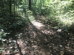
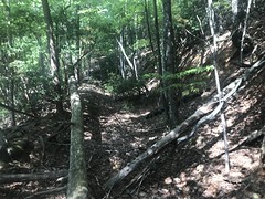
Yep. There was a little spur a few hundred feet up, blocked by a couple of downed trees, and a fall-line trail bypassing them. I explored that little spur 15 year ago. It didn't go far back then, but by the looks of it, it would now.
Yep. These days it becomes a nice little sidehill, and goes and goes...
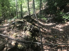
When it starts to flatten out, there are some interesting signs of former habitation.
An old post of some sort:

Some "organized rocks":

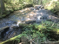
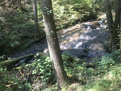
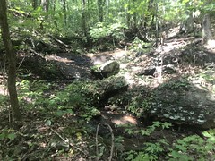
I eventually ended up on Old FS879, which I recognized from having explored it from the other end some 15 years ago as well. There's a bit of a waterfall down there.
Near the road are old bridge piers...

...and there's still even some debris from the bridge itself.

The wooden abutments are still in place too, but they were so covered with rhododendron that it was tough to get a photo.
On the way back up, I noticed even more stuff.
There were three distinct mounds off to the west.

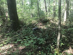

Tailings of some kind, maybe?
At the end of Old 879, there was once a distinct campsite. It's overgrown now, but before the advent of fire rings, 55 gallon drums were apparently common at camp sites, and this one's was still in place.

Woohoo! Detroit homeless fire!
At a point, the trail jumps up onto a little ridge for a bit, and nearby are a couple of fairly deep pits.


Mine shafts? Old bunkers seemed more likely. If so, they were VERY old. But, I think Camp Merrill was founded in the 50's, so that would be plenty of time.
Higher up... It'll be deer and bear season soon.

What seemed like forever later, I finally got back to that original road I was headed out on, and followed it east. There was a small falls-ish thing nearby.
Probably looks more like a waterfall in the winter.
The road was like 20 feet wide, but very flat. I mean, shallow like an old railroad grade. Like a mainline. There was even a good cut that was clearly made to keep it straight and shallow.

The width and lack of stone fills at the creek crossings suggested vehicular traffic, but for a while, the pitch made me suspicious.
There was a ravine up there too, with a rough trail leading up both sides. It looked unnaturally deep and steep.
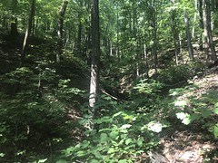
It struck me as having been mined hydraulically. There's a similar ravine up on Old Jones Creek Road that struck me the same way. I can't find any distinct record of mining in the area though, so who knows?
At length I got to the million-way intersection. It turns out that 6 roads come together there. I took the one that I figured was probably Old Cooper Gap Road.
Immediately I found this weird old metal band.

It looked to me like an old barrel hoop. Appropriate. But it could have been anything.
There were long rock walls along the outside edge.

Another sign that this was an old wagon road. As the road wears in, rocks would get exposed in the steeper sections, and people would move them to the side. This eventually forms a rock wall, which encourages erosion, and exposes more rocks, but also makes the road safer. I've seen this on the Hightower Express, Old East Mountaintown, the Dockery Lake Trail, and lots of other unnamed trails.
The old road got decidedly less overgrown at a point, and then soon after, I hit a private property sign.
Time for some lunch.

Mmmm. Delicious.
So, that was as far up as I could go. Down proved a lot more difficult. To start with, the old road was like 6 feet below grade, and a newer route had formed immediately to the east. Following the original route was super difficult. It was much easier to just walk in the woods beside it. Following the newer route wasn't actually that easy either, as it was much less distinct in some places.
I found an old air filter that I remembered having seen way back when I originally explored the area.

I thought I remembered some tires too, but I didn't find any this time.
Progress was terribly slow, as both the old road and woods to either side were pretty dense with brush. The road forked once too, so I got sidetracked for a while.
There was another old post out there on the fork.

Must have had a sign on it at some point.
At great length, the old road flattened out and joined a modern, well-maintained road. Though unmarked, I figured that was probably the beginning of some private property. I knew there was a farm down there somewhere, from aerial photos, and from driving up the road from the other end years ago. When I got back home, and crunched the gps data, it turns out that there's an oddly-shaped inholding up there, and the land that the road lies on becomes private fairly quickly below the intersection. It's totally unmarked, but who'd be crazy enough to go walking around in there?
Climbing back out was even slower, but I made much better progress when I reached the old roadbed that I'd come in on.
When I got back to my car, my brother and Mark B had apparently ridden by it.

I'm a "Psy" it would seem.
Heh.
They'd ridden a fairly epic lasso route that day, starting at the north end of Noontootla. Whew!
I was pretty satisfied with the day's wanderings. I'm now curious about those 3 other old roadbeds at that intersection, but it'll be deer and bear season soon, so it'll probably be a while before I have a good chance to check them out.


No comments:
Post a Comment