Last week I managed to explore the rest of Serenbe. I'm not sure that I saw every single thing, but I saw everything on the map that still exists, and a bit more as well.
I first hit the dirt road behind the park, which is basically just a construction entrance. There was definitely some interesting, ahem, construction, going on in the woods between it and Deer Run. Wink, wink.
There's an obscure parking lot behind some houses near Flynn Ridge Road and what looks like maybe stalls for an open air market or something kind of nearby. Trails lead from behind all of that back into the woods as well. The main destination seemed to be this waterfall.

But there was what appeared to be an old ropes course back in there too, as well as trails to various houses in the area. Across the creek there were more trails, but there was also a sign indicating that the creek was basically the border of the Serenbe property. It didn't specifically say stay out, but I had much more to explore, so I didn't cross.
Next up, I explored the Prom Field area, and found the ruins of the Serenbe Playhouse.


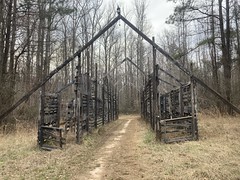
Those are all set pieces. They use them as small stages, and the crowd is in the middle, sometimes moving around. I always wanted to see a production there, but they've been closed since the start of COVID, and were mired in controversy even before that. Maybe someday.
I explored a little maze of trails in and around the Prom Field before making it back out to the main road. There, I met another horse with its head way out over the fence, looking for attention. A lady was walking another horse up the road nearby and we talked a bit. The horse I'd met's name was Murfadurf. That's right. Murfadurf. Super sweet horse. I gave him so many pats and scratches. The horse she was walking was named Dakota. Dakota was decidedly less friendly and only tolerated a single pat.
The last time I was out there, I took what ended up being a side trail over to the Farmettes, before picking up a road and following it around the property. That was, apparently, not the main route. This time, I found the main route, and explored it and the rest of its side trails. One led over and down to the weird pyramid that I'd seen the last time.
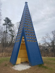
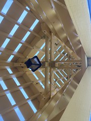
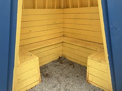
Interestingly, there were more remnants of an old ropes course in that area too.
It really made me wonder about the history of the property.
There was allegedly a little side-loop off of the Cedar Creek Trail that I'd missed the last time, so I tried to find it, only to come up empty handed. I followed the loop around, but there was nothing discernible other than the loop I'd already explored.
Well, not quite NOTHING. I did find this old homestead ruin right where the loop begins/ends.
It doesn't look like much in the photo, but that's a collapsed chimney.
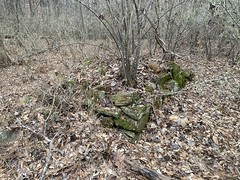
...and footings are visible here.

...with the chimney in the background.
It's a lot more obvious in real life, at least this time of year. You'd be hard pressed to notice anything in the summer.
I tried hard to find rest of the Big Inn Loop up on whatever ridge that is off of Tapp Road. The map shows it running along the ridge to what is now Lobo Loop. I saw the other end of it from that road, but it was way up the hill, and recent construction had made it really difficult to get to. It was the same case on the other end. The trail was gone. A road had been cut where it had been, and lots were getting built on either side. This seems to have been the fate of quite a bit of trail out there, actually. The maps scattered about the property show various loops, but you'd be hard-pressed to follow them exactly as they are shown. The trails are mostly there, but where they used to cross the road, there are now houses and shops. Sometimes the trail has turned into a little sidewalk with steps, leading between the houses. Other times, it just ends.
Still, there is plenty to hike or ride if you end up out there for some reason. Though a bit of a maze, it's still a pretty good system.


No comments:
Post a Comment