For a while now, I've been exploring the various trails in and around Chattahoochee Hills - Boundary Waters and Serenbe in particular, but also trails as far away as in Newnan and Carrollton. The big idea was to put together a "big loop" out there combining the Dirty Sheets roads with trails at the various parks; something in the realm of 100 miles, with longer loop options later. I already had a 70-odd mile loop out there that me, John, and Mark B did about 10 years ago, but it didn't include any trails. It was straightforward to add Boundary Waters, Cochran Mill and Serenbe to that loop, so I threw that together, and headed out a couple of weekends ago to give it a run.
It is also noteable that I was only a week out from a 114 mile fail in Ellijay, and was antsy to actually complete an attempt, and as such was a little nervous that morning. Fortunately those nerves didn't send me running to the bathroom on the drive over, as had been the case the week before, so I was feeling pretty positive when I got to the church.
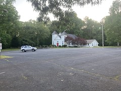
"The church" being the church across the street from Charley's store, where everbody who rides the Silk Sheets parks.

They specifically allow cyclists to park there.
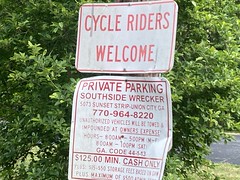
Everybody else gets towed.
The lot was crowded when I got there, people were leaving on their bikes, and arriving in their cars as I got ready. My bike was loaded.
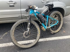
Not that I needed all of that, but a lot of my rides these days double as gear tests, and this one was no different. I'd eaten breakfast at Waffle House, and had a couple of grilled chicken sandwiches strapped to a custom top-tube food-carrier thing for later. This seemed like enough calories, offhand, but I wasn't really sure.
I was also testing out a new kit. For a while now, I've been wearing a standard XC jersey over some non-thermal Pearl Izumi Attack tights. The tights have no chamois, which works great for me. I haven't had a single saddle sore in over a year. The trouble is that the tights have a waistband, which is monumentally uncomfortable compared to bib straps, and just wears on you after 3 or 4 hours. I'd been wanting to try a trisuit for some time now. The minimal chamois might work, it's all one piece, so no waistband, and they're usually sleveless which is great in the summer. I talked to my buddy Kirk about them (he's done tons of tris, including several Ironmans) and he made some recommendations, but I figured I'd grab something cheap off of Amazon first, and if it worked out, pony up for something decent later. The suit had come in earlier in the week, along with a flipbelt to hold my phone, clif-blocks, and other stuff I'd usually put in jersey pockets, and I'd taken it and my fully-loaded BP rig over to North Cooper Lake Park and ridden 27 miles worth of laps around the various flow trails, to make sure the bike would still handle well, and that the kit didn't somehow act weird on technical terrain. So I was on a loaded BP rig, in a trisuit, with hairy legs, riding jumps, berms, drops, and wall rides. Nothing about it could have been more wrong. Everything worked great though. I'd worked to cluster the weight around the center of gravity of the bike, and didn't notice any difference in handling between it loaded and unloaded. The kit worked great too. No muffin-top of doom. The open weave was nice and cool too.
Let's go!
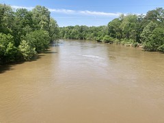
I actually headed north out of the church, across the street, and down some dirt roads along the Chattahoochee. The area is actually a county park, but I forget the name, and it doesn't look a lot like a park. There are various historic churches and buildings along the road. There's also this super-janky bridge that looks like it's one storm away from not being there any more.
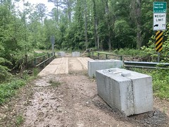
Pretty classic in that area, actually.
The first 10 miles or so are dirt roads and pavement that just loop around to the north, cross the river, and loop back towards Bondary Waters Park.
There are some ruins along the road there that I noticed when I first explored the park but didn't get a photo of.

That's one old chimney and a modern one across from it. I guess they added on to the cabin at some point, and took advantage of more modern building materials.
When I got into Boundary Waters, there were a ton of folks in the lot. It wasn't clear what they were up to, but the lot was packed, and like a hundred people were walking around. It seemed like something was going on, but there was no obvious thing. They didn't look like they were all there for disc golf. IDK.
Along the north end of the property, it floods pretty often, and I found it flooded again this time.
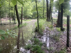
It wasn't a big problem though. I took it as an opportunity to see how well I could push/carry the loaded bike through those kinds of conditions.
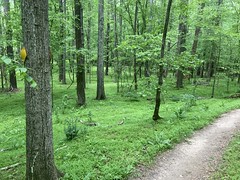
The rest of the park trail was pretty clean. There were a lot of hoofprints, but the trail wasn't soft or muddy. Other than the flooding, conditions were actually better than when I'd first explored the park.
I eventually finished my loop, got back on the road, and crossed the river again.
After a bit of the Silk Sheets, I jumped off on some gravel...

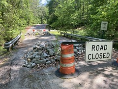
...and wound my way over towards Cochran Mills. I'd hoped to be able to enter the nature center and take the green trail around the back of the property. Years ago, a huge storm had dropped trees across like 50% of that trail, and a few weeks later someone drowned in the creek. As such, the nature center had been closed for a while, but I'd recently noticed it reopened under a different name. Maybe the trails would be clear...
Turned out no. There were signs saying the trails were closed for maintenance, and they looked pretty old.
No matter, I had an idea about how to get about the same mileage in, but it wouldn't be a clean of a loop as I'd originally planned. I.e. if someone else tried to follow the route, they'd have to know where they were going, as it would loop back and cross itself. Not ideal, but not a huge problem, really.
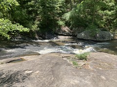
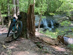
Also, it gave me a chance to see the falls.

And I still got to ride along Bear Creek for a while.
But I didn't get to ride past the old mill or any of the dam ruins upstream.
I did get to shred that glorious Cochran Mill singletrack.

And cross the creek upstream of Henry Mill Falls.
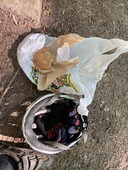
About that time, I was getting hungry, so I ate one of my chicken sandwiches.
I'd been carrying it, and another of the same in a Waffle House bag, strapped via some of those straps that come with a Blackburn Outpost Cage to a heavily modified Salsa Everything Cage which was bolted to my top tube via some custom drilling that Glen had done for me a few weeks back. It was almost as wrong as riding a BP rig on a flow trail in a trisuit, but it actually worked pretty well. The bag was kind-of captured in there, without a lot of pressure on it. It did kind of wiggle around, but after fiddling with it a bit, I got it so that it didn't flop around at all, even on singletrack. I was even able to get it so that it didn't hit my knees much if I stood up to pedal. I need to try it with 3 or 4 sandwiches, bit with 2, it was great.
I saw a snek on the way out of the park...

...and just had to stop for a minute to take in the splendor.
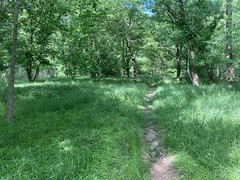
It's really pretty back in there this time of year.
I was nearly out of water in the lot, so I tanked up from the maddeningly slow faucet in the bathroom there. I downed as much as I could too, as it was going to be a bit of a haul before I'd be able to tank up again.
I took Upper Wooten Road...

...back to the Dirty Sheets route, and crossed another janky bridge.
See, plenty of those out there.
I probably rode about 30% of the Dirty Sheets before bailing, heading south, and heading into Serenbe from the west, via the gravel roads with the Farmettes along it.
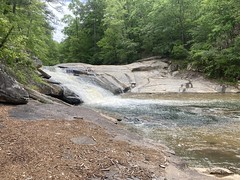
It took longer than I'd expected to get there, and it was getting pretty hot. I'd already gone through one bottle, and was starting to get hungry again, despite also feeling like I'd just eaten. Maybe that one sandwich hadn't been enough lunch after all. No matter, I had another, so when I got to the waterfall...

...I had another little picnic.
I didn't realize until just now that I ate both sandwiches while sitting next to waterfalls.
While I ate, I watched a dad and 2 kids playing on the rocks at the top of the falls. The kids were in bathing suits, and were climbing up and down, getting in the water, splashing, chucking rocks... having a great time. The dad was kind of just keeping an eye on them, and seemed pretty bored, but when they went back up to the top, he started chasing them around and swinging from a low-hanging branch. Ha! He was just a big kid too. Made me smile.
When you eat, you have to drink too, and I downed at least half of the other bottle, but I did feel good, full, and pretty energized. I managed to spin around the south end of the property, still feeling strong...
...,cross under the bridge, and climb up to Indian Rock. The last time I was there I'd actually ridden it, but this time there was just no way.
Some hikers were coming down as I was coming up, and I asked them if they knew which of the rocks up there was Indian Rock proper. They weren't sure.
This one?

Or this one?
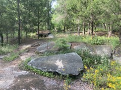
Possibly this one?

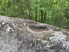
It does have this interesting feature on top.
Or it could be this one?
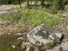
Or this one?
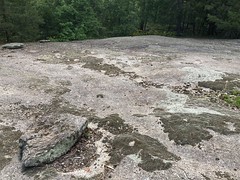
I'm sure somebody knows. It is a specific rock, it's not just the entire outcropping. Of that, I'm pretty sure.
Before long, I was over by PBR, so I figured I'd stop by, fill my now empty bottles, and maybe grab a soda from Glen's fridge.
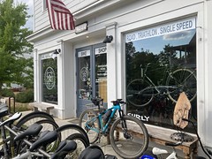
It was right at 6PM though, and the shop was all locked up. I helped myself to the hose though, and the deck chair out front for a few minutes before pressing on.
The rest of the loop through Serenbe took me around to the main road and out the north end of the property, where I picked the Dirty Sheets Loop back up and rode it on out.

I really hadn't felt very good all day. Though I'd made an effort to keep a sane pace, I constantly felt like I was pushing it. I felt hot. I felt dehydrated. It wasn't great. Somewhere in there, everything started feeling better though. I didn't hit proper diesel mode, but I settled into a comfortable level of effort that I felt like I could sit on for as long as I wanted. The precursor. If I continued like that for a couple of hours, I'd be in it. Either unfortunately, or fortunately, depending on how you look at it, I was getting fairly close to the end of the ride, and wouldn't likely be on the bike long enough for that to kick in.
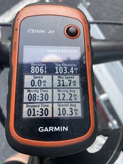
I'd been watching the GPS all day, and somewhere near the end of the Dirty Sheets route, I realized that I was closer to 100 miles than I'd planned on being at that point. Between twisty trail and elevation, the route-building tool that I use can easily be off by 10% as compared to real-life, and it looked like that had been the case.
I rode the rest of the proper gravel on the route, but then just took some pavement back north.
I passed a Valero a few miles from Charley's that I hadn't remembered being there, and couldn't resist stopping for a snack.
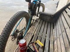
It turned out to be a super hood Valero, but I was apparently that filthy, possibly homeless guy with the thousand yard stare that I'd been at the Mapco on Pocket Road during that last TNGA. Everybody kept avoiding making eye contact with me. I didn't realize until later just how filthy I was. That sparkly dust from those gravel roads was all over my face, and I had multiple levels of farmers tan going.
White people are crazy.
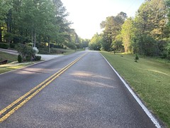
It turns out that it's almost entirely downhill from the traffic circle south of Charley's back to the church. I was spun out completely, almost the whole time. Way to end a ride!
I was the last car in the lot, but it was still daylight.
Hell yeah, 103 miles!
I was tired, but I was also fit to continue. I could have grabbed more sandwiches from the gas station and kept going if I'd wanted. All in all, I was pretty pleased with myself.
That is, until I uploaded my data to Strava. 89 miles.
What?! My GPS said 103. Strava said 89.9.
[cries to the heavens]
How, even?! I hoped to God that my phone had glitched out and missed the first 15 miles or something. I wouldn't be able to figure it out until I got home though, so it ate and ate at me on the drive back.
I finally did figure out what happened though. The night before, while getting stuff ready, I'd put the track in the GPS, and cleared the trip computer. However, in the split second between clearing it and turning it off, it apparently grabbed a single trackpoint. It was 14 miles from that trackpoint, as the crow flies to the church lot. When I turned it on and checked the trip computer, it still said 0 because it hadn't yet grabbed another trackpoint, and then I didn't check the distance until most of the day later. By then, I could easily rationalize it being correct. I didn't double-check vs. strava because I've learned not to mess with strava while riding or you risk accidentally stopping it or otherwise losing your data.
Dang it!!!!
Well, 89.9 miles is still a decent ride, but I totally could have ridden another 10.1. I guess the lesson is to stick to the route, and worst case, you'll just ride more miles.
[cries to the heavens again]
On the upside, the gear worked well. The bike worked well. The trisuit worked really well, except that I forgot to sunscreen my shoulders and they got slightly burned. The flipbelt worked well for carrying most of the stuff that I'd put in my jersey pockets, but it didn't work well for my phone. It's easy to pull the phone out, but it takes 2 hands to put it back in, and you really have to stop. I guess that's not terrible on a long ride, but it's not ideal. I often take photos on the go when I'm on pavement or gravel.
Oh well, more stuff to tweak.


No comments:
Post a Comment