I don't hang out at Mulberry Gap enough. Every time I do, it's great, but for the past year and a half, there's just been too much keeping me away. About a month ago I was fully vaccinated though, and this past Friday, I got to the end of some personal stuff that has been consuming a lot of time and energy as well. There was no family business looming, and work was even oddly stable going into the weekend. Seemed like the perfect opportunity to head up to the mountains.
On the downside though, I've been feeling pretty off, physically, basically since getting back from Pisgah. Weird discomfort in my chest and upper abdomen. It's not gas or constipation - I've been through the remedies for those. Woohoo! It's very unlikely to be covid or the flu - no fever, and I've had all my shots. Weird sensation that moves around on at the base of my right lung. Sometimes it feels tough to get a full breath, or if I do, I still feel like I'm short on O2. Sometimes my heart feels it does when I've been over my lactic threshold for too long, even at low BPMs, for hours or days. Then, it'll ease off and I'll feel fine, but it never really goes away. I've had this a few times before, and it cleared up on its own, but it was never this nagging. Historically, it wouldn't affect my performance either. I was always as strong on the bike, despite how I felt. This time, I definitely notice it affecting my performance around town, but I felt fine riding in Texas, so I figured it was gone, but then it kind-of came back this past week. IDK, but it's apparently not immediately fatal, and I'm going to the Dr. later this week.
So, that sets the scene.
I drove up Saturday morning, after trying to get some Waffle House, but having to settle on Wendy's instead. I parked at the end of a long line of cars, in the only remaining space available and checked in at the front desk. Kate and Andrew were hanging out in the shop, so I talked to them for a while. Zeke Lily was also there. He and Carey had been out doing some long ride, and had either just gotten back, or were stopping in. The last time I saw him was when my and Billy were riding Noontootla, years ago, and he just happened to be parking at the church right as we drove up. We shook hands, said some hellos, and they were back at it. I got something at the shop, but I forget now what it was. Kate had one of the cool new TNGA maps for me. I kept forgetting to order one.
I wanted to do the original Southern Cross Route, back when it was held in the Cohuttas - north from MGap, up to Crandall, back on Mill Creek road, then down off of Potatopatch. Something like that. All I remembered for sure about the route though, was that there was some funnily-named road up near Crandall. I had data for all of the roads, and normally, I'd build a GPS file at home, load it up, and print a map as a fallback, but I'd only decided on doing that particular loop after getting partway up there and seeing that, though it was sunny at the time, it had definitely rained all morning. I didn't know the details of the route offhand, but I'd seen Kate do it a few times on Strava, so I figured she'd know it pretty well. This was the case, though they call it the Back 40 up there. She even had a GPX file of it, and loaded it onto my GPS. That's service! Ha ha.
I'd left my pump in my Dad's car in Texas, so I borrowed theirs, and while doing so, met a guy named Chad who's been volunteering up there for a while now. After like 3 sentences, I was like: "Man, where are you from?" I almost asked "What part of South Louisiana are you from?" but I didn't want to be too presumptuous. Turned out I wouldn't have been: Thibodeaux. Ha ha! We talked all about Louisiana. Turned out he knew Mike Rasch. It ALSO turned out that Mike was staying at MGap that weekend, and was out on a ride at the time!
See, it's always a good time when I hang out at MGap.
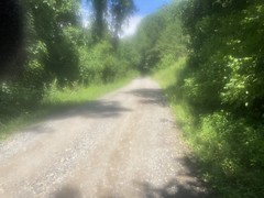
I hit the road a few minutes later, and passed the old firetruck.
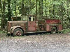
What word starts with an f, and ends with uck? Get your mind out of the gutter! Firetruck.
At Emery Creek/Holly Creek there were a bunch of people out enjoying the day.

Some guy and his wife drove up and asked me all about the local roads and points of interest. It was funny though... He was like: "I pulled over a couple of other people and asked them... You wouldn't believe it! People are just out here driving around. They have no idea where they are or where the roads go!" Something like that. It struck me, but apparently didn't strike him, that he, himeself, was out driving around, with no idea where they were, or where the road went! I could be wrong, but he didn't seem to be trolling me either. I gave them the low-down and they seemed really happy to have found somebody that knew their way around. What was really interesting though, is that he was specifically looking for the Licklog Trail, which I think is up near Chillowee, in Tennessee, north of Big Frog, and they were on the south side of the Cohutta Wilderness. It's a long way to Licklog from there. Still, they were pretty happy with the info I gave them, and I hope they were able to put it to good use.
I felt great cruising (downhillish) along CCC Camp Road, and even better when it became pavement.
I passed a guy on a trail bike finishing up his ride near the bottom of FS218 (Windy Gap) and we hollered at each other as I rode by.
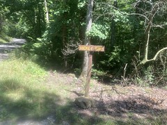
The Ellijay-Crandall Road is unmarked at its intersection with CCC Camp Road, as it turns out, so it was good that I had the GPX track. When I passed it, it seemed right that I'd want to turn about there, but I wouldn't have been sure until much later, even if I had.
"Shorty Lents" was the funnily-named road that I'd remembered, up by Crandall.

I'd been on the roads in the area before, like 20 years ago. My Dad and I got my truck stuck somewhere up there, following questionable directions to the Rocky Flats Trail, and some guys with better 4WD skills than I had at the time rescued us by basically just assuring me that I'd be able to drive it out, which turned out to be true. After finding where we were supposed to park, I remember we rode way south on Rocky Flats, then kept going past the end of the official road, ended up at the back of a some farm field, rode out to the highway, then rode back along the road we'd driven in on. The road with the field would have been Ellijay-Crandall, but I didn't see, or at least didn't recognize the field. Nor, did I notice FS630D (the Rocky Flats Trail) as I climbed FS630.
Speaking of FS630...
It was a pleasure to climb. It turned out to be about 8 miles long, about the same as Noontootla, but a little steeper, and a bit less scenic. Still, I felt pretty good climbing it, and the whole day was kind-of going pretty well.
I was near the end of one of my bottles just as I rode up on a spring that Kate had told me about.
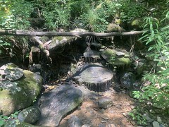
Remembering the lesson I'd learned in Florida so many years ago, I pounded the rest of the bottle that I had, drank as much as I felt like drinking from the spring, and THEN filled my bottle.
As soon as I got back on the bike, it was like someone flicked the suffering switch. I'm not sure why, but everything went immediately downhill. Figuratively, of course. I had another mile or two of climbing still to go, just on FS630.
It was grueling. All those issues I mentioned at the top of this post came back, fairly suddenly. My heart felt like I'd been pushing it for a long time, even though I'd been spinning comfortably all day. I'd try to get a breath, and I felt like my lungs just wouldn't expand. When I'd force a good breath, I still felt like I was suffocating. I had to stop a few times. I'd catch my breath when I did, but the discomfort in my chest persisted. I was getting lightheaded, over and over. My right wrist really hurt too, though I think that was unrelated. I need to fiddle with the grip a bit, and maybe the shifter position.
I've had all of those sensations before, on the bike even, but only when it made sense. It didn't strike me as making sense at the time. It was hot, and I was pouring sweat. But, it was Summer, in Georgia. It's hot, and I pour sweat like that every summer. I couldn't put my finger on the problem, but I was fit to continue, so I did.
At Hickey Gap, I had a hard time getting my super, super wet phone to take a photo.
The wet screen just didn't like my wet fingers. My kingdom for a phone with a touch screen that works when it's wet like that.
You can see how wet the lens was in this shot.
Pouring buckets.
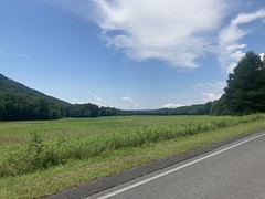
At the intersection with FS17, there is a bit of an overlook, which must be a lot nicer in the winter.
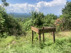
FS630 continues north and FS17 goes due south. The Cohutta Wilderness is to the east, and the Cohutta WMA is to the west. I think Sumac Creek creates that valley there, and the town of Cisco is somewhere to the northwest.
I was less interested in overlooks though, and more interested in the super steep-looking climb to the right. I crawled up it, grannied out, and then kept crawling for like a mile. I want to say it's another 6 or 7 miles from there to FS68. I knew this at the time, but I didn't remember FS17 being all that steep. I guess I'd never been this far down on it, except driving. Heh. It was steep, and relentless, and it never really let up. I mean, there were kicks and flats, but it was mostly just a steady grade, right up the ridge (Rough Ridge?) to FS68.
I stopped several times to catch my breath. I stopped for like 5 minutes at the Mill Creek Overlook.
More sweaty lens action there.
I almost fell asleep sitting there. It was bad.
I knew that I was getting semi-close to FS68 when I hit that overlook though, so that was heartening. I walked the final kick though. There only thing more disheartening that walking on a forest road is when a truck drives by and sees you doing it. This happened. No way to play it off. I was walking on the road.
Heh. I basically wore the soles completely off of my shoes in Pisgah, they're little more than road shoes at the moment. The stitching is slowly coming apart. Both soles came off, and both have been shoe-gooed back on. I also used a couple of screws on one of the soles. "Last legs" would be an understatement. I have a new pair, which I'd brought, and left in the car, that just need a pair of cleats. But, I like to get every last mile out of my gear, and I figured: "Hey, it's gravel roads and pavement all day today. That'll be real easy on the shoes. No matter if the soles are slick and bare. I won't need to walk."
Ha! Famous last words.
I might as well have said "Hey, watch this", or "Hold my beer."
I even wondered, at the time, in my addled state, if some cosmic joke wasn't being played. I.e. I'd have had a good day, all day, if I hadn't chosen to put more miles on those shoes.
Ostensibly, the route takes you to the right, for a run up to the Grassy Mountain Fire Tower, and back. No freaking way. I was headed directly home, but, alas, it's a climb to the left as well, so I had to do that. Fortunately, the climb was short and shallow, and I suffered no additional disgrace at that time.
I remembered it being "all rollers" from there to Potatopatch, but one of them is actually pretty long. It's really more like 3 decent climbs than "all rollers". Oof.
I did notice one really, really obscure thing on the way back. East of the Emery Creek trail, basically at the top of the first climb, heading east, there's a flat spot to the south, with a campsite, and to the north, the hillside is kind of notched. Like it had been dug into, to level the ground there, maybe for a structure, or maybe for a parking area. Whatever it's purpose, it's overgrown now, but you can see how it was notched and levelled and there's a bit of a terrace there where they stopped digging...
So, there's this super, super old video:
This instance of it was uploaded in 2018, but judging from the bikes and attire, I'd guess that it was shot in the '90s. I first saw it in like 2006 or so, not on YouTube. Decent trials riding, really. Anyway, when I first saw it, I recognized Windy Gap, and I recognized Mountaintown (even that specific gravel bar that the guy was doing tricks on), and I think that's the Emery Creek picnic area at one point, but there were a couple of places that I couldn't identify.
Near the end, they're trying to ride up some little terrace, and one guy makes it. When I saw that, it struck me as being that same terrace that I mentioned above. I even tried to describe the location to the people I was watching it with, but nobody knew what spot I was talking about. Since then, I've ridden by there a few times, always meaning to see if it looked right or not, and always forgetting.
Well, I didn't forget last weekend! And... anticlimactically, I'm pretty sure it's not the spot. They're pretty well up in the woods when they try to ride up the terrace, and at the spot that I rode by, the terrace is pretty close to the road. There's also a second terrace in the video, and there's not one (that I noticed) in that spot. But, hey, I didn't forget to look this time.
That was the highlight of the push over to Potatopatch. The lowlights wer more walking, and more suffering.
Ohhh... the suffering.
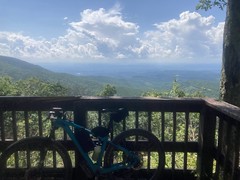
But, if it's a loop, andyou mostly climb for 20+ miles, then you're bound to descend for a long time, at some point. A couple of hundred yards down from Potatpatch, and I felt a lot better. I passed some folks hiking the road with a dog about halfway to the Bear Creek upper lot. I passed several cars and trucks too, only to get repassed at the overlook...
The overlook:


...and then pass them again.
I realized that I hadn't yet descended that on this bike, and it was a dream, though the fork did chatter a bit. I may need to tighten the headset, or it may just be that way. I realized too, that there will be a lot of "Hey, I've never ridden this bike here!" in the future, and it made me kind-of eager to get out and ride some classic stuff.
I roared down the mountain for miles, then climbed that little quarter mile up to Mulberry Gap. Rasch Hole was there when I got back as was Matt Smith and various other old friends! It was dinner time in the barn, so I hung out and talked to everybody for like 2 hours. Some guys were having a birthday party outside, and they gave us their leftover ice cream, which was some extra-good gourmet action. It was like the Dutch Monkey of vanilla. I was actually pretty amazed. Eventually they started turning off the lights in the barn, and it was getting semi-late anyway, so I said my goodbyes and headed home.
I did get Rasch's contact info though, so next time I'm in South Louisiana, we'll go for a ride somewhere.


No comments:
Post a Comment