Sun equals biking. Rain equals hiking.
I'm still rocking the Grand Marquis. With all this rain, I needed a trailhead on pavement. Tooni Mountain has one. Let's try that.
I didn't feel like driving 2 hours up through Dahlonega and over Woody's, so I took Doublehead Gap Road, which does have an unpaved section, but it's short and well maintained. I figured I'd risk it.
Laurel creek was high.

Fortunately not up to the main road though. The Toccoa was high too. It hadn't occured to me that there could be flooding. The rain hadn't been torrential, just steady. But I guess it fills up the river either way.
On the trail. The Benton MacKaye/Duncan Ridge Trail to be exact.
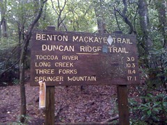
or crail as it were...

The initial climb was pretty steep, then it eased off and I wound around back and forth across the ridge.


The rain was light when I started, but it picked up before long. When it's cold, my jacket is great. When it's warm, I can be soaked with either rain or sweat, my choice. At first I chose sweat, but eventually I took it off and let the rain come down. I was wearing a brand new Craft Pro Cool sleeveless base layer, which turned out to be totally comfortable in the rain, unlike the button-up shirts I usually wear. Awesome.
I'd seen several side trails, none too interesting, but toward the southern end of the mountain, I had to get around a fallen tree and found a very well-worn trail leading east along an old roadbed. The Benton MacKaye went west, but for a minute I wasn't sure which way to go. I'll have to come back for that one, today I wanted to see the Toccoa River and the suspension bridge. Side trails will have to wait.
More crail action. Reminds me of the Ivestor Gap trail when my bro and I hiked the Art Loeb.
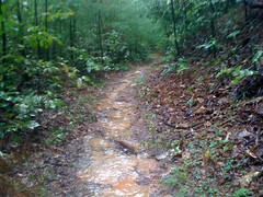
It has been argued, with vigour, to my face, that a hiking trail can be placed anywhere, as foot travel is incapable of causing wear, only bikes and horses wear trails. I guess those folks don't get out much. For example...

Ahh, the Toccoa Suspension Bridge!
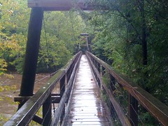
Last time I was here was with the girls. Probably last year, but it seems like so long ago.
On that day, we walked out on the rocks and played in the water. Not today. The rain had all but stopped, but the river was absolutely raging.
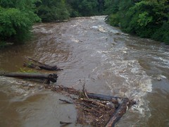
Even the little feeder creek that you cross on the south side to get to the camp sites was raging.

The bridge from the south side.

Crossing the bridge, I wondered how it was built. More specifically, how the materials were transported to the site. On the north side, the Benton MacKaye didn't follow an old roadbed. They could have carried in the cables and wood by hand I guess, but the towers were single timbers. No way they could have been brought in on the trails. Maybe they were cut from trees on the banks. The huge concrete pylons though, did they carry in all that concrete? Maybe there were old roads leading in that I didn't know about. That was now my mission. If they were there, I would discover them.
On the south side, an old roadbed led south and the Benton MacKaye eased off to the right. Ah, ha. The road must lead out to FS333 and they must have brought everything in by truck on that road. I figured I'd take the BMK out to 333 and loop back on that road. Looking at my map, I had a good idea where it would tee in.
The BMK led up a fairly steep hill, turned staircase.

Here's another good example of why rolling dips are better than water bars. The left side of this one is completely back-filled. It would need frequent maintenance to keep it clear, unlike a dip.
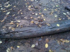
If I'd been here an hour earlier I could have taken a photo of water pouring over it. Every single bar on the entire hill was either back-filled or water was running around one end or the other.
I took a left on 333. It's funny how hard gravel feels when you've been walking on dirt for a while. There was a tree down.
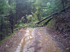
I took the first left. The map shows it leading all the way down to the river, but pretty far upstream of the bridge. I figured a side-road must split off of it somewhere. As it turned out, I was right. There was a gated road, but there was also a large flat camping area next to it. You could drive an 18-wheeler around the gate if you wanted to. The road was pretty rough though.

The old road led right down to the river. Mystery solved. Or at least part of it. How'd they get the stuff down to the north side? Did they cross the river, or was there another road over there.
Next to one of the support pylons, there was this big rock ledge and a hemlock tree twisted it's big gnarly roots all over it. Without something for scale, it looks less impressive here than in person though.

Crossing back over the brige, I noticed a plaque.

Built in '77. Also interesting.
The first time I saw the bridge, me and the girls parked at the end of FS816 and walked out on what looked like "Old 816" before it joined the BMK. But it joined at an odd intersection, with a trail leading east. I hiked back to that intersection and took that trail. It was, in fact, an old road, and led directly to a large camp site on the river. An impressive log jam had built up just offshore, and right when I got there, a bunch of logs came slamming into it from upstream. It sounded unreal. Like a house collapsing or something. Some of the logs kept going, but some got added to the jam.
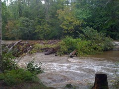
The campside was a bit upstream from the bridge, but another roadbed led directly over to the northern base. Ok, now the mystery was totally solved. It must have been an impressive sight when they brought in the timbers for those towers. Maybe there are photos of that. Seems like the kind of thing that might be documented somewhere. Hmmm.
Moving on...
I hiked back north on the BMK, took a couple of side trails, ended up back on FS816.
There was some sumac growing on the side of the road. Usually a treat, but too late in the season now.
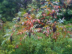
I took a spur of 816 east, hoping it would lead back up to the BMK. It turned out to be part of a network of old logging skidways. I poked around on them for a while. At the end of one the sound of rushing water got my attention.
I imagine it's usually just a trickle, but today, it was a full on, with cascades and pools every 20 feet.


I followed it upstream for a while. Later realizing that following it downstream may have led to a falls, but at that point I was already committed. The drips from a wide ridge of rock appeared at first to be the source...

but once I got above the ridge, there was more. A spring?

...no, further uphill, the stream went underground and just emerged there. I kept climbing and ran into a trail before finding the source. The trail led to the BMK, and to a bunch of other trails. Part of another logging network, or maybe part of the same one I was on earlier. These trails were much cleaner than the others though.
Maybe even used by some ridge runners way back...

It seems that when a road is abandoned, light reaches the ground and thick brush grows up quickly. Later a dense tangle of saplings crowd out the brush. At that point, unless a trail has been kept through it, the road is all but impassible. The saplings grow up though, crowding each other out. Some grow tall, others fall and eventually decay. At that point, very little light reached the ground. The brush is gone, the small trees are gone, and the old road is once again passable, as a trail. This section of the old road appears to be in between the last 2 stages. There were small trees down all over it; brittle, virtually explosive.
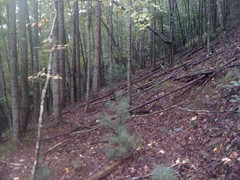
I followed the network of trails north, hoping to tee back into the BMK. But no luck. Eventually the trail I was on led off into a flat area and got swallowed up by the duff.
The woods was wide open though. I could see a long way in any direction and there was very little ground cover.

I needed to go west to get to FS816. It was starting to get too dark for comfort. With all of this open woods, west would be the one direction that was kind of blocked, so I went northwest. The car was actually pretty well due north anyway. Eventually I ran into some more old trails, followed them out to 816 and took 816 back to the car.
Tooni Mountain was pretty cool, despite not finding anything worthy of becoming a point-of-interest on my map. I'll definitely come back. Maybe next time the weather will be better.


No comments:
Post a Comment