We checked out the Bowman's Island area south of Richland Creek, hoping to find a trail crossing the creek and connecting to the trails north of there. No luck, but we had a pretty good time anyway.
We parked on Hwy 20, which was actually kind of challenging. There's a little parking spot just to the east of the Chattahoochee River bridge, but it's got a big no-parking sign. Up the road a bit is another little turn-out with more no-parking signs. West of the bridge there's an abandoned shop with no such signs and a bunch of cars were parked there. We joined them.
Crossing the bridge was nervewracking; inches from heavy traffic at highway speeds. That bridge is longer than it looks. The girls were very careful though.
On the other side, we followed an old roadbed...
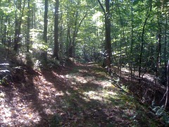
...around, up to a ridge, across the top and back down. A good bit of it was so old and ran across such flat ground, we kept losing it and finding it again.
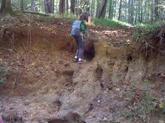
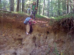
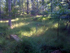
After that we headed north and had to negotiate this little creek crossing.
The trail joined an old roadbed and led north for quite a while before becoming pretty badly overgrown. To the right, the hillside must have been an part of an old farm. It was terraced and bordered by and old barbed wire fence.
After a while the overgrowth became lush. Lush. Why so lush? Perhaps the sprinklers had something to do with it.
They were everywhere. Why sprinklers? And more importantly, were we in an unmarked spray sewage irrigation field? Man that would be bad if they went off. The overgrown road joined a clean gravel road, we kept going. Maybe it would lead out to Suwanee Dam road or something. Nope, it led to a golf course. Maybe the sprinklers belong to the golf course. Maybe we were on their property :/
I really don't like being on private property, but I didn't see any signs. Just the same, we turned around and headed back. Oh, there was a sign, just not visible from the direction we were originally going.
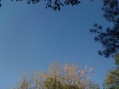
When we were back on corp property, we took a break. The vultures must have thought we were tireder than we were. Dozens circled overhead.
We checked out a couple of trails leading away from the overgrown road, some clean, some pretty overgrown. None led north across Richland.
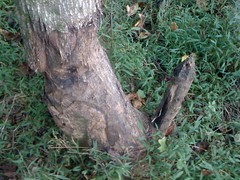
We did find a bunch of green, underripe oranges lying on the ground in a little clearing. I guess the tree above us was an orange tree. It took me a while to figure out what they were, I've got no idea what an orange tree looks like, or an underripe orange for that matter. The juice stained my thumb brown. It's a pretty good stain. I think it's going to be brown for a while.
It's that in-between weather now. Cool in the morning, warm all day, cool in the evening. Sophie was all "Guys, it's sooo hot." Of course, she was wearing a sweater, it was cool when we were riding bikes earlier.

After she took it off, she felt much better.
We headed back and took a side trail down to the river, where we found these awesome rocks.

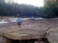
You could walk most of the way out to the middle of the river. We played there for at least half an hour.
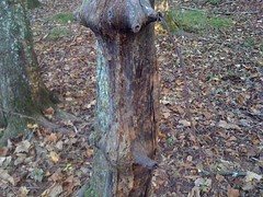
Next, we trekked through beaver country...
...and found more underripe oranges, but nothing else all that interesting.
Crossing the bridge earlier was scary enough. Crossing it going in the same direction as traffic, at dusk was a whole new level. The girls handled their nerves well. We probably won't be doing that again though.
There are a couple of side trails we didn't hit, some ridgelines that might have something interesting up on them, and the whole other side of the river has trails on it too. Good stuff for next time.


No comments:
Post a Comment