A while back I uploaded a bunch of USFS GIS data into my trails site and found out about a bunch of hiking trails that I had no idea were there. A couple around Brasstown Bald piqued my interest and yesterday I got a chance to check them out.
My plan was ambitious, at least for me: park in Young Harris, take the Wagon Train Trail south to Brasstown Bald, head west on the Arkaqua, then jog back to Young Harris on the road, or at least jog as far as I could and walk the rest. Wagon Train is like 6 miles, Arkaqua is 5.5 more, and who knows how much on the road, at least 7 or 8, plus a mile maybe from Young Harris to the Wagon Train proper. How would I fare? Lets find out...
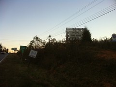
It was tricky getting to the Wagon Train trailhead. After one wrong turn, I found it, sitting there, anonymously. You just have to know it's there.
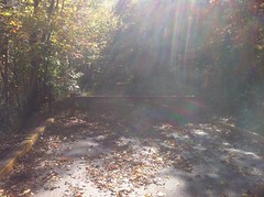
At first it was a gravel roadbed. It didn't look like it got much use, but it looked maintained.
I met a trio of hunters, heading back from their hunt, about a quarter mile in. Camo is one of those things that I never expect to work when I see someone wearing it in a gas station or getting out of their truck. How could it possibly do anything? But I've been surprised several times. In the woods, I've gotten really close to hunters and Army Rangers before realizing they weren't just part of the woods, and then, it was only the movement that gave them away. If they hadn't wanted me to see them, I wouldn't have. It makes me wonder how many times I've walked or ridden right by a hunter or Ranger, hiding in plain sight. Walking up the trail, I was just looking down, looking around, then suddenly an orange square appeared, floating toward me in mid air. "What the heck...?" and only then did I realize that it was the orange vest of an otherwise camouflaged hunter. Actually, there were three of them walking single file. Once again, I was amazed how well the camo worked.
(I was wearing my orange vest too)
"See anything at all today?"
"Nothing all day. Good walk though. Nice day to just have a look around."
"Man, I'll tell ya. Wagon Trail this way?"
"Yep, just up the road."
They were right too, it was a really nice day. High 50's, not a cloud in the sky. Just up the road, I hit the wilderness boundary and a USFS-looking gate. The trail beyond was an old roadbed, but oddly enough, not an old logging road. Legend has it that the road leading up to Brasstown Bald from Hwy 180 had been cut all the way through to Young Harris, but only finished from the highway to the top of the mountain. Eventually the land it ran through became the Brasstown Wilderness and the road became a trail. Locals called it the Wagon Train Trail, presuming it was just that. It was apparently built more recently than that, though I'm not sure exactly when.
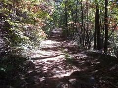
At any rate, after the initial climb up from Young Harris, the trail flattened out a good bit and became much less strenuous. A ribbon of singletrack lay on the outside edge of the old roadbed which meandered along the contours of the ridge.
Frequently, the ground was covered with fruit. Wild grapes and possibly some kind of cherry? The grapes tasted like grapes and had lots of small seeds. The cherry-things had a single pit like a cherry, but I'm always wary of cherry-looking things that I'm not sure of. Anyone know what these are for sure?
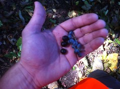
They were everywhere. I couldn't tell what tree they were falling from. I could identify everything above them (or at least I thought I could), and none of those trees bear fruit like this. Weird.
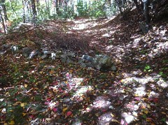
At Double Knob Ridge, I was surprised to find another gate...
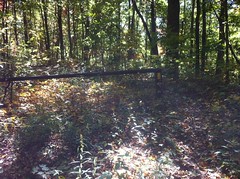
...apparently this was the edge of the wilderness, some time ago.
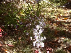
For a while, the canopy over the trail was thin, and these flowers were everywhere.
The trail itself was really nice. It looked like a lot of work had been done on it. Brush and debris had been piled up on the inside. The trail mainly ran along the outside edge with gradual turnouts every so often. Each turnout was armored with rock. Here and there, the trail meandered across the road. "Turn the trail, not the water." Some of the erosion control structures were pretty elaborate.
Maybe we could use something like that up on Bull Mountain.
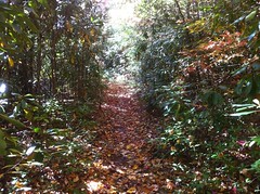
A few sections reminded me of Laurel Mountain; rhodo tunnels, paved with yellow leaf litter.
Further on, a cliff face formed on the east side of the trail. Not a natural cliff, the blasting scars were still visible.
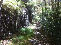
It went on for miles, and I started to appreciate the engineering involved in building that road. I don't know of another road in Georgia that required as much blasting to complete. Maybe some sections of Hwy 76. All that work, and it was never finished. I wonder if it was ever open to vehicles.
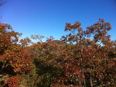
Now and again, I caught glimpses of the neighboring ridges and the valley below through the woods to the west, but never got a good, clear view... until suddenly I did.
Brasstown Bald...
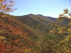
Not too far to go. But it wasn't exactly close either.
So far, the trail looked like it got light to moderate traffic, maybe like the Duncan Ridge gets on Duncan Ridge proper, but from there on, it looked a good bit more worn in. Before long I started seeing day hikers on out-and-back's from Brasstown. I talked to one family for a few minutes.
Near Brasstown there was this little monument, just off the trail.

For a dog? Maybe?
The trail ended as anonymously as it began. It just teed, unmarked, into the road that the shuttles use to ferry tourists up to the observatory from the parking lot. There is a plaque where it crosses the Summit Trail and a gate and kiosk down the trail a bit, but at either end, you've just got to know it's there.
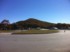
The Brasstown Bald parking lot was just a few hundred yards down the road and it was buzzing. I've been up there a half-dozen times, but never in warm weather and never in the middle of the day. Popular place.
A nice side effect of arriving during tourist time... The general store was open.
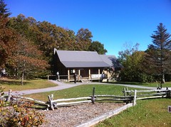
I'd brought food, but I was dying for a Coke. And there was peanut brittle. Score.
I sat down on a bench, snacked, drank, talked with an older gentleman down from Virginia (if memory serves) and eventually started moving again.
I'd felt good all morning; strong legs, solid feet, smooth joints. Standing up from that bench though, I realized that the suffering just hadn't set in yet.
Blisters. Dangit. I thought I was harder than that.
No time for self doubt, better get moving.
The Arkaqua was a lot different than the Wagon Train Trail. Newer, bench cut singletrack and very well worn in. It started out gentle enough, meandering through rhododendron, and I kept catching whiffs of that cinnamon scent I smell up at Bull Mountain all the time. On the approach to Chimney Top, the trail got rocky and chunky.
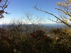
There were a series of overlooks up there.
Mt. Yonah, south of Helen.
Brasstown Bald.
Brasstown Valley.
I've joked before about the lack of creativity involved in naming North Georgia geography. I know, for example, of at least three Wolfpen Gaps. This one takes the cake though. Standing on Chimney Top, I could see another knob, also named Chimney Top, on the ridge I'd walked in on a few hours ago. By the way, that ridge's name: Wolfpen Ridge.
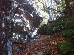
Beyond Chimney Top, the trail got really interesting. There were a few tight squeezes. I came down through this one.
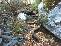
And there were endless, steep, twisty, rocky staircases.
It was about here that my right thigh really started to hurt. Like pulled muscle hurt. Come on! I was out hiking so the rest of my body could heal. Busting up something else wasn't part of the plan. As bad as it hurt, it might still be OK. About six years back, maybe more, I crashed at Blankets Creek, bruising my thigh from knee to hip against the bars. Eventually, the bruise turned into a string of little knots. I stretched and stretched and tore at the adhesions or whatever they were for years. Whenever I'd tear a new one, it always hurt, but it didn't affect my strength. This could just be more of that. There's nothing like steep down-hiking to put a ton of strain on your thighs. They're always tense. More tense or less tense, but always some kind of tense. And the stair steps on this trail just put down hit after hit after hit. If that's what was going on, I'd be OK, it would hurt, but I could keep going. Time would tell.
At Low Gap there was this big block of quartz or something.
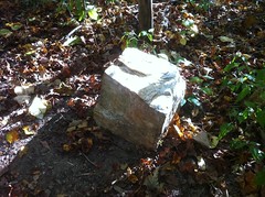
Somebody put in some effort to get that block of rock there. I didn't see anything like it on the adjacent hillsides. It wasn't just rolled downhill. How'd it get there? I sat down, had a snack and stretched my thigh out for a few minutes.
The descent to Trackrock Gap Road was a long, sustained, thigh-crushing, switchback deathmarch. On the upside, my right thigh wasn't getting worse and stretching it out had helped a little. On the downside, I had forgotten my post-Smokies vow to buy a new pair of shoes. On a long (or wet) hike, my feet swell and eventually, no longer fit in these shoes. The toe box is narrow to begin with, and with the swelling, the toe-crushing is epic.
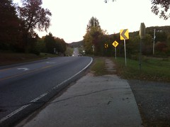
The pavement was a welcome sight.
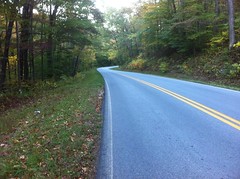
If you've never hiked a road before... After a reasonably long trail, it feels inconceivably hard. Like some kind of medieval foot-spanking torture. But it passes. And the road was infinitely shallower than the trail. I was glad to be on it.
I jogged north for maybe a mile before my toes couldn't take it anymore. I took off my shoes and walked in my socks. That was tough on my heels, but hey, one or the other. See Rule 5.
Wolfpen Ridge. I was up there earlier.
It must have looked funny, but I'd walk in my socks until I didn't feel like doing that anymore, then I'd slide my shoes back on and walk in them until I didn't feel like doing that anymore either, then I'd switch back to the socks. Over and over. Who knows how far it was. 8 miles?
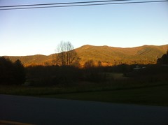
The sun was just starting to think about setting. The breeze was cool. The traffic was light. If it weren't for my toes. It would have been pleasant.
A kayaker stopped and offered me a ride. "No thanks, I'm good." Gotta run what I brung.
This sign was appropriate.
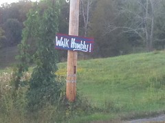
Every day brings a new opportunity to walk humbly. Yesterday's opportunity was just a bit more literal than usual.
Signs of progress.
I wished I was on a bike.
I wondered how many people mistook me for homeless.
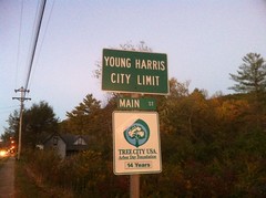
I started recognizing restaurants and shops.
Getting close.
Done.
And only a few minutes after dark. There's nothing like finally seeing your truck after a long day of walking.
I didn't even have to think about where I was going to eat. I'd walked past it a few minutes earlier.
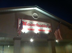
Chicken and Rice Soup, bread and Shrimp Carbonara. Oh yeah. Sitting for so long though, the pain set back in. The walk across the parking lot sucked.
It was in the low 40's outside. For some reason, and it only seems to happen when I'm hiking, not on the bike, if I've been going all day, get really tired and then relax in a warm place, then go back out into cooler weather, not cold, but maybe like 10 degrees cooler, I'll start to shiver uncontrollably until I get warm again. It's weird, and it happened again as soon as I got back into my truck. I pretty much just had to sit there shivering until I didn't shiver any more.
What a day. I learned a lot. Mainly, I'm buying new shoes at the next opportunity. Also, the road-hiking sucked less than I thought it would. It wasn't bad at all, actually. I'm not sure I'll do that particular route again any time soon, but there are plenty more where that came from. On to the next one.


No comments:
Post a Comment