Clark and Suzy were on board, and I met them at their place around 10. They have a herd of dogs.
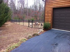
I thought they were deer at first.
Our destination: Gumlog Mountain. I've seen it on the map since way back when I was first trying to figure out the Trans North Georgia route and always wanted to go check it out. It's just a bunch of forest roads, but I dig long forest road rides, and it looked pretty long. Also, it had a chance of still having snow. I missed all the snow last week and darn it, I wanted snow.
It took a couple of tries, but we found FS100, parked and started climbing. The road was a little soft, like 2-miles-of-effort-to-go-a-mile-soft, and it was steep for the first mile, and there was no snow. Not the best start, but pretty soon it got better.
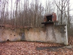
To the left, we noticed some ruins, just off the road, with a little trail leading right to them. Fairly modern ruins, as it were.
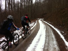
Eventually there was snow, but it wasn't that inch and a half of hard pack with a frosty/grippy-surface awesomeness that I'd hoped for. It was more like riding through a Slush Puppy.
Up the road a bit, we saw this sign.
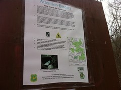
Apparently the Forest Service is trying to bring back the Cerulean Warbler. Henceforth, every bird I saw, was, at first glance, a Cerulean Warbler. I did legitimately see a small, Warbler-sized, blue bird, but it wasn't a Cerulean Warbler. We did see a really big, burly hawk that I thought was an eagle until we got a really good look at it. It's call wasn't exactly hawk-like, or at least not like the calls of the hawks around the metro ATL.
With the trees stripped of their leaves, there were plenty of good views. Ivylog valley:
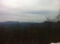
I was digging it. The climbing wasn't so bad, and mostly we climbed, but every now and then we'd hit a little downhill, and the Slush Puppy created a rolling shower, from below.
At Ivglog Gap, it was decision time. My rough plan was to do a lasso; out on FS100, then either continue around and climb back up through the valley and backtrack on FS100, or alternatively, descend into the valley and loop back around to the north. One look down FS852 and it was obvious that climbing it would be better on a drier day.
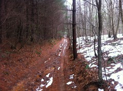
There were fresh tracks on the road. Somebody had been out wheelin' on it, maybe yesterday.
And so began our descent, and the real adventure.
First we found a cool little waterfall.
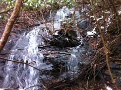
And each of us ended up dunking our feet, though Clark tried really hard not to here.
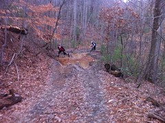
Check out that skill. Most people wouldn't have been able to avoid stepping into the water, or at least, when taking off their right foot, would have been unable to avoid spinning back and dunking their left. Skill. Unfortunately, there's no good way to recover from that stretch. It's bad enough to dunk your foot by accident. It really sucks when you have to decide to do it, especially after such an impressive effort.
About halfway down, we crossed a little creek with a bit more of a hole in it than any of us expected. I managed to skirt it. Clark wasn't so lucky.
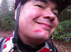
His endo would have been AFV-worthy if I'd been filming. His whole face and torso went into the water and his bars and stem crushed into a rock and even deposited some material on it. The mark on his face was really just a scratch, but it looked awesome. He cut his hand too, but that's what you get when you're not wearing any gloves, so wear your gloves, kids.
Earlier, when I called FS852 a road, I used the term "road" very liberally. At the top, it was heavily braided, with multiple former routes littered to the left and right. The current route was like a narrow Tibbs. Honestly, having some idea of the standards the USFS has for roads, I can't believe it's still open. It's a mess, it's right next to the creek, and it crosses it or its feeders half a dozen times, much like the now-closed-for-the-same-reasons Anderson Creek Trail. But still, it's in the USFS GIS data, there was an open pipe-gate at the top, there were no Kelly Humps and it clearly gets vehicular traffic. We rode it. "Blue on Black"
At the bottom, we were very confused. The details are infinitely complex, but suffice it to say, we tried really, really hard not to, but we ended up walking out on a private drive. There was only one sign, in the opposite direction from the direction we went, the fence lines are confusing, there are old and new fences that don't tie together, a timber sale added to the confusion, the western border of the National Forest there is unmarked, or at least we couldn't find it, USGS maps don't indicate ownership except for NF property, and so on. We tried hard, really hard. In hindsight, it's apparent that Ivylog Gap Road (a county road) ends at private property, but the road continues on that property and eventually becomes FS852. There's private property on both sides at the pavement, but the property to the south alternates between private and NF land. It's not unusual for a county road to run up a valley, bordered by farms and then become an FS road - Darnell Creek, Chestnut Mountain and Old Bucktown come to mind, but I'm sure there are a dozen in Georgia alone. At the time, I couldn't imagine the private drive wasn't a county road. I've never seen a county road become private, become pretty unmaintained, and only THEN become an open, inventoried forest road. I wouldn't have guessed that configuration existed before today.
Needless to say, the land owner was highly dissatisfied, got our attention, and rolled over in his truck, strapped with an AR-15. He started out with some posturing, but it was soon clear that he just felt violated, and maybe a little impotent about it. Like somebody who's house was just broken into, for the third time. Apparently folks regularly drive down the road and exit across his pastures and through his fences, with impunity. Since we were actually hanging around to talk, he seemed torn between kind of wanting to understand and kind of wanting to seize the opportunity to punish somebody, anybody. It was all over the place. He threatened us: "Oh, you won't see me but one more time in your lives", gesturing to his rifle, then later seemed to understand we'd tried to do the right thing and made an honest mistake: "Well, I suppose I've made a few of those in my life too", but then later still tried to call the Sheriff's office, or call somebody at least. Eventually, it occurred to me that we were actually no longer on his property, his threats were idle, and we weren't really obligated to hang around. We all felt bad about the situation though, and it seemed right to stay and talk it out. All in all, it went about as well as it could have. I hate that it happened though. I hate how I made him feel. I try to be a good steward, a good ambassador, and a generally good guy. Every now and then I fail pretty badly.
I guess the lessons are:
* Don't expect signage.
* Road configurations like this apparently do exist.
* Adapt accordingly.
Maybe that third one isn't exactly a lesson, just something to do.
So that's what I learned today. What will I learn tomorrow? What will it cost? What will it cost someone else?
With the day waning, we bailed on the lasso and took some paved roads back around to the truck. An elderly lady walking out to get her mail smiled and waved to us, so did a guy who passed us in his truck. Hey, somebody in the area doesn't hate us. Yay.
Nineteen-ish miles. Somehow it left me with a headache so bad that I had to take some Advil and a nap to kill it.
Maybe not the best way to round out 2010, but conflict aside, it was a good time, with good friends.
Happy New Year!


No comments:
Post a Comment