Yeah! Mountain bike's fixed, more-or-less, and it was supposed to rain hardcore all day today, so I skipped out yesterday evening for some shred up at Allatoona Creek.
I haven't been there in years - my Dad and I rode there just after it had first opened. I remembered glorious bench cut IMBA flow though, and I've been craving that for a while now. Plus, it's probably the closest trail to my house now, it's on The List, I need to put some miles in on the new brakes... Lets go!
I had a little trouble getting there. Traffic was really, really bad, and there are multiple segments of Old Stilesboro Road. Finding the one that the trail was actually on was also a bit difficult. Maybe I should have used a map. But I was like "I know where Old Stilesboro Road is..." It's been a while since I could say this, but I can again! Don't trust me to get you anywhere.
I did get there though, suited up and got right on the trail.
There are all these fields that you ride through at first.
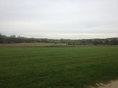
And I remembered part of what I'd liked last time. Diversity. I give a trail more points for diversity of terrain and scenery than for miles of singletrack. I may be alone in that, but I love trails where you ride through fields, under bridges, along creeks, out in the open, through the woods, on tight singletrack, and on open doubletrack... Not that 20 miles of singletrack isn't any good, but it gets pretty anonymous after a while.
Not so at Allatoona Creek! Diversity!
I rolled through the fields and onto the Rusty Bucket, but in my haste, I'd forgotten to fill my water bottle. It had like 2 sips left in it and I realized this about half way around. Ok, back to the bathroom. Filled it up. Let's try again.
Reset.
The fields appeared to have roads cut through them. Having done a little shred already, I felt like doing a little exploring, so I rode around a bit, seeing where things went.
Right away I found some craziness.

"Still water is deep water." as my brother has said. I decided against crossing that particular creek. Maybe next time.
Following the main trail out to the very end, I found a bunch of flooded trails and flooded woods, and eventually the confluence of Allatoona and Little Allatoona Creeks. But it looked like I was getting farther and farther away from anything that would be fun to ride, so I headed back.
Back to the bathrooms again, actually. Or more precisely, to the map near the bathrooms.
There appeared to be multiple new sections of trail out there - Mumbo Jumbo, Voodoo, a new chunk hanging off of Masons Bridge.
Yes! I would ride them.
And I did. And it was spectacular.
Mumbo was basically more of the same twisty singletrack found on Rusty Bucket, but with some amount of climbing involved. The woods was particularly beautiful at the time.
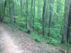
Ahh, yeah. Spring in Georgia. The trees are still leafing. It's just beautiful.
I forgot about Voodoo entirely, and when I hit the turn-off to it, I thought that I'd ridden all of Mumbo. There were two trail runners right there though, pondering what to do.
"How many miles is it back to the parking lot in the direction you just came?"
I was bewildered. The sign right there said that it was a 2 mile loop. If we were at the entrance/exit of Mumbo, it would be 2 miles. Or they could just turn around and go directly back to the parking lot, and it would be zero miles. I wasn't sure how to answer them.
"Aren't you coming from the parking lot now?"
"No, that's Voodoo."
"Ahh, I'm not where I think I am!"
And we laughed. I definitely need to shake more of the rust off of my Adventure skills. That was pretty bad.
"Have you ever ridden Voodoo?."
"No, not yet."
"Well, good luck to you!"
And we laughed again. They didn't spoil it for me though, and tell me what lay ahead.
It started out with a cool little set of puncheons that led around some trees, with a green "Keep Right" sign on either end. Then there was this craziness.
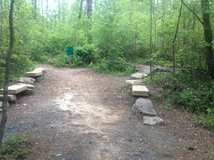
Rocks and logs and benches on either side.
Ohhhh Kaaay...
The rest of the trail was even gnarlier. Basically every few hundred yards there was some kind of obstacle. Rock pile, log ride, skinny bridge... Something. I didn't just ride into the first one though, and that it turned out to have been a good idea. The first obstacle was this series of rocks, but you had to keep speed and drop off of the last one. The speed I had wouldn't have been sufficient.
I didn't ride into the next few either, but they would have been fine to have, so I started riding into them, and the rest of them were fine.
Somewhere in there, there was this gigantic root ball.
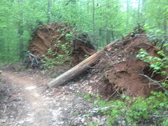
And this log ride looked fine but the other end of it was really steep and sketchy.
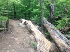
And I had too much fun on the rest of the trail to stop and take photos. There were some fall-line climbs out there though, or at least some climbs that didn't seem to follow the half-backslope rule. And a set of lazy switchbacks with the same issue. Maybe they did that on purpose though, so they would erode a bit. I don't know. Give how IMBA the rest of the trail is, it was surprising to see.
But man, those obstacles were fun.
Toward the end of the trail, it had that whole "I just built this" kind of feel: fresh dingo tracks, components of future obstacles scattered hither and tither... There might be even more fun in store, in the future. I'll keep an eye out.
The map made it look like there was another loop out past Mason's Bridge, so I headed over there next.
In fact, there was a new (to me at least) section of the connector too. You used to just run down along the creek. Now, on the way out, you hit some singletrack up in the woods, and run along the creek on the way back.
Under the bridge, I stopped to get a photo of the artwork on the far side.
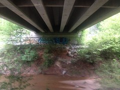
And of the creek itself.
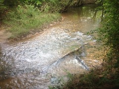
Which I half-wanted to climb down and play in.
But there was an odd, acrylic smell in the air, and turning around I noticed several young men milling about up right up under the roadway. One appeared to be trying to light something. They either didn't notice me, or ignored me. I didn't want to hang around though.
I'd ridden the Mason's Bridge trail before, but I didn't remember it. It was just more of the same fast, semi-twisty bench cut IMBA glory. Not too much climbing, just pure shred.
Somewhere out there, I ran into this Biceratops.
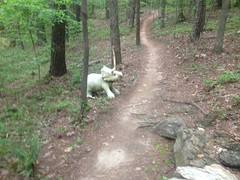
I call it a "Bi"ceratops because the nose horn was missing.
At the half-way point I merged onto Mason's Bluff, though at that intersection it was only marked as "Loop 2". It seemed to have slightly more climbing, but it's possible that I just imagined that. About two thirds of the way around, I saw a sign, thought that I was done, merged left and found myself out in the middle of a field with a guy walking his dog to my left and a lake ahead of me.
Hmm...
Turns out that's Bobe Lake. Also, I was pretty sure I'd made a wrong turn. In either direction, the trail appeared to just lead out to the neighborhood.
I spun back and that's when I saw the sign labeling the trail "Mason's Bluff". So, I guess that's the name of that loop: Mason's Bluff.
It was right about then that I started realizing just how dark it was getting. I was almost as far as I could be from the car, at that particular trail system, and it was starting to get difficult to see.
I put it down a little harder on the way back, but it's been a while and my bike handling skills seemed a little deficient. It's funny how riding a bike comes right back, but riding it well takes a while. I had plenty of energy, but I didn't have the skills to bring it to bear.
I did make it out in time though. The sun was down, but I didn't have too much trouble seeing the trail. The guys under the bridge were still there when I rode back through. One of them was lying down on a bench. I thought they were homeless at first, but they seemed to have a car parked up at the road. Maybe they weren't sleeping down there. Maybe they were just planning on decorating the bridge a little more. I guess I'll find out next time I'm down under there.
When I got back to the lot, there were still 2 more cars. Some guy was lying in the grass stretching too. Maybe he'd been out for a run.
It only took 45 minutes to get home, and I don't think I took the most expeditious route. Not bad though, compared to the hour and a half it took to get there, during rush hour, and after getting lost a few times.
Allatoona Creek! After crunching the data, it looks like there are almost 20 miles of trail out there, and there are two loops south of Old Stilesboro that I haven't even ridden yet. And there appear to be at least 10 miles of proposed trail that haven't yet been built. Woohooo!
I think I might have found my new favorite in-town trail.


No comments:
Post a Comment