It occurred to me yesterday, looking back at these recent journal entries, that one might conclude that all I do these days is hike the Upper Chattahoochee. I have done a fair amount of that, but it is, by no means, all I do. It's just all that I've done lately that's really worth mentioning. I'm on the road bike for a couple of hours 2 or 3 times during the week. That, or ripping singletrack at Allatoona. But those rides are generally uneventful. I guess I need to do some more eventful cycling. Come to think of it, I have been missing that lately. Hmm...
Of course, that said, this past Sunday I WAS back exploring the Upper Chattahoochee again. I've become somewhat interested in the "lost" history of the area. The Byrd-Matthews company built a rail network all through there way back, there were settlements back in there, and there's the Unicoi Turnpike too. None of these things are on any modern map. There are clues here and there though, and if you follow them, they lead to interesting discoveries. I dig that kind of thing.
Combine that with just generally enjoying being in the woods, generally enjoying exploring, wanting to recover my hiking legs, and the fact that Clark and Suzy live up there and might be able to join me from time-to-time... Exploring the Upper Chattahoochee reliably strikes me as a good thing to do.
As such, I did more of it again, yesterday.
Last weekend, I found that there's a clean trail leading north up into the Wilderness above the Upper Chattahoochee Campground, along the river itself. It was getting late though, so I didn't get to follow it too far.
Yesterday I tried to see where it went.
I parked outside the gates of the campground and headed up through it. Pretty quickly I ran into a guy and we talked about the various falls back there. He wanted to let me know about the second one, in case I didn't.
I did. The second one:
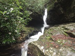
I described it to him like: "water comes tearing down through a crack in the rock" and he knew right away that I'd seen it. Knowledge of that falls is apparently not terribly mainstream, and he almost congratulated me on having it. Super friendly guy too. I love running into people like that.
So, I followed the river up north of the campground. Last week I'd followed a trail on the west side, but there was a trail on the east side too. Turns out it joins the other trail at the falls.
Last week, I'd decided that the old railbed ended at the campground, but it appeared that I was wrong about that. The rail also followed the east side of the creek, and apparently, once climbed directly up over the falls. Goodness. The engineering involved... I want to see a photo of that trestle.
The old railbed kept going too. Last week I hadn't even tried to look for it, but yesterday I did, and it was easy to follow. The trail zig-zagged across it sometimes. Sometimes paralleled it. Sometimes led right down it.
There's a field up there too. Crain Field, I think. It's the last maintained human construction below the Wilderness. Yesterday there were several wild boar in the field. As I emerged from the woods, one of them saw me, grunted, spun around, and took off. When it did, at least 4 more followed. I didn't know what it was at first. My mind was like: "that's close! not a deer... bear? boar!" At "bear" I instinctively raised my arms above my head.
I got in a bit of an argument with a doctor about 2 years ago about what I'd do if a bear suddenly walked through the door. Seriously, this actually came up. He contended that my instinct would be to run and thus the bear would kill me. I contended that I would likely stand and raise my arms up because I know to do it, and that's what I'd done in the past when I'd gotten up close to a bear. But, it did make me wonder... In the past, I'd had time to think for a second and choose how to respond. What would I do if I didn't have that second? It appears that I would, in fact, raise my arms. I've apparently trained myself to do that. All right! There you go.
The boar were hidden by the tall flowers but they were grunting and squealing off to the left of me as I circumnavigated the field. I spoke to them nervously. "Yeah, I hear you over there. Keep at it. Whatever you're up to. No need to come over here." Eventually, I put them behind me.
The trail/old-railbed led way up past where I'd been before. When I reached what I thought was the first confluence in the river, I followed the left branch. Turned out though, that I was actually at the second confluence, and needed to have followed the middle branch.
Heh.
It looked like I wasn't the only one that had been confused. There were several wrong-way-trails in the area that eventually petered out. Apparently everybody else figured out where to go though. I doggedly stuck to the left branch though, ignoring indications of trails to the right, figured the trail and old railbed must just end there, and ended up, oblivious to my error, bushwhacking along some unnamed branch all the way up to the AT.
It didn't help that the area was shot full of game trails. I'd end up on one for a few hundred yards, thinking "oh, THIS is the trail" but then it would just disappear. It also didn't help that way down along a creek there are no peaks visible, all you have to nav by is other, intersecting creeks. But, most of all, it didn't help that I didn't once consider consulting the compass (or GPS!) to make sure I was even generally heading in the right direction.
The woods was more-or-less open though, and relatively easy to get through. It had rained earlier, and sprinkled off and on while I was walking. Everything was wet, but if you don't mind the walking shower, it's great. Turns out that wet leaves and branches slip right past you without scratching. Ha!
I found several interesting things up there too.
First, it looked like somebody else might have done what I did.
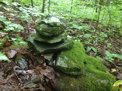
Or, hopefully they did it on purpose.
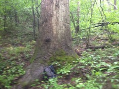
There were also several large trees. Not champions, but certainly bigger than everything around them.
I think this is a red oak.
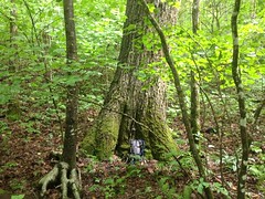
There were two decent sized poplars too.
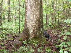
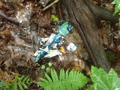
And, of course, the requisite mylar balloon.
It's not terribly steep up there either. I had a very easy time with the grade. It wasn't that "walk 20 feet, rest, walk 20 more, rest" thing that I've had to do in the past.
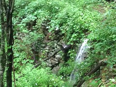
I hit the AT at what looked like a fortified wall. I took a picture of it, but it turned out super blurry. It looked a lot like this though:
The AT itself was kind of wide, flat, rocky, and really shallow in both directions. Parts of it had been blasted out of the surrounding rock.
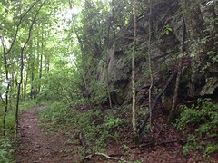
The stream crossings were all heavily fortified. Clearly an old railbed. I'd wondered about that. Now I'm sure of it.
I'd figured that I was at Red Clay Gap. From there, I planned on heading west until I hit the Jacks Knob Trail, which would confirm my location. Almost immediately though, I realized that I wasn't where I thought I was. There was a weird corner in the trail that I didn't expect to see.
Dangit, I hate that.
The compass doesn't lie though. Well, actually my compass does, it's poles are flipped, but it lies in a predictable manner. There were only 2 places I could be, and they weren't anywhere near where I'd thought I was. It was at that point that I figured out what I'd been doing wrong for the past few hours. Classic. [mocks self with dejected head-tilt]
Well, at least I knew where I was. I'd cut a few miles off of the route, but hey, that just meant I'd have more free time later.
Onward!
I jogged southish, around the spines of Horsetrough Mountain.
A snake had apparently molted recently and somebody had hung the skin on a tree, for my viewing pleasure.
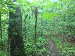
A few hundred yard later my stomach growled and I was suddenly hungry.
At the next curve there was a campsite...
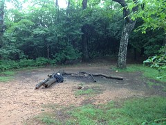
...so I paused a bit to remedy the situation.
Lunch:
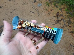
Actually, I also ate about half of a Tabasco Slim Jim.
While I was eating, a guy walked up and we chatted for a few minutes. He'd come from Neel's Gap and he was getting picked up at Unicoi. He was planning on hiking the Georgia AT in a series of day hikes, presumably to test out his gear and fitness, then do the rest of the AT in sections over the next few years. Sounded like a good plan. I might have to do the same some day. He wanted to keep moving though, and didn't stop for long.
I got moving again pretty quickly too.
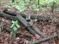
At the next big curve, there was another campsite, and rummaging around behind it I found some old ruin.
At the time, my mental origami skills weren't up to the task of figuring out what it was. "Some ruin" was all I could come up with. I'm not sure what it even could be. The rail came through sometime between the 1890's and 1920's. The mountain was clear cut, abandoned, and almost immediately bought by the Forest Service. Maybe somebody had settled up there prior to the rail. If so, I'd expect some kind of road nearby. I didn't see one, but maybe I missed it. Maybe it was somehow associated with the rail. Maybe it was somehow associated with the old fire tower up on the top of the mountain.
There were also very new-looking markers up there too.
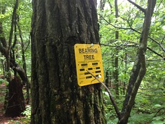
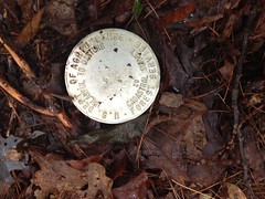
Maybe the area was recently determined to be archeologically significant. Who knows? Somebody knows, not me though.
I ran on to Poplar Stomp Gap, picked up the old Poplar Stomp Road (AKA Poplar Stump Road, AKA Old FS44C) and ran it back down into the valley.
There were a few interesting things there too.
For instance, this weird banged up old metal bucket of some kind:
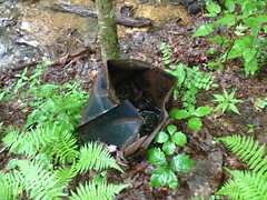
And this culvert that the forest seemed to have pushed out like a splinter at some point.
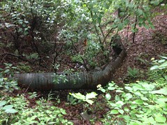
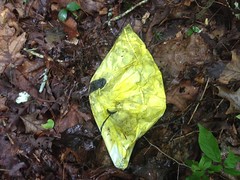
And, of course, another mylar balloon. This time, of the smiley-faced variety.
I suspect that 44C was also a railbed. It has a very consistent grade. Way up at the top it's narrow and had a heavily fortified stream crossing. But if you do the math on it, it's like 9.3% grade, which is super steep. Even a geared locomotive would have had a hard time with that. It'd have been climbed unloaded though. Maybe that was possible. Or, maybe it was only used as a downhill run and they climbed up somewhere else. This is what I'm talking about... I dig this stuff. Mysteries and clues. Somehow all of that is fun to me.
I hit a couple of side trails on my way down from the ridge.
One of them lead over to what appears to have been the location of the old Vandiver homestead.
No trace of the structure remained, so it may sounds like quite a presumption that there was one, but...
According to USGS topo maps, the creek in the area is named Vandiver Creek. According to a WMA map from 1980, the wildlife planting on either side of the creek, is called Vandiver Field. According to USGS maps, there's a small clearing upill from the field. Uphill from that is another field. Old roads lead between all of these fields and clearings.
The small clearing is now invisible in satellite photos, but it's still there, more or less, with a pretty large white oak dominating the area.
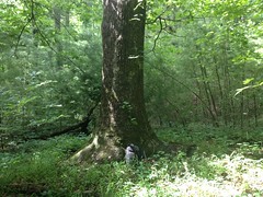
The land there also appears to have been levelled.
According to a really old Georgia Supreme Court Case, Vandiver had a farm back in there somewhere (on "Lot 2") and sold timber rights to the Byrd-Matthews company. Twenty years later they built a "tramway" over to his property to get the timber out. At that point he tried hard enough to bail on the deal that it went all the way to the State Supreme Court, who sided with the lumber company.
The Byrd-Matthews rail led up the Chattahoochee, at least to the campground. FS44 from the campground to Vandiver Creek is shallow and consistent and could easily have been the route of the aforementioned tramway.
So, all together, it would seem that we have the Vandiver farm consisting of two fields with a farm house between them. Of course, I could be completely wrong, but this conclusion fits the evidence.
I checked out a few little trails that led down on Vandiver Creek too.
Down there some snails were mauling this mushroom to death.
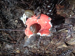
Can you imagine a piece of food so enormous that you can crawl all over it? That's what it must be like for a snail.
Someone had recently built a little monument down there too.

I'm pretty sure that wasn't there last week.
I also managed to get a good look at Vandiver Falls itself.
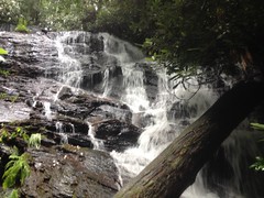
In case you're interested in doing the same. It's not worth it.
Every now and then I look back and say "Ok, THAT was the sketchiest thing I've ever done." The scramble down to the falls is, to date, the sketchiest thing I've ever done. When it's steep or loose I'd always tell my kids "hands and feet", but this was hands and feet and knees and elbows and entire forearms and spreading out my body for maximum surface area contact, and triple checking every hand hold, and about 10 feet where there were no hand holds and the foot holds were super questionable, and walking across on rocks across rushing water while ducking under deadfall. It was at the very edge of what I felt confident doing. I'm not doing it again unless I experience some leap in all related abilities.
That was enough. Time to call it a day.
I drove out in the direction of Unicoi Gap, stopped at the gap and looked around a bit. It looked like there are a few spots up there that are worth a second look, someday.
I also noticed two interesting things on the drive back.
The first is: if you take a sip of your Mellow Yellow at Unicoi Gap and close the top, your Mellow Yellow bottle will be deflated in Cleveland.

Also, all day it had been rainy and sunny, cloudy and clear. This chaotic weather ultiamtely produced a tiny little rainbow over Long Mountain.
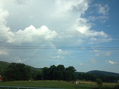
Teeny tiny.
Well, I had a good time, but, in fact, I failed to accomplish my primary goal. How unfortunate. Terrible! Though, I now have yet another excuse to go running around up there. And I shall. Until then...


No comments:
Post a Comment