There's this road off of Nimblewill Gap Road, across from FS28D, that looks very road-like, but doesn't appear on any map. I've seen it for years, but never had the inclination to see what was out at the end of it. That changed a few weeks ago though. I'd explored the general area around FS28D, but not had time to check out that particular road. Whenever that happens, I tend to want to get right back out there.
Such was the case.
I drove up to Nimblewill and parked along the road near my objective. A family was camping in the site at the near end of FS28D, and a gentleman came out to greet me as I got ready to go. I was wearing my orange vest, and I imagine he might have been curious about what I'd be doing, and more precisely whether I'd be doing it too close to him and his family. His expression and demeanor became abruptly friendly as he got closer, perhaps as he noticed I was unarmed, and we had a very friendly exchange. He and his family were up there for the 4th year in a row, at their favorite spot, for what was becoming a post-thanksgiving camping tradition. He hadn't seen anyone else hunting nearby all day, so I wasn't likely to bother anyone traipsing around off trail, or them, for that matter.
We wished each other well. He headed off back to camp and I headed off in the opposite direction.
Chester Creek turned out to be the name of the creek that runs up along the road. The road itself had a number of significant mud holes, which appeared to have been well enjoyed by the local 4wd enthusiasts. Other than that, it was a fairly clean and well-maintained road, less rutted even than FS28D. It wasn't immediately clear why it was omitted from maps.
On the way out I found what might have been a former route, and a couple of little side trails, all very overgrown. I also found this balloon between the road and the creek.

Eventually I reached this non-FS-looking gate and accompanying signage.
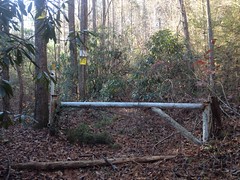
Ahhh, an inholding. Now it all made sense.
No idea what the weird PVC-pipe thing is to the left of the gate. I studied it for a few minutes but couldn't make sense of it.
I noticed the remains of a signpost to the right, and found the old sign that was once attached to it nearby.
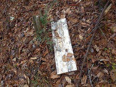
Whatever it once said, it no longer did.
I imagined it may have said something like: "No Trespassing. Violators will be shot. Survivors will be shot again." Ironically, between then and now, I saw a similar notice at a house I was picking up some theater props from.
On the way back, I checked out the former route and side trail.
Near the east end of the former route, I noticed this crater.
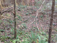
Which, of course, looks like nothing in the photo, as is generally the case with holes in the ground.
I'd seen a similar construction off of Randa Creek, and another one off of Jones Creek below the Horserange. It was clearly constructed. It looked like part of it was dug out of the sidehill, and that part was used to form a levee around the rest of it.
I've seen a few of these now, but their purpose is still elusive. I haven't yet seen a similar construction in modern use.
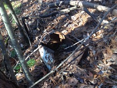
I found this old metal bucket off of the side trail, but it was otherwise unremarkable.
So, that was it for Chester Creek proper, but there were several little dotted lines on my map nearby, so I hiked back down the main road to the east a bit, to check out another long-neglected side trail.
It was a really messy old road - braided where it teed into the main road, and went straight up the draw as soon the second it got up above the little stream. It was relatively overgrown, except for a clear path cut through it, which soon became a well defined sidehill leading up to the ridge.
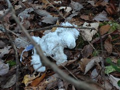
At the ridge, this little stuffed pony was lying next to the trail.
It's not a good idea to go climbing over ridges during deer season, unless you really know what you're going to find on the other side. For all I knew, someone had parked at the foot of that draw, hauled a tree stand a mile uphill, in the dark, and had been sitting there freezing for the past 6 hours. I didn't want to ruin someone's day, or my own, so I decided to turn back. Later I discovered that the ridge was the border of another inholding, and it was private property on the other side. The border lacked the typical red blazes, but at least it explained the trail.
After that, I headed back to the truck and drove up the road a ways.
I passed an elaborate campsite on the way up. It looked like the occupants were planning on being there a while, but there were no vehicles or people nearby, and the fire looked long dead. I wondered if they'd just abandoned a bunch of gear. I'd seen something like that in the Upper Chattahoochee once - thought it was an active campsite, but it was just 2 tents packed with garbage.
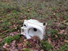
Up the road, I explored a couple of side trails. One had an abandoned camp toilet lying out near the end of it.
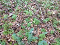
And an even older logging cable just below it.
The others just went this way and that before ending randomly.
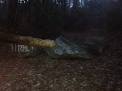
It was getting dark, and I wanted to see if the road to Bearden Falls was still open. Billy and I had recently visited Cochran's Falls, and discovered that the road had been blocked. It occurred to me that the same may have been done at Bearden Creek.
Indeed, it had!
Nice.
For the watershed, at least.
It was officially dark a few minutes later, so I changed and headed out.
I think I grabbed some Nashville Hot Chicken Tenders at O'Charley's in Canton on the way back. That seems right, at least.
It had been kind of a lackluster day. Semi-interesting, but not especially strenuous. I remember lamenting the lack of full-body-tiredness that I'd hoped to feel, and I vowed to get out earlier the next time, and push harder and farther.
But, I also remember taht the sleep I got that night was good. Best I'd had in a while. So, it wasn't a total loss.


No comments:
Post a Comment