The north end of the land that's now the Pinelog WMA was mined for iron pretty heavily around the turn of the 20th century. I've rummaged around back in there, trying to identify the various ruins and structures that remain, but I was never able to find the actual mining camp. I know ruins of it exist, I've seen photos, but wherever they are, they're rather difficult to find, and last year, I basically gave up looking for them until the leaves were gone.
And then it was deer season, Pinelog is a super popular spot, and orange or not, it's not especially courteous to wander around in the woods randomly for hours disturbing the hunt. So, I waited until that was over too. A few weeks ago it was squirrel season, and wandering around randomly is pretty much what you do to hunt squirrel, so I felt free to roam.
When I arrived, I was surprised to find the North Gate closed. Instead of being able to drive right up to the spot I wanted to explore, I'd have to hike in 3 miles.
Good think I like hiking!
Right away I noticed something I'd never seen before, despite having ridden past it umpteen dozen times.
The old WMA sign.
I've seen this a surprising number of times. It's time to replace the old sign, so the old sign is torn down, and the new sign is installed, but the old sign is basically just chucked into the woods nearby. No need to haul that out. Nobody will notice, just chuck it off in the woods. I've seen the same thing when pipe gates are pulled up and replaced with Kelly Humps. The old gate is usually lying nearby.
I always wonder if the contractor was supposed to remove the old thing, didn't, said that they did, and then no one ever noticed.
Just down the road I noticed yet ANOTHER thing that I'd never seen before, despite having ridden past umpteen dozen times.
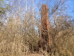
Ha!
It's literally feet from the road and I never noticed it.
I recognized it from the B & E Roberts page though, so I figured I might be on the right track.
Further up I crossed the Neel Lake Dam, and Neel Lake was still half-frozen from the previous week.
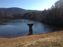
Sadly, it wasn't solid enough to walk on.
There was a small mine cut on the west side of the road just past the gate there that I'd also never noticed before.
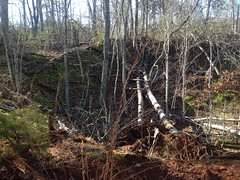
It's amazing what you can see in the winter.
And there's another cut to the east of the Lower Sugar Hill Creek Dam.
Also never noticed it before.
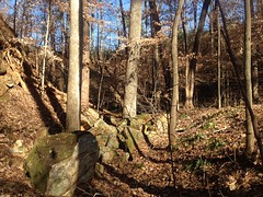
My old topo map of the area, from around 1914, shows a dozen or more structures above the lower dam. Some lined up neatly along the upper lake, others lined up neatly along Little Log Creek, and still others scattered about randomly.
I found what might have been the basement of one of them, notched into the hillside, but other than that, nothing. I wasn't too surprised though. Most of what I was looking for would have been out in the open. I hadn't seen it before, and I really didn't expect to find it this time. But there were some structures alleged to lie along Little Log Creek, that would be way back in the woods now, and those were the ones I figured I'd find that day, so I headed in that direction.
Along the way, I noticed that the DNR had been pretty busy during the past winter. Last summer they'd put up signs everywhere, marking various side trails closed to vehicles. Perhaps dissatisfied with the response to the signage, this past winter, they cut 3 foot deep trenches across each of these same side trails and piled the dirt up this side of the trench. Most of them are completely blocked. I guess that's good, for the environment at least.
One such road, the one along Little Log Creek, looked like any other forest road last year, but with the recent storms and snow, it now looked like as unused as any old ghost road in the NF. I was amazed how quickly it reverted. I could easily get down it on foot, but with all of the deadfall, you'd be challenged to enjoy it on a horse or a bike.
At the (modern) end of the road there was an old brick lying in the middle.
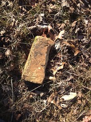
I was hopeful that it was just the first discovery I'd make.
The road kind-of branches there. One branch leads to the old Little Log Creek Dam ruins. The other crosses the creek and quickly becomes overgrown. I'd been loathe to push through the brush in the summer, but being winter, I figured I'd give it a go. There was supposed to be a structure of some kind along it too.
I followed the old road until it blended into the backslope. It allegedly kept going, but tracing it wasn't my primary objective. I never found the structure, or any remnant of it either.
Down along Little Log Creek, there were a dozen or more crisscrossing old erosion channels leading from the general direction of the road down to the creek. These ended abruptly at a levee, the purpose of which appeared to hem in all of that runoff.
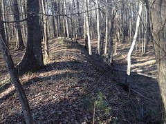
I figured, cool, maybe it was intended to protect the mining camp from runoff. Maybe I'd find the camp.
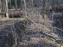
Nope, nothing. Not a trace. I found the spot where the structures should have been, but there was nothing there at all.
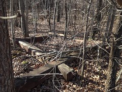
I scoured every inch of woods between there and the northernmost food plot. All I found was this old metal washtub.
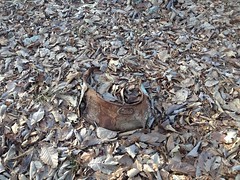
What the heck?
I was frustrated to say the least. It was getting late too, and thinking about getting dark. I needed to get back for some reason that I don't remember, so I had to jog out rather than walk.
That turned out to be the best part of the day. I can't remember the last time I did any jogging, but I could apparently still jog a couple of miles.
Yay?


No comments:
Post a Comment