I called my buddy Andrew from work to see if he wanted to go hiking but he left me a nearly unintelligible voicemail in response. Sounded like he had an awesome time last night.
Solo.
Ages ago, on a topo map, I noticed a road leading north from Hwy 60 at the foot of Tooni Mountain, winding it's way up into the headwaters of Little Skeenah Creek. Up in those headwaters, on the map, was the word "Falls". I'd once checked out the spot where the road T'ed into Hwy 60 and it looked pretty overgrown. As such, I'd written off the entire road. Today I finally got curious enough to go see what it was really like.
On Doublehead Gap Road, just north of Doublehead Gap proper, I saw 2 cyclists riding toward me, heads down, working hard. Their kits looked familiar, do I know them? Yes! Norma and Johnny! Woohoo! What are the odds. Well, it's been raining so much lately, there is no viable singletrack in Georgia, and though there are ten billion FS road, there are only a couple of popular ones. So, maybe the odds aren't too bad. Still though, it was cool. We chatted a bit, but we all had places to go, and soon enough we parted.
I parked at the BMK trailhead on Hwy 60 and spent 20 minutes deciphering the maze of trails in the immediate vicinity. It took a while, but eventually, I was on track. And the trail looked like this:
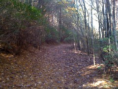
...from about 30 yards in, all the way to Little Skeenah Creek. So much for overgrown. I did see some ATV tracks. Naughty, naughty. It looked like pretty light use though. I spent the first couple of miles practicing how to "follow the terrain"; not using the compass, just keeping track of where I was by comparing the map to the terrain. It's easy to do on a ridge, or up along a creek, but a lot harder when you're sidehilling, even on a trail. I did allright, but I've got more work to do.
Eventually I got to Little Skeenah.
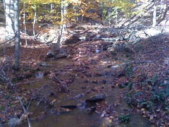
I'd hoped there'd be a trail or something, but no, no trail. I just had to follow the creek. And apparently I wasn't the only one. Rhett R. had been up through there back in 2008. Or, at least, that's what he carved into a beech tree along the bank. Thanks, Rhett, for memorializing your epic journey. Without that insightful carving, no doubt every visitor would have passed by that tree and wondered, most likely aloud: in 2008, was Rhett R. here? And none might have known, though the question burn in our minds and torment us unto the grave. Surely, none might have known. But, thanks to his godlike foresight and whittling skill unmatched among even the greatest works of the renaissance artists, we do know. Yes. Rhett R. was here.
Further upstream...
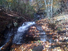
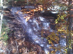
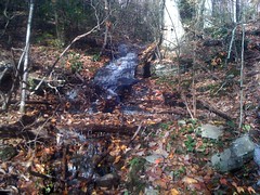
I guess the map was right. Falls.
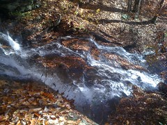
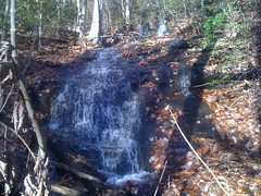
Where there is one cascade, there could be another. I would find out.
Yep. Another.
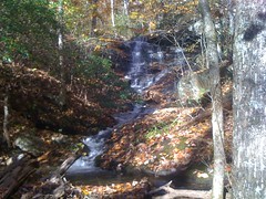
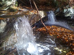
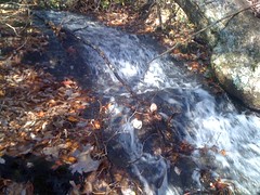
And another.
And another.
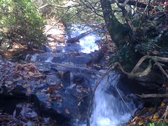
And another.
Way up at the top, there was a trail too, and not too overgrown. I followed it upstream until it disappeared, and back down until it tee'd into the road.
As luck would have it, there was another little waterfall there too.
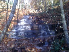
Jackpot on the waterfalls, eh?
I'd planned on following the road around until it hit private property, then cutting back across the middle, but it was getting kind of late and I didn't have quite enough time for that. Maybe next time.
I'd kind of also hoped that some side trail would lead up over Licklog Mountain. Didn't find that either. I did some other side trails, including a BMK connector, and a trail that might lead up to Wallalah. Next time...
By the way, the entire road was marked with triple-blue-blazes.
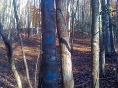
I've seen the triple-blue-blaze everywhere. EVERYWHERE. I assume that way back, the logging companies went in and marked the trees, then came back through with the bulldozer, following the blazes. Usually I've seen them bordering old roadbeds, but occasionally there's a line of them in the middle of the woods, where there is no road. Maybe they never got around to building that road. Or maybe I'm wrong about what they mean.
Now that I think about it, there are a bunch of different colors. Red rings mark the forest boundary. Triple-blue appear to mark the path of roads. I've seen turquoise blazes too, and orange. In Rabun county, there are several trees marked with purple. Up along Two-Run creek, there are blazes of every color all over. No idea what they mean. Sure wish I knew.
Speaking of colors. There were a lot of beech trees up there, all turning yellow. Come on Rhett, why didn't you carve your name in every one of them? Now I'm going to wonder if, in 2008, you were there or not.
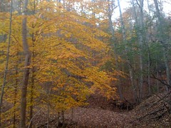
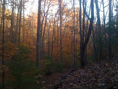
The fall colors sure don't last long. Next week they'll all be gone, I bet. Good I got to see them while I had the chance.
Skeenah!


No comments:
Post a Comment