We pounded some calories; eggs and dry toast.

Does that count as healthy? I mean, it's eggs and dry toast, but also, it's Waffle House.
When the girls were too young to go running around in the woods, we drove all over North Georgia in my truck. Inevitably this took us past Mount Yonah and I'd tell Isabel: "One day, we're going to climb that mountain."

She always thought I was crazy, but I showed her. Today was the day! Mount Yonah day.
We met Clark's place, and immersed ourselves in his happy dogs.
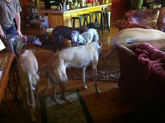
Clark and Suzy tend to a herd of rescued greyhounds. They're very friendly and hypoallergenic as well. Kathryn's deathly allergic but the last time she was up there, she barely got any symptoms.
We did some a'settin down for a spell, and then headed out to the trail.
It was about 9:30 or so when we got there, and it was just starting to get warm.
We climbed...
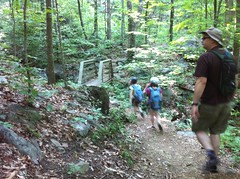
and climbed...
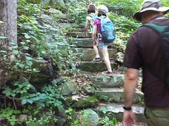
and climbed some more...

It's a steep hike up Yonah. The first section was all singletrack. There were a couple of little spurs off to either side here and there, leading to the various climbing walls.
About a mile in, we ended up at a clearing with a great lookout rock.

It was hazy out, but we still got a great view of the sprawling piedmont to the south.
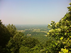
We sat on the rock and snacked.
There were a billion ants running around. One of them, for some reason, was dragging the dead carcass of another ant up the rock. "You're going the wrong way, there's nothing up here."
The girls were a little more fidgety and pushy than seemed like a good idea to be. They were jostling for space on top of the rock like it wouldn't kill them if they fell. It made me worry whether they were responsible enough to be up there. We talked about it a little. They are usually very good about that kind of thing.
The next leg was a much steeper climb up an old, deteriorated roadbed. Clark said he'd seen marks from tractor tires on it recently. Maybe they run the tractor down and mow the clearing every now and then. I'd like to see that. Except for the very last little bit, it looked really rough.
That led to a forest road, and we followed it up to a campground. Apparently the road leads down to a neighborhood with a private drive and isn't generally accessible.

The Rangers out of Camp Merrill have a key though, and they train on Yonah all the time. I've seen video of it on TV even. That'd be cool to see in real life too.
We tried looking out of the back of the campground towards Clark's house. He says in the winter, you can make out his roof, but there was way too much brush in the way today, and it was hazy.
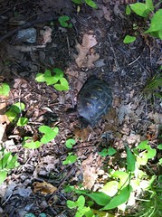
We did find a turtle though.
The slog up to the top was steep and gravelly. Sophie was dragging her feet and acting really tired. Both girls had been up 'till 11 cleaning and decorating their rooms. Eight hours of sleep is a long night for me, but it might be short for a growing girl.
Eventually though, we made it to the top.
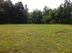
There wasn't much to see up there. No view, just a clearing and a ring of trees.
Well, there was also this little oddity. Me and Clark puzzled over it for a while.
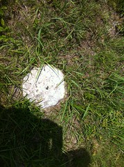
Clark had initially thought it might be a benchmark, or what's left of one. That's possible. It might also be what's left of one of the footings of the lookout tower that used to be up there, but it was in an odd spot for that. A mystery. Somebody knows.
Successful in our summit attempt, we took a break.
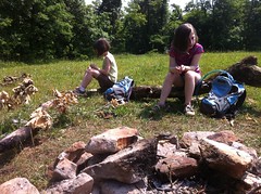
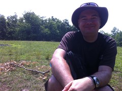
According to Iz, there's "nothing better than sitting around a campfire that's not burning on a hot day." I'm not sure that there's nothing better, but we did enjoy the break. Granola bars and leftover Starburst from yesterday. Apparently neither of my kids like lemon Starburst. They are crazy though, all Starburst flavors are good.
The top of the big rock face that makes Yonah so recognizable was just downhill to the southwest. The views were even better there than the view from below.

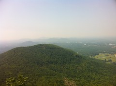
Clark pointed out some pitons that had been placed up there for rappelling.
As below, the girls were using slightly little less self control than I'd have liked. Iz slipped on some lichen. Sophie screamed and jumped and stamped around uncontrollably when she noticed some ants. Not the kinds of things you'd want to be doing if a fall could kill you. When they were younger, they were more careful. Now, they're confident enough not to be nervous but not yet wise enough to be generally careful. I remember that from being a kid too, but I wasn't often in such a dangerous situation. We're going to have to work on that, I think. I made sure to stay a little further downhill than either of them, just in case. He didn't say anything, but it looked like Clark was doing the same thing.
The views were great and it was much cooler up there than back at the car, but we had a lot more to do, so we headed back down.
On the way, we passed "The Shoe" and Iz required a photo.
The Shoe:
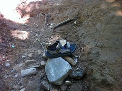
We took a slightly different route down and found a bunch of side trails leading to even more climbing routes.
We also watched this crazy looking centipede eat a dead millipede.
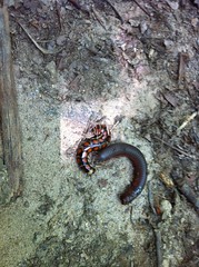
There was also a dead juvenile copperhead getting eaten by a bunch of bugs. I should have taken a picture of that.
About a half mile from the bottom, we passed a group, heading up. "How far is it to the top?" "You've got about another mile and a half." "And you have to walk back down?" "...Yes" It made me wonder. Stone mountain has a gondola that can bring you down if you walk up, but then you'd still have to walk back around. I wonder if there's anywhere that you can climb up and get some kind of a ride straight back down to your car.
Haha! Done. I finally followed up on a commitment from like 5 years ago. We climbed Mount Yonah.
Our victory celebration included pizza and popcorn from the Nacoochee Tavern and it was excellent.
We dropped Clark back off at his crib and played with their dogs for a little while, two of which simply walked outside and collapsed in the grass, with zero interest in the ball. This amused Sophie, substantially.
Next up, we had some TNGA recon to do. Tornados had tracked directly across Tray Mountain during the storms last month and who knows what roads were still passable. I know some folks that were planning on doing the TNGA as an ITT this summer, so I figured I'd get up there and take a look. It would also give me an opportunity to see how the Outback handled on some fairly rough terrain.
I had no trouble at all getting up FS79. It handled as well as the Durango had through mud holes and humps. I did slap the nose on the ground once, but I'd done that in the Durango too. The really chunky section of FS79 was fine too. In fact, I got way less body roll in the Outback and I was able to take some lines that I might not have considered in the Durango.
This doesn't look bad in the photo, but I wasn't sure whether I'd make it or not. It turned out to be a piece of cake.
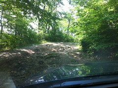
There was one spot where I could feel it shifting power away from wheels that wanted to slip. It made this odd noise that I didn't expect, but I never lost traction. Woohoo!
The tornado apparently came right over 79 because there were trees down across the road for about a quarter mile. Somebody had come in and cut out the limbs that were hanging down, but the trunks were still up.
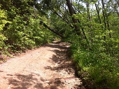
I'd caught up to a guy in a Jeep that was too tall to get under one of them. We thought I might be able to, but the bike rack stuck up a few inches too far. Darnit. We had to turn around.
I wanted to check out Corbin Creek and Charlie's Creek too. I'd meant to descend Corbin, but that was out of the question now. We headed back down and around to Charlie's.
The kids were both knocked out for most of that trip.

I woke them up as we forded the Tallulah River. It was down. That's something I'm still not too sure of. I'd dunk the Durango up to the hood sometimes, but how deep can the Outback go? We didn't find that out today.
If you check out the novelty maps of North Georgia that hang by the bathrooms in some gas stations, the comment next to Charlie's Creek road is "4 Wheel Drive or a Horse." It appears to be completely unmaintained.
I had a little trouble with this hole.

It took 3 tries and a get-out-and-look down from the top to figure it out. I got it though, with no spinning. I wonder if I can get it up Hawk Mountain.
There were no trees down on Charlie's Creek. It didn't look like the storms had gone up that way at all. We circled back around to Corbin Creek but right at the bottom we ran into some folks who'd just driven up to Trey and back with no trouble. It was open all the way. All right!
We took their word for it and headed home. It was still light outside when we grabbed some Moe's in Dawsonville and the girls were in bed by 9:30.
Ahh. It was a long day, but a long, productive day. We can cross Yonah off the list. It's also nice to know that some of the roads I was worried about are passable. I still need to check out the Hickory Nut though. It wasn't directly in the path, but you never know. Maybe I can do that this weekend. I think we've got a work party at Bull this weekend too.
Busy, busy, busy.


thanks for the TNGA route report! good to know.
ReplyDelete