I hang my hat in Mableton these days. Cobb County - home of the Big Chicken and future home of the Atlanta Braves, so I hear. The closest dirt is a little "gateway trail" at North Cooper Lake Park but the next closest dirt is at Sope Creek.
The last time I rode at Sope Creek was in 2000 when I first moved to Atlanta. I think it was literally the closest trail to my house at the time. I remember riding out from the lot on a super-bumpy doubletrack, getting lost, tearing down a fire-road and eating it on a slanting piece of wet granite that extended across the entire road. I remember then wandering around for hours before finally finding my way back to the car, beaten and confused.
I never went back.
But... I've been hearing about "new" trail out there for years now (or at least one year), and given how convenient the park is these days, I figured I'd check it out.
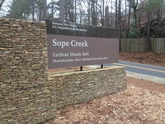
I'm a little better on the bike than I was in 2000. I figured I could probably avoid careening into random slickrock. Also, I got the lay of the land back then by turning randomly until I recognized something. I'm a more accomplished explorer these days and my methods are a bit more refined. I felt confident that I wouldn't get lost.
I looked forward to the outing.
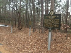
The Paper Mill Road Lot itself held no shortage of interest to the curious explorer. There were at least 3 historical markers, possibly more.
And just down the main trail there was a beautiful, still pond.
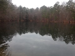
Can you fish there? I didn't see any signs one way or the other. I'll have to find out though. If you can, I'll be back this Spring.
Another historical landmark lay just down the trail.
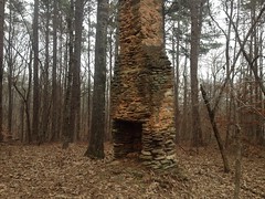
I'm actually looking forward to getting out there without a bike just to look around. I'll bet there's a lot of cool stuff out there.
As I understand it, the trails at Sope Creek used to be open to anyone but they weren't designed for bikes, hooves or feet for that matter, they were just there. And, from what I hear, they kind-of went the way of the old Yellow River trails. Shortcuts, re-routes, extensions, a maze, a spider-web, nothing marked... Eroded, patched, shredded, patched, patched again... Fun? Presumably. But not really built-to-last. So I hear. These days, things are a lot different.
The doubletrack I rode out of the lot on was sweet and well-marked.
There were well-signed foot-trails to the left and right. "I must've missed the sign that said this was a hiking trail" probably won't get you out of trouble here.
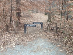
Nor will "I didn't realize the trail was closed."
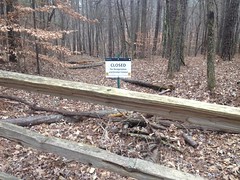
I did have to think about what day it was though, and I almost went the wrong way.
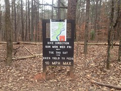
The trail was great. Where it wasn't clean doubletrack, it looked like dingo-cut singletrack and it meandered deliciously. It's been a year though, and I had roadie legs and a roadie brain. I felt like I was getting back on the skateboard after recovering from a broken ankle. I could feel in my head what I was supposed to do but my body didn't automatically do it.
Two riders passed me. I slid out on a wet root. The outslope of the trail felt steep.
It's going to be a long road back.
The signage was prolific but some of it was confusing. For example, this sign.
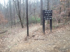
It says go left or right, but what it means by "go left" is "go left for three feet, then turn right and descend". If you actually go left without turning, you end up at some apartments.
The trail was laid out like three lassos. Ie. an out-and-back with a loop at the end, and halfway around that loop, there's another out-and-back with a loop at the end of it too. That second loop intersects the loop of yet a third lasso. The first two are what you'd think of as bike trails, but the third is more like an exercise trail.
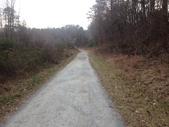
Oddly enough, I'd ridden it once before when I rode from Cumming to Atlanta and back on my road bike.
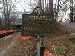
The exercise trail area is accessible from the Powers Ferry Lot on one end and Columns Drive Lot on the other. There was more cool stuff to read at the Powers Ferry Lot.
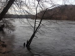
The trail runs right along the Chattahoochee too and offered some great views. The river was a little high and the water was really moving.
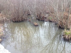
On the non-river side, it was really swampy and there was a beaver dam...
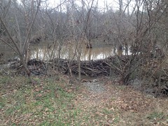
...and ducks everywhere.
The trail back toward the Paper Mill Lot ran right up along Sope Creek itself.
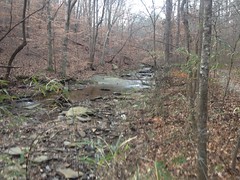
There was one pretty muddy spot where I had to walk on rocks for like 100 yards, but aside from that, it was more of the same flowy single and doubletrack.
I almost wish I'd ridden out there once or twice in the past 13 years just to have some basis for comparison. Some people say that it's terrible now, nothing like it used to be. Perhaps. What I rode was great. Twisty, fun trail with a decent amount of climbing, kind of like Rope Mill. The closed side trails I passed looked less inviting than the trail I was on. Who am I to say though? I don't know what I'm missing.
When I got back to the car it was right at 5:00 and traffic in every direction was moving 2 miles an hour. It took over an hour to get home less than 10 miles away. I think next time I'll go earlier in the day, or maybe just ride over.


No comments:
Post a Comment