Sunday! Sunday! Sunday!
This past Sunday I explored vast uncharted swaths of the Raven Cliffs Wilderness. I say "uncharted" because no maps show any trails there. There are several though, as Lidar data reveals, to the trained eye. They looked like they'd be pretty easy to find, and who knows what wonders they'd hold? The urge to explore them was irresistible and I made no effort to.
First things first though... My new shoes were killing my feet, or my right foot at least. Goodness, it was terrible. Of course, shoes always need to be broken in, but I did plenty of that a few weeks back, and this was well beyond your run-of-the-mill breaking-in trouble. The shoe just wasn't bending correctly at the big knuckle on my big toe, and it was murder walking the few miles we'd walked the day before. After some engineering analysis, it appeared that I could resolve the problem by skipping the bottom-most lace-holes.
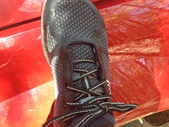
And upon doing that, it was night-and-day better. However, damage had been done, and my toe still hurt quite a bit. After a little more engineering analysis, it seemed that layering up some duct tape over the affected area would spread the force out and ought to help.
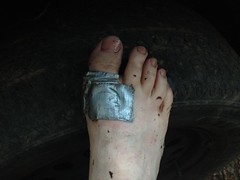
And boy did it. My feet felt just right, and it was time to get a move on.
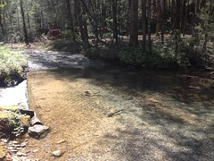
I failed to mention earlier... I parked on FS244, just past Davis Creek. There was once a campsite there, but it's blocked off with rocks now, so you can't drive back up in there any more, and there are several "No camping behind this sign" signs along the edge. Still, it looked well used and the fire ring with the I-was-just-burning-yesterday coals in it suggested the same.
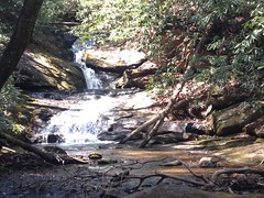
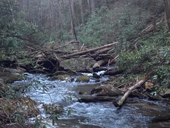
As I headed toward the back of the old site, I thought I could hear a waterfall, and pretty soon I could see it.
There was an elaborate memorial bench back there too.
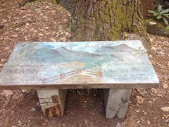
It would have offered a great view of the falls, but it was so ornate that it seemed wrong to sit on it.
It looked like there was another old campsite on the other side of the creek, so I headed over that way to check it out. This involved crossing, and the best place to do that seemed to be the ford along the road.
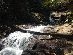
A bit of a trail on the other side led to an upper cascade.
And lying nearby was a Letterbox.
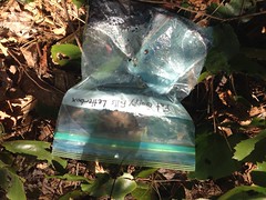
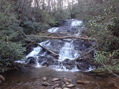
If the title is to be believed, then the name of this waterfall is Fat Guppy Falls. I was glad to know because so often I have no idea what a waterfall is named and what I end up coming up with is usually descriptive, but a lot less creative.
And there was another memorial nearby too.
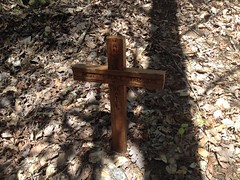
It must have been a good camp site to be so significant to so many people.
To the north, I could see the old railbed that I was interested in. At least, given its location, I expected it to be a rail. At the bottom end, it was well traveled.
And I saw several signs that it was, in fact, an old rail bed. The grade was consistent. There were several rock fills. At creek crossings, the trail ended abruptly, and picked up again, just as abruptly on the other side, as if a trestle once spanned the gap.
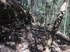
At a point, I ended up in rhododendron hell and when I found the trail again, it was clear that I was among few who had. It clearly got less traffic from there on, though after fighting through deadfall for a block or so, the trail cleared somewhat, and stayed clear all the way to the end.
The end:
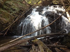
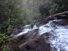
It was clear why the old rail didn't proceed any further. It was hemmed in ahead by this waterfall, and to either side by steep cliffs.
Though impassible by rail, the cascade was particularly easy to get over on foot.
Of course, then there was just another cascade...
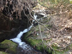
...which wasn't as easy. I got most of the way up, decided that I wasn't confident I could get over last 10 feet, and climbed back down.
The old rail was one of the trails I'd intended to explore, but there was another as well, and from where I was it looked like I could get to it by just heading due north over one little ridge and halfway up another one.
And that's exactly what it took. It's always comforting to find out that you are, in fact, where you think you are.
I followed the other trail toward the head of the valley. It wasn't likely an old rail: inconsistent grade, no rock armoring, no gaps. It may just have been an old forest road from before the area was designated wilderness. While no maps that I know of show the location of the trail, old topo maps do show two clearings way back up in there. It's possible that they were food plots once, and farms before that. The trail may just have been somebody's long driveway.
I found one of the old clearings. It wasn't so clear any more though. The trail seemed popular up to that point, and substantially less popular beyond it. Up near the very top, where the terrain flattened out, it was so hard to follow that I lost and reacquired the trail multiple times.
Somewhere up there I found this burrow.
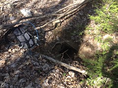
Maybe a fox den? I struggled to imagine what animal would have made a hole that size. Way too big for most burrowing animals. Way too small for coyotes and bear. I decided fox only by process of elimination, and of course, I could be wrong.
I found all of this hog rooting up there somewhere too.
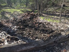
It looked fresh.
At the very, very end of the road, a pig trail led up toward Morris Gap. I followed it until it blended into the background and then just pushed up to the gap across country. I definitely picked the right time of the year to do it too. It looked like any later and it would be choked with scrub.
At Morris Gap I sat down on a hollow log and enjoyed the breeze for 10 or 15 minutes. I didn't have good food with me, just a couple of Clif Blocks, but they were pretty satisfying, nonetheless.
There was a tree stand to the south.
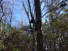
I guess someone figured they might as well leave it up. As inaccessible locations go, Morris Gap is pretty good. Slim chance of anyone bothering it. I sure didn't.
The descent back down the cove was kind of fun.
I didn't exactly scree-run, as there was no scree, but I did something similar, with brush and leaves as a weak substitute.
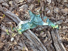
On the way back I found the requisite mylar balloon...
...and the requisite length of cable, coiled up in the old clearing.
I usually assume a logging operation when I find a cable like that, but this one was really short. It may just have been strung between two trees as a gate. Or maybe someone dumped it back there, that being as far back as they could drive at the time. Trash or artifact? Always the question.
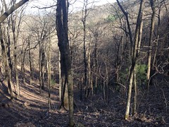
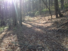
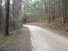
On the way out, most of the trail was really wide open and clear.
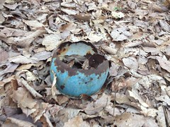
I ran into several really old campsites that clearly hadn't been used in a while. One had an old metal pot nearby, flipped over to keep it from collecting water, but abandoned long enough for the bottom to rust out.
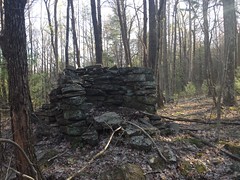
It looked like there may have been a house up on the ridge at one point.
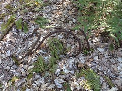
On old twisted pipe lay nearby as well. It looked like a chunk of driveshaft to me, but I guess it could have been something else. Again, trash or artifact?
Oddly, as I got closer and closer to the main road, the trail narrowed more and more. Kind of the opposite of what I expected. There were several rhododendron tunnels.
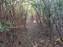
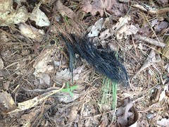
And in one such tunnel I found what appeared to be a tuft of bear hair.
I might have called the trail The Bair Hair Trail, but there are already Bear Hair and Bear Hare trails in North Georgia, and if Bear Hare is so named because Bear Hare was already taken. I guess it could be called Old Morris Gap Road, though it doesn't go all the way to the gap, or if that ridge has a name, then it could be named after the ridge. Until I hear a real name though, I'm calling it the Adams Bald Ridge Trail, as it runs along the ridge topped by Adams Bald.
At the very bottom, within sight of FS244, the trail became substantially more overgrown. So weird. For most of the trail, it gets more and more clear, the farther away you get from the main road.
It hit the main road about a quarter mile down from my car, but I recognized the spot. There's a trail there that I always presumed led to the top of the huge falls at the confluence between Davis and Duke's Creeks. I hadn't planned on checking it out that day, but hey, I was there... might as well, right?
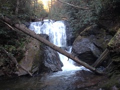
The trail led down to a campsite and there were two forks. One straight ahead and the other to the left. It seemed right to take the one to the left first, and it led down to the top of a waterfall that you can see from the trail when you're hiking in to Duke's Creek Falls.
The trail was incredibly sketchy, and getting a good look at the falls required a daring leap to a rock in the middle of the creek, and an equally daring leap back.
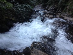
This was the certain death downstream from that rock.
Upstream I found this massive logjam, just waiting for some good rain to knock it loose.
Every now and then I look back and say "Ok, that was the sketchiest thing I've ever done." The most recent of those was scrambling down to Vandiver Creek Falls. The trip down and back from Duke's was not the sketchiest thing I've ever done, but it was a close second. It was hands-and-feet most of the way, and I double-checked every hold. I'm sure if I were a climber it would have seemed easy, but I am not and it was not.
I imagined the range of people that might use the trail, from hardcore fishermen to half drunk locals. The idea of half drunk locals scrambling up and down made me laugh, and if I'm honest, feel a little inadequate, but still, I cannot recommend this trail.
The other fork led to the top of the massive falls on Davis Creek. The one that people think is Duke's Creek Falls, but isn't.
There's an overlook that peers down over the edge and down into the gorge.
I couldn't see the observation area from up there, but it looked like if I was brave enough I take some sketchy trails down a bit where there might be a better view. I was not brave enough though. I'd had enough of that earlier.
A trail led upstream though, and I took that, past another cascade...
...through an empty campground, and back to the main road.
From there it was a quick bit back to the car, and I was glad to get back.
Whew!
Pretty cool though!
There were plenty of side trails off of that old road, so I'll be back to check them out someday. There appears to be another old railbed up the road too, so I'm not done with the area yet, in general, either.
My foot-patch held up and my right foot felt fine at the end there. I'd whacked my left heel the day before though, and it hurt terribly. Still does, in fact. I've got The Brutal Loop this weekend at Mulberry Gap, and I hope it heals in time for that. I've tried twice this week to get some miles in on the bike, only to be thwarted by work and weather. Nothing like heading into a ride with the word Brutal in the name on wounded feet, bad sleep, and no miles.
I'm looking forward to it, but I'd by lying if I said I wasn't a little apprehensive.


No comments:
Post a Comment