Sunday morning I woke up with my head pounding. The Brutal Loop had lived up to its name and I'd forgotten to keep a glass of water next to my bed to quench the midnight thirst. Two glasses later though, my skin started feeling cool and my head started feeling normal. I needed some kind of recovery and I didn't feel like even thinking about my bike.
Some light hiking might do the trick. If I could fit in a relaxing dip in some random stream, that would be even better.
I knew just the place.
Unfortunately when I was about 1 mile away from the place I realized I'd left the maps I'd printed out at home. That's a new one. I've forgotten everything from shoes to jerseys to my camera/phone but I'd not, until yesterday, ever forgotten a map. I'd originally wanted to check out the old railbed that appeared to run up along Dover Creek, but I didn't know the area well enough to be able to even find it. Which of these dozens of creeks is Dover again? The second though, Pheasant Branch (or Pleasant Branch depending on which map you look at) was pretty hard to miss, and I'd been there before. It would be a new challenge navigating off trail with no map, but I felt up to it. Worst case, I had the GPS to tell me where I was parked. What could go wrong?
I parked at the last campsite at the very top of FS244, which lies just south of the Raven Cliffs Wilderness.
I got dressed, patched up my feet...
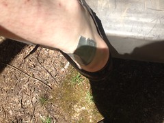
...and checked my gear. Right before I got going, a couple that I'd passed on the way up drove by, parked a little further up the road, and headed off into the woods.
The end of that road is just about the most remote place that I know of, that you can actually drive to. 4 miles up a rough road, across two creeks, at the top of a mountain. No roads or inventoried trails for 4 miles in any direction. What are the odds that we'd both choose to be in that exact spot, at that exact time?
There are 4 different trails up there - one to White Oak Gap, one that's really just a firebreak and goes straight up the ridge, one that goes to a food plot, and one more that looked somewhat overgrown. There's actually a little jeep loop too, but I'm not counting that one. I wasn't sure which one they'd taken, so I took the overgrown one, figuring I might avoid bothering them. Nope, the trail I took was apparently the original route up to the food plot, and I ran into them almost immediately.
"Sorry guys, don't mean to be all on top of you like this. I'm just up here exploring."
They were very gracious. I felt bad though. Best case I might have interrupted some plans for romance. Worst case they might have thought I was stalking them or something. We got to talking though, and they'd lived in the area their whole lives, so I quizzed them for information about the local trails. Turned out I knew far more than they did and they thanked me for the info about the White Oak Gap trail. There'd also been what looked like a controlled burn the previous week, and we talked a bit about that too.
At the north end of the food plot I found a really old road, turned trail, heading in the direction I wanted to go.
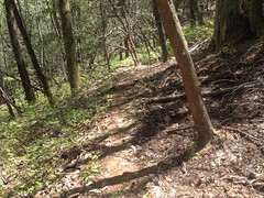
It blended into the backslope at Walnut Gap (though I didn't know the name of the gap at the time, because, no map), but there was a firebreak running along the ridge to the right, and diving down toward Pheasant Branch to the left. Score!
At the gap there, I noticed a couple of boards nailed to a tree, for some reason.
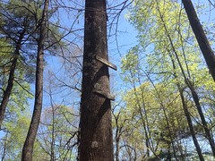
It didn't seem likely that they were part of an old tree stand. Was there a sign here at some point? What could it have said?
I puzzled about that as I scree-ran down the firebreak. With all the recent rain, to describe the soil as "loose" doesn't really say it. I probably sank an inch into it with each step. I had arrived at no conclusion about the old sign when something else grabbed my attention.
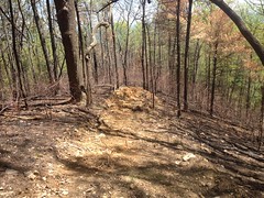
Admittedly, I don't know too much about such things, and maybe this is somehow correct, but for a firebreak, it sure didn't seem to have done much breaking of the fire. While the road had been very effective lower down the mountain, up here, the earth looked equally scorched on both sides of the break.
As I descended into the Pheasant Branch valley, I came upon the end of the disturbed soil, and realized that whoever plowed that particular break must have figured that he was getting close enough to the creek and stopped there. Unless it was intentional, for some reason, I don't think he was close enough, as the fire appears to have burned down around the end of the break.
Though it was a gnarly, burned out wasteland...

...there were a few distinct benefits to the fortunate off-trail hiker. Primarily, the lack of ground cover meant way less whacking of shins and shredding of ankles. But, also, I could actually see the surrounding ridges in every direction. For example, Allison Ridge lay ahead of me, with Mount Yonah towering over it in the distance.
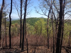
I very much enjoyed being able to actually see stuff, and took my time descending into the valley.
On a shaded relief map, the Pheasant Branch Valley looks like a great crack in the earth. In fact, if you pair it with the Bearden Branch Valley to the north, it looks like an even longer crack. It's perfectly straight, heads due north and south, and except for a short interruption in the vicinity of the various roads in the area, runs for 4 miles or so.
I've wondered if there's a fault there or something, that locked those unrelated creeks into such perfect conjunction.
Down at the bottom of the crack lay Pheasant Branch, an otherwise unremarkable creek. Locked in like that, it had long since worn away any interesting features, and was extremely shallow in grade. I guess that's why it's so easy to mistake for Pleasant Branch. The names look kind of similar, and "Pleasant" makes sense, given the shallow, featureless grade.
If it was once a pleasant stroll though, those days are long gone. It's not quite rhododendron hell down there, but you work for it.
I had assumed that there would be a rail leading up the valley, because of how shallow it was, and because the northern end ties in to Dukes Creek and there are all kinds of old railbeds in that area. Overgrown railbeds are hard to spot though, especially when the terrain is shallow. I thought I found one though, and I followed it north.
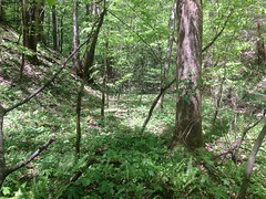
A bit further on, I noticed an old rusted out iron drum lying in the creek. I'd normally take that as an indicator that logging activity had occurred in the area, or that there was once a campsite there, but there had been a clear cut up the ridge to the east some time ago and it could have rolled down from up there.
Further on still, I found various cuts and fills and notches. Unless I imagined them, which was possible. Then I found an old cable.
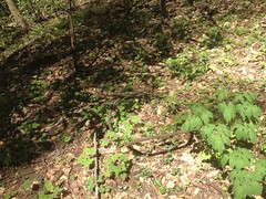
Evidence? Maybe, maybe not. Those are used for everything in the world, and still might have been from that modern clear-cut.
But!
Eventually!
The smoking gun:
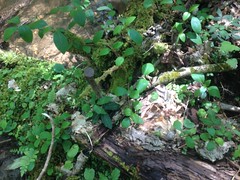
Doesn't look like much, but there were two tree trunks, laid parallel to each other pinned together with cross-ties, by these giant spikes.
Spikes!
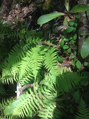
Spikes!
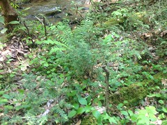
Here, you can see the parallel trunks.
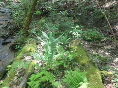
It looks like almost nothing in the photo, but in real life it's really obvious. There was a fill running along the west side of the creek and where it got too swampy they'd built a low trestle and I guess just abandoned it rather than take it apart and reuse it.
At the north end of the trestle, a weird triangular rock wall divided the creek and rose some 6 feet up into the air as the creek dropped out from under it into a small cascade.
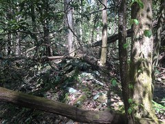
At the time, it was enigmatic. Clearly constructed by man, and almost certainly part of the old rail, but I couldn't divine its purpose.
I appeared to be at the point where the creek hooks hard right and joins with Dover Creek. At the time I couldn't remember the name "Dover Creek" but I knew where I was. I'd been looking for that spot, actually.
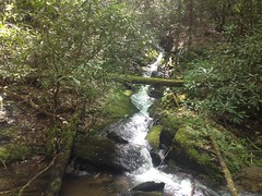
The creeks joined at the bottom of a pair of falls.
Pheasant Branch Falls:
And what I guess could be called Dover Creek Confluence Falls:
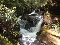
I searched all over for the rail and soon found it running along the south side of Dover Creek. The triangular rock wall I'd seen earlier was actually the far end of a massive stone fill that stretched out forever to the east. Over the years, the creek had rerouted itself and eaten away at the wall until the bit in the middle was all that was left. I could probably draw it better than describe it with words, but I'm too lazy to do that.
The stone fill went on and on and on.
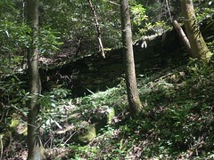
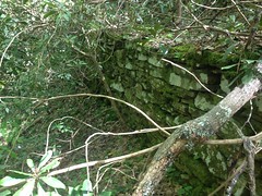
I never reached the end of it. I knew I was getting close to the border of the Dukes Creek Conservation Area and they are very strict about visitors. On the only other entrance that I know of to it, there are no fewer than 7 signs telling you to stop, and that you must have a permit to enter. What idiot would bushwhack in from this direction? It seemed unlikely that the border would be marked, so I kept my distance.
That said...
I did follow the old rail for quite some distance, and it was absolute rhododendron hell.
Screw fighting the woods. The creek below looked really inviting.
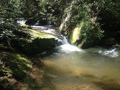
I was hot and a little tired, and it seemed like a good spot for a snack, and a swim.
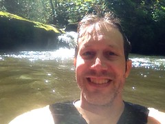
Man was I wrong about the swim though.
It felt good standing knee deep in the water, and it felt good to wash off, but the full body immersion could not accurately be described as feeling good. It usually takes a minute, and by torso got accustomed to the cold after a few minutes, but my arms never did and just kept hurting more and more. I guess that's why my smile looks so forced in that picture. I found out later that it was only 60 degrees outside. The water had to be in the 50's.
I think I'll wait for a warmer day to try it again.
I could see dangly arms of magnolia and rhododendron strangling the old rail bed and it looked like it would be a lot easier and more fun to bounder hop along the creek.
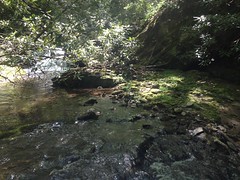
I ended up climbing up several shoals and short cascades before eventually climbing over that Dover Creek falls I'd seen earlier.
At the top there was a big flat spot with even more enigmatic features. A notch cut in 20 feet up the hillside. A skid to nowhere. These weird stone structures.
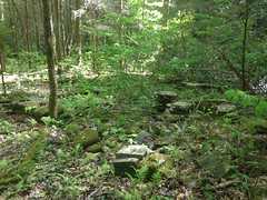
Too far away from the old railbed to be ruins of the fill. Old enough to be overgrown with moss. I'd guess the remnants of a chimney, but it would be a terrible place for a house. Perched between two waterfalls, no road in, and it'd be washed away by one heavy rain.
No idea.
I mentioned "between two waterfalls". Just upstream lay this monstrosity.
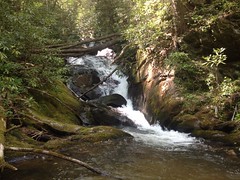
I hate that I never have anything to show scale other than my camelback, which I can't just tell "go stand over there".
So far, Dover Creek had been pretty good for boulder hopping, and I managed to climb up over that falls too.
Ok. I knew that the road was to the north and west. If I headed either of those directions, or both of them I ought to hit it eventually. Due north didn't seem like a good idea because there's a weird pinch in the road, I could end up walking parallel to it for a long time without actually hitting it, and then I'd still be a long way from the car. Heading more west than north would just put me closer and closer to the car when I finally did hit the road.
But I wasn't sure of the terrain. I didn't know if I had to climb directly over ridges whack through tough brush or what. I ended up sidehilling on pig trail after pig trail through more burned out wasteland for most of it, but I eventually, more or less followed Dover Creek and Winkle Branch back to the road.
This took forever.
For. Ever.
About halfway on, I realized that the road must be over the ridge to the north of Dover Creek, but the ridge looked completely barren, fortified with exposed rock, and inascendible, so I just kept pushing west until it looked a lot better. It was around Winkle Branch that I was able to turn north.
There's a long sliding falls on Winkle Branch. It's not very photogenic, but it's semi-impressive in person.

As luck would have it, I hit the road about a block from my car. I will admit that at the end there, I checked the GPS a few times to make sure I wasn't just heading off into oblivion, and it was reassuring to find that I wasn't. At some point I guess I'll have to work on navigating without the map or the GPS. One step at a time though. No need to do everything today.
The couple I'd seen earlier were gone when I got back.
I discovered later that I'd only walked 4 and a half miles. In 7 hours. That's how tough the terrain was. Admittedly I was more focused on enjoying the woods than cranking out miles, but it seems like I'm usually faster than that, even when I'm taking it easy.
On the way home I had some Tacos La Cabana, at La Cabana, and they were delicious. I also grabbed a Dr. Pepper at the Kountry Kupboard in Cleveland, next to the Laundro-Mutt dog wash. I got home a little early actually, around quarter to nine. It pays to get an early start, I guess. I'll have to do that more often.
I was pretty satisfied with the Adventure, overall. That railbed fill is the largest intact structure I've found yet in the National Forest. The trestle remnant is probably the second largest, and it's always fun to find definitive proof of something you suspect. I keep hoping to find an intact, standing trestle, or the broken wheels of a derailed train car or something. Such things litter the Silver Comet Trail. Perhaps they litter the forest as well, if you know where to look.
I'll have to remember to bring my map next time and explore the old Dover Creek rail.
I wonder what it would take to get access to the Dukes Creek Conservation Area...


No comments:
Post a Comment