Ok, so I've been to Pinelog at least 8 times since the last post. The first four trips I spent scouring Stamp Creek for Jones Mill and Pool Furnace. Legend holds that the two occupy the same property, and if I found one, then I ought to find the other nearby. My search was monumentally misguided though. Someone should literally erect a monument to how wrong I was about where I thought it was.
Of course, I didn't know that at the time, so for a while, I proceeded, with enthusiastic optimism, directly into oblivion.
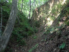
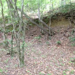
Fortunately, Stamp Creek itself is very scenic.
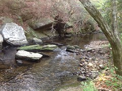
So, at least there was that.
During the first trip, I searched every inch of the creek, from the paved road to the falls, or at least every inch of land not marked Posted, Keep Out. All I found were old roadbeds. All manner of them. This one was particularly interesting because it may have been a ditch rather than a road.
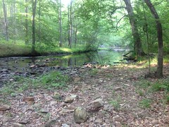
During the next trip, I started way south, at Hwy 20, and searched north until I hit private property. This involved a really long trek through really tall grass, in snake and tick season. Fortunately, I encountered neither.
The creek is a lot wider down there.
Trying to cross, I slipped down the bank and kind-of cannonballed into it, so I guess it's good that it's deeper too.
Again, all I found were old roads. Despite modernish topo maps showing a ruin where the road crosses the creek, I found no such ruin. It may have been bridge pylons or something, long washed away. No mill though. No evidence of one. It was discouraging, because the map also shows that the road that I found leads up to another road, named Old Mill Road. How can Old Mill Road not lead to an old mill? I would eventually find out, but not for a while.
I did find an Ohio plate back in there, all shot up, in the middle of nowhere.
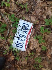
Didn't expect to find that.
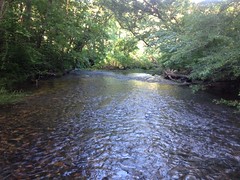
During the next trip, I started at the Stamp Creek Road and explored south until I hit the WMA boundary.
Again, the natural beauty of the creek itself made the otherwise fruitless effort seem almost worthwhile.
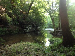
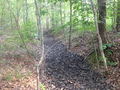
The fishing trails along the creek were braided, occasionally washed out, and generally difficult to follow. As before, I found various old roadbeds, all of which eventually led to private property, or back to the pavement.
I did find a bunch of what I like to call "organized rocks"...
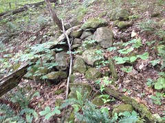
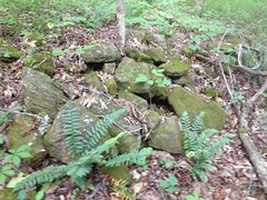
...and I was momentarily optimistic, but the moment was fleeting. That's all there was.
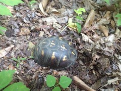
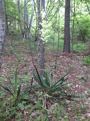
For all my frustration and effort, nature rewarded me a bit on that trip.
Turtle:
Yucca:
Blackberries!
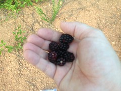
I ate so many of them.
So many.
And a wolf spider the size of my hand, carrying her babies on her back.

Just hanging out on the road there.
But no furnace, and no mill.
Before leaving, I looked at my map again. By process of elimination, there was only one place that it could be. It must be south of the paved road, in a tiny little corner of the WMA further south than I'd yet been, but north of Allatoona. I could see that there was a creek that I could follow down to that spot. There's an old gated road leading north of the pavement along that creek. Maybe it also led south, and I just didn't notice before.
On the drive over, to check it out, I drove right by a road named Old Jones Mill Road. Seriously?! How did I never see that before? Well, it's not named on any map, I'd only driven by it once, ever, and, I'd only ridden by it once, in total darkness. Plus, I'd never thought to look over that way before because a semi-modern map of the area and hunters talking about it on the GON forums, both put the mill well north of the paved road.
Ha! Maybe I could drive to it.
Alas, the road became a private drive almost immediately. There was a trail leading down that creek though. Hmmm...
During the NEXT trip, I brought Billy with me. I figured I wouldn't fail if I drug someone else along. The stakes were just too high.
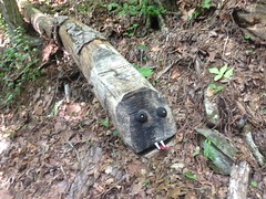
We parked at the gate, descended the trail along the creek, discovered a crashed flying saucer...
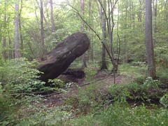
(in real-life it looks a lot more disk-like)
...and eventually discovered a maze of trails and old roadbeds which looked like they got plenty of foot, horse, and ATV traffic.
These took a while to sort out. They all looked promising, and we anticipated finding something quickly, but we mostly just found more and more trails and old roads.
There was this rift in the hillside along one of them though.
Which looked like it might be an old mine cut. And that same hillside had a few more of what may have been slumped-in cuts along it too. It was encouraging. We might finally be in the right place.
We also found a cool snake.
Billy does not like snakes, but he didn't seem to mind that one.
We'd crossed Flying Saucer Creek 3 times, explored all we could on that side of Stamp Creek, and finally had to cross Stamp Creek too.
It was good that we did though.
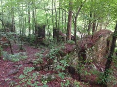
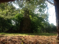
Because, finally!
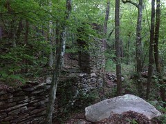
The Pool Furnace!
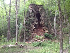
You can really see the chimney in this one.
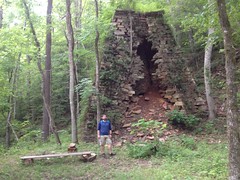
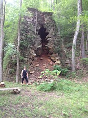
Built in 1855, owned by B. G. Pool and John W. Lewis. This furnace is sometimes referred to as the Lewis Furnace, which is confusing because the actual Lewis Furnace is located way farther north, but also on Stamp Creek.
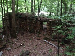
Ore was dumped in the top of the furnace. Air was blasted in through the tuyere arch on the left side by a set of bellows, powered by a waterwheel. Molten iron flowed out of the casting arch on the front side. Slag also flowed out of the casting arch, presumably to the right of the molten iron.
There were old slag heaps to the left of the furnace. Though they were not as extensive as I expected them to be.
It wasn't clear where the waterwheel and bellows were placed. No remnants of the race were visible in the creek. No remnants of the outflow box were discernible. We wondered if the wheel might have been placed in the semi-rock-armored hole directly next to the furnace, and may have had a long race leading to it from well upstream. It just wasn't clear.
I was facing the casting arch, explaining the operation of the furnace, and Billy was like: "Hey Dave, there's a door over here on this side..."
"Yeah, that's the tuyere arch..." (walking around to the side) "...that's where the bellows... Aaaah!
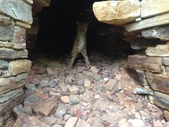
Gave me a heart attack.
Oh, man, we laughed.
An old road wound its way up the hillside above the furnace, and I explored it a bit.
The cellar of the Big House was a little ways up hill.
There was a small mine cut above that.
And further up there were more small cuts and old eroded chutes. I didn't explore it very thoroughly though. We had a mill to find.
Goodness, it was difficult to find. It HAD to be ON an old road though. It just had to be. We followed every one we could find. The further upstream we got, the more narrow and inhospitable the terrain got. It just didn't look like a good spot for a structure of any kind. It was also getting dark. Finally, we crossed the creek again, and followed a rugged ATV trail, as a last ditch-effort. It led to a well travelled old road, notched into a steep hillside, and the mill ruins sat right below that road.
Woohoo!
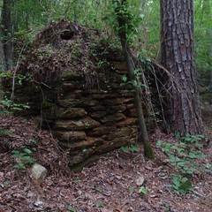
The mill was built, post-Civil War, by R. H. Jones as a saw and woodworking mill to support his carriage, buggy, phaeton, and wagon business. Eventually furniture and caskets were also produced.
There is a large room at the northwest end of the structure...
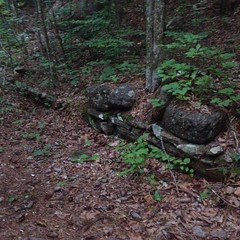
...and a smaller room at the southeast end, which I couldn't get a good photo of.
The back wall supports the road, and extends a bit southeast of the smaller room.
Front face:
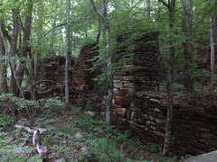
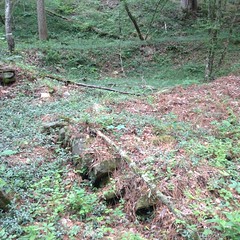
On the northwest end of the complex, a sluice and 3 large spikes mark the location of the mill wheel. Presumably that room housed the main machinery.
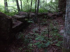
Both rooms are raised above a curious box-shaped depression, 2-feet deep, and 4-feet wide, walled and floored with rock, that runs the length of the complex. It may have housed some set of shafts, belts, and pulleys below the floor.
Also, I suspect that the mill mas multi-story, the remaining ruins effectively having been the basement, and the main part of the mill having been a wooden structure above it.
The structure may have extended over and across the road too, as the remains of a few small walls line the backslope above the road, behind the larger room:
In addition to the woodworking mill, the complex was alleged to have eventually housed a grist mill and store. The grist mill may have been run by the same wheel and occupied the southeast end, in and above the smaller room. The store may have occupied an excavation above the road, above the rock wall supporting the road to the southeast of the smaller room. The excavation may have originally provided fill dirt for the road itself.
Of course, all of this is speculation. I cant find any reference to or photographs of the mill when it was in operation.
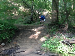
From the shape of the road to the northwest, it was clear that people usually came in from that direction. We followed that road a bit. It crossed the power line cut and eventually led to a deep pool with a rope swing. Oh hell yes, I was swinging! The rope was solid. The pool had good depth and was free of debris. The tree had plenty of leaves. Check, check, check. Swing!
As I hit the bottom of my arc, the branch the rope was tied to broke and I went flailing into the water, trying to get as far out into the pool as I could. Fortunately, the branch fell straight down, and missed me by several body lengths.
Ha! I guess I'll know to check the branch the rope is tied to a little better next time.
I can't explain why we have no video of this. It would have been great.
I hauled the rope, branch still attached, back up into the precipice. Sorry guys. Glad it was me though, and not you. Whoever you are.
Ohh, it was getting dark. Who knows how much further the road goes. We gave up and headed out, avoiding 2 creek crossings by betting that an overgrown road would take us over to one we'd been on earlier, which it did.
We also passed a snow leopard, perched in a nearby tree.
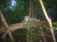
We'd walked right past it earlier. Makes me wonder how many bear, mountain lions, bobcats, and bigfoots I've walked right by in my life.
When we got out, it was as dark as it gets, but we'd finally done it! I was so happy. You can't imagine.
During the next 3 trips, I explored various extents of various old roads, discovered that "Old Mill Road" and "Old Jones Mill Road" were once the same road, and were once connected across the creek by a bridge...
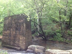
...only the piers of which remain.
(Side note: I'd might have known this before, had the ArcGIS USGS Historical Topo Map Explorer provided the Cartersville Area Special Mining maps from 1906 and 1941 when I was integrating that data into the Historical Topo layers on my trails site. But they are notably absent. The University of Alabama Map Collection has them though, and they graciously sent me full SID files, which I converted to GeoTiffs, georefereneced with QGIS, cut into tiles, and included them with the rest of the historical topo maps on my site. So, now I can browse them at my leisure. Ahh, el luxurio.)
There's also what appears to be an old mine shaft near the mill.
It's hard to take a picture of a hole in the ground though! The photo looks like nothing.
After exploring a while, and comparing my GPS data to various boundary maps and became very curious about the status of all that land out there. The Pinelog WMA boundary is well marked in some places and completely unmarked in others. The furnace appears to lie inside of the WMA. The mill appears to lie just outside of it. The Allatoona WMA is well marked. It's not clear who owns the bits between them though, or between sections of Pinelog, or whether they care if you're on their land. The roads and trails appear to be equally well traveled, across borders. Is it county land? The few posted signs I did find face the road, as if to tell people on the road to stay out of the woods to either side, but maybe the road itself is OK? I'm no fan of trespassing, but I also like clear indication as to whether I am or not. It all makes me a little nervous.
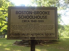
During several more rides and hikes later, I discovered the Boston-Brooke Schoolhouse at the end of Brooke Road.
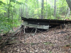
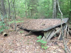
...and an old collapsed structure of some kind on a spur of Rock Quarry Road.
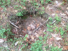
...and an old well, I guess, also in the Rock Quarry Road area.
Sadly, no actual Rock Quarry though. The hillsides are quite notably strewn with squared-off boulders, so maybe they just collected rock from the side of the road back in there. Perhaps the road never lead to a quarry, but rather WAS the quarry.
I also found myself, again, and again at this overlook on Grassy Meadow Road.
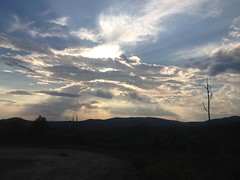
I'm not sure this gorgeous vista was intentional. I think it's just a byproduct of the recent logging below it. Either way though, I've stopped there many times to take in the big sky.
Big sky is rare in Georgia, and I always appreciate that I have such a good spot to see some.


No comments:
Post a Comment