I was on the bike all week - Allatoona, Blankets, and the road, but this past Saturday it rained all the morning, and though I wanted to get in something long, I wouldn't be able to do it on the bike.
Springer Mountain was the obvious choice, as I'd made a half-effort the previous weekend to get up there.
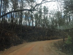
I intended to park at the end of FS877, back behind Bull Mountain, but the last time I was up there, there were controlled burn signs everywhere. They were apparently going to start burning the next day.
Boy did they!
Burn!!!!
Feel the burn.
"Blackend is the end..." I was singing that all the way to my destination.
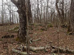
Jones Creek and the various roads back there were good firebreaks, and the woods was untouched just a short distance down 77A, so I lucked out and didn't have to go walking through the char.
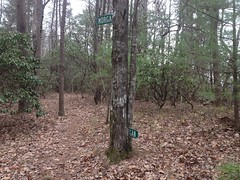
I parked past the third ford and headed up the old Jones Creek Road, hung a left at the Little Road sign and whacked up to Bear Hare. At the cairn, I hung a right and followed the trail up Saddleback Ridge. It was easier to follow this time, and it didn't look as indistinct as it had the previous time. I guess it was familiar to the back of my mind, or something.
There are several pink ribbons up there too, to nudge you on through the less distinct sections.
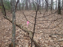
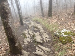
Above the ribbons, the trail is a lot more trailish.
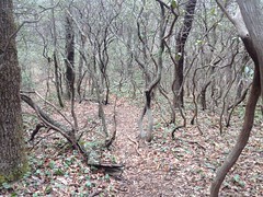
It passes through a bit of rhodo jungle.
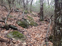
And skirts a lot of rocks.
Again, I saw indications of horse and Ranger traffic, but nothing else. No bikes. No casual hikers.
Last week I'd wondered if the trail sidehilled to the little gap between Springer and Ball Mountains, or if it just led straight up to the top of Springer.
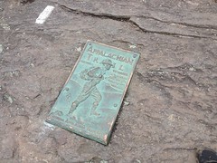
Turns out it heads straight up to the top of Springer, directly to the Southern Terminus of the AT.
When I got there, there was a couple taking a break. They looked like through-hikers, coming up from Amicalola. They were both smoking, they had a cute little dog with them, and they had a lot of gear. It was one of those where they either really knew what they were doing, or they really didn't know what they were doing. I couldn't tell which.
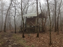
I didn't stop to find out though, just said a quick hello and took off towards the Springer Shelter.
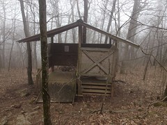
I'd been there twice before, but never really looked around much, and I figured "hey, I'm in the area..."
There are 2 privies.
There's a bit of a garbage dump behind the southern privy.
There's a bit of a group-camp with a bear-box nearby. Then there's the main shelter.
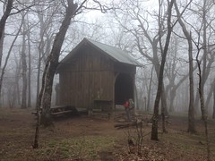
It has those cables that you can use to hoist your gear into the air. I can't remember what those are called now. There was also a bear box nearby, in case you trust it more than the cables.
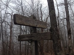
A super old and busted sign pointed the way towards water.
And the little creek was deeper and wider than I expected for how close to the summit it was.
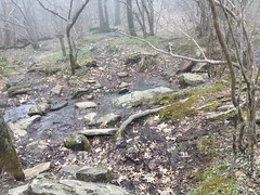
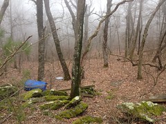
Past the creek there were 6 or 8 more campsites along the trail that wound back south around the top of the mountain.
There was a veritable maze of trails up there leading between the various campsites and structures, and I made no effort to decode them, except for the main trails. There could easily be one leading down the mountain in some odd direction that I just didn't see. If there is, maybe I'll discover it some day, but not that day.
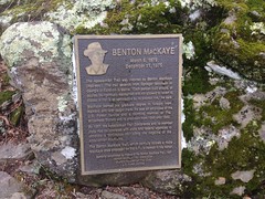
A little further on I picked up the Benton MacKaye trail...
...and took it in the direction of Ball Mountain, past the memorial.
The BMT is really grassy up there.
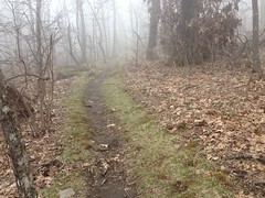
It was also super, super foggy.
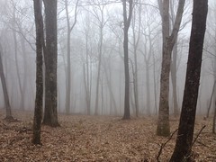
I think the only times I've ever been up on Springer Mountain, it's been in almost the exact same conditions. Super foggy, wet, and cold. That day was no different. Earlier, I'd been climbing and it had kept me warm, but now that I was just milling around on flat ground, the chill was setting in, and I had to put on my jacket.
All I had with me was my rain shell, but it turned out to be plenty. I even unzipped it after a while.
I planned on taking Ball Mountain Ridge back to the truck. I'd heard there was a trail leading down it a few months ago, allegedly popular with the Rangers. I found the trail straight away, but I wondered if there wasn't another trail leading over the top of Ball Mountain to FS42. It seemed like there might be, considering that the Rangers generally appear to avoid the AT, BMT, or other major trails, except to cross them. I didn't find anything, but it's possible that something more distinct might stand out in the summer.
The trail down the ridge there is really similar to the one running up the ridge to Springer - steep, alternately well defined and indistinct, randomly ribboned, and apparently used by the Rangers and riders on horseback.
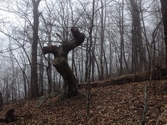
There aren't too many notable features though.
There was this one gnarly tree.
And I saw some kind of black salamander up there.
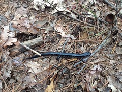
I felt kind of sorry for him though. He couldn't have been further from water, and he was heading up the ridge even further away from it.
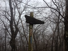
Oh, yeah, there is one very distinct feature of that trail. The Morgan Dairy sign.
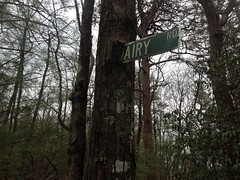
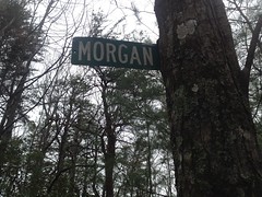
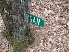
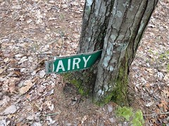
It looked like someone had cut a Morgan Dairy Road sign in half, notched off the rounded edges, and hammered it into the tree there. I imagine, in antiquity, Morgan stuck out of one side, and Dairy out of the other. It looked like maybe one side had fallen off though, and someone had jammed it (backwards) in between the two trees there.
So far, I've seen Silver Dollar Road, Farm Road, Little Road, and Morgan Dairy Road signs on various trails leading up into the general Jones Creek watershed. I really hope I run into someone who knows the story behind these some day.
The salmander was the only wildlife I saw all day. I haven't seen much in the way of wildlife yet this year, actually. I guess it's not quite spring yet, up north, and up high.
There were purple flowers popping up here and there though.
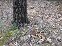
So, it may be spring up there pretty soon.
There's one spot where the ridge bends to the left, the trail isn't super clear there, and it's easy to get wide. Then, down near the bottom, the trail disappears suddenly, and it's easy to get off to the left if you're not visualizing the terrain well enough. Or, at least that's what happened to me.
At the very bottom, there's a bit of a trench, where the trail was more heavily used way back, maybe as a skid, or maybe just for whoever lived back in there to get up into the woods.
Ultimately, I ended up in the food plot at the end of FS877, right where I wanted to be, and my truck, with its heater, was a welcome sight. I'd gotten a good chill up on Springer, and though I felt OK, I really hadn't totally gotten over it.
Driving out, I passed a guy with a pretty loaded-up bikepacking rig, pumping water out of the creek into a bladder. I wondered where he was coming from and where he was headed. I'm not aware of any popular routes that would put you on 77A or 877.
Adventure! I guess.
I ate at Burger and Shake in Dawsonville, but I didn't get a burger or a shake. I got a chicken sandwich instead, and I think that I prefer their burger. I just forgot to order the shake, and only realized that I'd forgotten as I walked back to my car, in the cold, misty, drizzle, and didn't feel like turning around to go back for it. A little further down the road I saw the sign for a Marble Slab Creamery, and having warmed up by then, decided that I must have a shake. It turns out their shakes are $7. My goodness. They made a joke about a $5 shake in Pulp Fiction. "That's milk and ice cream, right? And it's $5?" No, these days, it's $7.
It was a pretty good shake though. I'll give them that.
It rained again last night, so today I'm sitting around the house working. Looks like it's going to turn into a no-bike weekend. I guess, technically I could still go ride later, if the trails are open. The family's on their way home from vacation in Gulf Shores though, and I'd like to hang out with them this evening, so we'll see.
Decisions, decisions.


I saw a picture from a trail runner of another sign that says "pleasant rd" on that trail from the rock cairn to springer. That Ball mtn trail seemed more distinct last summer than it did a couple of months ago when I was on it last. I also tried to find a trail from fs42 straight to it but there didn't seem to be much of one. I'm always on a bike so I've hiked-a-biked the BMT or bushwhacked from fs42 to get to the ball mtn trail.
ReplyDeleteYeah, I remember you mentioning the pleasant rd. sign and I looked for it, but I didn't see it. It's probably up there somewhere. It might be more obvious on the descent. I suspect both trails might be more distinct in the summer, with grass and brush growing up everywhere except the trail.
ReplyDelete