Last weekend seemed like a good time to hit the PaCO Mixed Loop again. PaCO stands for Paulding County, and the loop is mixed because it's part gravel, part road. People generally ride it on cross bikes, or just on road bikes with 25's. I rode it on my mountain bike last time and told myself next time I'd hit it on the road bike. But I forgot that I'd made that decision until I was a few miles from the trailhead, with my mountain bike on the roof.
Ehh... It's still fun on the mountain bike.
On the drive over, I took some back roads to avoid the highway through Hiram, or more precisely to avoid the dozen or more 5-minute traffic lights through town there. As such, I arrived at the Rambo trailhead on the Silver Comet after only about 45 minutes of travel. Way better than last time.
It's early spring, but the trees in the lot, and down the trail looked like fall. Fall colors in spring. A lot of them are still flowering, and only some of them have even started to leaf out. We've had a particularly spectacular spring this year, for some reason. I guess it has to do with all of the rain we got. It was terrible for riding on the weekends, but maybe good for the trees.
I left the lot at about 3PM, I think, heading west.
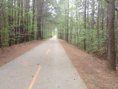
I only kind-of remembered the route. I mean, I generally knew it, but I didn't remember every turn or how far it was between them. I'd printed out a map, and made some notes on it, but apparently even that didn't jog my memory very well. In particular, it seemed like I was on the Comet for a long time before hitting the first turn. Way longer than I remembered it being. It turned out to be fine, but it also reminded me of the scale of the map. I guess my maps are usually twice as zoomed in as that one was. Everything was twice as far as it seemed, intuitively, looking at the map.
I turned right off of the Comet onto a super rough road - not unpaved, but super rough. I remember the road in front of my Grandma's house in Covington, LA being rough like that. Too rough to ride a skateboard on. We used to bring our skateboards, but we could only ride them in the driveway, or otherwise walk a mile to the nearest decent road. We'd generally avoided doing that, but one day we did. Turned out that the whole rest of the town had great roads and fun stuff to skate. Stuff that we'd been missing out on for years, all for not wanting to walk what seems in retrospect, a very short bit.
I think the next road was Johnny Monk Road, which was all gravel. I didn't recognize it at first though. Since I was last up there, someone cleared a wide strip all down the left hand side of the road, and grass had grown back in. Not sure what it's for though, I didn't see any gas line or power lines, or anything.
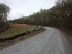
There were a couple of paved roads after that, and some churches and cemeteries.
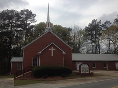
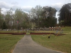
High Shoals Falls is somewhere near that last church. I've never been there, but I hear they used to baptize people in the water below the falls way back. I dig stuff like that, so I can't really come up with a good reason for not having been there except that I just keep forgetting about it. Maybe next time.
I felt pretty good at that point in the ride. I'd been riding pretty consistently for the past few weeks, and getting good sleep too, and it was paying off.
I remembered Thomas road being tough, but I felt like I was crushing the pedals all the way down it that day.
There's a bit of a view to the south, somewhere along the road...
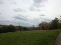
...but it's tough to take a photo of. There's this one little spot where it's spectacular, and then everything gets in the way if you miss it.
Thomas road starts out as asphalt, quickly becomes deteriorated pea-gravel on old asphalt, then transitions to actual gravel at some point:
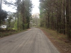
The transition is subtle though, and I didn't notice exactly where it happened.
I guess that I should mention that the loop I do isn't the standard PaCO Mixed Loop. There are short and long options of the standard route, which are like 32 and 37 miles respectively. The loop I do adds a bunch of roads to the north of the short loop, for a total distance of 60 miles.
Actually, the last time I did it, it was just short of 60 miles. Since then, I discovered some additional gravel and added it into the route this time. Most of that gravel was in the vicinity of Narroway Church:
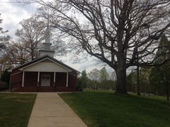
There are a couple of old farms back in there, and it seemed like everybody had a lake in their yard, so I enjoyed the scenery. Extra dirt is always fun too, and I think there was some extra climbing, which I was up for.
At the north end of the loop, Lucas Road cuts across the north end of the forest.
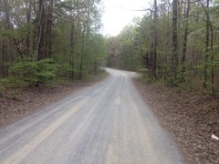
There's almost nothing at all on the map to the south, for a long way. There are a couple of WMA's, but they're huge and I don't know if they're open to bikes. I always imagine land like that being dotted with old chimneys, rock walls, and stills. Some day I'll have to get out there and see.
Lucas Road eventually becomes paved, and there are farms to the left and right, all the way to the highway. The first farm was a goat farm, and there were like 300 goats congregated in the southeast corner of the field there, right by the road. They were alternately scared and intrigued by me.
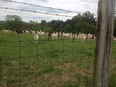
When I pulled up, they all ran over to see me, then when I stopped, they ran away, then immediately turned around cautiously approached at first, then decided I was cool and ran back over.
Ha! Goats.
Plant Bowen is another prominent feature in that part of the state.
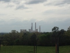
It randomly pops up on the horizon as long as you're generally looking west.
Other than that though, it's all cows, horses, goats, crops and ponds.
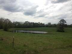
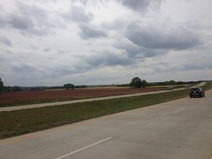
I think one of those fields is cotton, but I don't know what the other is. Fall colors again though. Fall colors in spring. those fields are everywhere up there. Those 2 crops in particular.
Most of the cow pastures had little ponds too, and the cows were either wading in them or congregated at the edges. I've seen plenty of cow pastures with access to water of some kind - usually a big creek flowing across it, or a large pond notched in between a couple of hills by a small dam. These were very different though, they were almost universally formed by C-shaped levees at the base of a hill. If one was empty, it might make you think it was bomb crater. I'd seen similar ponds in the Armuchee area, though none in cow pastures, just sitting kind-of near a house. I saw a dozen or more that day though, and they all had the same purpose.
I'd also seen a few of them in the woods of the National Forest - one near Bull Mountain, another off of Chester Creek, and another below Horse Range. They were just up in the woods though, and dry. At the time, I'd puzzled over them. They looked like the ones I'd seen in Armuchee, but at the time I could only guess what the purpose of those was too.
Mystery solved! There were apparently cow pastures back in the woods at some point, and the craters were cow ponds. The land around the Armuchee ponds must have also been pastures at one point. I discover stuff in the woods all the time, and I most often end up with new questions. As much as I love that, I love it even more when I end up with an answer.
Between the northwest end of Lucas Road and Braswell, it's all pavement. Like 15 miles of pavement. The mountain bike feels like the wrong tool for the job in that section, but it's not all bad. If you're hungry or thirsty, it's a lot better than being in the middle of the woods.
There's a Dollar General...
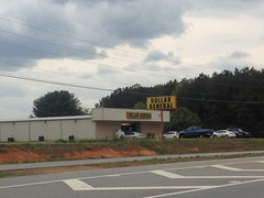
...and just up the road there's a T&M Store (whatever that stands for) and the nondescript restaurant named "Restaurant" across the street from it.
Last time I was up there I was out of water at the Dollar General. But, that time it was like 102 degrees outside. This past weekend it was only 86, which is warm for this time of year, but generally pleasant. I still had one full bottle and about a third of the other, so I didn't stop.
Near the Davistown community, a truck came tearing around a corner about 100 yards ahead of me, entirely in my lane. No part of the truck was in the correct lane. The driver saw me though, and gave me an apologetic wave and nod after pulling back into his own lane. I gave him a "no problem" wave and nod, and he gave me a "thanks" nod.
It made me smile thinking about how many different things we were able to communicate with just waves and nods.
It's mostly flat for most of that 15 miles, but toward Braswell you climb over Knox Mountain and it's not so flat.
You also pass by Pizza Farm, which always sounds super enticing.
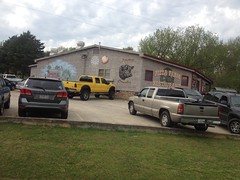
One day, I'm going to have to ride from here out to there on my road bike, eat there, and ride back, or something. The place is always packed though. I wonder if I should make a reservation.
There are a couple of historic building on Knox Mountain Road.
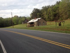
And a couple more as you approach Braswell. I thought about taking more pictures, but that would have taken all day.
When I got to Braswell, I had about half a bottle left. It seemed like I ought to be able to make it to Yorkville, but it was also Saturday, and the local convenience store might be open. The last time I did the loop, it was Sunday, and it had been closed, but this time I had a chance.
There wasn't anyone in the parking lot, but it turned out that the store was open. It wasn't a convenience store any more though. It was now Richard's Bottle Shop.
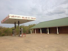
Hmm... I wondered if they had anything that wasn't liquor or beer. Turned out yes!
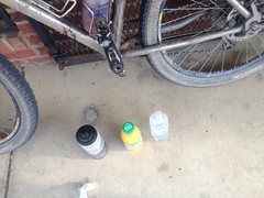
They had a cooler with several bottles of water and even one bottle of orange juice.
Score! I downed the orange juice and refilled my empty bottle with water.
Also... The lady that runs the store had put a hummingbird feeder out front, and there were hummingbirds coming and going constantly the entire time I was there. It's amazing, you never see them, ever. But, if you put out a feeder, a new one will fly by every minute, and then another one will come a few seconds later and chase off the first one.
Actually, when I got there, the lady was walking around the store with a broom up in the air, swinging it at a hummingbird that had gotten in but couldn't find its way out. Apparently two of them had gotten in, one had already gotten out, but the other one was totally confused and had been buzzing around like crazy for the past hour, driving her nuts.
I don't know hummingbird species at all, but usually you just see little green ones with short tails and red chests. This one was totally different. It had a long tail with little embellishments off to either side. I couldn't tell the color though, because my eyes hadn't yet adjusted to the light in the store.
The town of Braswell consists entirely of: a liquor store, a night club, an establishment of unknown purpose with a sign on the door saying no one under 21 admitted, a municipal building (police station), 2 rows of apartments, a two small neighborhoods with like 20 houses each, and The Palace.
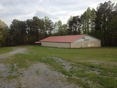
I have no idea what The Palace is, but last time I rode by it, it looked like it had been abandoned for decades. Since then, it's been refurbished and repainted, but I still don't know its purpose is. My first impression was bingo hall, but really I have no idea.
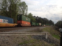
Several trees had fallen across old Skyline Drive, and when I got down to the train tracks, I had to wait for an actual train.
I was still feeling strong on the climb over Brushy Mountain.
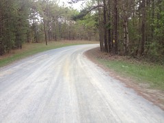
Though, I realized it had been a while since I'd done anything decently long when my palms starting to get sore.
At least 3 turkeys ran across the road in front of me on Brushy Mountain Road and Yorkville Pass. I think it's turkey season right now. You know turkeys - they like to tempt fate.
I made it to the Yorkville Grocery with plenty of water and even some Gatorade left, so I didn't stop.
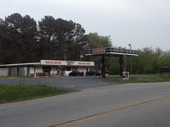
At the Y at Goldmine Road, it's safer to hang a right, go behind the cars backed up at the intersection and cut through the Darlene's Pizza lot, than to try to cross your lane of traffic and then cross in front of the backed-up cars. When I did it though, I noticed that the pizza place was closed.
Way back when I was first exploring the area, I kept seeing it open and always wanted to try it, but I always had to get going and kept putting it off. Fortunately, I didn't put it off forever, and on my last exploratory trip, made a point of eating there. It was good too. It made me sad that it was closed, but happy that I'd managed to eat there when it was still open.
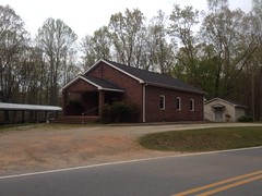
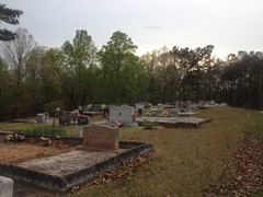
Almost done. Just a little kick up Goldmine Road, and Willow Springs Church Road, past its namesake...
And... Dangit, I still had to ride back on the Comet. I'd forgotten about that last time too.
It's like 3 or 4 more miles too, it's not a quick little jaunt.
I was ready to be done when I was done, but I still felt strong. I still had energy, but my hands and feet (and butt) were tired.
I grabbed some dinner at La Cocina, a Mexican restaurant nearby. I think I got the Chili Colorado, but I don't remember for sure. I did hear part of a conversation at the next table, where a guy said: "...he used to work Anne Rice's balls..." and some of the other people at the table hadn't been paying attention, and they were like "What?", "Anne Rice doesn't have balls", and "What do you mean he 'worked' her balls?" It was hilarious. Apparently she used to hold Vampire Balls and it was a big event. I'd never heard about that, but it sounded plausible.
It seems like there's more to tell, but I don't remember it well enough to tell it. I've got to start journaling day-of or day-later. This weeks-later thing isn't nearly as satisfying.
It'll have to do for now though. Busy, busy, busy...


No comments:
Post a Comment