For one reason or another, I've had a difficult time making it to any of the events on my list for like a year and a half now. Obviously the covids played a pretty major role, but family stuff and just scheduling conflicts have been a factor as well. Not to say that I haven't had some really good rides, but I've been missing out on Events.
One event, in particular, that I'd been looking forward to since I first rode it 2 years ago, was the Tour DeLiverance. It's basically gravel and pavement around Ellijay, but it's not your standard Cohutta grinder. It mostly focuses on stuff leading up into the Cohuttas, Talona Mountain, and Burnt Mountain. Stuff that I've never ridden much, and, as it turns out, really missed out on. In 2020 it was cancelled outright, I think. This year, there's no grand depart, but you can do it as an ITT and submit your GPX file afterwards. As long as you do it within the month of April, you're in good shape.
Yes!
With virtually no chance for a scheduling conflict to occur, I put it on my calendar for last weekend. As fate would have it, it stormed all day Saturday, but ha! Flexible schedule. I rode it Sunday.
Two nights before I got really good sleep. The night before I ate well and got decent sleep. I felt good waking up. Though it was in the 50's, it didn't feel chilly outside as I got my stuff together at 5am. I felt good and strong, like I remember feeling on a good race day.
I spun by the local Waffle House to find all of their furniture piled up in a barricade, with a chain wrapped around it. Clearly the dining area was closed, but there were no signs and only one lady behind the counter, and the only words I could coax out of her were "Our grill is down!" Some other guy in there rambled incoherently about not being able to get his order. It all seemed pretty sketchy. I drove over to the next nearest Waffle House and could see three people doing Waffle House-type stuff behind the counter, but they had a hand-drawn CLOSED sign taped to each of the two entrance doors. They appeared to be getting ready for customers though, so I called, twice, and got no answer either time. I waited until 6:00, figuring maybe they'd open then. Nope. Moving on. Being Atlanta, I didn't have far to go to find a third Waffle House, and this one appeared to be open. Awesome. Breakfast accomplished. I got out of town about half an hour later than I was hoping to, but it was still ok.
The drive up was beautiful.
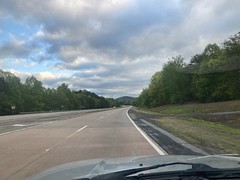
The sun was coming up and the clouds were dense and fluffy. The mountains looked beautiful. This time of year the leaves aren't all the same shade of green yet, so they look all patchwork. Love it!
Although... I did become a little concerned when I had to urgently get off of the highway and run to the bathroom two different times on the way up. Not the best way to start a hundred-plus day, but I figured maybe I was nervous or something. I didn't feel nervous though, and I don't typically have that kind of reaction when I am. Hmm...
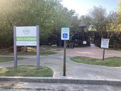
I parked at Harrison Park, with it's old barn off to one side.
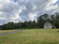
While I was getting changed, two other cars pulled up and two groups of people headed off on the walking track.
It felt colder there than it had in Atlanta, but it probably was a little colder there. It wasn't bad though, just a little chilly. That want-to-get-dressed-in-your-car kind of chill. I was sure I'd warm up when I got going though, and it would certainly get warmer as the day moved on.
I triple-checked my gear, pulled up the route on the GPS, and realized that it actually started up the road from where I was. I'd glanced at it on my computer the night before, and it looked like it started at Harrison Park, which is where it had started the last time I rode it, but in fact, it started basically at the Cartecay Bike Shop, or more precisely at the midpoint of the bridge behind it.
No problem. Quick warmup through town...

That's Kaylee's office there.
Ok. Ellijay Creek.

The official starting point.
Reset GPS... Start Strava...
Go!
I'd passed the shop getting there and saw a guy out front fiddling with his bike, so I waved to him after grabbing a photo.

"Hey hey!"
"Dave?"
"Yep!"
"It's Chris!"
Ha! It was Chris Gray, creator and coordinator of the event that I was presently engaged in. His beard was about twice as long as the last time I'd seen him, and I realized I'd never seen him without either a hat, scarf, or helmet on his head, or in bike clothes. He looked like a marginally different person. Not totally different, but I didn't immediately recognize him.
It was turning out to be strange day. Interesting, but strange.
We talked for a while and he gave me some info on the route. I was especially happy to hear that the gravel in the WMA near the end was nice and packed, unlike last time where it had been freshly lain wrestling match-gravel. He was going to do the medium length option (68 miles) with his bike in full-bp configuration as a gear test for what sounds like an adventure and a half he's got in the works.
Good luck Chris!
Post-chat, I spun back to the bridge, and reset everything again.
Go!
(for real this time)
...And I immedaitely missed the first turn. I hadn't even looked at the GPS yet and rode right past it.
Like I said, interesting day.
For a while after that though, things went really well. It was still morning, and the pastures and mountains and clouds were as lovely as they'd been on the drive up, except now I was out, moving through the morning air, and I was looking at it all with my actual eyes, directly, instead of through dirty glass.
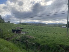
Last time I'd been riding in a crowded pack, which made it easy to miss things, lose track of time, and focus on the riders more than the ride. Not this time. This time I noticed how steep the roads leading into the Cohuttas are. But I also noticed how the various churches really glow against the woods in the early morning light.
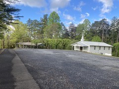
I noticed all the kitchy decor people had strewn about their yards. This one was a refreshing departure from the elaborate, threatening signs you usually see at the street-end of people's driveways.

Right when I was thinking "I haven't hit any gravel yet..." Bam! Gravel.
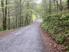
And not too much later, Wolfpen Gap Road. Not the Wolfpen Gap Road in "The Gaps" but a road through one of the many other Wolfpen Gaps scattered around North Georgia. This one is much less steep, but much more horrible in other ways, than the Wolpen Gap Road that everybody knows.
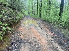
I didn't have a good opportunity to get photos of the spots where water came rushing down both tracks, or the full-width, 50 yard long puddles where you had to hug the edge and pray that your side logs are adequate. Mine were, as it turned out! No pigpen for me.
Wolfpen was the nastiest section of the route last time, but there were some reroutes, so I was only cautiously optimistic, at the time.
I ended up on Gates Chapel Road somehow, and recognized it by the old chimney on the left.

There was more glorious mountain scenery as I approached Bear Creek.
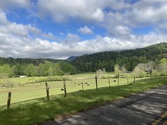
I'd kind-of felt the climbing earlier, but I guess I'd gotten warmed up by then, because the climb up over Holly Creek Gap seemed pretty tame. On the backside, bombing down CCC Camp Road though, my bike developed a disconcerting rattle that just got worse and worse. It sounded, offhand, like a bottle cage bolt was loose, but when I stopped to check, they were all snug as can be.
WTH?
Turned out it was my seat. Again. The rear bolt had worked itself loose, and it was rattling all around. Great. Fortunately, I was prepared for such eventualities, and withing a few minutes it was snug again. The seat didn't feel right though. Just off in some way that I couldn't put my finger on. Maybe the front was tipped up slightly. Maybe it felt less flexible. I wasn't sure, and I figured it would feel right soon enough, so I pressed on.
I passed the old firetruck...
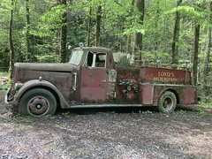
...and Mulberry Gap.
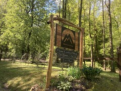
Interesting side note: Between the firetruck and Mulberry Gap I noticed another property, with a big sign declaring it to be "Terra do Pica-Pau". I'd not noticed it before, but that's probably beacuse I'm rarely approaching MGap from that direction, at least not early in a ride, when my brain is still functioning, and in the other direction, I'm usually going 100 miles per hour down the road. So, the name of the property stuck me as weird for a couple of reasons. First, it's in Portuguese, which is not commonly spoken in North Georgia. I can get by in Portuguese though, and "Terra do something" means "land of the something" which is a fairly common way for people to designate their property. I don't recognize "Pica-Pau" but "Pau" means stick. It's ALSO some very dongtacular slang. What does "pica" mean? I didn't know offhand, so "Land of the something-or-other-dongtacular-slang" is all that I could come up with, which cracked me up at the time. I was fairly sure that I must be wrong about some part of that, but couldn't, at the time, figure out how. I looked up "pica" today, and you know what it means? Cock. That's right. Cock. WHAT!!!??? "Land of the dongtacular-slang-dongtacular-slang" That can't be right, or if it is, it's the funniest thing I've ever heard. What does pica-pau mean together? Well, turns out, it's woodpecker. Ha! Like "stick-cock" or more precisely "wood-cock". I'd never heard "pau" refer to wood, only "madeira" which I guess really means lumber. Quite the rollercoaster, that one.
But back to the ride.
I kept seeing these signs everywhere.

Freaking everywhere.
Must have been 100 of them. All you can read from a distance is PAIN, and I kept saying "yeah, yeah, pain" when I'd see one. I was not yet in any pain, but I kept wondering if the signs knew something that I didn't.
At some point, you run along the Cartecay for a while...

...and then pop out in East Ellijay. During the event, the first SAG was at a church a bit earlier in the route. No SAGs this time, but I figured I'd self-SAG rather than trying to carry enough food and water for the whole route, so I put waypoints in for various stores, including this one:
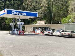
The Tim Buk Tu. I'd just barely finished one bottle at that point, and most of a Clif Bar, but I figured I'd fill my bottle back up and grab something salty, as I was craving salt at that point. I wasn't hungry at all though, which I thought was a little odd. I'd pretty much crammed that Clif Bar, and I could still feel it in my stomach. I hadn't had any meat for breakfast, only eggs, a waffle, and some toast, so it wasn't like I was suffering from bacon syndrome or anything. I don't know. It was odd.
Up the road from the Tim Buk Tu, there's this weird concrete quaterpipe.
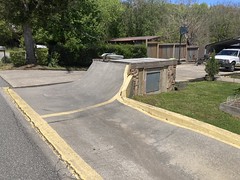
I don't think I got a photo of it last time, but I knew it was coming this time, so I was able to. What even? Is it really intended to be a quarterpipe, or does it have some other purpose and it just happens to take that form? There are scooters in the background, so maybe. But I couldn't tell just looking at it.
Just after the quarterpipe, I climbed Alpine Road, which is just crushingly steep. I'd leapfrogged a mail truck up the road last time. This time a couple of cars passed me, but no leapfrogging. There were a bunch of roosters running around at the very bottom, and I was like "'sup cocks?" and then laughed at myself because I said cocks and it was actually appropriate.
The road had been paved semi-recently, so it was actually pretty nice to climb.
I rode under 575 soon after, and hung a left for a new addition to the route - a climb straight up to the top of Talona Mountain. Goodness, what a climb. I had it. I wasn't quite out of gears, but I could imagine wanting a 52 in the back. I keep kind-of wishing for a 52 sometimes. Maybe. Maybe a 52 would be good.
The folks that live along the ridge there have stunning views of the Cohuttas.

That's from between two houses.
At the very, very top, there's a giant cross.


And there's also an overlook...
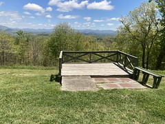
...with a view of what I guess is over towards Blue Ridge.

It was actually a little sketchy coming back down off of the mountain. I felt like letting it go, but you really pick up a lot of speed, really fast, and the pavement is really grippy, so a very small amount of brake does more than you expect.
It was a very interesting addition to the route. Tough. Fun. Nice reward for your effort.
Back on the familar route, I buzzed down Talona Road...

...with its weird marble gravel piles...
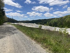
...and beautiful yellow patures.


There are many, many ruins along Talona Road too. I need to go back out there some day and check them out when I'm not trying to make good time through there.
Next up, Raven Cliff Road. I remembered it being difficult, but it wasn't as difficult as I'd remembered it. Some guy an a barely functioning car drove by me near the bottom, but it took him a very long time to get up enough speed to pass me. He was just "right back there" for the longest time.
Did I say Raven Cliff Road wasn't as hard as I remembered? Well, maybe from an effort perspective, but not from a pain perspective. About 1/3rd of the way up, my knees started getting a little upset. Hmm... In my experience, when ones joints start getting sore, it's not usually the joint itself that is the problem, but rather the result of some earlier nutrition mistake. I mean, sometimes it's just that you haven't done enough rides climbing steep stuff all day, recently, which arguably was the case, but more often than not, it's actually not that. I don't understand the actual mechanism. Maybe you're just more sensitive to pain when you're undernourished, or maybe there's some specific thing that you're short on that makes your joints swell a little, or... IDK I just ride here. But, it's definitely a thing, at least for me.
Trouble was, I wasn't hungry AT ALL. Sometimes that can mean you're underhydrated, but I'd been pounding gatorade all day, and peeing what seemed to be an appropriate amount.
It was weird.
I ended up walking the very last little kick, and then wished I'd known it was the last little kick, because who walks the last little kick?
I passed two riders on gravel bikes right as I came over the top. I didn't recognize the guy. The lady looked kind-of like Lisa Randall, but I couldn't be sure. I passed more riders on gravel bikes about 15 minutes later. Everyone was headed in the other direction, and it made me wonder if they were out doing the loop too, and I was going the wrong way. I was pretty sure that I wasn't, and if I was, well, I wasn't going to reverse course at that point.
There were an annoying number of PAIN signs out that way. I still felt strong, like I had energy, and I wasn't just crawling, but on any extended climb, my knees would eventually start gnawing at me, and I walked another hill or two somewhere in there.
I noticed that I wasn't really paying attention to the ride any more too. Just paying attention to ticking off miles.
The gravel seemed endless.

And it was always uphill. Damn. Somewhere in there I realized that I was no longer competitive, even with my own previous time.
Time to take a break.
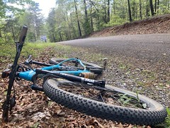
Oddly enough, nobody passed me while I was sitting there. Not a single car. But, I wasn't there long, 5 minutes tops.
My next self-sag was at the Ellijay Mini Mart, just slightly off-route, in the middle of absolutely nowhere.
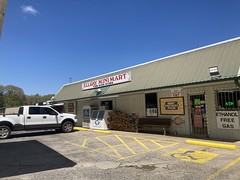
When I walked in, I found the lady working the store scrubbing the heck out of the floor, ledge, and bottom of the door frame of one of the cooler doors, with borax or something. It was getting super, super clean. She appeared to have already hit the one I was interested in because it also looked super, super clean. They get so nasty sometimes. The rubber even wants to stick to them sometimes because they're so nasty, and the door bends before it finally peels off. I admired her dedication to providing an enjoyable shopping experience. The dedication! Heck yes, Ellijay Mini Mart lady. Heck yes.
I grabbed a Coke, a Skor bar, a slice of pizza, and another bottle of Gatorade. I'd just finished another bottle at that point, and sat down at the picnic table outside.

When I pulled my phone out of my pocket, I noticed that I had a voicemail from my Mom, so I called her back. She and my Dad were driving somewhere at the time, but we talked for a while. They were not surprised to hear that I was 65 miles into a 114 mile ride, nor that I was at a mini mart but wasn't sure of its location. My Dad and I joked about having been in such circumstances, several times, recently even.
That random gas station pizza tasted so good, but I had a hard time finishing it, and the candy.
I'm not saying that the problem I was facing wasn't that I hadn't done enough long rides with ridiculous climbing recently, but I am saying that something was definitely wrong with my ability to put down calories. Minor stomach bug maybe? Whatever it was, food, and possibly water, seemed to be trickling through my system, and I needed it to be flooding through.
I felt ok for a while after lunch. There's a winery up there that hosted SAG 2 during the event a few years ago. Across the field, there are beautiful views of the mountains in every direction.


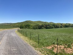
I felt well enough to enjoy that. Maybe my day was turning around.
Up the road a ways, there were cows...
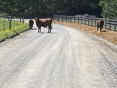

...just hanging out in the road. "Hello cows." As I approached them, they kind of jogged up the road a bit. To get past them, I had to kind of encourage them to group up on the left hand side, then walk around them slowly. Riding by was not an option. They just kept trotting away, and they'd spread out across the road again when they'd stop. I didn't see an open gate, or hole in a fence, or anything. It wasn't clear where they'd come from. There wer also no cars at any of the houses that I could see. Siri said I was in Talking Rock, so I tried calling the Talking Rock police non-emergency line, but it just rang and rang like 10 times. I tried twice. Same thing both times. Eventually, I saw a lady with a wide brim hat walking toward the road from, I guess her house, but it was too far back off of the road to actually see. Yes! I rode up and told her about the cows. "They might be ours, are they black or red?" "Red" "Oh, those are so-and-so's. I'll let him know, we look after each other." Awesome.
Good luck cows!
Somewhere in there it all completely fell apart. I didn't experience any sudden bonk. It was very, very gradual. I felt like walking again. Then again. Then I felt like stopping for a minute. Then again. Then when I'd walk, I didn't feel recovered when I'd get back on the bike. Little by little.
Last time, I'd gotten caught by Mike Rasch and Graham Skardon just past the winery, while fixing a flat and we rode together up over Burnt Mountain. It seemed like Burnt Mountain was fairly close to the winery. Indeed, it was not, or at least it really didn't feel close yesterday.
I crawled over that hill. I mean, absolutely crawled. I probably walked half of it. I had to stop for like 10 minutes before even getting to the overlooks.
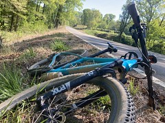
I wonder what people thought I was up to, just sitting there on the side of the road.
I did, eventually get to the overlooks.

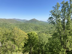
But I can't say that I was able to enjoy the view.
It's a long stretch from the Ellijay Mini Mart to the next store. I knew this, but rough math the previous week said I should be able make it on 2 bottles, and that I'd only burned through 1 between the previous stops seemed to confirm this. If I'd been moving anywhere near nominal speed, I probably would have made it, but I was moving so slowly... I soon realized that I'd never make it. And, man, I was up on top of a mountain. Water sources weren't exactly abundant.
But, I knew what to look for, and after a while I found a little spring. Unfortunately, without really digging into the ground and/or rearranging rocks for like 10 minutes, I couldn't fill a bottle. I still had half a bottle left, and I could get just enough for a mouthfull though, so I drank like 10 mouthfulls, basically until I felt like I couldn't drink any more, and pressed on.
What I was really looking for though, was something like this:
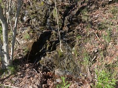
Exposed rock, with water pouring out of the ground, and tumbling down it. I'd seen plenty of exposed rock with water barely dripping down it, but considering the rain we'd had the night before, I was pretty sure I'd find something like that if I kept an eye out. I eventually did, and not a moment too soon. I was down to one last draught of the Datorade.
I pounded what I could there, but that was only about 1/4th of a bottle. Intuitively, it seemed like I ought to have been able to put more down, but that was it. I filled both bottles though, and crawled over a few more hills.
I kept thinking stuff along the lines of: Yeah, I'm having a bad day, but Burnt Mountain is tough. The lead up to it has lots of punchy kicks, and then you still have to grind over the mountain itself. The toughest part is behind me. If I can get down into the piedmont, it'll be easier. Things could turn around.
It wasn't long before I was rocketing down to said piedmont. It's like a 6 mile descent, and I was off the brakes almost the entire time. I probably haven't gone that fast, for that long since the last time I rode that particular descent. I'm not sure I even have the confidence to ride something like that on my road bike. I felt comfortable on the mountain bike, but I was definitely listening carefully for anything that sounded even slightly wrong. It was a little nervewracking, but not enough to slow down.
After screaming down the road, there were a couple of miles of gravel shred...

...and some narrow pavement shred.
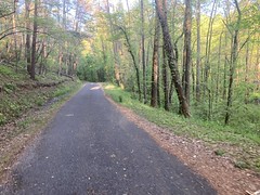
And indeed, things turned around. I could climb again. My knees felt tired, but they didn't hurt, per se. Sadly, it didn't last. Ten miles later I was back to hurting and back to walking. My mind was in full-on escape mode. I was at about mile 94 of 114. I had 20 miles to go, but it might as well have been 100 more. It was kind-of like Zeno's halfway-to-Rome thing. It felt like the first 50 miles took some level of effort, then the next 25 took the same as the first 50, then the next 12.5 took the same again, then the next 6.25 took the same again... Forever. I remember thinking about that at the time. Like, it would take an infinite amount of effort to finish.
Heh.
I knew that wasn't actually true, but I did have a realistic problem that I probably couldn't overcome. When I started, I had not imagined that I could possibly run out of daylight, and so I didn't bring lights, other than the little commuter lights that are just always on my bike. At the pace I was going, I was looking at well over 2 hours back to the car, and it was already like 7:00. I could very easily run out of light, way up in the WMA. Not that I couldn't make it out at all, but without adequate light, I'd be moving even slower. It could be 10PM before I get done.
That was it. It had transitioned from fun to work at about mile 70, and then to suffering within a few miles of that. I was just riding to finish what I started at that point, but the cost was just more than I was willing to pay.
Damn.
Fail.
I crawled back to some road and took it to the Crossroads Market. Yeah, I could have taken the route goes there, but it was much more direct to take that road.

I grabbed some recovery fuel while I was there, but again, I couldn't just pound it down.
I'd initially planned on taking Hwy 52 back to Ellijay, as there is a bike lane almost all the way down, but then I remmeber that Mark B. lives pretty close. I gave him a call, and he was home! Mark B. to the rescue. I thought it was like 3 or 4 miles back to Ellijay on the road, but it turned out to be more like 10. God, that would have taken me forever. Thank you, so much Mark.
Done. Officially.
I grabbed some dinner at the Ruby Tuesday's on the outskirts, and the both the waiter and the guy next to me were amused by my plain burger and plain mashed potatos order. It looked like something I'd have ordered for the kids when they were little. The waiter did mention how she likes sauces, I mentioned that I do like barbecue sauce, she mentioned their maple bourbon sauce, and I was like: "That's right! You guys have that. It's specific to this place! Yeah, give me a side of that, I'm going to put that all over this burger." And I did. And now that I'm thinking about it, I want another burger with that on it. It's dinner time too. Hmmm....
Man, it's the first hard fail I've had in a while. Quite a while. And what a hard fail it was. Easily in the top 5 of worst days on a bike, aside from days where I just crashed and broke something. Two things immediately come to mind. The first is that I was clearly slightly sick in some way. Slight GI bug maybe? Maybe a slight cold that just happens to also have some GI effects? Hard to say, but I probably should have known something was wrong when I had to run to the bathroom, urgently, twice, on the drive up. Whatever it is, it's not enough to matter walking around, or even on a moderate ride, but I could feel it after long enough. The other thing is that I haven't really done a lot of long, tough climbing in a while. I think of 1000 feet in 10 miles as being tough, and I get that kind of climbing in nearly every ride I do around here, but the climbs are mostly tempo climbs. The only tough climbs are short little kicks. The longest is maybe a block or two. I'm not riding for 6 hours in real mountains every weekend, or even every other weekend. My seat is another problem. After fiddling with it early in the ride, it never felt good again. It was just a bit uncomfortable all day. Same with my pants. I've been wearing Pearl Izumi Attack Tights for about a year now. They're great because they have no chamois. They're also full-length which is great when it's chilly but not cold, and not bad when it's warm but not super hot. Also, the full length action is great on overgrown trails. But it's not a bib, and the waistband is also just a bit uncomfortable after a while. Between that and the seat problem, I felt like I was tensing up little muscles all day. I couldn't relax, and it adds up. I need a proper chamoisless bib, but so far I've had no luck finding one, and I've destroyed 2 trying to cut the chamois out. Also, my right wrist hurt like the dickens for a good bit of the ride. Two very specific spots. I may just need to adjust the grip. My left hand felt fine. I imagine it has to do with shifting, but I don't know for sure. I'll have to work on that.
On the upside, the bike performed admirably. The geometry was comfortable. Other than the seat/grip issues it was great. Wheels felt good. Tires didn't feel like velcro climbing. Not bad at all.
So, I think I've got a little work to do. I'll see if I can get that done soon and put in some more good miles soon after. Here goes...

