Tuesday, July 3, 2018

Cohutta Pinhoti

A few weeks back I had a great idea!

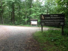
I'd been spinning a lot of laps around Blankets recently, successfully dodging bad weather, and feeling reasonably strong. I'd had a few successful rides in the Blue Ridge WMA area, but it had been a while since I'd ridden in the Cohuttas. Not a terribly long while, but long enough to make me want to get in some more.

So, me and Sophie drove up to Mulberry Gap. I rode while she milled around the place, did a little summer homework, and kicked back.

Kate had just returned from a rough trip to Kansas where some wicked dehydration had put her in the hospital. I'd read the story, but it was cool to hear it firsthand. I could totally relate too, the same kind of thing nearly happened to me the last time I did the Huracan.

I changed in the midstation bathhouse and noticed this weird dedication on the back of the toilet.
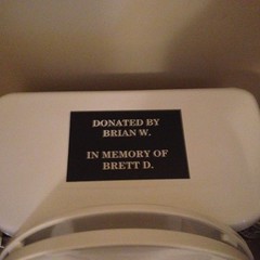
In Memory

What could it mean??? Last I heard, Brett Davidson was alive and well. I think he's even leading some bikepacking training rides this summer.

I was almost ready to roll out when I remembered that I hadn't changed my pedals. The one on the non-drive-side had seized up at Bull Mountain the previous weekend, and I'd acquired a new set during the previous week, but hadn't get changed them. I'd even done a mid-week ride on the busted one, seriously pushing my luck. I mean... Just to get every last mile out of it.

Dangit. Frustrating little delays.

Fortunately it was quick and easy to swap. To save time, I only swapped the busted one though. So, I was riding a brand new black Eggbeater 2 on one side, and a blue Eggbeater 3 on the other side where the spring is so old and worn down that you have to lube the body on either side of the clip so it doesn't squeak against your shoe all day.

Every last mile.

Finally, I took off in the general direction of Adventure.

Ginny's last words to me on the way out were something indicating that I was going to get rained on. It did look possible, and that is how my luck goes sometimes, but I was optimistic.

There was another day rider there who left just before me. He checked in just ahead of me, and was new to the sport, and this was his first ride in the Cohuttas. I recommended he take the shuttle over to the upper Bear Creek trailhead and ride it and P2 back, but he went for the tough climbing instead - P3 to Hwy 52. We ended up rolling out at the same time and climbed over Mulberry Gap proper together.

When we hit P3, he dropped back, but he looked like he had it - like he might enjoy it even, if he took it easy. I never saw him again though, so I'm not sure how it turned out.

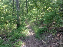
P3 was in great shape. The tread was perfect, and it was a little overgrown, which is always fun.
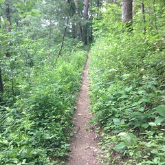
P3

I guess overgrown isn't ALWAYS fun. There can be ticks, for example.

I felt strong, and I cleaned every switchback.

As usual.

Heh.

And I still felt good at Hwy 52.
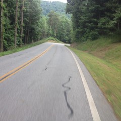
Hwy52

On P4 it started to rain, but not enough to even make it through the canopy.

That changed on Tatum Lead though, and by the time I hit P5, it had drizzled, poured, soaked me, dropped back to a drizzle, and stopped altogether.

P5 was beautiful.
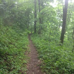
P5

People had been riding around some of the rougher sections, and they'd started getting backfilled and overgrown. "Healing" so to say.

There were some downed trees near the bottom.
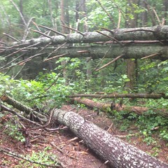
Downed Trees on P5

And the grass in the field was super tall, almost over my head.
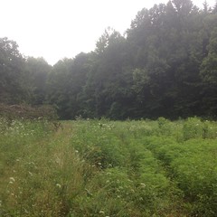
P5 Field

It started raining pretty hard again, somewhere around there, and then stopped abruptly again.

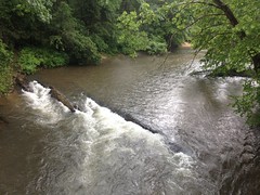
Baker Creek was roaring, but I had trouble getting a good photo of it.
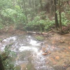
Baker Creek

At FS3 I had a decision to make. I'd planned to take P6 over to Dennis Mill but the clouds were super dark in that direction and it was thundering constantly. To the north it was a lot clearer and I could even see the sky in a few spots.

North it is.

Actually, it was west and then north, but not south.

I've only ridden Peeples Lake Road a few times, and I had forgotten how punchy it is. It's like 100 short, steep climbs and descents. There's no good way to keep speed, and then at the end, there's the final insult, followed by an almost dangerous downhill to the highway.

At Peeples Lake proper, there was all kinds of excavation going on.
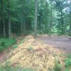
Peeples Lake Work

I couldn't make heads or tails of it. It wasn't clear what they were doing, and I didn't remember what it used to look like. They might have removed the old toilets and dug up the tank. I couldn't remember if that's where they had been though. They may have been down a little side road from there.

No idea. It was a mess though. Something to see.

Heading North on Old Federal Road, the sun was getting lowish, and the patchy sky made me happy.
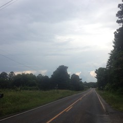
Old Federal Road

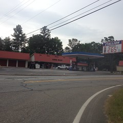
I didn't stop at the Stallion.

Stallion

I thought about stopping. It's traditional. But I had plenty of food and water and opted to keep moving.

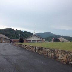
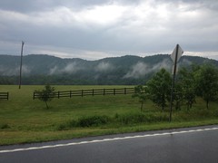
There were good views of Fort Mountain to either side of Holly Creek Baptist.
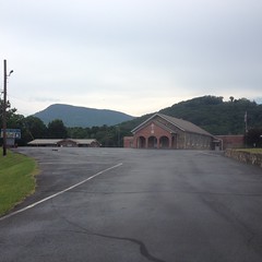
Holly Creek Baptist Church 1 Holly Creek Baptist Church 2

And even more between there and the gravel, but nothing I hadn't taken photos of before.

There were a lot of people hanging out along Holly Creek. Some fishing, others just playing in the water. There was one kid splashing like crazy, having the greatest time in the world. Her parents were well amused by her antics and it made me smile seeing it too.

Further up I paced a pickup up the road, and around the first switchback. The guy sitting in the bed was like: "Man, I don't know how you do that!"

Ha ha!

Validating.

Even further up, I passed the rock slide repairs. Last year I'd ridden through when they were still working on them. There's some kind of weird felt and chain-link slurry wall in place now.
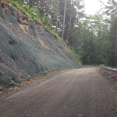
Chain Link Slurry Wall

Awesome.

I was still feeling good when I got back to MGap, but the final climb up the hill to the barn was as tough as always. Sophie happened to be walking around right as I got back too, threw her arms up, and greeted me: "Dad!!"

It was nice to see her.

She'd had a pretty good time. Shed walked all over the property, including the trails, played with the dogs, and ate some steak strips and ice cream with brownies under it.

I let Andrew know that I'd made it back safely, grabbed a quick shower, got changed and stood around in the barn talking to Ginny for a while before finally heading out.

I hadn't eaten steak, ice cream, and brownies, so I grabbed some dinner on the way back. I think Zaxby's, but I don't really remember. I do remember feeling worn out and really content, like I had after the previous week's ride. I hoped it would be the start of a trend.

Sophie crashed and slept most of the way back. I guess she was pretty worn out too!
Monday, July 2, 2018

Bull and Jake Mountains

I'd made a bit of a commitment to myself to ride Jake and Bull more this summer. It's a great system, and I've done so much work up there, I should reap some fruit of that labor.

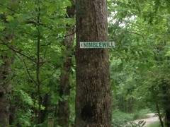
But... The Rainbow Family Gathering was going to be held up there this year, for a week or two, starting early July. Some folks were allegedly already up there getting things ready. I'd never heard of such a thing until a day or 2 before, but I'd seen a "Rainbow Family" sign at 52 and Nimblewill Road the last time I was up there. I didn't have any idea what it was about, and I didn't see anyone that I thought might be involved. To add to my confusion, I'd also seen a sign for a wedding at Nimblewill Road and 28-1, and I thought maybe the two of them were related.

Turns out no, the gathering is a much bigger event, and it could create a lot of traffic into and out of the area. It was still mid June, so I figured I ought to get some riding in then, if I could, in case it proved logistically difficult to do so later.

I had some trail maintenance objectives too - it had rained A LOT the past few weeks, and I wanted to see how some features had held up. In particular, I wanted to see how the rolling dip I'd built earlier that month had fared, and to check on the one that me and Iz and Sophie built on Moss Branch last year.

Traffic was horrendous through Cumming on the way up. Not because of any Rainbow Family action, just from the constant road work on 400. It must have taken 45 minutes to get from exit 14 to exit 15.

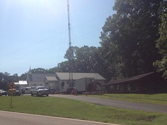
There was no traffic in the Nimblewill Area, but there was a mobile communications tower set up at Nimblewill Church.

Mobile Cell Tower

I was sure it had been set up for the event, but I wasn't sure if had been set up for the participants, for law-enforcement, or for both.

I also noticed that the port-a-potty was missing from the Jake Lot!

Missing Port-a-Potty

Well, if Woodstock '99 can be taken as a reliable indication of how a crowd can mistreat a port-a-potty, removing it was probably a good idea.

There was one other car in the lot when I got there. A lady was taking her dog hiking but didn't know the system at all, and planned to follow the map on her phone. I've seen a lot of people doing that lately. I wonder how reliable it is. Every time I ever tried to do any GPS-related thing on my phone, it nuked the battery. I could maybe get 2 hours out of it.

She asked me some questions, I gave her a little info, and she was off.

It took me a little longer to get going, and when I did, my left pedal felt a little funny. Like it was pulling my shoe in one direction of the other. I couldn't figure it out though. When I'd coast, the float felt normal. But, while pedaling, it would tug at my shoe and eventually my foot would pop out.

The heck?!

I finally got frustrated enough to stop and fiddle with it, right as I caught up to the lady and her dog.

I turned out that the pedal was almost completely seized up. I hadn't washed my bike since riding in the rain at Noontootla, and then washed it thoroughly earlier that day. Apparently that's not so good for pedals. The lady looked at it with me, and thought it was funny how small my pedals were. I needed a flat blade of some kind to get the dust cap off, but neither of us had one.

I got it kind-of broken free, and figured I could limp back to the car, fix it for real, and hit the reset button. She thought I was nuts. How could I possibly fix that? I felt pretty confident that I could, and complete my ride. My bike isn't called "the rolling junk show" for nothing.

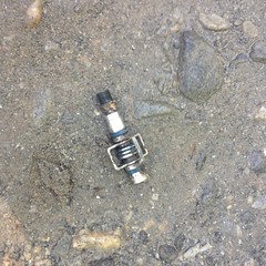
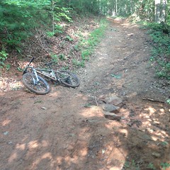
On the way up 28-1, the pedal unscrewed itself from the crank and fell off onto the ground.

Pedal

Ha!

That's a new one.

Nothing to do but screw it back in, finger tight, and pray.

My prayers were answered though, and it stayed in place long enough to get back to the truck. There, I took it apart, applied copious amounts of tri-flow, got it loose enough to call it fixed, and headed back out. I didn't have an allen wrench big enough to get tighter than it had naturally gotten from wrenching on it with my hands, but pedals tighten as you ride, so I figured that would be good enough. That or it would seize again and I'd be walking out. I was prepared for both, but I figured I'd hedge my bet by asking anyone I happened to meet if they had the right sized allen wrench.

When I'd driven by earlier, there was a crew of guys hanging out by that coms tower. They looked like they might have a more well stocked toolbox than mine, so I headed over to see. Despite three of their trucks running, there was no one to be found when I got there.

It seemed strange, but that's how it goes.

Onward!

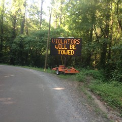
Climbing out on 28-1, I'd seen this big highway sign, but I hadn't turned around to read it.

Towing on FS28-1

Apparently, parking would be prohibited along that road.

On my way to Moss Branch, I ran into several people in cars, none of whom had the correct sized allen wrench. One of the guys was headed to the gathering, but had missed the turn on to FS83. I gave him directions, but I wasn't sure that he understood them.

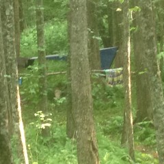
On Moss Branch, I saw where some dude had built a makeshift shelter off in the woods.

Rainbow Family Shelter

Barely discernible in that ridiculously blurry photo.

Trust me, it looked very, very, not waterproof, and I wondered how he'd fare over the next few weeks. There was a guy camping along the former route of the trail too. I actually ran into that guy further down the trail. We were both headed down to the creek.

I was heading down to see how the rolling dip was functioning.

Rolling Dip on Moss Branch

Pretty well, actually! Water was turning off. The mound was intact and looked really solid.

Rolling Dip on Moss Branch Detail

One of the huge rocks we'd buried was exposed, but it looked firmly cemented in place, and it was armoring the mound exactly as I'd hoped. The rest of the rocks were still buried, and the ground looked exactly like the matrix of rock and dirt that I'd hoped it would devolve into.

Perfect. Now I just need to see how long it lasts.

I ran into the guy again on the way back and warned him about drinking out of the creek. I had a hunch that he had been. He had, in fact, without filtering, boiling, or otherwise treating the water. His mileage may vary, but in 2008, I'd run out of water, tanked up there, and gotten ill from it, so I figured I'd give him the heads up.

I also got a photo of this carving that someone did way back.

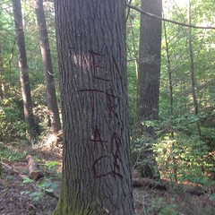
Entrance

I'm pretty sure this predates the Rainbow Family guys. I recognized it. I swear that I saw it last time I was on Moss Branch, which was forever ago. So long ago that I'd have to look back through my blog history to figure out when that was.

"Entrance" or "En-trance" i.e. to put you into a trance? No idea. No idea what it would be the entrance to, other than the creek, or how it would en-trance you, except with its fine, fine flow.

At 28-1, I headed up to 28B, rode out to Jake, and rode down to check out the dip I'd built on the drop to Jones Creek.

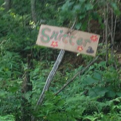
On the way, I passed a sign that, I guess, indicated where a latrine was to be located. Maybe?

Shitter

You decide. I saw no latrine or anything like it in the vicinity.

I saw some folks walking up the road with some dogs. One dog only had 3 legs. I saw a few people parked along the road too. One guy had leaned some deadfall up against his car, thrown a rug over it, and was dead asleep, directly on the dirt under it. No blanket. Directly on the dirt. Not on the forest floor. On the gravel at the edge of the road. I did something like that at the camp fire ring on Dug Gap Mountain once, and on the side of the road at the top of Sugarloaf Mountain in Florida, and once on the pavement, halfway up Hogpen during the TNGA. Must have been a long drive.

It was weird to see so many people. I typically go out there, ride 5 hours and run into like 1 other guy, usually on foot, bike, or horse.

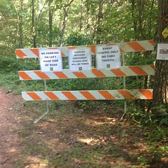
It looked like 28B was where everyone was supposed to park. At least down one side of it.

Parking Signs on FS28B

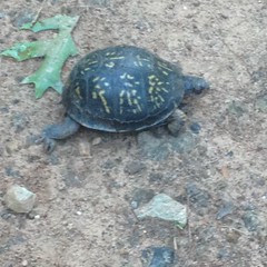
I also passed a turtle in the middle of the road.

Turtle

He didn't seem too upset with me for taking his picture.

On the way down to Jones Creek, it looked like some trail work had been done. Some nicks and grade reversals had been cleaned out. A lot of brush had been cut back. Me and Iz had done a good bit of that the last time we were up there, but this was much more aggressive than we had felt was appropriate. We had thinned. Since then, someone had mowed. The work looked good though. Did they have a work party up there that I didn't know about? Debbie said there wouldn't be a party in June, so I didn't even bother to come. Maybe there was one.

When I got down to the dip, I barely recognized it.

Rolling Dip on Jake

It appeared to be functioning as expected, but it also looked like it had been re-engineered a bit. Those 4 bit rocks armoring the outflow were new. They looked suspiciously like the rocks I'd buried in the mound. Maybe there'd been enough rain to expose them, rather than cement them in, and someone moved them. Or, maybe they weren't the rocks I buried in the mount, those were still buried, and someone drug these up from below.

Climb on Jake

Comparing this photo to the one I'd taken earlier in the month, I could see that the rocks had been moved around, and several of the largest ones were missing. I'm not sure who did this, but I would imagine it must have been the same crew that did the rest of the work. I'll have to inquire.

At any rate, the mound was firmed up, the dip was functioning, and the intuitive route through it appeared to be settling where I'd hoped it would. So, we'll see how it goes.

I headed directly back out the way I came in and rode up to 28A, which looked like it might end up being where the main gathering takes place. There were 20 or so people doing various camping-related things in the general vicinity of no-tell, near the largest of the food plots.

Everybody was super friendly - smiles, peace signs, and energetic greetings. They seemed legitimately happy to see me, and each other. If any of it was false, it was a good show. I didn't really talk to anyone though, other than to say hi.

This was about what it was like:

Rainbow Family Campsite

Tarp strung up between some trees back up in the woods. Maybe a tent underneath it, maybe just another tarp on the ground with some gear on it. Maybe less.

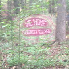
There was a more elaborate tarp shelter strung up, uphill of no-tell, where it intersects 28A.

We Home Community Kitchen

It looked like it was going to be a kitchen, but it was in its early stages.

There were a few more shelters along the older section of no-tell, but I didn't seen anything past the beginning of the newer singletrack.

It seemed like there were maybe 30 people total in the entire area. Again, it was weird to see anyone there at all. 30 seemed like a lot. I couldn't imagine the 20,000 that are alleged to attend some of these things.

My phone died somewhere in there and I couldn't get any more photos. There wasn't much else to see though. I rode no-tell -> Black Branch -> 28B -> 28C -> Turner Creek -> Jones Creek Ridge -> FS83 and through the Bull Mountain lot.

Climbing up off of the dam on Jones Creek Ridge, I saw 2 different turtles, each of which had dug a hole in the ground and was backed up to it. I think they lay eggs like that, but I didn't see any eggs yet. I was pretty disappointed that I couldn't get a photo of it.

Below Bull Mountain, someone had run a hose down from a spring up there somewhere, to a point near the parking lot and put a sign on it encouraging users to boil or purify the water. There was 1 car in the lot at the time, and a guy camping near it. I don't think he even noticed me ride by.

I took the trail up to 83 and rode out on gravel from there. Right as I was about to turn on to 28-1, I saw the same guy that I'd met waaayyy earlier in the day, who had missed the turn ont 83. Finally, it seemed, he'd found it, like 5 hours later.

When I got back to the lot, I was beat. My pedal had managed to stay loose enough to ride on, and, miraculously, stay in the crank.

I'd accomplished my goals, but the ride was just kind-of ok. Not spectacular. It had been a little wet, and I'd been keeping an eye on the pedal, and my tires are getting pretty worn out, and I had a new spoke in the rear and half-expected another one to pop, and I'd ridden a couple of short out-and-backs instead of long loops. Just that kind of stuff.

I can't remember eating dinner exactly. It seems like I tried to eat at Big D's Barbecue, but they were closed, so I waited until I got back to my side of the world, and everything was closed except Wendy's, and the drive-thru was super slow. That sounds right. Something like that at least.

Noontootla/Winding Stair

Early last month we were in the middle of some garbage weather patterns. It would pretty reliably rain whenever I wanted to go do something outside. Never for very long, but the timing and duration always seemed perfectly tuned to ruin my plans.

"Ha!": I figured. I'll just go do something where it doesn't matter if it rains. Of course, that "something" was the Noontootla/Winding Stair loop.

It seems like something interesting happened on the way up, but this was long enough ago that I don't remember what.

When I got to the Mt. Zion Church, my standard starting point for that loop, rain seemed to be the furthest thing from the sky's mind.

Mt. Zion Church

It was cloudy, but the clouds were all big, pillowy, white clouds - the kind that make the sky fun to look at because you can imagine they look like animals and people and stuff. It was a little warm though - mid 90's, but that's just how it is this time of year, and I was accustomed to it.

I rolled out of the lot, past the entrance to Camp Merrill, and up that little stretch of pavement on Cooper Gap Road, right before it becomes gravel. The instant I settled into the climb, a spoke broke on my rear wheel.

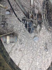
Broken Spoke

Ha!

I didn't expect that.

No problem though. I have a lot more spokes on that wheel, it ought to be fine. I wrapped up the hanging bit of it and left the other bit dingling around in place, as it didn't look like it could get caught on anything.

Turned out it couldn't, but it could definitely rub on something. I didn't notice it while climbing, but when I got onto FS42 and was able to coast for a while...

FS42

...it made a most obnoxious racket, and I had to stop and figure out what was going on. Turned out the head of the spoke was dragging against the inside of the cassette when I'd freewheel. It needed to be wrapped up too, but that was no easy feat considering how little of it was projecting from the hub. I managed to get it threaded between a couple of other spokes, but 15 minutes later it was loose and dragging again.

Dangit!

I threaded it through the other spokes again and hoped it would stay. That time it did.

As I headed toward Hightower Gap, it started getting chilly and the sky started getting dark.

On the last little drop down from Mauldin Gap, it started raining.

And it poured all the way down FS69.

FS69

Torrentially.

Ha! though. I was riding gravel roads. On purpose. Because they're fine to ride in the rain.

Take that space coyote.

Passing Rock Creek Lake, I saw a guy in a canoe way out on the lake, frantically paddling in. It seemed like he hadn't expected the rain either.

Right on cue, it was starting to let up as I approached the Fish Hatchery.

Approaching the Fish Hatchery

It was barely a drizzle a few seconds later, and a beautiful band of mist formed above the entire length of Rock Creek.

Misty Rock Creek

I could see Blue Sky at the Fish Hatchery.

Fish Hatchery

And it hadn't rained at all at the church.

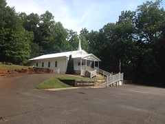
Shady Grove Church

So, it had been a short, intense burst, directly above me, and seemingly nowhere else.

At the bridge over Rock Creek, the "please avoid this area" sign had been taken down, but I felt like riding out to the Highway, just in case it had rained over in that direction.

The Toccoa was high, as expected.

Toccoa River

And Tooni Mountain was mistier than Rock Creek had been.

Misty Tooni Mountain

My phone, gloves, and even bare fingers were too wet to function together. I was barely able to get that photo. I wish I'd been able to get a photo closer to the mountain, because by the time I got there, the mistiness had tripled, and it was spectacular. I tried for like 5 minutes, but there was nothing I could do to get the camera app to open. That's the balance with a Lifeproof Case. Your phone says dry, but it barely works.

The pavement was wet around there. It had apparently rained there too.

Doublehead Gap Road

It was drier in the direction of Alex Mountain, but not dry in the absolute sense.

Alex Mountain

I felt strong at the bottom of Noontootla.

Noontootla

Stronger than I had expected to feel. I'd put in a lot of mid-week miles at Blankets, and Rope Mill, and Cochran Mill, but there's not a lot of extended climbing on any of those trails, and no amount of not riding in the mountains can keep you (or, me at least) in shape for riding in the mountains.

I kept a good pace up Noontootla, until the very top, where the last 2 kicks got me, as they are prone to do.

I was crawling when I reached Winding Stair Gap. I think there were some people there when I got there, but I can't remember who the were, or what they were up to.

Nimblewill. Yes, that's the general direction I needed to go.

Winding Stair Gap

The gravel at the top was loose and the road was a little washboardy. I sketched once, but saved it easily. The rest of the descent was just fast and fun. The road was a little soft and tacky, which I guess is good for being safe.

I don't remember much about the grind back to the car except that it was almost dark when I got there, and I was glad I'd put new batteries in my lights because several cars passed me on the road, in both directions.

Aside from breaking a spoke, it was a great ride. I half-bonked at the top of Noontootla, but I'd half-expected to, so that was fine. My bike was filthy, and so was I, but that was fine too. Gravel roads are good for a ride like that.

I ate at El Jinete in Dawsonville on the way back. It was surreal. The wait staff was the least ethnic staff I'd ever seen at a Mexican restaurant, and they were playing runway modeling music the whole time. The high point was a pretty great cover of the Cure's "Whenever I'm Alone With You." They gave me so much meat in my Chili Colorado that I couldn't fit it into all of the tortillas, and it was so spicy that I couldn't eat it all without them. I had that whole-body tired action, I was nearly stuffed, and my mouth was on fire. That may sound bad on paper, but I hadn't felt so content in a long time. I had a weak smile on my face all the way home, and you should have seen the water running off of me in the shower.

Wednesday, June 6, 2018

Sawnee Mountain

When the girls were young, I took them up Sawnee Mountain to the Indian Seats nearly every week, to "see the whole world". I'm not sure about Iz, but Sophie remembers it fondly. Her 16th birthday is coming up next month, and to celebrate, she wants to take a group of her friends up to the Indian Seats too.

She has a plan lined out for the day, but last weekend she wanted to scout the trail. It's been years since we've been up there, and for all we knew, it might have been rerouted, closed, or who knows what.

Oh, contraire!

It was more popular than ever! The parking lot was completely full, and the county had even built a second phase on the other side of the road.

Ha!

The trail itself was a little different though. The soil is mainly decomposed granite, and it was originally built as an outsloped bench cut, but it was a little wide - between 4 and 6 feet in most places. As a result, it doesn't drain quite as well as it ought to. In some places, it was chunky on the upslope side and sandy on the downslope, and you could see where people have been avoiding both and widening the trail. They say hiking trails are especially susceptible to creep. I'd seen very old evidence of it on some trails in the NF, which appeared to have crept and crept over the years before finally settling in, but I'd never seen it in action until this past weekend.

Sophie on the Indian Seats Trail

You can kind-of see the creep in this photo. The original route was to the left of the tree, but it's gotten chunky and the popular route these days is to the right.

But enough of that nerdity.

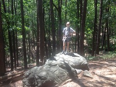
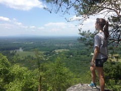
The girls always liked to climb on these rocks, near the bottom of the trail. Sophie recognized them right away and here she is standing on that same rock 11 or 12 years later.

Sophie on a Rock

On the way to the top, we must have passed a dozen groups coming up and down. Way back, we might have seen one other couple all day.

It could almost be described as crowded at the top, too.

We had to wait our turn at the Indian Seats.

The Indian Seats

But we did, and we got to sit in them, once again.

Sophie in an Indian Seat

The whole world was still there too.

View from the Indian Seats Sophie at the Top of Sawnee Mountain

It was a little too hazy to make out the Blue Ridge, but the Burnt Mountain system was pretty visible. I used to know the names of the peaks in the distance, but standing there, I couldn't remember them.

Awesome. It didn't look like her plans were in jeopardy, except maybe from crowds.

The hike back was slightly more interesting than the hike up. They'd rerouted the trail a bit and my map wasn't exactly accurate any more. Fortunately, every major corner now has a map. Apparently the Indian Seats and Laurel Trails had been merged into one trail, and the Interpretive Center Trail had been renamed Laurel Trail Spur. I thought this was funny because there was no actual Laurel Trail to spur off of any more.

I think it took us 45 minutes to hike up, mill around a bit, and hike and back down. We figured we should double that for the group, and add some extra time for snacks and fooling around at the overlook. Even with those numbers though, her timetable for the day ought to work out fine.

Excellent!

On the way home, we stopped by the Dutch Monkey (of course) and nuked our respective pancreata.

Insulin response never tasted so good!

Cochran Mill

Isabel graduated High School a few weeks ago, and my parents were in town all week. We were super busy with various graduation-related festivities, so we didn't get to do much riding, but we did manage to sneak out Friday afternoon and get in a ride at Cochran Mill.

My Dad even got some GoPro video of a good bit of the ride. I realized I'd never seen myself ride before. It was really weird, and it reminded me of something I talking to Sophie about a while ago. You have a group of friends, and if you imagine them, that image is your concept of the group. But! When each of your friends imagines the group, they see you as part of it. You are part of their concept of the group. In stark contrast to your concept, which doesn't contain you! Seeing myself riding was like that.

We had a good time. Lots of fun. No crashing. My Dad had never ridden there before, so he loved it. Oddly, it didn't occur to me to take any photos though, and my Dad didn't post his video on YouTube or anything, so I don't have much to show for the ride.

We did stop at Cochran Falls though, and I did get a shot of him there.

Dad at Cochran Mill Falls

So, at least there's that.

One funny thing too... Riding across the parking lot, a lady in a car was driving out and asked us where the falls was. Well, there are like 5 falls, but I figured the one she must mean was the big, primary falls, that used to drive Cochran Mill proper. We gave her directions and took off riding. Later, as we were riding down to the creek, she and her buddy were climbing the road back up to the parking lot. They were both completely soaked, had clearly found the falls, and had clearly been enjoying it for that entire time.

Success!

I was glad to have been able to help. It struck me too... Over the years, I've given countless people directions to this or that, but very rarely been able to verify that my directions did them any good. It was pretty validating to see that they had.

I hadn't thought about it until now, but I guess it was a day of rarities.

Berry College

I've ridden my bike at Berry College a dozen times, and during those dozen times, I noticed a good many side trails. Some of them are signed, and I've seen people hiking them, but I don't know what the rule is for riding on them. They definitely aren't on the bike trail map, so I always avoided them, but a few weeks back, me and Billy got up there to check some of them out on foot.

We parked at the horse lot on the north side of Lavender Mountain and approached from that side. There's an old roadbed leading up the mountain from that lot. Like the rest of the trails, nothing in the field indicates what you can do on the trail. It's on the horse map, not on the bike map, but horse trails are generally ok to walk on, so we went with that theory.

The road itself was braided wildly. It looked like it had been rerouted several times, but the reason was unclear. The trail lay on the steepest route, which was in fine shape. Whatever the reason was for the reroutes, it wasn't because the old route had gotten worn out.

When we reached Redmond Gap, we hung a left and carried on until we found the first of the side trails.

Tightrope

There are signs with arrows indicating that it leads to "Tightrope" and the "Old Mill", but the trail itself isn't named on any map I've ever seen.

It dumped us out down by the lake. We proceeded around its perimeter until we found another trail, and took it up and over a gap between the main ridge and some little subsidiary knob. The trail eventually ran down along some little creek and crossed it several times.

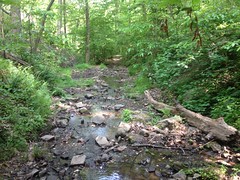
Some Creek

We ran into some hikers coming the other way near one of the crossings, but we also ran into something much more interesting after another crossing.

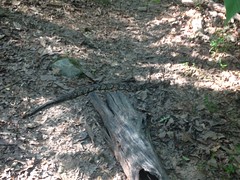
Timber Rattler

I was a bit ahead of Billy, and while I waited for him to cross, that snake started crossing the trail between us. When it saw him, it stopped, and when he saw it, he stopped too!
Billy really doesn't like snakes, and really wanted to find a good, wide route around that one, but it turned out that he didn't have to. We just waited a minute for it to decide to keep moving across the trail and down into the creek.

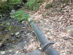
Farther on this old pipe was partially exposed on the east side of the creek.

Old Mill Feeder Pipe

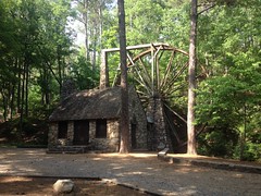
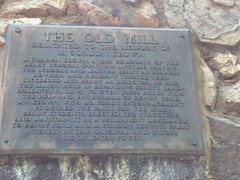
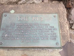
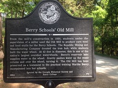
And, even farther on we ran into that Old Mill that the sign on top of the mountain had mentioned.

The Old Mill

The mill features an unusual water supply. Water actually climbs that tower behind the wheel before spilling over it. That pipe we saw earlier starts higher up the mountain than the top of the tower, so it's able to push water up the tower. I read somewhere that it's the tallest such overshot wheel in the world, or the US, or something.

Maybe it says that on one of these historical markers...

The Old Mill Plaque The Hub Plaque Berry Schools Old Mill Historical Marker

Just east of the mill, a trail leads back up the mountain. And, my goodness, it's steep.

The trail is called the Longleaf Trail because of all of the Longleaf Pine in the vicinity. I don't remember whether that stand was restored, or just still stands from way back, but either way... Longleaf Pine, everywhere.

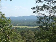
There were a couple of clear spots too, with some good views.

View from Longleaf Trail

We ended up on Mountain Goat, I think. The last time I was up there, Redbud was blooming all up and down the south side of the road. The bloom was over by the time we got up there, and I kept looking for those heart-shaped leaves, but nothing jumped out at me. I think I remember only seeing one. It was weird, given the significant abundance of them I'd seen before.

We took some trail that seemed like it might have been a former route of Mountain Goat. It dumped us out on the Old Mill Road...

Old Mill Road (Paved)

Which led back to the House o Dreams Road...

House o Dreams Road

Which took us back to Mountain Goat.

A guy on a bike was climbing, very slowly, behind us for quite a while. He eventually passed us, but we caught him again a few hundred yards later. I felt bad for him, because after passing him a second time, he never caught us again. A lady on a cross bike came crushing past us at Mountain Goat though, looking really strong, in sad contrast to that poor guy.

Really, in contrast to us too. We were ready to be done, and basically just marched out. There wasn't too much more climbing between there and Redmond Gap, but even the flat was tough, because, for some reason, I was developing a blister on my right foot.

Come on!
Since switching to barefoot shoes like 8 years ago, I had yet to suffer a single blister. I didn't even realize that was what it was at first. I thought I had something in my shoe. It looks like the upper layer of the insole has gotten detached from the other layers, and can now slide around a bit. I guess that's what caused it. These shoes have been a nightmare since day one. I'd finally modified them enough that they didn't bruise me every time I'd go for a walk, but it might be getting to be time for some new ones.

On the way back home, we drove past a few neat things. There's a Family Guy themed convenience store somewhere between there and Rome, with giant pictures of Peter and Stewie on their signage. There's also an old Scottish Inn that some independent owner bought and renamed "Cottis Inn" by painting over the S and h. I joked that he should have turned the first t into an i, making it "Coitis Inn", which, though misspelled, would almost certainly describe its present function in the community.

We tried eating at Gondolier Pizza in Rome. I think I ate there after a big road ride with Travis and Russel once, and I remembered it being fantastic. Sadly, it was under new ownership or something, and not as good as I remembered.

You can never go home again, they say. Rome isn't technically home, but whatever. Something like that.

There are plenty more trails up there. We have plenty more to explore, and I imagine we'll get to it soon enough.

I may be wearing a new pair of shoes next time.