Wednesday, July 24, 2019

Pinelog

I wouldn't normally write about an after-work ride, but last week, I managed to ride Pinelog for the first time in a million years.

I just spun a figure 8 on the roads, but even doing that it was clear that a lot had changed!

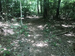
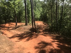
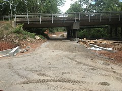
The roads are way less accessible by trucks these days, and mostly look like this:

Basically doubletrack.

Nearly every little side road/trail has been crosscut. Most are choked with lezpedeza. Some with young pines. I have no idea which are still passable, even on foot. I may have to totally re-explore the whole system at some point.

The overlook is getting to be less and less of an overlook.

I had to hold my phone way up high through the one gap in the trees to get that shot.

The church is the same.

Or, it looks the same from the outside, at least.

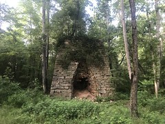
The Lewis Furnace is still standing, but the area surrounding it is densely overgrown now. There's barely a campsite, and the road that led to it before is more of a trail now. Not even doubletrack.

It's still a road up over Pine Log Gap. In fact, it had been freshly graveled in a few spots, and it was loose and shifty.

On the backside, the Cripple Creek Ore Bank was full of water. Unusual this time of year. I could barely make out where the old railbed diverges away from the modern road. If I didn't know it was there, I'm not sure I'd ever think to look for it.

I always love these rocks.

My modernish iPhone washes out the color less than my old 4s did, but it still doesn't quite capture the colors.

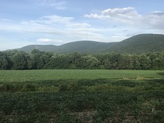
The old lower lake was fully planted, and the view of Pine Log Mountain was as striking as ever.

My 34-11/52 felt really good up there. I never felt too spun out. It even felt good on the road, coming back around toward White. I could stand and crank when I wanted to. I could spin up over Wolfpen Gap when I wanted to as well.

Nice!

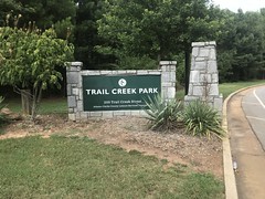
Trail Creek Park and the North Oconee River Greenway

A week or so ago, I was itching to do some exploring. There are plenty of trails within an hour or two that I've never ridden, but most of them are only a few miles long, and not worth burning a whole Saturday or Sunday on. Some of them have second trailsytems nearby though, so you can combine them. One such system is the one at Trail Creek Park in Athens. I'd actually tried to ride it once before - drove all the way out there, in light rain, to find it still raining when I got there, and the Weather Channel app still saying that there was a 0% chance of rain.

Well, there was a 0% chance of rain a few weeks ago too, but I didn't fully trust it until I arrived at the lot under blue skies.

When I got there, I really, really needed to pee. I'd followed the signs to "parking" and "restroom", but the restroom was hundreds of yards away from the lot. The lot was completely full too, as there were multiple soccer games going on, so I had to park on the outskirts. Annnddd... The restroom was part of a building that served a little water park, that was going full bore, with plenty of wet, splashing, rushing sounds to tempt me as I approached it.

I can't put into words the sense of relief I felt after finally getting to the bathroom.

Whew.

Back at the lot, I got ready, and hit the trails.

Almost every trail in the park is somehow named after a band from the Athens area. There are: Orange Crush, Drive By Truckers, Widespread, and Panic. There is also, for some reason, The Green Trail. If that name is somehow related to a local band, it's not clear to me how. Widespread and Panic are two separate flow trails, but they parallel each other. You'd think Panic might be more difficult than Widespread, but it's the other way around. Maybe because the gaps are more widely spread on Widespread?

Drive By, Green, and Orange Crush are fairly tame, but also a lot of fun. They reminded me of the Chicopee College trail. Not a lot of elevation, but not really flat either.

They both have flow-trailish side loops, but Widespread and Panic are full on flow trails with berms and jumps and drops and gaps.

Having recently crashed over and over, I wasn't in the mood to even try and manual tame doubles. I'm glad nobody was behind me on either of those runs or it would have been pretty embarassing.

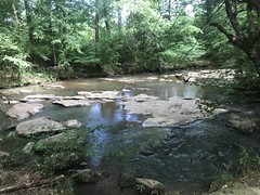
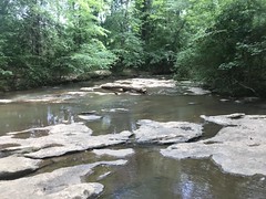
At a point, one of them ends up down by Trail Creek proper, and there's a little shoal there that you can walk down and gawk at if you like.

It took a few laps to ride everything. I think there are 4 and a half miles of trail there, but I rode more than 15 before calling it quits. Getting to and from Orange Crush required me to cross the Trail Creek Greenway, so when I'd had enough singletrack, I picked that up.

I didn't know how long it was, but I knew it headed toward the river, which had its own greenway. Turns out there's a little chunk of surface street between them, where you have to climb this big hill, then drop down to the river.

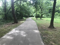
At the river, you're at about the halfway point of the greenway. It's basically just a sidewalk there though.

I took it north for a while, discovered the popular corner for the city's homeless to hang out, kept moving, and eventually dropped down to a more proper path.

It looked like more path was under construction to the south as well.

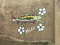
There had apparently been some kind of summer camp hike there recently because someone had written all kinds of stuff in sidewalk chalk on the trail. Like "Campers! Do you see the fish?"

This being the fish:

At the north end, the greenway continued through the Sandy Creek Nature Center.

There was some side creek there, and from the bridge, I could see an large, old, abandoned building on the creek. I couldn't get a good look at it though, so I didn't see any good indication of its purpose. It wasn't on any of the maps in the area either. Hmmm...

There were plenty of side trails, but they were all hike-only. It might have been wishful thinking, but it occurred to me that maybe someday Kathryn and I could drive out there and check them out - make a day of it.

At the far north end, the trail just becomes the Sandy Creek Parking Lot, and beyond that, a local road. I backtracked to where I'd originally gotten on, and continued south.

To the south, the trail was even more diverse, crossing various roads, and alternating between purpose-built trail and sidewalks.

It passed through a parking lot at one point, for The Heritage Trail section.

There had been a waterwheel on the river there, way back.

Several different wheels, actually, at different times. They had apparently powered the machinery in the Cook and Brother Confederate Armory across the street.

The building is now the Chicopee Building or something like that. The facade looks like any of the old stacked-stone mill ruins that I've run into way back in the woods, but it's clearly been gutted and renovated several times, and these days, it's probably like any modern building inside.

The trail led through Dudley Park, and there was a side loop down toward the river and back. The park was full of these weird boulder collections.

If they have any significance other than just being decorative, it wasn't clear.

I went under at least 2 trestles too. One looked abandoned, and the other looked like maybe it had been converted to use as a path, but I couldn't really tell from underneath.

Eventually, the trail became a collection of sidewalks with markers at the corners telling you which way to keep going. Then, there weren't any more markers. I wasn't sure if I'd ridden everything or not. I wandered random streets and climbed the same hill 3 or 4 times before finally just backtracking and calling it a day.

When I headed back toward the park, I had to climb up off of the river, and passed another guy on a mountain bike, apparently headed to the park as well. I was pleased that I felt fresh enough to climb strong and pass him, even though I'd ridden close to 30 miles already.

I might not die in the woods during this year's TNGA after all!

Downtown Athens has various pretty good restaurants, and I ended up at Amici's. After a ride around the Oconee NF some years back, we'd eaten at Amici's. Maybe at that one, I don't remember exactly. I liked it, but my brother thought that I only liked it because I was starving. I figured I'd give it another try. Nope. I still liked it, and I wasn't just starving. No accounting for taste, I guess. Not sure which of us is right, but I'll keep eating there.

The drive home seemed interminable. I swear there are 3 times as many red lights on 316 as there were 6 years ago. Sprawl, I guess.

Progress! Marching on.

Tuesday, July 23, 2019

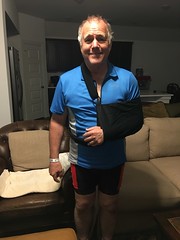
Dad at Rowlett Creek

So, I've been crashing a lot lately. Four times in the last month and a half. Busted ribs, lots of bruises, some lingering muscle damage to my left shoulder, various cuts and scrapes... But my dad has me beat.

He crashed at Rowlett Creek and broke his arm!

Of course, he broke it way out on 12 too, about as far as you can be from the car.

Heal well Dad. Heal well.

Sunday, July 14, 2019

Turner Creek

Today we had a work party up at Bull/Jake, but it was really kind of thrown together at the last minute. It's been raining all week, and it stormed last night. We weren't sure who'd show up, if anyone, so we didn't go for anything too ambitious.

Last month, we'd started working Turner Creek toward the north, so we figured this month, we'd head south and see how far we could get in that direction. With any luck, we'd get to where we'd worked the previous month.

Turned out, we got a decent crew. Debbie and Nancy showed up, of course. They'd recently both driven up to Tennessee together, and both bought new trucks! A lady I'd met once before, named Francine showed up too. She lives off Jess Grizzle road, basically on the way in. I've driven by that road hundreds of times. Another lady showed up too, but I always forget her name. I worked with her husband last month. It seemed like they had an orange Subaru, but she drove up in a yellow one. "New car?" No. Turns out they have 2 of them, one orange, and one yellow! Ha!

There was a tree down partway across the road to the parking lot, so we ran up and cut it way back. By the time we got back to the cars, there were 3 more ladies hanging around. One was a trail runner named Elizabeth. The other two were her daughter and her daughter's friend, both of whom needed community service hours for school. Nice! Second month in a row we've had trail runners at the work parties.

All right!

After carpooling to the top end of the trail, we started working it south.

Right away we noticed that someone had worn in a new line bypassing the first downhill. We talked about covering it with debris, but... actually... Despite being user-created, it was, in fact, a more sustainable line, and we ended up just leaving it.

We broke up into groups of 2 and did that standard nicking, deberming, and restoring turnouts. I was working with the trail-runner's daughter, who's name also Liz (Elizabeth Jr.) Turns out she had a lot in common with Sophie - both in IB, both had taken a bunch of AP classes, both took IB/AP french, both needed community service hours for school, etc. She worked super hard. Like... Super hard. I was worried she might burn out, but no, she kept it going the entire time.

It was incredibly hot though. Actually, more humid than hot. Halfway through, 100% of my clothing was soaked. I didn't even want to get into my truck later.

We got a bunch done but had to knock off when it started thundering. Clear blue sky, but tons of thunder. It was like 11:55 anyway, and we often call it a day at noon, but we felt like we could have gotten more done. Nancy was especially reluctant to go and just kept cleaning up the corner we'd been working on, and finally telling us to go on and she'd catch up.

Back at the trucks, I ate the best apple I've had in forever, some delicious turtle brownies, and some chips. So good. That apple, especially. I got some Big D's Barbecue on the way home to top it all off.

When I got home, I unloaded the truck, showered, and slept for like 4 hours.

Sunday, July 7, 2019

Cochran Mill

I wouldn't normally mention a ride at Cochran Mill, but sometimes something crazy happens. That's how it was last time I mentioned it, and that's how it is this time too.

In fact, the story is almost exactly the same:

  • My brother texted a bunch of us to see if anyone wanted to ride.
  • I was the only one who could.
  • I met him after work on Friday.
  • I was following him on the orange loop.
  • I hit something that yanked the bike out from under me and sent me flying.

Shred.

Shred.

Cram.

This time, I pedaled into a rock though. Also, this time, I didn't break any ribs or injure my back. Actually, I may have injured my back, but just a little. Not like last time. Also, unlike last time, my seat was broken, so we had to call it a day.

I just can't seem to keep from crashing. That's 3 times in the last 4 or 5 rides. On the one hand, I think it's God trying to tell me that I CAN crash without breaking ribs, which I was starting to doubt. On the other hand, I don't know what else to take away from it. Maybe that I need to ride with other people more? My following skills are probably to blame for the two crashes at Cochran. The two on the River Loop were new tires and wet roots though.

Whatever it is, I hope I manage to figure it out soon, because this really sucks. I'm having a hard time finding positions to sleep in. I'm just constantly waking up because I've managed to turn in my sleep and lie on some injured part.

Sucks!

Sloppy Floyd State Park

Last weekend I decided to take a break from the bike and walk around a bit. I've been on the bike way too much this year. Really, for the last year and a half, and just generally haven't been exploring as much as I used to. Part of it is trying to just improve/reclaim some fitness. Part of it is "training" (if you want to call it that) for the TNGA. Part of it is just that I get stuck in a rut at times and just want to keep doing what I've been doing.

For whatever reason, I felt like hiking and exploring last weekend, so I got myself up to Sloppy Floyd State Park do some of that. I'd ridden through the park a while back, while exploring that part of Taylor's Ridge, and it looked like fun.

Turned out it was.

I parked in the gravel lot and just kind-of meandered around on the Jenkins Gap and Marble Mine trails, and on the various connectors between them until I figured out where everything was.

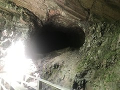
The Marble Mine itself was pretty cool.

It looks like it goes way back up into the mountain on the left side, but I didn't follow it. There's a barrier, I didn't have any light, I've never done any caving before, and it didn't seem like a good time to start.

There was a weird little scramble loop up above the mine that I did follow. I figured it might lead up the creek for a while, but it didn't. Just made 2 little loops and petered out.

The "trails" up there are mainly old roads that led to the mine from a couple of different directions, and they still retain the general character of a road. There are some more proper trails too, though some are more arguably doubletrack.

In particular, there are a set of trails that lead up to the Pinhoti and back down.

So, I made that loop too. Most intersections are well signed, but the names on the signs don't really match the names on the map, so it can be confusing. Also, some of the Pinhoti signs look really similar, and there are 2 intersections that are easy to confuse with one another. But, it wasn't that bad, and I managed to figure it all out eventually.

The southernmost trail leading up-to/down-from the Pinhoti is super, super steep. It has signs indicating such, and they're not kidding. I had to take quick little half steps, lean way forward, and keep moving to keep from slipping. The tread was mainly decomposed granite too, so there were tons of little marbly rocks underfoot. It was nervewracking to say the least, and I was glad to be off of it.

The park really has 2 sets of trails - one set up on the mountain, and another set down around the lakes.

The whole area was originally industrial. There was the mine, and roads and stuff to support the mine. Presumably when it was abandoned, the state bought the land and turned it into a park. I haven't done any research yet to figure out who operated the mine, but I'm sure the info is out there. The lakes weren't originally there. There was a spring though, which is now below the upper lake. The road leading through the park runs along a dam between the two lakes. I guess all of that was built when the park was created.

After exploring most of the trails up on the mountain, I ended up at the upper lake. Then, I found another connector leading back over to the mountain. It was apparently the main drag back in the day because it had various ruins along it that must have been related to the mining operation way back.

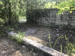
These looked like storage bins.

I've seen similar at modern facilities.

Across the road there's a privy for the nearby campground now.

But an old map shows that there was a building there at one point. I'm guessing it was the office.

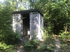
Further up the road, there's a shack of some kind that isn't on any map.

No idea. Old bathroom, maybe?

After exploring all of that, I ended up back at the upper lake again.

There's a boardwalk across part of it now, but in antiquity there was a road in almost that exact spot, that led along what's now the lakeshore and then became that connector with the ruins on it. It's amazing how different it is now from how it must have been.

There's a trail, with a couple of spurs down around the lower lake too.

But, I didn't have the energy to explore it too. My shoes had been giving me some trouble too. They have plenty of tread left, but the insole is kind-of separating and the layers slip around on each other. This is garbage and basically causes the same problems that non-barefoot shoes cause. It might be time for a new pair.

At any rate, I didn't have the energy or feet left to keep hiking, so I made it back to the car and went home. I'd gotten almost all the way home when I realized that I hadn't eaten anything. There's a good Mexican restaurant just down the street though, called Rancho el Molcajete, which is generally very good, so I went there. I had no idea until I walked in, that it was karaoke night! Everybody was singing songs that I'd never heard before. But, they all knew them really well. I love that kind of thing. Every now and then you discover this whole separate world that you don't know anything about.

Sunday, June 23, 2019

Baldwin's Burger Ramble

Mark texted a bunch of us last week, hoping to get some folks together for a ride out of his house, then some swimming, then some burgers.

Sounded just right.

Me, Hirsch, and Peter Josky (Joski?) showed up. Eddie was house hunting or something, so he couldn't make the ride, but said he'd be by afterwards for festivities.

On the way up, I stopped at the QT on 515 near Jasper and apparently there was another ride going on.

The lot was full of trucks with bikes on them, and the gas station was filled with the chisel-calved set. There was apparently a social ride heading out of Mulberry Gap. Sounded like they were heading up to the overlook, then taking Bear Creek, P1, and P2 back. I had no idea what we'd be riding, so I couldn't compare it, but I wished them well.

Heading into Ellijay, it looked like a tornado had come through. The roads were still wet, and there was leaf debris everywhere. When I got to Mark's place, he was cleaning up his pool. They'd had a pretty significant storm the night before, and he'd woken up to the same kind of mess in his backyard as I'd seen on the road. That's luck, right? The day you invite friends over, nature wrecks your pool. He had it in hand though. I wouldn't have known, except that he told me.

I got there at about 9, but everybody else would be there around 10, so I got to hang out for an hour or so with him and Ryn. During this hour, I got to know all of her dolls, horses, and "stuffies", and we had a dance party with a rotating light ball and the Karaoke version of some Megan Trainor songs. Kalee showed up about the same time as the rest of the guys, Mark handed off Ryn to her, and we all hit the trail.

Well, the road first. We actually had to spin down Hwy 52 for a while before hitting any actual trail.

There are some rollers on 52, and I'll tell you, I had a little trouble with them. Not that he was ever weak, but Mark has gotten exceptionally strong since moving up north. He was riding his long-travel bike, with some weird new bulk-monster Trust fork on it, and he was STILL moving. Hirch is always strong. I hadn't ridden with Peter in like 15 years, since we all raced GAP/GSC/SERC together, but he was as fit and shredded as I remembered. It was tough keeping up.

We hung a right off of 52 and rode all the way down to the Cartecay. There's a bridge there that you can cross and get a good view of the river, but as fate would have it, that one day, there was a security guard there, turning away anyone that didn't live in the Blackberry Mountain neighborhood on the other side. People were tubing in the river, there's a take-out just downstream from the bridge, and we could imagine they'd get out, then go stand on the bridge to watch their friends come down the river, and block traffic. So, it made sense, but it was a bit of a drag.

Still, we went down to the take-out, and watched the tubers for a few minutes.

Good enough.

Next, we hit the River Loop.

The River Loop is, allegedly, the oldest official trail in the state of Georgia. It was formerly opened to mountain bikes in the mid-80's. I'd only ever ridden it once, in the early 2000's, when I first moved to Georgia. Me and John rode it, I think. The road in appeared to have been improved a bit since then, but the trail was the same as I remember. There's this super-sketchy descent down to the river. I remembered it. Not in detail though, just that it existed. Mark warned us that it was sketchy. "I've crashed."

There are 2 lines, one to the left, and one to the right. Pick one.

I picked the left.

The trail was deceptive. The tread seemed dry, but the rocks and roots were still damp. That plus new tires equaled me crashing about halfway down. I tried to go left of this stump, but just couldn't get around it. I went over it, got kicked around into the rut, and thrown into a tree. That's how you break a collar bone!

Fortunately, I did not. I was uninjured, and not even hurt. I did get a little brush-burn on my right shoulder, but I couldn't even feel it.

Ok, let's try that again.

Immediately, crashed again.

This time, I didn't lift well enough over a root crossing the trail at an angle, and it yanked the front tire out from under me. It was one of those where you hit the ground faster than you'd expect that gravity could pull you down. I never even let go of the bars, and slammed hard on my left shoulder, this time.

Come on!

Peter was behind me the first time, and Hirsch the second.

I just sat there for a few minutes, expecting to have broken a rib or something. The crash was so much like the one at Cochran that had injured my rib, that I fully expected to have done it again.

Turned out no though. No obvious damage, actually. I felt basically fine.

I was at the very end of the downhill too. There was nothing left but a little rock garden that you don't even have to ride.

Man. I used to ride that kind of stuff, all day long. So confidently, that I'd ride it solo, with no mishaps. What the hell?

Hirsch said I was just having a bad day. I'd like to believe that. It felt like the new tires were throwing me off, but I couldn't be sure. My instinct are tuned to Continentals, but the Ikons like to "right you" more. It's hard to describe. If you turn, you have to kind of lean into it a little harder. They kind-of want to pop you back up out of the turn. I couldn't immediately tell how that translated into the two problems I'd had on the descent though, so there could be other dynamics that I haven't learned yet. They are definitely grippier than the Conti's. Like, when it's dry and marbly at Blankets, you can lean into the corners harder than with the Continentals. Maybe I'd been expecting them to be grippy when it's wet too?

No idea.

We regrouped at the bottom and Peter pointed out that I had actually taken a little damage during that last crash. I was bleeding through my shorts from a 6-inch gash, running all the way up my thigh.

Yikes!

It wasn't immediately clear how bad it was. It was bleeding a bit, but I couldn't tell if it needed stitches or not. No matter, I'd been carrying around some first aid supplies for years now, and finally had a chance to use it. Turned out it was entirely superficial. No need for the butterflies, just some gauze to keep it from getting dirtier.

Let's ride.

Actually, we only rode a few yards. There was a nice spot on the river there to chill for a few minutes.
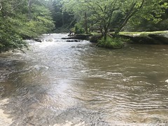
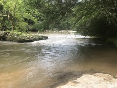
So we did.
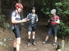
I led out after that, and was gunshy for the next couple of miles. The rest of the trail along the river is flat, but there were plenty of slick roots and rocks. I didn't have any trouble with them though. So, I felt a little better after a while. The climb out was tough, but it turned out that the 34-52 was plenty of gear for it.

Ha-ha!

And, I hadn't had any shifting issues at all, the whole day. Looks like the new cassette might actually work out.

On the way back towards Mark's place, we spun a gravel loop through the Rich Mountain WMA, some of which I'd ridden during the Tour De'liverance. The 34-11 turned out to be enough gear to stay hooked up through most of that too, at least as well as the rest of the guys. With the 30-11 that I'd been running before, I'd regularly get spun out and watch everybody just ride away from me.

No longer!

To get back to Mark's place, we went around the back of the mountain and climbed "Kill Hill." On Strava, only 9 people have ever climbed it. Me, Mark, and Marc were 3 of them (Peter's not on Strava). It's less than a mile, but it's super steep. I wanted to see if I could just sit back and climb it though, and I totally could. Another win for the 11-52 cassette. Not having such ridiculous gears, the other guys had to grind it out, and as a result, they all beat me back to Mark's house by over a minute.

When we got back, Mark was like: "I've got a garden hose with your name on it."

I was covered in dirt. Both shoulders, and all the way up the left side of my body.

I had a chance to get a good look at my wound too.

The cut is actually nothing. It looks bad, but it's totally superficial. The wide bruise beneath it, that you can't see in the photo yet hurts much worse than the cut today.

Pool time!

I realized I'd hardly been in a pool in years, and had the greatest time. I also realized that I'm getting old, and had to warm up a bit before going for gymnastics off of the diving board. I managed to do a pretty good faceplant going for a one-and-a-half early on there.

Eddie showed up soon after. Mark grilled some fantastic burgers, and we all sat around in the shade "just getting all fat and sassy." Kalee had made some brownies too, that were just right - nice and crispy at the edges and corners, but still a little soft in the middle.

Perfect!

What a day! I managed to crash my brains out twice, and yet somehow, when I think back on it, it's still a fond memory.