Thursday, April 21, 2022

Horseshoe and Knob Hills

There's a lake kind of north of Dallas called Lake Grapevine. Or is it Grapevine Lake? I forget, but there's also a trail up there that everybody calls Grapevine, which is more correctly called Northshore. I've ridden it a few times, once in the early 2000's with my brother and my Dad, back when my brother lived there, and once more recently with my Dad. Since that last time though, two more trail systems have been built, or at least opened to bikes around the lake: Horseshoe and Knob Hills.

Saturday night, I'd come up with this half baked plan to ride all three of the trails. It looked like there was kind-of a greenway that you could take between them. Kind-of... After fiddling with the gps data for a while though, it looked like it would be like 70 miles of completely unfamliar roads and trails. I figured I should probably scout it first. Maybe do the full loop during my next visit, if it was worth it. Yeah, that seemed wise, and safe. There was a time, recently even, when I would have felt confident that I could do it, but my fitness took a big hit this winter from just being sick all the time. I'd felt good all week, but I wasn't sure if I felt good enough to commit to that. And, my Dad and I have this 100% rule where if you don't feel confident that you can do it safely, you don't do it.

So, Sunday morning I drove up to Horseshoe and scoped it out.

The trail is kind-of weird. It's just one loop, but the map declares it to be a dozen individual trails.
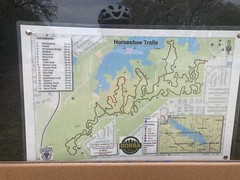
Horseshoe Trail Map

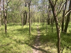
The first few miles were super, super twisty. Like, Cedar-Hill twisty. It was very technical and pretty hard to keep speed. It wasn't as bad as "1" at Squabble Creek, but it was definitely more difficult than fun. But, little by little, either it settled in or I settled into it and it got better and better.
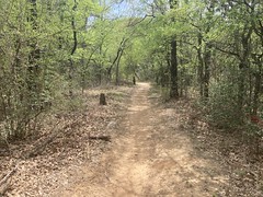
Less Twisty Horseshoe Singletrack

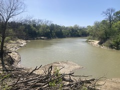
It mostly wound around the area where Jones Branch becomes Lake Grapevine, and there were some pretty amazing little overlooks of either the creek or the lake.
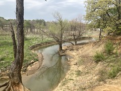
Jones Branch Overlook

Like so many trails in Dallas, it was mostly easy, but here and there, punctuated by really difficult or technical bits, like this climb.
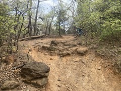
Chunky Horseshoe Climb

I cleaned it. [smiles douchily]

The signage was really good. Every time you hit a new section, there was a sign with a map, and a you-are-here.
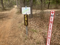
Good Signage

And, that was good because it wasn't impossible to get lost. There were plenty of trails cross-cutting the main trail, and periodically it either crossed a paved trail or ran along it for a second before dropping back into the woods. There was one spot that I don't even know how to describe. Braided all to hell, maybe. "Twisty little passages, all alike." It took me several tries to figure out where I was supposed to go. I couldn't just follow the most well-traveled route because I think everybody struggles equally through that section. Fortunately it was just that one section that was exceptionally difficult. The rest was mainly easy to figure out.

When I got done spinning that lap, I checked out the C. Shane Wilbanks Trail, which was that paved greenway thing that I'd seen on the map the night before.
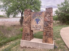
C. Shane Wilbanks Trail Sign

I almost enjoyed it more than the Horseshoe trail.

A lot of it was just an old paved road...

Horseshoe Trail Proper

...but there were purpose-built sections too...
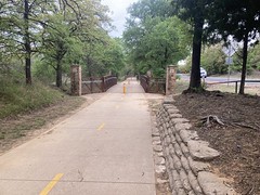
Bridges

...that took you to the various neighborhoods and parks.

To the left and right there were various "park roads" or in some cases fairly rough trails that led to picnic areas on the lake.
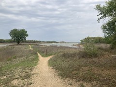
Picnic Area

A lot of the picnic areas were in disrepair, but it looked like people still used them for some, possibly nefarious, purpose. Ratty or not, they were undeniably scenic and I kept liking it when I'd pop out of the woods and see the grass and the lake spread out ahead of me.

One thing I didn't like though was thorns.
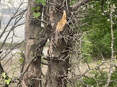
Thorns!

Holy crap, there were so many of these trees. I kept worrying I'd just brush into one accidentally, but they always seemed to be in obvious, easy to see places. Maybe somebody cut them all down along the trail or something.

There were various little coves like this all along the trail too.
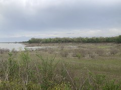
Some Cove on Grapevine Lake

A lot of them had benches where you could just sit and enjoy them. I didn't make use of the benches, but I did stop and just take it in for a few minutes, more than once.

At the very far end of the paved trail there was Grapevine Cemetery.
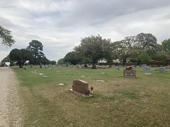
Grapevine Cemetery

It had a gravel road leading through it, and I was there to explore, so I made a pass through.

At the main gate...
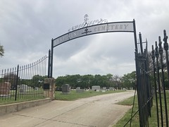
Grapevine Cemetery Gate

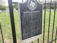
...there was a historical marker.

Grapevine Cemetery Historical Marker

I looked around near the gate for that oldest grave, but if it was near the gate, I didn't see it.

One interesting thing though... At one of the graves, a family had driven a couple of cars in, placed a bunch of flowers on the grave, and were having a bit of a party. They had a Dallas Cowboys flag flying and music going, and a picnic. There were kids running around and the adults were all laughing and carrying on. They were having the greatest time. It made me wonder if maybe it was somebody's birthday, perhaps the birthday of the deceased. It had that kind of vibe to it. At the time, it seemed like the sweetest thing in the world to me. A big family, and they all enjoyed each other's company so much.

It took a while to get back to the car, but at least I had the wind at my back for most of it.

I threw my bike on the rack, changed my shoes and headed around the lake to my next stop: Knob Hills.
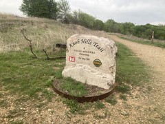
Knob Hills Trail Sign

Knob Hills was the real deal. It was fast and fun from the gate. Twisty, but not overly so. Technical, but not a crawl. You could get moving and stay moving. I had the greatest time. I probably should have taken more photos, but I was too busy ripping.

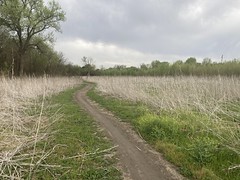
The trail passes through a bunch of different environments. Some of it is out in the open.
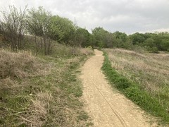
Trail Out in the Open

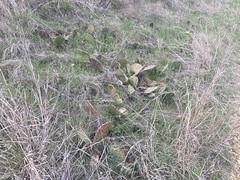
There's tall grass and cactus.

Cactus

Then there's a lot in the woods too, but it's not all just cedar.
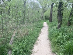
Trail In the Woods

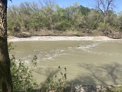
You run along Denton Creek for a while.

Denton Creek

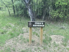
There's good signage.

Freds Revenge SIgn

Fred's Revenge turned out to be a chunky downhill. There's a bypass though.

The trail is a bit punctuated, as is to be expected from a Dallas-area trail:
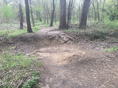
Punctuated by Drops

For example, the trail is all la-la-la, then you have to drop into that ravine above from the other side. On the left, it's like dropping in to a 4ft mini ramp. On the right it's super rooty. Choose the form of your destructor!

I dropped in. You can walk it, of course, but you have to know that it's there and you might not expect such a thing. You might just ride into it figuring it'll be fine. Beware.

More of those different enviroments:
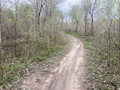
Trail Running Along the River 
	Trail Out in a Field

There was this one section called "Serenity" that runs along the river for a while. To the left and right, nearly every tree had been chomped on by beavers.
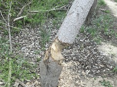
Beaver Damage

I don't know what the beavers were thinking. The river was like 100 yards across and it was like 12 feet down to it. They're not going to dam it up, no matter how they might try. I didn't immediately see any feeder creeks or wetland of any kind nearby either. There may have been something there that I just didn't notice, but I defintitely didn't notice.

It was funny too... The beavers had dragged logs across the trail here and there. Like maybe every 200 yards or so, for maybe a mile. So, on the trail named Serenity, where you'd think you'd have the easiest-going time, I had to hop log after log after log, at speed. It was fun, but far from serene.

There was this one long section of rock armor that was pretty cool.
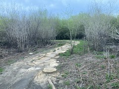
Rock Armored

I eventually figured out that the system was 6 stacked loops. Each loop had at least one "special" section. Eg. this loop had a section named "Me So Thorny".
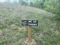
Me So Thorny Sign

huh huh

It really should have been called Me So Chunky. I didn't see a lot of thorns, but there were lots of very chunky hills.

It seemed like, generally, the trail was more technical, or at least more challenging, the further out you got. It was windier out there, and there were more little drops or technical climbs.
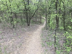
Windy Singletrack

There was one section called "The Gauntlet" that from a distance, just looked like you'd have to walk over these weird boulders.

The Gauntlet

But, then as you'd get into it, a path through them became clear. Tricky, but clear.

Out at the farthest end of the trail, there was a lot that was back out in the open again. It was pretty rocky out there too.
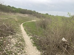
Rocky Trail Out in the Open

One bit had a million little yellow flowers along the trail.

Yellow Flowers Along the Trail

They don't look like much in the photo, but they were striking in real life.

At the very end, the trail hits a dirt road, and there's a sign for the Cross Timbers Trail.

Cross Timbers Trail Sign

The Knob Hill trail circles back, but the Cross Timbers Trail actually continues on. I debated whether to keep going or not. There were tire tracks leading on, but the trail wasn't obviously marked. After looking around a bit, it looked like the Cross Timbers Trail was a horse trail. It paralleled Knob Hill to the north, and shared a little of the same trail here and there, but was mostly its own trail. I couldn't immediately tell if the trial that continued on was horse-only or not, but I figured I'd look it up online and maybe come back and check it out later. I didn't want to end up riding out, only to find out that I was on a trail I wasn't supposed to be on 2.4 miles later, and have to find some other way back.

It was kind-of more of the same on the way back. Lots of different environments:
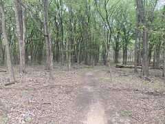
Trail Through Open Woods 
	Old Bridge 
	Nice View

My Dad called me for some reason, right as I approached The Goat Killer Climb.
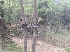
The Goat Killer Climb Sign

So, I got a chance to stop for a minute to take the call before attempting the climb.
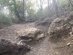
The Goat Killer Climb

I didn't clean it. However, since it's a GOAT killer climb, and it killed me, that must make me the GOAT. [smiles douchily again]

Back near the entrance there were bluebonnets.
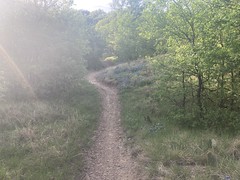
Bluebonnets Along the Trail

I want to say the last little bit of the trail was semi-confusing. I think you could go left or right, and right turned out to be correct, but left never joined back up. Something like that. I went the correct direction, but only by chance.

And that was it. Horseshoe and Knob Hill. It turns out there are a myriad of other trails around the lake, but most appear to be hike-only or horse-only. Maybe. Info online is scarce. It does look like it would be viable to circumnavigate the lake, connecting all three trails, and they're worth connecting too, especially Northshore and Knob Hills. I think I'd want to start with Horseshoe, then ride the rest.

Something to think about at least. Maybe I'll give it a try next time I'm in town.
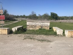
Goat Island

I'd been riding the roads around Forney because it had rained for like 3 hours one night, three days earlier, and this time of year that's enough to shut down every trail for a while. Goat Island usually opens up first, and as fate would have it, it was open first this time too. So, I made my way over and spun a lap.

Goat Island Sign

I've actually ridden there quite a bit. It's actually the closest trail to my folks' place, and since it's usually open when other trails aren't, it's become my Dad's go-to spot. We've hit it at least once every time I've been out that way.

It had been a while since I'd been there though, and there were a few new features. Most noticeably, signage:

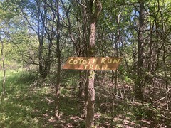
Coyote Run Sign 
	The Island Trails Sign 
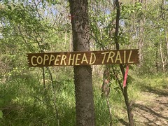
	Copperhead Trail Sign 
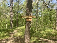
	Wilderness Trail Sign 
	Rapids Trail Sign

I'd never noticed any of those signs before. There were plenty of signs way out at the back, but I think the ones on the island are new.

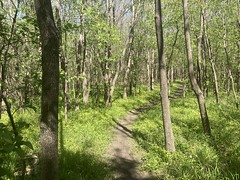
The singletrack was fantastic.

Goat Island Singletrack

Perfectly dry except for the always-flooded-spot.

The Always-Flooded Spot

It was, of course, flooded. It's only dry in the dead middle of summer.

There was a trail out on the island that led to "The Rapids".

The Rapids

I don't specifically remember ever having seen the rapids before.

The Thicket trail led to an overlook, which pretty much looks directly across the river at another overlook, but you really can't make it out in this photo.

Overlook From the Thicket Trail

One think I love out there is how the woods just row after row of trees, forever.

More Goat Island Singletrack

It might even make me feel claustrophobic if there wasn't a trail through it. Just the same thing forever in every direction. I'm not sure why that's cool, but it is. Croom in Florida gives the same vibe. A while later in the ride, I stopped for like 5 minutes and just looked through the trees, all around, taking it in.

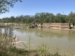
Obligatory Lock and Dam #2 photo:

Lock and Dam #2

Part of it had collapsed since the last time I saw it. That chunk with the gauge on it used to be upright and attached to the lock.

The power of water!

I also noticed this old farm implement out there.

Old Farm Implement

I'd swear that I'd seen it before, but I'm not sure if I ever got a photo of it.

When I got back to the car, there were 2 guys parked across the street fishing in what I thought was just a flooded gravel pit. I guess there are fish in it though. They were both smoking so much weed that I thought I was going to catch a contact high from across the parking lot, 100 yards away.

I don't remember exactly why, but I had to get back, and I didn't really have time for more than 1 full lap, which is 12 miles or so. I want to say that I got under 100 feet of climbing in the whole lap. Ha ha! Gotta love it.

Poetry

East of the McLendon-Chisolm area lies the community of Poetry. I'm not sure if it's a proper town or city, but it's on maps, and they have a water tower.

They also have a bunch of dirt roads.

Allegedly.

I'd ridden all over west of there the day before, and had a good enough time that I figured I'd go back out and wee what else I could find.

Just like the day before, I drove up to Terrell...

Terrell Sign

...parked at Ben Gill Park, and headed north.

Somehow the wind was even stronger. We had 50 mile per hour sustained winds that day. I considered turning around after the first 15 minutes, but I figured: "How often do you get to ride in wind like this?" I can always turn around later. The wind was from the west. Almost due west. I was pretty amazed by how bad the crosswind was when I was heading due north or south, but also by how much it helped if I was going even slightly east. Like if I was headed north-northeast or south-southeast then I got a noticeable kick.

Like it had the day before, it really felt like Texas out there. Big open sky. Farms and ranches everywhere. Lots of cows.

Cows

My first bit of alleged dirt was a right hander off of the main road. It was an old FM road, and it looked a lot like the corridor of the NETT at first. Like there ought to be a trail there, but it doesn't get a lot of use. It was kind-of blocked at first, but it didn't look like it was specifically blocked to keep people out, rather just that it was blocked because it was a convenient place to pile stuff up.

Blocked

Past the blockage, there was a corridor, but it was moderately overgrown.

Alleged Trail

It certainly wasn't any worse than some sections of the NETT though, so I pressed on for a while. Eventually I ran into some barbed wire strung across the road though that kept me from going any further. There were fenced pastures to either side of the corridor and gates just this side of the barbed wire. It looked like somebody had put it up to prevent cattle from wandering down the trail, more than to keep people off of it, but who knows? There weren't any signs. If it doesn't say don't I might, but not in this case. The corridor ahead didn't look too inviting. I figured I'd try it from the other direction later. Maybe there was a reason it was blocked, like a bridge out or something.

Further north there was plenty of gravel.

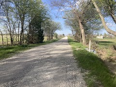
Gravel Road

And north of that the road just became dirt.

Dirt Road

It was super sandy up there though, not the typical blackland clay that I was used to.

The road got super rutted at one point. I'm not sure I'd have been able to make it down it in my truck, even if the ruts were clear of water. I had to walk a few times and one time I sliped down into a rut and buried my wheels up over the rims. Fortunately, it was sandyish and didn't cake up like the cookie dough to the south does.

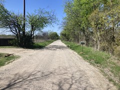
That dirt road had led west, and coming back east was supposed to be another dirt road, but it had been recently paved, except for a tiny bit near a cemetery. Like one block of it was still gravel. I have no idea why they left that one little bit unpaved, but I rode it.

The Campground Cemetery...

Campground Cemetery Gate 
	Campground Cemetery

...was adjacent to the Campground Church...

Campground Church

...which was looking pretty bent from the side.

Bent Church

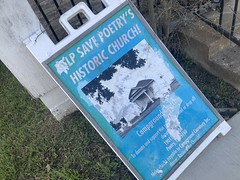
There was, apparently, a move to save it.

Save The Historic Church

But, I couldn't tell whether they were in the process of saving it or not, or if they once had but are now facing round two. It reminded me of the church in Ladonia that had fallen apart, gotten restored in the 70's, but was now falling apart again.

Heading back south, I picked up the other end of that corridor that I'd abandoned earlier. A gravel FM road out there just became dirt, then became grasstrack.
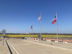
Grasstrack

Eventually I came to a T. If I continued the grass was taller and less inviting, but it still looked like people went that way sometimes. It led in the direction of where I'd had to turn around earlier too. If I went that way, I'd be able to figure out what the deal was. But it was wet and rutted and muddy and the soil was way less sandy than what I'd ridden through north of there. I did not feel like getting mud caked up on my tires, so I left it for next time, hung a left, and headed east on better dirt.

That eventually led to the highway and I took that most of the way back into Terrell.

It was bluebonnet season, and they were growing all up and down the sides of the highway.

Bluebonnet

Bluebonnets, fields of yellow flowers, and that horrible clay. Then yin and yang of the roads east of Dallas.

I made it back into town, but I kept having to ride directly east for a block or two at a time as I snaked my way through neighborhoods back to the car, and the wind was just punishing. I'd gotten in just under 30 miles, but they were so much harder than the day before.

That wind, man. That wind.

McLendon-Chisolm

I explored the heck out of the dirt roads south of Forney in 2020, but there are alleged to be even more to the north. So, while I was in town, I did a bit of research, put together a rough GPX, drove out to Ben Gill Park, and headed north.

The wind was the strongest I've ever ridden in. It felt like climbing in the mountains when it was in my face, and the crosswinds were just dangerous. I had to lean pretty hard into it, and every time it would gust or let up I'd have to react quickly or end up in the road or the ditch. It was nervewracking to say the least.

The legends were true though, there were plenty of good gravel roads up there. It had rained two days earlier, and they were already rideable, a rarity on the blackland prairie.

Gravel

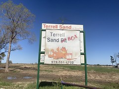
The Terrell Sand Box looked inviting.

Terrell Sand Box

There weren't any private property or no-trespassing signs, at the entrance. It looked like a place you could dump your dirt or debris and they'd give you money for it. There were piles everywhere and a huge open pit, now full of water. I rode in, took a good long look, and headed out. On the way out, I passed a guy in a truck who stopped me though. He was friendly enough, but let me know that it wasn't just open to the public and that I shouldn't be in there. No problem. I headed out.

It turned out that I'd ridden in from the south, but all along the west edge of the property were Posted signs. If I'd come in from the north I'd have seen them.

After a while, I passed the Poetry watertower. There's a community called Poetry out there, but I didn't ride through it that day.

Poetry Watertower

Some of the roads that were alleged to be gravel had been paved, but others hadn't.

Some were still gravel.

More Gravel

Some were just dirt.

Dirt Road

Some used to be paved and had just deteriorated into gravel.

Used to be Paved

There were lots of farms and ranches up there. In a few places it just looked green forever.

Endless Green

And there were so many cows.

Cows

Other than the wind, it was a really great ride. I covered like 40 miles and the whole area really had a good East Texas feel to it.

On the drive back home though, I saw this insanity:

What in the World?

What in the world?

The cars were full of gravel or dirt or something and the excavator was driving along the tops of the cars, digging dirt/gravel out of them and dumping it on the ground to the side of the rail. When it had dug all it could out of one spot, it would back up and dig some more. When it hit the end of the car, it would precariously back over the space between them and carry on. Just prior to this photo, he had been in the grey car, and had just backed over the gap into the black car as I stopped to get the shot. I feel like an OSHA inspector would have a heart attack if they saw this.

Forney

A few weeks back I visited my folks in Texas for about a week and a half. My dad's been dealing with a non-bike-related back injury lately, so he wasn't able to ride much while I was there, but we did go for one ride around the local neighborhoods.

Dad Fooling With His Phone 
	Dad

They're building a bunch of them right now and extending other ones. There used to be a giant field south of my folks' neighborhood, with a big hill and trails all over, but it's been obliterated and they're building houses there now. Fun while it lasted, I guess.

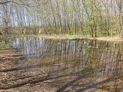
One of the new neighborhoods has a bit of a lake behind it. Maybe it'll have a trail around it some day too.

Lake Behind Some New Neighborhood

During another quick ride around town, a hole in my back tire that I'd been managing for weeks started leaking. I had to stop over and over, find some dirt to crush it into, then hope it would hold for a few more miles. I made it home, but I could feel it getting low before I did.

Still, I managed to get a few good photos while I was out.

It was pretty windy.

Pretty Windy

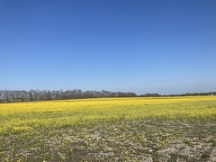
And, there are these massive fields of yellow flowers north of 80 that just go on forever. When I think of Forney, these fields are one of the things that always come to mind.

Flowers on Gateway Boulevard 
	More Flowers on Gateway Boulevard

No doubt they'll be developed some day, so I'm glad that I've been able to see them like this.