Once again, I barely feel like a cyclist any more. My mountain bike is in the shop with a popped spoke and a worn-out big ring. The rain has kept me off of the road all week. The last time I rode was weeks ago. No good. The forecast called for rain yesterday, so I figured I'd just do family stuff, but then it didn't rain! Come on!
Today it would certainly rain. These days, when it's raining, I'm walking, and so is my brother.
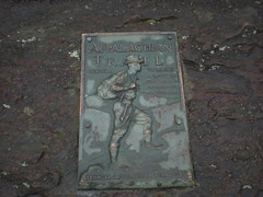
Amicalola.
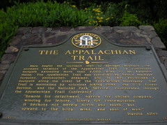
We stepped through the AT gateway, as if to start a 2100 mile journey. Divide that by about 100 for us though, we're just day-hiking.
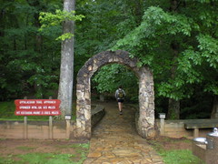
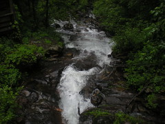
The approach trail runs through the park, up some stairs and past the falls. One good thing about all this rain is it makes waterfalls look awesome.
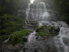
There are like 700 stairs leading to the top of the falls. I've climbed them before with my wife and kids, but today I was following my brother, and feeling the burn.
We didn't stop climbing when we reached the top of the falls. The burn was gone, but it still wasn't easy. This section of trail is called the "yard sale" or something like that. It's here that people start to realize they're carrying too much and start ditching the junk. We didn't see much today, just a light jacket, which looked like maybe somebody just dropped it accidentally. Apparently my map had heard about this place though, and worked it's way out of my pocket. It could have joined the fun, but we just happened to pass a couple going the other way, right then, who noticed it.
There used to be fire tower on Frosty mountain. Two pylons remained in the center of a clearing. A third was downhill a bit. Was the fire tower mounted on uneven pylons? I guess it could have been. Odd though.

As we approached Nimblewill Gap I saw 2 cars parked there, a Jeep and a little Honda, covered in mud. FS28-2 is a decent road, but with all of the rain we've had, some sections could have gotten pretty bad.
I was just saying to my bro that I was impressed with whoever drove the Honda up there, and then we ran into them; a guy and his girlfriend. They greeted us with the most confusing question I've ever heard: "Is this the trail that Jesus took when he walked to New York?" All I could think of was: "I don't know about Jesus, but Jesus (hey-soos) may have walked to New York from here." I guess it was the right answer because they cracked up and we ended up talking with them for a while. Turns out that the guy's last name was Seabolt (as in Seabolt Branch, Creek, Coves, Trails, etc.) and the girl's last name was Turner (as in Creek, Trail, Cemetery, Road (in Cumming) etc.) and they were getting married at Nimblewill Church in a week. The encounter provided further evidence of my theory that you can't do anything in North Georgia without meeting someone with a road, city or geographical formation named after them. Awesome. I needed to change my pants from the waterproof sweat collectors to lightweight zip-off-the-legs luxury. I did that, and more comedy ensused. It was fun hanging out with the future Mr. and Mrs. Seabolt, but we had a long way to go and had to start getting there.
But not before a quick, but important, photo.
I expected to climb over Black Mountain, but we skirted it instead. Before long we were passing the shelter and on our way up Springer.

The Southern Terminus of the AT.
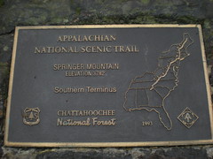
I need to get a book on the AT or something. Why isn't the Southern Terminus at the Nimblewill Falls Interpretive Center? Why is the trail we've been on all day just the approach trail and not part of the AT itself? Why was the terminus moved from Oglethorpe Mtn.? I must know these things.
No view today.
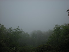
The frere was disappointed. He'd heard that Springer had a meadow on top with an awesome view and had imagined a bald or maybe something like Blood Mountain. There is a a bunch of grass growing up there, and a view (except for today), but it was lamer like he'd imagined.
We took a quick trip to the shelter to rest and refuel...
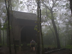
...and started back. Backtracking is intolerable, so we took the Len Foote Hike Inn Trail, which featured this guy...

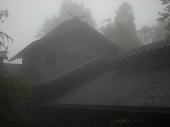
...and this magnificent structure.
I've been wanting to go there with my kids. I think they can handle the trail. We'll give it a try later this year.
We did a little a-sett'en down on the front porch with some folks who were staying overnight.

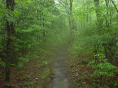
At this point, I had plenty of energy, my legs were fine, but my feet were not. Every step felt like getting slapped with a 2x4 or something. I am still too soft for this sort of thing. At least the trail was nice.
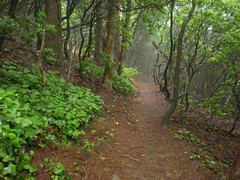
The horrible thing about the Hike Inn Trail is the random mile markers. Mile markers are cool when they're placed at even intervals, like every mile or half mile or something. The Hike Inn Trail markers were placed randomly, or at least it seemed like they were random. For example, there were markers at mile 1.2 and 1.9. My feet were screaming, and I know it's impossible, but I'd swear we walked at least 2 miles between markers 1.9 and 1.2.
When we got to the falls, the sun had come out and the view was pretty nice.

Descending the stairs punished my knees in the same way that the trail had
punished my feet.
Soft.
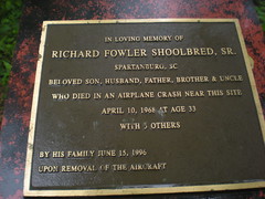
Near the bottom, John noticed the wreck of an old car. The staircase had been built right through the middle of. I'd read a story about it on the web once. A moonshiner had missed a turn near the top of the falls and driven over the edge. I can't find a link to the story now though.

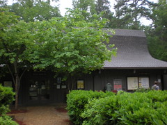
I was looking forward to getting a snack at the interpretive center, but they were closed when we got there. Imagine if you hiked the whole AT and were looking forward to a snack and it was closed. What a drag.
We did about 20 miles. My feet and knees are wrecked, but not as wrecked as the last time I did the same distance. I guess that's good. My brother was talking about doing a road ride tomorrow on the Silk Sheets. I won't be making that. Hopefully I'll be recovered enough Tuesday to ride to work.


No comments:
Post a Comment