Rain. Every day. Except yesterday. My mom had the kids though, so me and Kathryn did couple-stuff yesterday. Today I could get outdoors, but, the rain. The RAIN. I've had a years worth of wet riding already this season. I couldn't bring myself to even think about pulling the bike out.
Yesterday I bought some new trail shoes. Apparently I have some dainty little feminine feet. The men's sizes don't fit right. My last pair were women's shoes and again, this time, women's shoes. Oh yeah. They fit though, and they must be broken in.
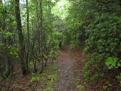
West of Cooper Gap there unexplored trails. I'm sure somebody knows them, but I don't. That's what I mean, unexplored by me. One trail heads south from Locust Gap. "Trail" is a pretty loose term for this one. Remember in Lord of the Rings, where Frodo has to climb this ridiculous steep staircase and there's a huge spider at the top? Maybe you don't, but I'm a nerd, so I remember. The Locust Gap Trail is kind-of like that, but without the spider.
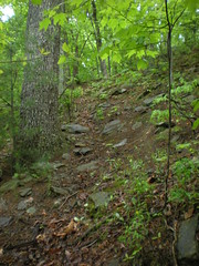

Sketchy, sketchy, sketchy. I slipped a couple of times and almost got tangled in barbed wire.
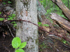
Why barbed wire? There are a lot of old fence lines in the forest, but way up here? Maybe someone dumped it off of FS42 and it's been making it's way downhill, slowly, for years. Who knows.
I hoped the trail would suddenly turn east and end up on Lumpkin Ridge, but no luck. It just went directly down and ended at a creek. No hint of a trail beyond. There were footprints though, on both sides of the creek, perhaps from the Rangers of Camp Merrill, or the students of Hidden Lake. It looked like they'd been climbing. I can only imagine how hard you have to be to climb that trail. I CAN'T imagine it with a 60 pound pack and a weapon. Hard.
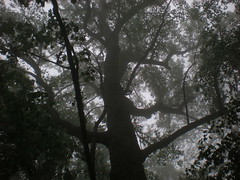
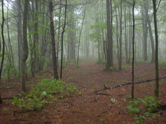
I quickly gave up sidehilling and just walked down the creek bed itself. There was virtually no deadfall and plenty of rocks to step on. No rain yet, but it was cloudy and windy, and the trees were full of last night's rain. Every now and then I'd get a little shower, but it wasn't too bad.
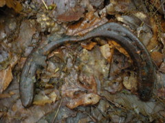
I did see ten thousand snails and slugs though, and a salamander with no tail. I tried to get a picture, but he was too quick.
No matter how "middle-of-nowhere" you think you are, someone else has already been there and left trash.
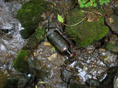
I'm rich! Or a fool.
The Ward Gap Trail was right where it was supposed to be. I took it back up to 42.

I milled around a bit on the knob between Ward and Locust Gaps. Apparently some Rangers had milled around up there too. Maybe putting a hit on the road.
Enough of that area. There's more stuff to the North. I jumped in my truck and took a quick trip to a campsite just down the road, on Long Mountain. A trail leads from there to the AT and beyond.
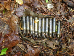
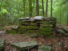
Artifact.
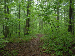
The AT's been rerouted back up in there, and I've always been curious why. At first, it was the same as the other sections nearby; an old road bed, a bit below grade but not terribly worn, kind of close to a drainage, but despite the recent rain, the drainage was dry. Eventually there was a trickle, but it quickly joined Blackwell Creek.
In antiquity, a bridge spanned Blackwell.
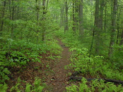
Beyond that, the trail was a clean bench cut. An old barbed wire fence ran down the left side.
But past that it was a different story. Over the years, a little creek had changed course and devoured a culvert and about 50 yards of the roadbed. Past that, the trail ran up along the creek with no grade reversals, dips or water bars. Puncheons had been built up one side, causing water to drain down the other, away from the creek, no doubt contributing to the destruction below. They couldn't drain the trail into the creek, there wasn't enough of a buffer. Further up there were a couple of fall line trails and some ridgeline trail. Good idea to reroute it.
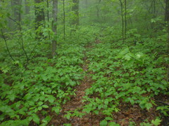
The whole trail was being reclaimed by Poison Ivy. Fortunately, I'm not allergic. My wife is though, and my older daughter. They'd break out at the just the sight of this much.
The rain was really coming down now. I'd been ignoring it for a while. My pack had been kind-of keeping me dry. But, it was getting pretty bad. Time for the rain gear. Next time I'm at REI, I'm going to look for waterproof gloves and a hat. I wonder if those exist.
The old AT tee'd into the new AT on Gooch Mountain at a campsite. An old roadbed continued south from there, but it would have to wait for another day. I headed west to Blackwell Creek.
The whole area was covered in chestnut trees. I didn't see any tall ones, but there were saplings EVERYWHERE. There are virtually none where I live. There's one in the near right of this shot, with a chestnut-oak towering over it.

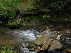
My brother and I had gotten water from Blackwell the last time we came through here and I'd seen a little bench cut just up the hill from the intersection. There is a trail that parallels Blackwell, but it doesn't match the trail on Topo maps of the area. This little trail appeared to match the map. I'd hoped it would lead by a waterfall or something, but no luck with that. It led upstream for a while, but the creek had apparently changed course and eaten it up. Before long, it was gone without a trace.
I cut cross-country to the other Blackwell Creek Trail, took it North to the old AT and then back South to FS42. The last time I'd been there I didn't know how to use my GPS real well. This time, I got a good accurate track. And some pictures.
Near the southern end, there's an old chimney or something. Not really sure what it is. Neat though. I wonder who lived there. I guess maybe the Blackwell's.
Across 42 there's an old road leading south down into Cane Creek Cove. I followed it for a few hundred yards, but it was really overgrown with some kind of onion-smelling crap. Ehh. Maybe another day. I was more interested in a trail to the west, at a bend in the road. I've seen it a billion times, but never checked it out.
At the bend, across from the trail, there's a big poplar tree. Really big. I should have put my poles or something down by it for scale. Seriously, it's big.

The trail goes straight up to Long Mountain ridge. Whooo. Steep. On the ridge, trails led left and right. The left trail might lead all the way down to FS234. That would be awesome. But, my truck was to the right and it was getting late. The right trail might lead to my truck. I went right.
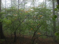
Mountain laurel was blooming up there. So was this, whatever it is.
The trail disappeared after a few hundred yards. I turned north to stay on the ridge. Hey, look, another trail, marked with ribbons, no less. Maybe it would lead to my truck. No, it disappeared quickly too. Then the brush got dense. It took forever to push through it. I got off course a couple of times, and in keeping with today's theme, every square inch of ground was covered with Poison Ivy.
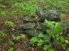
There were quite a few of these rock piles up there. I've seen similar near the Benton MacKaye on Rich Mountain and in a few other places. There is no trail here though, just woods. Are these natural formations? Indian graves? Alien artifacts? Since I don't know what they are, they MUST be alien artifacts, what other proof do you need? :) The geotag is off pretty badly on this one. Apparently the GPS reception was pretty bad up there. See, only alien artifacts can disrupt a GPS signal. The piles are all over the place up there though, stay on the ridge, you'll find one.
At great length, I got to a trail I recognized and followed it home.
Yay. End of a long day. My legs are tired and my thirst for exploration is well quenched, for now.


Good read and great photos!
ReplyDelete