I've been training and racing and crap like that for the past couple of weeks and ignoring the urge to just go out and explore the world. I also just washed last week's race off my mountain bike, and couldn't bring myself to even think of a road ride. It seemed like a good day to indulge.
Persimmon Creek runs down the north-ish side of Brawley Mountain. USGS maps show an odd, lasso-shaped trail looping off FS119, up around the creek and back. Was it really there? Today 119 was open for some reason so I drove out and parked right at the end of the trail.
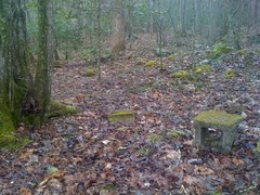
It was there, and really clean and open for maybe a mile. At the first creek crossing, there was sort of a clearing off to the right. Maybe an old homesite? I looked all around, but a single cinder block, or at least part of one, was all that remained of whatever used to be there.
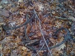
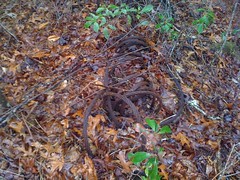
The trail went on and on, and then, abruptly, became the most solid wall of saplings I've ever tried to push through. Despite being seriously overgrown, it kind of went where the map said it would. But, just as the brush cleared, the trail ended. It looked like there might be something down along the creek itself, so I trudged down and ended up following another trail north of the creek toward Hickoryland Mountain. It was a little rough at first, then suddenly became totally clear, like I-could-drive-my-truck-on-it clear. A little further up there was another clearing, with what looked like an old rock wall cutting across it, and there was this old cable.
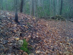
The rock wall looked more like a rock wall in real life.
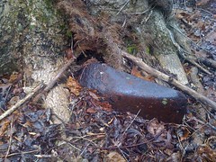
And there was also this shovel, buried in the ground and a tree had grown up around it.
The road bent around behind the clearing and there was another, longer cable coiled up there.
Something used to be there.
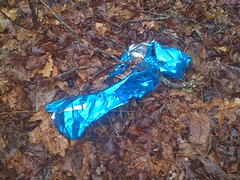
Hey, look, another mylar balloon.
The trail was extremely overgrown beyond the cable, then cleared up a little, but not so much that I'd call it "clear". How could it be overgrown on both ends and clear enough to drive on in the middle? There were a couple of side trails, but they all looked pretty bad. Maybe one of them wasn't as bad as it looked. Weird.
Eventually the trail turned north but I really wanted to go southeast, on up to Brawley. From a ridge nearby, I could see the peak and started navigating toward it. I sighted on the highest point along the ridge, but the closer I got, the more I realized I was really headed toward a little knob to the southwest of Brawley proper. That little knob looked like the tallest point though and I could see Garland Mountain too, right where it should be. I really don't understand what I did wrong.
As I climbed up the side of Brawley, I found another cable, in the middle of nowhere on the side of the mountain.

It was a good day for finding cables, if you're into that sort of thing.
...and I recognized where I was. The last time I was here, there was corrugated plastic everywhere. This corrugated plastic:
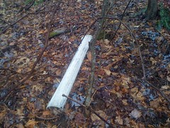
I ended up on the landing at the end of Old FS119. Having been there before, I wasn't looking forward to being there again. Uphill, the brush was super dense and thorny and it took a lot of effort to get through it. There was one clear spot though, and looking behind me, I had a great view of the Rich Mountain area. I think that's Davenport on the right, Rocky in the middle and Cold Mountain on the left.

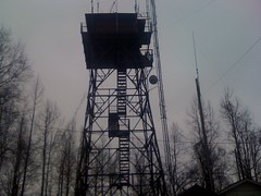
Eventually I made it to Rocky Knob Ridge Road and the Benton MacKaye, and the Brawley Mountain tower sprung, suddenly from the fog in front of me. My first thought was that it looked like one of those fighting machines from War of the Worlds. "Monstrous tripods, higher than the tallest steeple, striding over pine trees and smashing them."
A trail led southeast from Brawley. I followed it down to FS35 and ran across this nasty, half-scavanged deer carcass about a third of the way down.
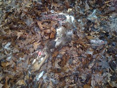
Maybe a pack of coyotes took it down, but more likely a hunter just shot it, took a quick photo and abandoned it there. I've seen so many abandoned deer carcases... I always figured they eventually get eaten. I guess they do. The intersection with FS35 was kind of weird. It didn't tee in at the same level, like 35 was built way later, or at least widened later. Or something. I wonder if it was the original road up to the tower. Who knows?
35 is pretty flat, so I jogged north to Brawley Creek and around to the base of a ridge that, at least at the top, had a trail on it. At the bottom there was no trail, but the ridge itself was easy to follow. Somebody had painted yellow stripes on like every 5th tree on the entire ridge. I imagine there will be some logging up there at some point. The stripes looked old though. Do they mark the trees and come back to harvest them when they're grown?
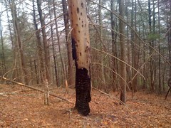
This one looked like it got struck by lightning, burned, died and then got attacked by woodpeckers, or birdpeckers as Sophie calls them :)
Not far up, an old roadbed turned in from the northeast and went straight up the ridge. I followed it to FS45 and took a series of old, overgrown trails over to Ledford Gap. The wind was screaming through the gap and as I pushed through the brush to get out to the road, some thorns whipped around my face from behind, leaving 3 cuts on my nose. I didn't notice at first, but a few minutes later, something just didn't look right, and I realized that they were bleeding, fairly profusely. Yay.
Back at the tower, there was a little three-walled shack housing a generator. I had a seat inside, out of the wind, and ate some lunch. It had been raining off and on all day, but up on the ridge, the wind was fierce and the rain was stinging. It was nice to be out of it. But, sitting still equals getting cold, so I didn't stay long.
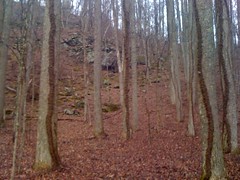
The Benton MacKaye led west along a ridge to Garland Gap. Up on the ridge, the wind was relentless, and there was a bunch of horse sign along the trail. Naughty, naughty. On the back side of Brawley Mountain, the BMK bends around through a large, flat area with interesting rock formations. They look like caves, but the last time I was there I walked up close to them and it's just an illusion.
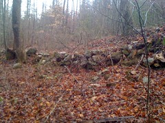
There are also rock piles all over the place, at odd angles to each other. Indian Graves?
At Garland Gap I went south. I'd seen an old roadbed there last time, but I couldn't tell if it went anywhere. Turns out it runs down along the creek to FS35. Near the end, there was a long rock wall, which looked as if it had been built to support the road.
Or maybe there was a house or something there and when it was gone, they built the road right through where it was. Either way, it was interesting. The last hundred feet or so, down to FS35 was overgrown, as if it has been scarified. There was a small tunnel through the brush beside it though and I was able to get through.
On the other side of Garland Creek there was another trail, leading back up toward the gap. It was a bit less passable than the one I'd come down, but I took it back up, took the BMK water trail down the other side, cut cross country to the Garland Gap Trail, and again to some other old roadbeds I'd been on last time, explored them a bit, and finally headed down to FS119 and jogged back to the truck.
I still can't jog very far, but I'm finally at the point where I don't feel like I'm going to wear out some little muscle in 5 minutes. I can't yet just pick a pace where I can jog all day, but I'm getting there. I'm also getting more comfortable navigating when I can't see more than 100 feet at a time, though I still have trouble judging how far I've gone without some kind of landmark to measure against.
All in time.
I'd totally forgotten about getting my face all cut up until I happened to catch a quick look in the mirror. The cuts were tiny, but they sure did bleed. My entire nose and most of both cheeks were covered. I guess the wind had blown it all around as it dried. It looked pretty awesome. I should have taken a picture. It's lucky that I even noticed though. I grabbed a bite to eat in Dawsonville and I can only imagine how crazy they would have thought I was if I hadn't.


No comments:
Post a Comment