In short. It was one of the best days I've ever had on a bike. THE best day was Fool's Gold '09 but this one easily ties for second. Any excuse you might have for not riding FATS probably isn't good enough.
In long...
I got up late. Almost too late to go. Emily says there's 40 miles out there, but she also says it's pretty flat. I guesstimated that I'd get there around 3. I'd have about 5 hours of daylight. Yeah, I should be able to do that. No time to screw around though.
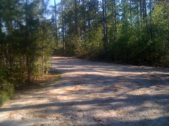
The trailhead was unmarked. There are big signs saying "Fork's Trail This Way" at the main road, but the trailhead itself is just sitting there anonymously. I drove past it at first :)
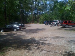
When I did get there, I loaned a patch kit to the guys parked next to me and my phone to a guy who'd lost his. There was also a stray dog running around. He was obviously a stray. The guy who needed my phone was willing to take him in, but there was nothing we could do to catch him. I even tried flanking him to drive him toward the other guy, but he was too smart for that. He kept his distance and we eventually had to give up.
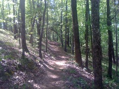
I got on the trail at 3 and right away I could tell it was going to be a good day. And it just didn't stop. Ever. I think the best way to describe it is: downhill, both ways. I mean, there are climbs, there have to be, it isn't physically possible not to have them, but on the first 3 trails, I only remember sitting back and climbing once or twice and not for any appreciable amount of time. The descents are long and you carry so much speed into the climbs and there are so many little grade reversals... you can look up the trail and see it ascends, but you just keep on rolling fast, all the way up. The trails aren't technical in the rocky, rooty, chunky sense, nor are there switchbacks, but it's incredibly twisty and there are an infinite number of jumps and drops. I can't describe it. It's unbelievable.
The weather was perfect. Sixty-something degrees and sunny.
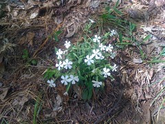
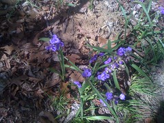
It's starting to get green too.
And it's definitely spring.
At the start/finish of the Brown Wave there's this monument.
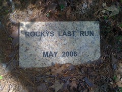
Who's Rocky?
Brown Wave. Heh. Is that anything like the Golden Gallon. Seriously, who comes up with these names.
There is also this shrine near the beginning of the Great Wall Loop.
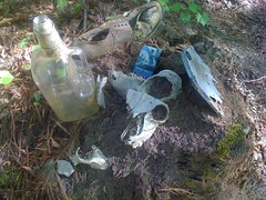
Creepy.
After riding the southern trails, I looped back to the lot and took the Deep Step over to the north side.
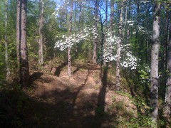
Bam! Dogwood.
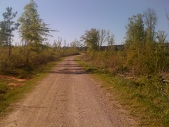
Eventually the Deep Step trail popped out on Deep Step Road and signs led me up FS661...
...to the North Trailhead, which wasn't hopping like the South Trailhead.
A truck had passed me on 661. By the time I got to the trailhead, they'd parked and were getting ready to ride. I talked to them a bit and took off on the big rock trail.
Big rocks all right.
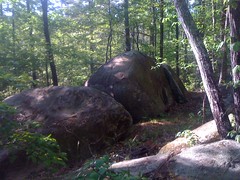
Later, there were more, that you ride over.
Finally, on the Big Rock and Tower trails, there was some actual climbing. Or maybe I was just starting to get tired. Since there were big rocks on the Big Rock loop, I kept expecting to find a tower on the Tower Loop. Nope. Or at least, I didn't see one.
The sun was getting low and I raced it back to my truck. When I got there, the little dog was still hanging out, but also still apprehensive. I offered him a clif block and after 10 minutes or so, he was warming up to me a little. I figured if I waited long enough, I'd be able to take him home, but my wife is so allergic to dogs, she had to get an emergency inhaler the last time we had one over. I didn't want to leave him, but I wasn't sure what to do. I called around but nobody I knew could take him and animal control was closed. Eventually I had to just leave him. If anyone wants a cute dog, I'm pretty sure he's still there.
I grabbed some pizza at Vinny's on the way back toward Augusta. Pretty good, but it took a while.
I took a different route home, but it still took 3 hours. As such, it'll probably be a while before I ride FATS again. Until then, ahhh, memories.


Ha! glad to hear you liked it. If I'd known I would have mentioned the unmarked trailhead... there used to be a sign out on the road but I think it fell over or something.
ReplyDeleteIt's a really fun set of trails. The visitors for the giant IMBA convention should really enjoy them.
I badly need to make it out there sometime.
ReplyDeleteLike you, I'm like 3 hours away from FATS but I keep hearing or reading such good things....I have no excuse not to go.
ReplyDeleteOf the maps on your other site I've picked the SC Trails program map as my guide. Can you vouch for its accuracy?
Also, it looks like if I do nothing but right turns at major intersections that I will hit it all. Sound right?
The SC Trails program map is accurate. It doesn't have the same level of detail as the other maps, but you shouldn't have any trouble if you use it.
ReplyDeleteIf you turning right at all major intersections, you will hit everything, except there are a few intersections where you cannot turn right. Namely, where the trail follows Deep Step Road. On the way out toward the northern trails, you must turn left onto the road, and on the way back from the northern trails you must turn left again.
Thanks! Here's hoping the weather pans out....
ReplyDelete