Great photo here:
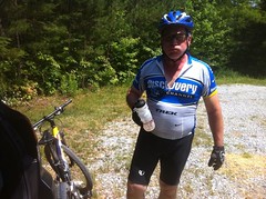
"It's warm out today. It was warm yesterday.... Warmer today." 95 degrees. Georgia springtime. It'll be 50 degrees next week, just watch.
There was a dual sport bike event or something going on nearby. We'd seen a Sprinter van parked by Nimblewill Church and a rider heading down into the Jake Campground. He had put his blinker on when turning off the main road, and when we saw him headed back out he'd forgotten to turn it off. Later on we saw some more riders, with matching tee shirts. I wonder if they were doing a poker run or something.
Right as we parked, I got a voicemail from Russell. He'd apparently just left after riding all the trails that we were planning to ride. We must have passed each other on the road without realizing it. Darn!
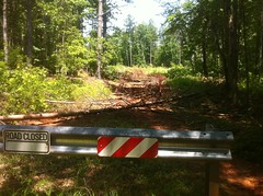
We screwed around with our gear for half an hour, and eventually got down to business. I'd heard that there was a new trail connecting Jake Mountain to the the Bull/Jake Connector, so we headed over to Jake to check it out. I had been mistaken though. Jake was closed.
Ohhh! There might be an entirely new Jake trail! Maybe that's what's going on. Oh, man!
There were 2 reasons I wanted to ride at Jake.
First, I just wanted to get GPS data for the new trails. The Fool's Gold is coming up and if the trails we use have been shortened significantly, I'd need to do some re-figuring of the route. I'd heard that Black Branch in particular had become a good bit shorter.
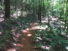
Another objective was to examine the new construction. As I understand it, and have observed, bikes and horses tend to ride directly down the center of the trail. Hikers tend to walk on the very outside edge. Nobody knows why, or at least I've never heard that anyone knows why, but that's what apparently happens. When a trail is fresh-cut, the soil is soft and as it gets worn in, on a bike/horse trail, the center gets packed down. On a hiking trail, the outside edge tends to get packed down. The inside edge tends to get filled in by slump and deposition from the backslope. The outside edge tends to slough off. These forces fight each other, but you often get berming on a bike/horse trail and creep on a hiking trail. Not long after the initial cut, you usually need to go back and deberm the trail, nick the turns, clear the turnouts, and so on. There is probably a formal process that trailbuilders go through. I need to get a little education on that actually.
I expected to see some berming and there was some.

Some folks on the Sorba forum had reported as much earlier in the week.
It was present along most of the trail, though I noticed something I haven't noticed before. The steeper the downslope, the more sloughing off of the outside edge had occurred and the less berming had occurred. It was consistent along the length of the trail, and later I noticed it on other trails later too.
The upslope was filling in, as expected. There's work to be done, but so far, it looked pretty good. The initial cut looked like it might have been 3 feet wide, but it'll be 10 inch wide singletrack before long.
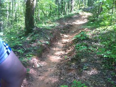
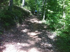
I expected a couple of reroutes here and there, but Jake was an almost entirely new trail. Most of it was IMBA-looking singletrack; bench-cut with grade reversals.
The grade reversals were a little shallow though, not the deep kind I've seen at FATS or Jackrabbit. Will they hold up? I'm a little concerned about that, but we'll see. One section of the new trail criscrosses the old trail all the way down a long hill. The trail there is much less sidehilly an there are short runs of fall line trail. I'm curious how those will hold up too. They are short runs though. We'll see.
The new Jake has been open for a while and appears to have gotten a lot of equestrian traffic since it opened. Despite the heat, we even ran into 2 riders on horseback a mile or so out from the campground. There were hoof prints everywhere, but they were little shallow footprints and barely even made the trail bumpy. It looks like they got the grade right. The wear appeared to be entirely compressive. I didn't see any shearing (chewing up) at all, just packed down trail. It was extremely fun to ride and I imagine it's just going to get better over the next few months.
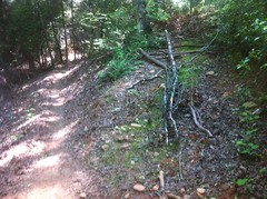
I did see this and thought "Oh, man, what a disaster, the rest of the trail was so nice..."
But it turned out that's right where they tied into the old trail to cross Jones Creek and that was the one bad spot that I saw all day.
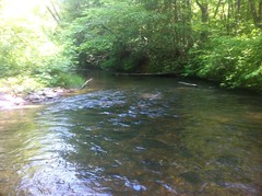
We walked across Jones, it was mid-thigh deep, and the cool water was delicious.
Both sides of the crossing had been armored with gravel and rock and looked like they'd held up well over the past few months.
The ruts on the unclimable climb on the other side had been filled in a few months ago and a bunch of rock had been littered around on the lower section. The Padre climbed it easily.
That section used to have a trench down the middle and will almost certainly, eventually get wrecked again. It's just too steep and the horses slip. Fortunately it's over a hundred yards away from the creek, and it took decades for it to get wrecked last time. Hopefully it will take another couple of decades to get wrecked again.
The new trail diverged again shortly after the climb and eventually teed into Moss Branch.
Somehow, my dad broke the visor on his helmetm right when we stopped at the intersection and had to fix it with some duct tape.

Moss Branch had received the same treatment as Jake, though the unclimbable hill past the creek crossing had been rerouted rather than patched up. That's it up to the right, with the new trail straight ahead.
Actually it looks like they patched it up, then closed it after scarifying the soil and dropping trees left and right across the trail. There was new grass was growing up in between the trees.
Either side of the creek crossing had been armored with rock and gravel like Jones too.
From there to FS28-1, it was new cut, flowing singletrack.
On 28-1, we ran into a pair of riders, out for some base miles. It was blazing hot on the road. We followed them for a while, then pulled off toward Black Branch for a little more recon.
The new Black Branch trail was similar to Jake. IMBA-ish, but not quite perfect. If there's anything I'm worried about, it's the shallow grade reversals. I'm just not sure about them. I know water can't flow up hill, but I can imagine them getting flattened out. Black Branch hadn't been open for long and it was still insanely bumpy. There was very little berming yet, but I imagine that's coming. It's getting worn in quickly and it won't be long before it's as smooth as Jake, but it isn't yet and in the mean time, the hoofprints are tooth-rattling. Russell had ridden it on a rigid singlespeed earlier that day and it wore his arms out.
Somewhat in keeping with the character of the old trail, there's a long, fast descent on the way in, which tied into the old Vietnam trail right at the creek crossing, and then left it again almost immediately. The second half had been rerouted around the most rutted out climbs, but otherwise utilized the existing trail. My Dad's been riding in Dallas all year and was not amused with the rollers near the end.
The trailbuilders didn't screw around with the sections of the old trail that they didn't use. The parts that we could see from the new trail looked scarified and they'd dropped trees and ebris across them, left and right, for as far as we could see.
We ran into another guy on horseback where you pull off Black Branch over to 28-1. He passed us and headed off at a gallop. I'd never actually seen a horse galloping off down a trail before. It was almost like watching it in slow motion. The horse covered lots of distance with each bound, but didn't look like it was working very hard. It reminded me of watching the mountain lions run around in their pen up on Grandfather Mountain. It's amazing how quickly and effortlessly a large animal can cover a large distance.
We headed further north on 28-1, up past Wahsega, past Merrill. I never realized how long of a climb it is from there. It's just one long climb, all the way up and I was feeling it. I was able to sit back and take it easy, but I had to. Still, I was feeling a lot better than the day before, like being outside was doing me some good.
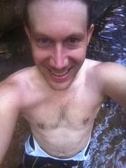
On 141, we took the Bee Trail to Montgomery Creek Falls, AKA False Black Falls, ditched the bikes and went for a swim.
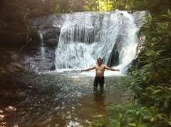
We played in the water. We swam in the pool. We sat on the rocks.
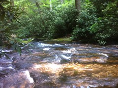
The water must have been 60 degrees, but with the air probably 85 degrees, it felt even more delicious than Jones Creek had earlier. We felt like we'd earned it too. There's nothing better than a refreshing swim on a long, hot day.
Woohoo!!!
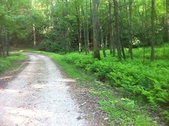
Cinnamon ferns encroached along the rest of the Bee Trail and they smelled awesome. That trail has healed well since last year's mess. I couldn't even immediately identify the sections that we'd had problems with.
On 141 there were signs about logging activity, but so far we had seen no logging, only more of the same lush fernery we'd seen earlier.
Eventually we ran into the logging operation, but it was Sunday and everybody was off. We saw one clear cut, two or three strip cuts and a ton of select cuts. Select cuts? I think that's what they're called.
One funny thing... The signs called the area "Pin Cove" but I think they meant to call it "Pen Cove", which is short for Penitentiary Cove. There's a cove to the northwest called Penitentiary Cove because of how steep the surrounding slopes are. I've heard that there is old growth forest up in there because it was too steep to log. Maybe there's even some longleaf pine up in there. I've walked way back along the upper reaches of Montgomery Creek but I never ran into any old growth. I've always wanted to walk down from the top though. I'll have to put that on the list.
141 seemed like an endless grind, as did the connector trails over to Moss Branch. My Dad and I were joking about this thing a friend of mine, Ruth had said on Facebook last week. It was something like "I'm going for this long ride, meet me at such and such, bring an overstuffed camelback and a roll of duct tape... for your mouth, if you start to whine." We had some duct tape, so we made sure not to complain, lest we'd have been required to use it.
The Moss Branch Connector was also new and as rough as Black Branch. Moss Branch proper had apparently been opened sometime between Jake and Black Branch. It was about halfway between them in roughness. A good bit of the northern end Moss Branch just reused the old trail, but there was a long section of new trail as well.
At the intersection with Jake, we headed back to the car, our missions accomplished. At Jones creek, we took extra time wading across. It was hard not to just stand in the water for 20 minutes.
Kathryn called my phone, which for some reason had service. Since I was climbing a long climb, slowly, I answered and talked to her, but it took her forever to explain what she wanted and I kept worrying I'd get done with the climb before she got to the point.
On that same switchback climb, my Dad became officially worn out. He started cramping and had to stop and rest. Afterward, the cramps didn't return, but he still struggled. We were only two miles from the car, but he said if it had been three, he'd have had to stop again.
Done.
Now that I've had a chance to analyze the GPS data and crunch the numbers, here's how the distance stacks up. I'd heard reports of Black Branch being cut in half and so forth, but it didn't feel that way riding it. The numbers don't lie though.
Old:
Jake Mountain - 2.12
Moss Branch Connector (Old) - 0.87
Moss Branch - 1.88
FS28A cutovers - 0.45
Black Branch - 3.25
------
Total - 8.57 miles
New:
Jake Mountain - 3.03
Moss Branch - 3.6
Moss Branch Connector (New - replaces FS28A cutover) - 0.49
Black Branch - 2.34
------
Total - 9.46 miles
Black Branch is about 2/3rds of it's former length, but there's about one net mile more of total trails. Some of the designations have changed too.
Heat, illness and struggle notwithstanding, I had a great time. It wasn't a major adventure, but it was exactly what I wanted to do. My Dad alleges that he had a good time too and says he's not even sore today. Excellent.
This morning I felt great, but by mid afternoon I started feeling sick again, and got a series of nosebleeds. When I got home I had a fever and all but collapsed on the couch. I'm only up now because I was waiting for a report process to finish for work. It's done now though, so I'm about to sack out. I'm going to the doctor tomorrow. I don't know what I've got, but it's killing me. I need to kick this thing and get back to knocking some of those real adventures off my list.
Update: Current map and GPS data is available here: Bull/Jake Mountain


I'm surprised Black Branch turned out to be that much shorter. I bet most of the lost mileage was on the downhill.
ReplyDeleteAnd Jones Creek was not "mid-thigh" deep. It wasn't even knee deep. Oh, wait.....
Ha, ha. Yeah, it was above MY knees.
ReplyDeleteHi David,
ReplyDeleteJust curious what are you using to log the trails? garmin, etc....
Thanks
Hello Anonymous,
ReplyDeleteI've used a Garmin 60CSx for the past few years. Before that, I used to have an eTrex Legend, I think. Little blue Garmin unit. Both were presents from my parents. The 60CSx is bulkier and heavier than some of the newer units but it's got a built-in compass, you can mark waypoints and it gets great reception, even when stuffed in my camelback.
I use gpsbabel to get the data off and mostly crunch it using software that I wrote myself.
Very cool, thanks for the reply. Have been trying to use my phone but the phone is usually about 3 to 5 tenths off as compared to what the signs say at blankets. May start using my lowrance out and back although it is quite bulky.
ReplyDeleteBryan