The plan was great. The execution wasn't so great.
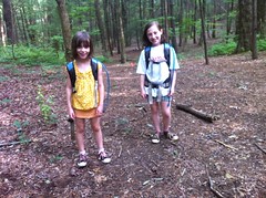
Right out of the gate, I forgot my GPS. We were right on the edge of whether it would be worth going back for it or not. Ultimately we did, but it added about 30 minutes to the round-trip.
Next, we grabbed some lunch at Chipotle.
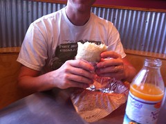
I loved it. Sophie loved it. Isabel didn't love it so much. They've gotten to where each girl loves everything the other hates, so there's no possibility of satisfying both of them any more. We're definitely going to have to work on that.
About an hour later, we stopped at a little C-Store for a bathroom break and I let the girls go in by themselves. Ten minutes later I finally went in after them. They'd had to wait in line behind two other ladies, and then Sophie got locked in the bathroom. The lock was so old, loose and wobbly that when you'd turn the lock, the entire inside of the mechanism would turn and it was impossible to unlock it. Iz told the lady at the counter who all but refused to help, possibly thinking that they were just playing in the bathroom: "We don't have a key, she'll just have to unlock it herself." It wasn't until they saw me come in that they were remotely motivated to help. The lock looked easy to pop, so I went to get a screwdriver, right as another lady came back with one popped it herself. From the scrapes on the lock, it was clear that this occurred regularly. When the door swung open, I could see that it was split down the middle from somebody having kicked their way out too.
Sophie was scared that she'd be stuck in there forever. I forget sometimes that she's a kid. She's not afraid of getting lost in the woods, but being stuck in some bathroom forever was still a legitimate fear.
Eventually we made it to Clayton. That's either Screamer or Raper Mountian on the left.
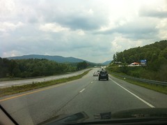
I forget which one. There's a big, lit up cross on the side that you can see it when it's dark out. At least I think it's on that mountain.
We rolled east to Warwoman and lo, it began to rain. Not crazy, punishing rain, just enough to get everything really wet. Then it stopped.
We headed up Sarah's Creek to see the old bus. There's an old heap of a bus up there near the top, abandoned some unknown number of years ago, now hollowed out and covered in graffiti. Or at least, it was the last time I was there. Unfortunately there's a big slab of rock across the road near the top that I just couldn't get the Outback over. I'd bet it wouldn't be a problem if it were dry, but after the rain, it was hopeless. No bus for us.
I had to cross 3 or 4 creeks on the way up, and on the way back, I took what looked like a good line, but turned out not to be so good.
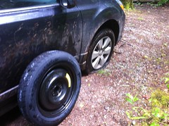
Pinch flat. Ok, so that's one thing less durable about the Outback vs. the Durango. We changed it quickly.
We didn't get to see the bus, but we did get to see the old bed.
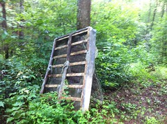
That's almost as good, right?
Warwoman is huge and has several designated hiking trails, but you pretty much have to hike them out-and-back. There are no clear loops that you can make without walking on the road for miles at a time. The USGS maps show lots of old trails though, and I've been looking for a chance to check some of them out that might make a loop possible. Plus, I just like exploring the woods, you never know what you'll find.
So we began exploring. For the first half mile or so, brush encroached on the trail and with that little bit of rain we had, it was the proverbial walking shower. Eventually it cleared though and we dried out.
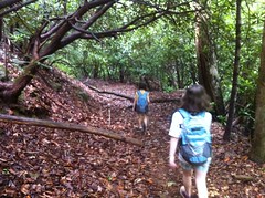
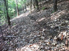
The trail followed an old "road" bed. I'll put road in quotes because it was really old, very narrow and didn't appear to ever have been all that wide. Does that still count as a road? There were several creek crossings with remnants of old bridges. In some places it looked like the road had been abandoned and reverted to a trail, which had been somewhat maintained, then also abandoned. Only a really primitive trail remains today. There were a few places where somebody had hauled timbers up there and laid them into the ground to fill in a soft spot. The same had been done with rock. The rock was laid in a narrow strip, up the middle of the trail, like I've seen on the AT, especially up on Blood Mountain. Deposition off the backslope was slowly burying all of this though. It appeared to have been done a very long time ago.
We saw one spot that looked like it had been flattened out, right along a spur of the creek with an old remnant of a road leading up to it. We didn't see any chimneys though, or any other evidence of a settlement. It looked like a good place for one though.
We did see some semi-mysterious rock piles though.
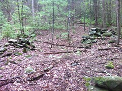
That can't be natural. I wanted Sophie to stand next to them for scale, but she was all: "No way! They might be indian coffins! If you touch them, their ghost will attack you. I'm not going near those things." All that from an 8 year old. I guess technically she's almost nine, but still, pretty funny, and impressive that she immediately thought of indian graves, or "coffins" as she called them.
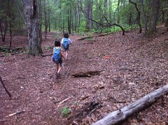
Almost at the top...
There was a huge campsite at the top. Only 1 fire ring, but an area about 200 yards in diameter has been picked clean of firewood.
On the way down the other side, Sophie had to re-tie her shoelace 3 times.
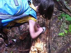
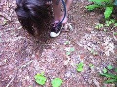
Come on kid, double-knot it!
The trail down the other side appeared to get a lot more use than the trail we'd just climbed. It was narrow and the canopy was close. Too narrow and close to be fun on a horse. I didn't see any tire tracks or hoof prints. I did see one chainring mark on a log from long ago. Iz pointed out some hog rooting that I hadn't recognized.
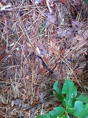
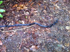
We ran across a tiny snake. It turned out to be a ringneck.
Earlier, Sophie had given up the lead "I hate being the leader. So many spider webs!" Iz had taken over when we went over the top and freaked out at the first semi-significant spiderweb she ran into. Like arachnophobia-level freaking out. Like, get-it-off-me-get-it-off-me-get-it-off-me-I-totally-understand-that-it's-crazy-but-still-get-it-off-me!!!! freaking out. We just had to stop until she calmed down. Man, I guess Iz is really afraid of spiders, not from a distance, but definitely up close. How is it that's never come up before?
I took over the lead and we soon discovered enough blackberries to eat until we didn't feel like eating them any more.
Eventually I started seeing what could explain the existence of the trail. To the right, down by the creek there were several large campsites with little side trails leading over to them. The creek on the south side of the gap had been small but on this side it was much larger. It could be a decent trout stream. Unfortunately, or maybe fortunately from the standpoint of sustainability, the trail didn't get very close to the creek and we only caught a glimpse or two of it.
At Hale Ridge Road, we took a break, ate some snacks and then walked up the road to the Rabun Bald trailhead to take a picture of it. We'd hiked it last year while the TNGA riders were suffering up to Wilson Gap but I'd forgotten to take a picture of the trailhead.
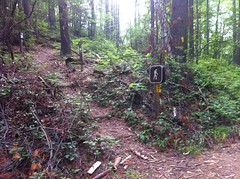
Got it this time.
The hike back over went much faster. It's funny how much faster you move when you know where you're going.
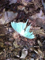
We saw slightly more wildlife on the return trip - a luna moth, I think.
We reached the gap quickly.
I thought I saw a trail off to the northeast when we'd crossed over the first time so I went to check it out. Hmm. Narrow, outsloped, bench cut, with grade reversals.
Ha! Apparently, these days, even unauthorized trails have been built using sustainable techniques. What's the world coming to? "Back in my day..."
On the way back down, Sophie led again and ran into this snake.
She stopped, didn't say anything, just quickly jumped back around behind me. If it had been poisonous, she'd have basically thrown Iz into the line of fire. Oh, boy. We talked about that a bit. She knows what to do, but instinct took over. I guess it's hard to resist.
I struggled to identify the snake. It didn't strike me as being a black racer. They're usually long like this one, but they like to twist up on themselves more and drape themselves over things. Plus, its head looked like a rat snake's head, but it didn't strike me as a rat snake either. It seems like they're generally fatter. I'm not sure about this one. Probably one or the other.
We didn't run into any more wildlife on the way back to the car unless you count the thousands of snails, slugs, centipedes and millipedes we saw.
On the way out, we stopped by the campground so Sophie could hit the bathroom. There was no toilet paper, but one of the campers offered us some of theirs. I talked to him for a while and told him what we'd done that day. Apparently somebody had dragged the bus down last year, let it sit for about 3 months, and then cut it up for scrap. It's completely gone now.
Good old duality - I'm sad it's gone, but I'm also glad it's gone. I guess it's cool that I got to see it while it was there.
We still had to drive about down off the mountain and over 100 miles back home. That's tough work for a donut. We all agreed that it would really be pushing it to try getting out to Earl's Ford. So, that was it. We ended up driving 3 and a half hours for 3 hours of hiking. Some days are like that though.
We took some roads back that we'd never been on before and grabbed some dinner at the Wild Wing Cafe in Gainesville. It was better than I expected. We were fortunate that they were open too. It was July 3rd and just about everybody had closed early.
Well, it wasn't a bad day, it just wasn't a great day. I still want to go swimming at Earl's Ford though, so we'll have to try that again. Fortunately, we've got lots of summer left.


I have 3 children ages: 13, 11 and 7, and was considering camping and hiking at Warwoman this summer(I did this often as a kid with my dad). I realize this was written a while ago now, but I have heard rumors that the Warwoman area has become a haven for drug activity and general criminal behavior. Did you witness anything that was concerning for someone interested in a 3-4 day camp in that area?
ReplyDeleteThe only criminal activity I've heard about up there is mountain bikers riding on the hiking trails or on other unauthorized trails. I've never seen or done that, but I've heard about it.
ReplyDeleteOther than that, I haven't seen or heard anything concerning but I haven't really spent a ton of time up there either. Anything is possible and it is a fairly remote area. I could imagine pot farming and moonshining going on but I've never seen it.
The campgrounds usually seem full of families and friendly people and I've only run into friendly folks on the trail.