Either way, I was down. I've put in a lot of miles on the bike lately, especially on the road, various biking muscles are tired, and these days my brain translates that into "I feel like hiking" rather than "I don't feel like riding." So, I felt like hiking.
I met the McClung party at their campsite at Trackrock Gap Campground.
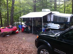
It wasn't super easy to find their site. There are a couple of of camping loops up there, but none of them have signs indicating which sites are off of which loops. I just happened to run into Vonnie, headed down to the bathhouse for a shave while I was searching and he pointed the way.
Tiffany, Cadence and their buddy Merit, who's name I'm almost certainly misspelling, and his dog Zaxby were milling around when I got there. Merit had come up the night before.
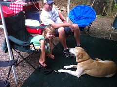
Clark and Suzy showed up a few minutes later. Cadence ran over and hugged each of them for minutes apiece. She's the sweetest little kid. I half wished I'd brought my girls, but they'd put in a long day yesterday and Iz has gymnastics on Monday. It was probably best that I hadn't.
Vonnie and Merit parked his truck at Trackrock Gap. When they got back, we piled into a couple of cars and headed off into the Brasstown Range.
We parked at the Brasstown Bald lot.
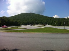
There was a bunch of construction going on. Some little building had been torn down and they were rebuilding it. I struggled to remember what used to be there though. The bathrooms by the Arkaquah trailhead had been torn down too and a swath had been cut for some new construction there as well. Dangit! Now I'm going to have to go back up in a few months, just to see what they've done.
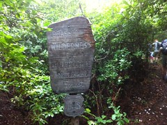
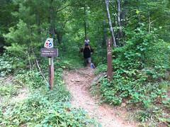
Fortunately there were bathrooms out in the middle of the parking lot, and after we ran our little train through them, we were off into the wilderness.
Literally, the Wilderness:
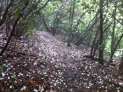
I'd hiked the Arkaquah once before, in early winter. Today it was a lot warmer and everything was blooming. There were Wild Azaleas here and there, but mainly, tons and tons of magnolia:
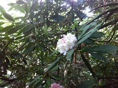
Petals littered the trail in the tunnels that had been cut through it.
Later in the year, the mountain laurel will do the same thing, and then in fall, at lower elevations, maple leaves.
There were a couple of rocky outcroppings.
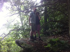
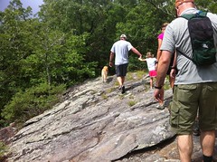
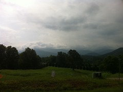
In winter, I'd seen beautiful views from them, but the views were largely obscured yesterday.
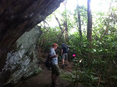
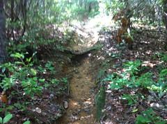
There were several rocky overhangs that looked like they'd be good shelters if we'd needed to camp. We took a break under one of them.
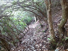
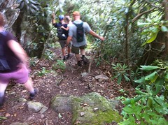
We ran along the ridge for a while. There were a couple of tricky, rocky descents.
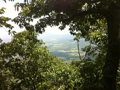
I managed to sort-of catch one view of Brasstown Valley.
Blueberries, or at least blueberryish things were growing all over up there, but we only found a few berries that were actually ripe.
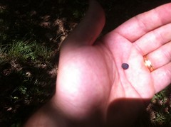
They were hit or miss too. This one was dry and crumbly, but the one Clark got off of the same bush was juicy and delicious.
There were blackberries too.
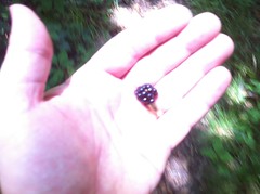
They were uniformly sour though.
The last mile or two of the Arkaquah is an unrelenting, potentially knee-shattering descent. Clark and Vonnie took turns carrying Cadence. At one point, Zaxby just flopped down and pretty much refused to keep going until he'd had some water and rest.
In the end though, we made it out.
Clark's and my vehicles were up at Brasstown. After dropping everyone else at camp, Vonnie shuttled us up to get them. Clark and Suzy had to get back home to attend to their dogs, so they took off, but I'd had an idea the night before and wanted to see it through, or at least determine if it was possible to see it through.
There are several trails leading up to Brasstown. Wagon Train from the north, Arkaquah from the west and Jack's Knob from the south. But, if you look at a USGS Topo map of the area, it shows a trail leading up Fodder Creek from the east. When I was up on Wagon Train last year, I even saw where it might tee in. I love exploring old, primitive trails, and being in the area, with my car at the top of the mountain, if it was possible to access the bottom end of the trail, I didn't want to pass up the opportunity.
Nobody else wanted to do it, but Vonnie was happy to drop me off.
The map shows a campground and one of the roads through the campground just becomes the trail. Presumably, the road once led to the top of the mountain and since it's inclusion in the National Forest, has become a trail, or more likely, a "trail"
The campground turned out to be an RV resort. They had a billion RV campsites where you could pull in and stay a while. They had ball parks and playgrounds and pools and lakes and a creek and food and everything a resort generally has, except lodging. Wow. I'd never seen anything like that before.
There were signs everywhere saying "Registered campers only beyond this point!" But they didn't appear to apply to the roads, just to the various amenities. I started to get that Indiana Jones feeling...
There weren't any signs saying not to do what we were doing, but after seeing enough of those signs, I got the idea that they probably don't want random people wandering around their facility. We needed to move quickly before we bothered anybody.
Unfortunately the roads were a bit of a maze and they'd changed since the topo map was published. In the movies, the hero blends into the crowd at first, but his wrong turns give him away. We were blocked by a dead end, but I could see a little foot bridge that led where I wanted to go. I had phone service, so I figured I'd check it out, Vonnie could drive out and I'd call him to let him know if it worked out or not. If it didn't, I'd walk out and meet him. Immediately though, on the other side of the bridge was a sign: "Residents only, beyond this point." There were houses back along that road. That's where I drew the line. If it doesn't say don't, I might, but if it says don't, I almost never do. For all I knew, I'd have to walk through somebody's yard to get to the trail, if it existed at all. Vonnie hadn't left yet, so I jumped back in the truck and we headed out.
Looking at the map, it would be a long bushwhack to get to the trail any other way. Fodder Creek would have to wait. I took Jack's Knob up instead.
I think Jack's Knob is the steepest, on-trail, sustained climb that I've ever hiked. I'll have to compare it to Rainbow Falls, but I'm pretty sure it is. Moving quickly, I was actually able to get my heart rate up and keep it up, which is pretty rare on a hiking trail without jogging. It felt like tempo climbing on the bike, but using different muscles. Woohoo!
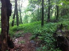
Jack's Knob has many different flavors. It starts off with a little ridge running through a mostly-pine forest...
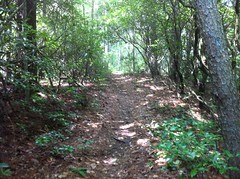
...gets a little too steep for a while...
...meanders through an infinite series of long, lazy switchbacks...
...and tops out in some open, ferny forest...
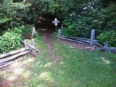
...before dropping back the parking lot, the only descent on the entire trail.
There was a lot of pine in the woods there. More than I'm used to seeing in the mountains. The trail had that pine-needle kevlar surface going. Most durable surface ever. It didn't look like it got a ton of traffic either, maybe because of how steep it is. We're halfway into the summer and last winter's leaves hadn't yet been crunched into oblivion.
I also saw a lot of Chestnut.
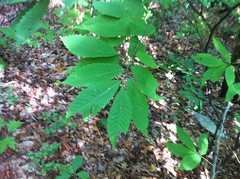
I'd seen some on Arkaquah too, including one that had to be 30 feet tall. It was still thin and spindly, but that's tall for a Chestnut in Georgia.
There was also a good bit of Shagbark Hickory.
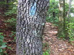
Or, at least, I think that's what it was. The bark kind of feels like balsa wood. Whoever marked the trail used them almost exclusively.
It took less time than I expected to get to the top.
I jumped in my car, cranked the AC and headed back to camp. Me and Vonnie played softball with Cadence for a little while and we all generally sat around lazily for an hour or so. I figured I'd better get home before I got sleepy, so I took off when I felt it creeping in.
It was great to see everyone again and spend the day running around in the woods together. Thanks for having me up.


No comments:
Post a Comment