When deciding to have Fake Mother's day on Saturday, we should have looked at the weather forecast. Sunday, it poured, all day. In the morning it was so bad that I didn't even want to wake up. Rain makes me sleep in sometimes. Part of it is the cozy sound of it pattering on the house but this time I think part of it was also realizing that it was useless to go for a ride.
Then I had a dream that I'd driven north, past the rain and ridden all day in Chattanooga. When I woke up I realized that it might not be raining everywhere, checked the map on my phone and went back to sleep again because, yes, it was raining everywhere.
Eventually I got up though. The kids and I raced over to the Dutch Monkey, hoping to get there before they closed at 1, only to find that they now close at 4 on Sunday (and have for a while) and also that they were nearly sold out. We had to settle for chocolate cake donuts, which were still good, but just not what we were hoping for.
The rain wasn't coming down in sheets anymore and the more I thought about it, the more I wanted to go running around in the woods. I did a bunch of that last year, in the rain, and I had a lot of fun then. Maybe I'd have fun today too.
I even knew where I wanted to go, and I drove there as quickly as rainy Sunday traffic would allow.
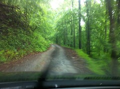
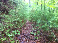
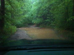
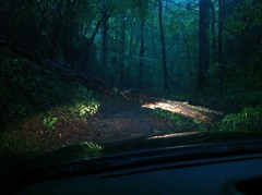
I wish the camera in my phone could really capture the green. It's so much greener here than it looks in these photos and the rain made it look all shiny and crazy. It was really dark and misty too. When it's warm, the woods usually looks so inviting, but it's a lot different when it's been raining. I guess the mist and the darkness are scary, and then the over abundance of bright, glossy green leaves seem unnatural in that setting. The woods is a fisherman with a shiny lure.
I parked at the Bear Creek Campground.
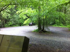
The girls and I had been there a month or two earlier and I'd noticed two trails leading away from the lot. One appeared to lead north toward the Bear Creek loop. I'd long seen remnants of a trail leading north along the east side of the creek and wondered if they were the same trail. The other led east. For all I knew, it might lead over to Mountaintown. If so, it could have Northwest Passage-level significance - I could descend Mountaintown and do a short hike-a bike to the bottom of Bear Creek, avoiding the private road altogether - that is, if the trail actually goes over that way. I would find out.
The first trail didn't go anywhere near where I expected. I soon found myself decoding an old logging network that apparently still gets some small amount of foot traffic. Several little spurs spun off of the main trail and with each downed tree got more and more overgrown as people got less and less interested in climbing over them, eventually becoming almost impassibly dense.
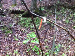
One spur was less overgrown, and from the looks of this marker, might be the right way to go.
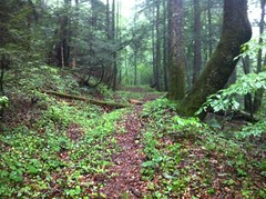
Actually, it petered out too but a not-quite overgrown spur led over to a very clear trail which turned out to be that other trail that I'd wanted to explore earlier.
There were, of course, side trails and eventually I unwound the maze.
Along the way, I encountered beautiful, clean trail...
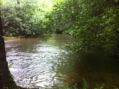
raging, rain-fed creeks...
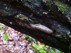
"Wildlife"...
an empty, overturned nest...

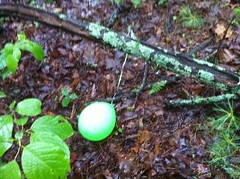
another balloon, though oddly, not mylar...
...and a walking shower.
Seriously, try to walk through a stand of small pine trees when it's been raining. Your clothes will become saturated in the first half second and then the water just pours down your body in sheets. You'd stay dryer in the middle of the road during a thunderstorm.
So that second trail never led over to Mountaintown, except to private property at the bottom and the first trail never led to the Bear Creek Loop Trail. Part of the network eventually led to FS304 but not to the trail down by the creek. So what of that trail that I'd seen there before? This was a mystery and I wasn't about to let it go unsolved.
Explore!
I made my way to the creek...
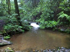
where somebody had recently gotten very artistic...
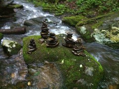
and nearly broke my leg trying to get a photo of those cairns. I guess I should remember that it can be slippery when it rains. That could be important to remember.
I followed the old road south along the creek. It was literally right along the creek. In fact, it appeared to have been the original route of the old roadbed that eventually became the Bear Creek Trail. It was overgrown for a while but cleared after a while and rejoined FS241. There was evidence that people drove trucks there occasionally. Oddly, there are signs saying No Camping but no signs marking it closed to vehicles.
It looked like the road may have been the original route up Bear Creek. At the top end, it looks like it used to join what is now the Bear Creek Trail. The union was obliterated when they built the parking lot but it doesn't take much imagination to see the two connected. I bet that if I looked, I'd find that diverges again from FS241 and follows the creek south too.
I always wonder about old roads like this. I've seen a lot of them - right up along the creek and eventually replaced with a better road higher up the hill. How old is that original road? Who built it and why? The obvious answer is logging, but surely some of these old roads existed before all that. Which ones?
The first part of my mission was more or less accomplished and I walked around the campground for a while. It turned out to be substantially larger than I thought, stretching probably a half-mile or more south along the creek.
I think something is wrong with the toilet though. Between the toilet and the bridge, basically downhill of the tank, it stunk horribly and later inspection revealed that the stank was getting carried around on soles of my shoes. I could be wrong but it seemed like maybe the tank was leaking into the ground and then coming back up through the parking lot, right there by the creek. In fact, as soon as I crossed the creek, the smell was gone. It was really, really nasty.
Ok, so now the first part of my mission was entirely accomplished and I was thoroughly soaked, to the bone, head to toe. It was bout 7:00 and I had about an hour and a half of light left. I really needed to dry out before getting something to eat and for the longest time I've been wanting to drive around and explore the great unknown between Gates Chapel and Boardtown roads.
I drove up Zion Hill Road, all the way up, as far as I could go. Eventually the road took a hard left and looked a bit more unmaintained than I was down for and I had to back up for quite a while to get out. According to the USGS maps, it keeps going up around a pair of old lakes which appear to have long since dried up and a spur leads off into the greater unknown. Maybe I'll have to go running around up there some day. I found Old FS56 too. The USFS GIS data shows it to be a road, but it's definitely not a road any more.
On the way back down I took Harpers Creek Road over to FS425 which turned out to be even less maintained than that road at the top of Zion Hill and taxed my weak 4WD skills. The Outback did way better than I expected though and being lighter than the Durango, had way less tendancy to slip down into ruts, even with the stock tires. Eventually I reached an obstacle that I wasn't confident I could cross.
Maybe if I had a shovel and a stick and a comealong or a buddy with another truck... Not by myself though. In the other direction, FS425 was substantially more sketchy than it had been on the way in, and I slipped and scraped the bottom a few times more than I was comfortable doing. That road actually might be fun to ride a bike on.
On the way back I drove up Whitecliff Road until a downed tree stopped me and I had to just back up for at least a quarter of a mile.
The USGS maps show that road becoming a trail that leads all the way up to the White Cliffs of Fowler Mountain. I wonder if it still does.
I spun a loop around Flat Branch and checked out FS245 from the other side too. It doesn't get any less gnarly on the other end either.
The rain had picked up and the fire department was really earning it clearing downed trees off of the road.
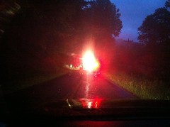
I felt bad not being able to give them a hand but my thanks seemed to be enough for them. Thanks again guys.
All of my missions were accomplished, but ohhhh, it was late. 9:15 or so, on a Sunday. My clothes were remarkably dry but nobody is open for dinner past 9 on a Sunday except, as it turns out, Ruby Tuesdays by the Walmart, south of Ellijay. It would have to do.
I rarely eat out any more and when I eat in, I guess I serve myself smaller portions or at least less dense portions. It was virtually impossible for me to consume the entire burger and fries, and mashed potatoes, at least all at once. I guess it's good for my health but it is a little awkward. I got like half of it to go, which I guess was also good because they closed at 10 and I didn't keep them late. I ended up snacking on all of it later too, so maybe, now that I think about it, it was really a win all the way around.
Yay! Rainy day! Running around in the woods in the rain is great! Go run around in the woods in the rain! I think next time I do, I'll bring a change of clothes though and maybe a towel.


No comments:
Post a Comment