So, a little more than a month ago I explored the Alec Branch Cove area, trying to discern the northern-most segment of the old Stock-Hill to Randa route, and though after doing so, I was fairly certain that I'd found the oldest road out there, when I got home, and compared my GPS data to the old topo maps, it didn't 100% match up. I'd missed a turn somewhere, and also, after looking at the FS boundary more closely, it looked like most of Angel Drive is actually in the NF, and I hadn't fully explored that either.
Incomplete exploration!
Can't have that.
So, on the 4th of March, I drove back up to try to knock it all out.
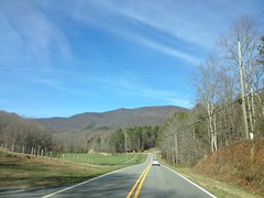
On the way in, I always get a good look at the Rich Mountain Wilderness, a place I've barely ever explored. There ought to be an old road running along the top of that ridge. Maybe some day I'll make it up there to see.
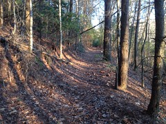
I parked at the Friendship Baptist Church, as usual, but rather than just walking down the road, I followed a little trail behind the cemetery that I'd seen last time I was up there. It just led over the little knob, which I think is called Pine Top, to FS58. If it's not named Pine Top, then it ought to be. There's a lot of little pines up there. I hoped to pass the ruins of an old school, as one is alleged to have existed in the area, but I didn't see anything that looked like ruins up there, just trees.
The old road appeared to keep going past FS58, but it was super overgrown so I didn't follow it. Also, there's private property in that direction, and I didn't want to end up in someone's backyard.
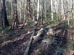
I did notice a little rock wall nearby though...
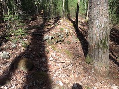
And I ventured a few feet into the woods to check it out, but that's as far in as I went.
I wanted to explore the lower reaches of Angel Drive, which heads almost due east from the corner of FS58 and Doublehead Gap Road. So, you'd think maybe I'd just walk down the road, right? Well... It's not really clear if you can. The west end of the road there is definitely not part of the NF, but is it a county road, or private? It doesn't say "Private Drive" anywhere, or "No Trespassing", and there are fences on either side, so you'd think maybe its county, but there are various signs directing people to the AT and Long Creek Falls on a tree nearby, as if to suggest, politely, that people stay out. And way up the tree there's a super old, barely legible "Posted" sign, which might apply to road itself, or might just apply to the fenced-off land to either side. It's just not clear. I am wary of such things, so I took a much more circuitous route.
Up FS58 a bit, there's a sliver of land between two properties that's clearly marked as owned by the USFS, so I walked down the road a bit, whacked up the south side of Alec Mountain to a little shoulder, hung a left and whacked down into the cove from there.
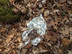
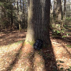
I discovered the day's balloon as I descended into the cove.
I also found another little rock wall along the edge of an old road...
... which, as fate would have it, turned out later to be another chunk of the same old road that I'd followed up over Pine Top earlier.
There was a pretty big pine tree in the same area.
It looked like the kind of place that might have had a homestead on it at some point, so I searched around a bit for a chimney ruin, but I couldn't find anything obvious.
If I tried to recite the exact details of how I explored the area, it would read like indecipherable nonsense. Suffice it to say that I followed most of the little "a trial goes off this way"'s that I'd marked last time and discovered what trial went off that way. I did a lot of backtracking too, and a lot of double-checking that I was, in fact, still in the NF, and hadn't wandered onto someones property. Fortunately, the forest boundary is super-well marked back in there. There must be a hundred trees with red marks on them, and in some cases, there 3-foot tall red stakes hammered into the ground every 10 yards or so.
So, I managed to find the length of Angel Drive that's in the NF, and I walked it end-to-end.
I could even see my truck from the west end of the NF property, not 100 yards away. There's a cemetery at the west end of the NF property too.
The Stock Hill Cemetery.
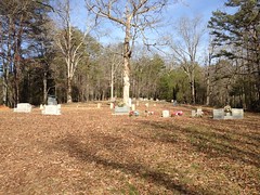
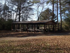
The cemetery didn't appear to be on NF land, but churches and cemeteries generally welcome the public. There wasn't any signage indicating otherwise, and their facilities appeared to be rather welcoming too.
At the east end of the road, I discovered why it was called Angel Drive.
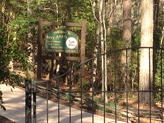
At that end lies Jerry Angel's place. Not sure exactly what it is. Maybe a hunting lodge? Maybe a little resort tucked away in the woods? The internet doesn't seem to know anything about it. Who knows? Clearly where the road gets its name though.
There's a bit of a maze of old roads back there, and I managed to sort them out a bit more. It looks like Angel Drive proper used to keep going, all the way up to modern FS58E, and there were various spurs off of it, way back in the day. That road, and its various spurs got super worn out, and was eventually abandoned. In more modern times, someone wanted to do some logging back there, and cut a new road, parallel to the old one. A ways back up in there, that road makes a loop, and there are odd dirt piles everywhere with cables and barrels sticking out of them left and right.
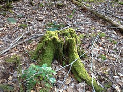
Last time, I didn't understand what was going on back there, but upon further examination, it was clearly just a very messy logging operation.
Old stumps in the area helped confirmed this.
As did the network of modern-looking logging roads leading away from that spot.
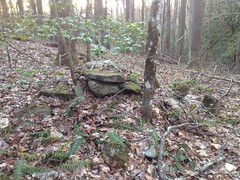
The rest of the day's wanderings took me way up along Alec Branch proper, all the way to Bryson Gap.
On the way, I passed a tree stand...
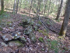
...and another set of enigmatic rock piles.
There were like 8 piles of rock, many with trees growing out of them. I always wonder whether piles like that are Indian graves, or just where a farmer piled up rocks to clear the land. I've run into so many of them over the years. Maybe some of both, or of some third thing.
There's a bit of a gorge about halfway up to Bryson Gap, and it looks like it might never have been cut down in there.
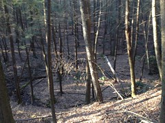
Too bad the photo is out of focus.
At one point, I found what looked like a little marble deposit sticking out on one side of the old road.
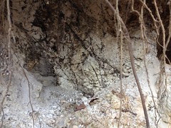
Kind-of neat, I guess.
I eventually ended up on a trail I knew.
I'd discovered it on the bike, probably 12 or more years ago.
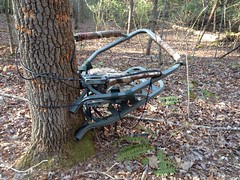
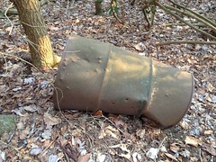
Walking up it, I noticed lots of little side spurs.
One had an old drum abandoned off of it.
At Bryson Gap there was a trio of BMT hikers, camp set up, having some dinner. I explained where I'd come from when they asked, and they seemed suspicious, like they didn't believe me. Sorry guys, didn't mean to make you uncomfortable. I promise, I was telling the truth. It was getting pretty late at that point too. The sun would be down in an hour or less, and I had a ways to go, so I didn't hang around.
Instead, I took another old road down along the south side of Alec Branch. I'd partially explored it some 12 years ago as well, but never gotten back up to see where it really goes.
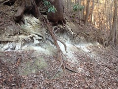
At one little corner, there appeared to be a chimney ruin.
Though it doesn't look like much in the photo.
The trail just teed back into the main one I'd been on earlier, which I took back down to Angel Drive. I reasoned that since most of Angel Drive was on public land, and that there were distinct fences to either side of it, and a distinct lack of keep-out's, that even if the westernmost 100 yards were private, that it was unlikely anyone would mind if I walked out on it, so I did. Hope that's ok. I won't make a habit of it.
Sadly, though I'd followed every old road I could find back there, when I got home and crunched the data, it looked like I still hadn't quite hit the exact route shown on the old maps.
Come on!
Ughhhh.
I'd be back.


No comments:
Post a Comment