Pine Log!
I had such a great time there the last time, I couldn't wait to go back. And, the opportunity afforded itself yesterday at about 3PM. I'd put in a solid day's work, but I had a lot more to do, and I needed a break. It doesn't get dark 'till almost 8 these days, so I figured I had plenty of time to do some exploring. I grabbed my commuter lights off of my road bike though, just in case.
It took a while to get up to Pine Log. It was almost 4:45 when I made it to the lot. Traffic on 75 north between 285 and 575 is apparently terrible, even as early as 3PM, on a Wednesday.
No problem though, I still had plenty of time.
First stop... The Lewis Iron Blast Furnace.
I'd ridden right by it the last time and not seen it. I thought I knew where to look this time though, and voila, when I looked there, I found it.
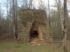
I'd seen photos, but I really had no sense of scale, so here's my bike next to it.
This thing is huge.
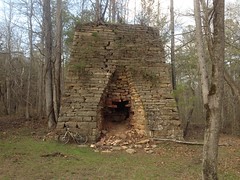
Really, freakin', huge.
Ore was dumped in the top of the furnace. Air was blasted in through the "tuyere" arch on the right side by a set of bellows, powered by a waterwheel. Molten iron flowed out of the casting arch on the front side. Slag also flowed out of the casting arch, presumably to the right of the molten iron.
There were extensive piles of slag along the creek to the southeast of the furnace, now overgrown with brush and trees. There were also hills behind the furnace which may have been stockpiles of ore. I need to go back and study them a bit more.
To the right of the furnace there would have been all kinds of machinery, but mainly a bellows, driven by a waterwheel.
The waterwheel would have been driven by water taken off of the creek by a raceway. A vague hint of the old raceway is still visible in the creek behind the furnace.
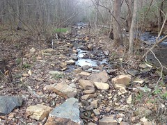
It's not clear whether the wheel was over, under or breastshot, but in any case, the water would have poured over or under the wheel, dumped into this rock-armored output basin...
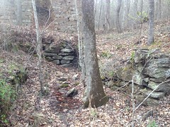
...and been directed back into the creek.
There were a few big chunks of either slag or ore lying on the ground, to the left of the furnace.
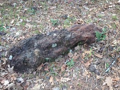
Given their size, and location, I'd guess ore. Also, there's a bunch of rock that looks similar to that in the Sugar Hill Mine area to the north. But honestly, I don't know enough to tell one from the other.
About 50 yards away from the furnace, to the southwest, there was what I guess is a basement wall.
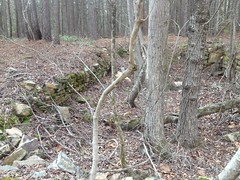
I actually saw it as I rode in, and recognized it from B & E Roberts' photos, but I couldn't remember what he thought it was. Struck me as a foundation/basement for a building. No idea though. Could have been a coal bunker or something too. Did they use coal back then?
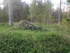
To the south of the furnace, right along the main road, there are more ruins, completely overgrown with some creeping vine. They bear a striking resemblance to the main furnace ruins though. There's this random pile of rock, which used to be something.
And this wall is part of another box, directed at the creek, in similar proximity to that rock pile as the waterwheel output above is to the furnace:
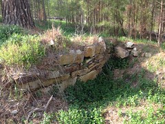
There's another old rock wall to the west too, which could conceivably have been a footing for whatever structure gave access to the top of the furnace.
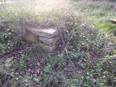
It made me wonder if an older furnace had stood there at some point. Perhaps it was canibalized to build the Lewis Furnace. No telling though. It could have been anything, really.
So, that was a lot of fun, and though it required a lot of words to describe it, I only spent about 10 or 15 minutes checking it out. I had lots more on my agenda.
Namely, there was another furnace nearby, along Guthrie Creek, and the ruins of a sawmill somewhere in the area as well. I needed to see them too.
Fat chance of that though. I followed the road leading west from the furnace until it hit private property. There were a couple of little spurs to the left and right, but they didn't really go anywhere, except to more of the same private property. Man, it would be really disappointing if the other furnace and the mill weren't in the WMA. But I was sure they were. Hmm... Well, turns out I wasn't on the road I thought I was on. The trail that leads to the mill and to the other furnace was south of me. I was on a semi-parallel road to the north.
I've got a pretty well trained eye for side trails though, and I didn't see anything where the trail to the mill was supposed to be. I guess I'll have to try again, now that I know the area better.
There was plenty more to see though, so I headed back to the lot and hung a right on Stamp Creek Road, toward the town of White.
Miller's Chapel was nearby. I'd seen it last weekend when I was riding back in the dark. But, being dark, it wasn't a good opportunity for photos. There was plenty of light yesterday though.
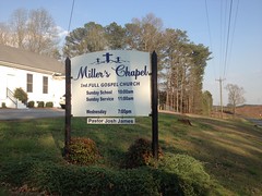
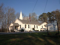
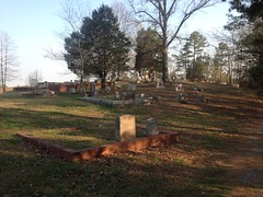
There are a couple of rollers, but it's mostly downhill to White. Downhill, from Wolfpen Gap, actually. In fact, according to old maps, at least, the entire area between the gap and White was once called Wolfpen. North Georgians really don't seem too creative when it comes to naming things. The various Peachtree Roads in Atlanta come to mind, of course, but I can think, offhand, of at least 3 other Wolfpen Gaps, and a Wolfpen Ridge, in North Georgia. And I'll bet there are more that I can't think of right now, and probably at least one more that I don't know of at all.
Ha!
Anyway, I came tearing down the road into White, hung a right onto 411, and hung another immediate right onto Oak Street. There was no street sign indicating that it was Oak Street. On the other side of the highway, it's Richards Street or something. But pretty soon I spotted some piece of power or phone equipment with "Oak Street" written on it, and before long I hit the WMA boundary.
It's gravel, immediately when you enter the WMA, but for a while it looks like it was once blacktop. I didn't notice the old-blacktop/true-gravel border though.
One thing I did notice was a fence made of old railroad ties along the north side of the road.
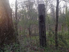
Oak Street used to be part of the Iron Belt Railroad which ferried iron (ore, I guess) from mines in the nearby mountains to Chattsworth in the late 1800's and early 1900's. I imagine those ties were once part of that railroad. Though, I thought about it later... Wouldn't it be funny if they weren't. Like the guy just bought them from some local landscape company. Oh, the irony that would be.
It made me smile thinking about it.
There was allegedly a "Dove Field Road" somewhere up Oak Street a bit, and since it was turkey season, and the roads were all open to vehicular traffic, some helpful soul had put up a "Dove Field" sign at the intersection with the road. Woohoo! No guesswork.
As I was riding in, a hunter was hiking out, and I spoke to him for a few seconds, just to confirm that he was finishing up rather than just getting started. I didn't want to be riding on top of him. He was finishing up though, and hadn't seen anyone else on the road all day.
Further down the road, you know what I saw? Turkey prints. Lots, and lots of turkey prints. Oh, man. They were everywhere, and they were fresh. It reminded me of that time in Florida where I took a photo of a bear on one of the roads in the Ocala, and then right over the top of the hill a bunch of guys were heading out bear hunting.
Dove Field Road ended at a clearcut.
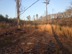
I'd hoped it would lead all the way out to Stamp Creek Road, but it didn't. I could see the road though, and hear traffic on it. I figured it was close enough to shoulder the bike and whack through to.
Ha!
Thorns.
Everything had thorns.
My knees were bleeding for the next hour.
It was a little tricky crossing Wolfpen Branch, as it was trenched pretty deep, and there were no obvious fords.
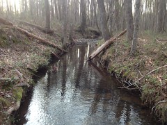
But, I was back on the pavement directly, and back on Oak Street again a few minutes later.
As Oak Street is an old railbed, it has a very consistent grade, thanks to the numerous deep cuts and fills along its length.
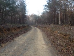
There were a bunch of recent clear-cuts uphill from the trail and some of them exposed the borrow pits for the fills. In some spots though, it looked like they'd shaved off a lot more of the mountain than would have been necessary for the next fill, and I wondered if I was actually looking at an old mine cut.
The land behind one of the fills had become a little pond.
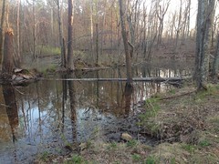
I wonder if it dries up in the summer.
Past the pond this weird hole in the ground caught my eye.
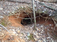
It's hard to tell in the photo, but it's about 3 or 4 feet tall. I thought it might be some animal's den, but I didn't know of an animal that would be found in that area that's the right size to have a den like that. On closer insepection, it looked a bit like the mine shafts on Sawnee Mountain. Further uphill it looked like bits of it had collapsed too. I don't know enough about iron mining to say whether it might be involved in that or not. Whatever it is, it's interesting.
"End of the road, boys. It's had its twists and turns, now it deposits you here."
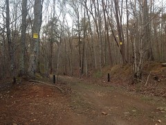
Dangit, I'd hoped I could keep going past the WMA boundary and end up somewhere off of 411 or East Valley Road.
On further examination, I wasn't sure that I couldn't. I mean, those "Posted" signs look pretty definitive, but the gate had no crossbar. The road beyond was just as worn as the road behind. I.e. it didn't look like a long-standing border. And most curiously, there were posted signs on trees down the road, facing the road, that you would see if you were on the road, past the gate. I wondered if the signs were meant to indicate that the land to either side of the road was private, but the road itself was ok to travel on, as long as you stayed on the road. There certainly are plenty of cases of that. That's why I like "Private Drive" signs. No ambiguity. If I ever have a private drive, I'll put up one of those signs.
I didn't like it, but I erred on the side of caution and turned back.
I did check out a few side trails on the way back. There's a maze of ATV trails west of the road, and one that looks more official and less ATV. Almost all of the trails led directly to someone's house. I wondered if they'd been used to access the WMA before the neighborhood was built, and then as each house popped up, a new trail popped up from the next lot over. It seemed semi-plausible, but the trails all looked equally well used. Like maybe every family in the neighborhood had an ATV and each of them made their own trail. No telling. It's also possible that the trails don't actually go all the way to each person's house. There may be a rail that ties them all together, just inside the WMA or something. Each time I could see the trail going straight toward a house, I turned around. People were out cutting their grass and hanging out in their backyards, jabbering. I didn't want to bother them, walking up on their backyard. Who knows though, maybe that happens a lot and they're used to it.
Anyway, I gave up on the maze quickly and headed back down Oak Street in a direct abort. It must have been slightly uphill on the way in because I was spun out quickly heading out. It was getting late and pretty, so I tried to take a photo of the ride out, but it was too dark, and shaky.
When I got to town I flicked on my commuter lights and rode back to the trailhead in the dark. I felt a lot stronger than I had last weekend, maybe because I was more well recovered from the flu. Or maybe just because I'd done a lot less climbing than the last time. Either way, I felt pretty good and pushed pretty hard back to the car.
On the way home I stopped at a gas station on Hwy 20 near I-75 and saw 2 interesting things. The first was a guy purchasing 2, and only 2 items: beer, and detox pills. The second was the impressive selection of Confederate Flag themed stickers and other memorabilia, juxtaposed with the older Indian couple who appeared to own and operate the store. I imagined them looking through catalogs, deciding to stock those items. I wondered what their thought process must have been. It made me smile and thinking about it kept me entertained for longer than it probably should have.
Whoo! Another good day at Pine Log. Still plenty more to do and see there too, so I will, no-doubt, be back again soon.


Well I will be the first to comment if it ever gets read of course. I live only miles from Pine Log WMA and I have seen each and every place you show in this adventure blog. I have to say Pine Log is one beautiful piece of land. I am glad you enjoyed it. There is a ton of history to be found out in the woods here. More than you have even had a chance to see but you have get back in there and explore a little bit.
ReplyDelete