I don't remember how long ago I first rode Five Points. Fifteen years ago, I think. I rode there once by myself, I think, then me and Travis rode there. Or maybe it was just me and Travis? It was that long ago. I tried to go ride there with my Dad once too, but despite the 10% chance of rain, it was storming when we arrived. We ended up getting some really good Mexican food on the way home though. Like memorably good. So, it wasn't a total loss. But it does take 2 hours and change to get up there from the atlanta area, so we didn't hurry back.
Years later (again, I don't remember how long ago), I discovered that there were way more trails up there, and that 2 hour and change drive up didn't seem so not-worth-it. But, apparently it was, for some time, because I never did get back up there. "Lula Land Trust" made it on to my list of places to explore though, and eventually, just last month, in fact, percolated to the top.
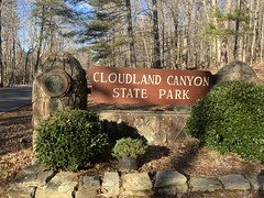
The drive up is seemingly simple - take 75 north to 136, then take that west, all the way to the top of Lookout Mountain, then take 157 north and park at the Ascalon Lot, Five Points Lot, or Nickajack Lot. There are even signs for Cloudland Canyon along 136, telling you which way go to. SEEMINLGY simple! But there is an unmarked turn near LaFayette. You have to turn right to stay on 136, but there is no sign that says this. If you look down the road, there is a sign down there saying that you are on 136, but you'd have to think to look that way to notice it, and it's just some random road. You'd be unlikely to look down it. There's also no Cloudland Canyon sign at that intersection either. Even worse, on the way back there's a similar situation. So, if you use GPS to get you everywhere, you'll have no trouble, but if you're like me, and you only use it to get places that you don't "know" how to get to, you'll have some trouble.
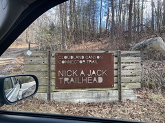
So, on my way up there, I missed the turn, figured out my mistake, corrected it, and eventually made it to the Nickajack Road Trailhead.
There were few of us there, presumably because it was like 28 degrees or something outside.
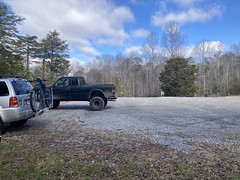
The lot was really well furnished.
There was a changing maze:

A composting privy:
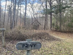

One scoop per poop, please:

Funny thing... Later on, while riding, my mind began to wander, as ones mind tends to do, and I started thinking about that "one scoop per poop" thing. Did they mean one scoop per individual poop? Nah, can't be. Must be one per visit to the privy. What if you sat there a really long time? At what point would one visit be equivalent to multiple visits? Oooh, what if you took an absolutely enormous poop? Would that warrant 2 scoops? Would it be the volume or surface area that would matter? Yeah. That's my brain. Go ahead and try to turn that off. It's like trying to not think of a polar bear. You're automatically thinking of one.
Lord.
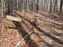
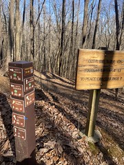
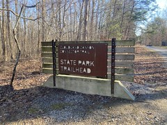
It couldn't have been more obvious where to go to get on the trail...
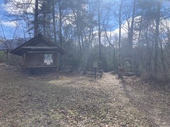
...or where you were going.
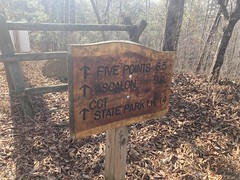
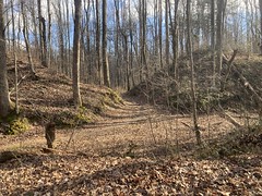
The trail I was on was called the "CCT" or Cloudland Canyon Connector Trail. This also baked my noodle. Cloudland Canyon Connector Trail should be CCCT. Were they compressing "Cloudland Canyon" into one C or dropping "Connector"? Alternatively, the trail was named Long Branch, as it roughly followed the Long Branch of Rock Creek, which I would later learn was a very significant part of the local watershed.
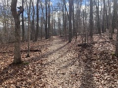
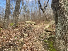
The trail itself was kinda bumpy and debris-covered. It wasn't the sculpted, bench cut, purpose-built singletrack that I usually encounter these days. Though, it was also fairly flat. Not much bench to be cut up there, really.
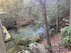
The first creek crossing was impressive. The bridge was really well made.
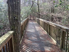
And, to the right, there was a very well constructed equestrian crossing.
You can't tell in the photos, but it was still uncomfortalbly cold.

It's funny, you start out cold, get colder, then eventually get warmer, then eventually can't imagine not being comfortable, until evening starts rolling around. Every year, I forget this, then relearn it.
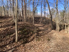
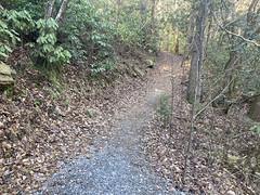
I passed a family out hiking after a mile or so, then a group of riders heading the other direction a few miles later. By that point, the trail had become more benchy and purpose-built-looking, but it was also very chunky, which was fun.
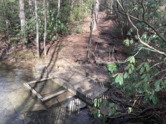
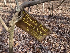
I remember crossing several gravel roads, and after a while, several private trails teed into the main trail.
And, then, abruptly, I crossed a paved road, and I was at the north end of 5 Points.
I recognized it immediately from all of the tailings.
The whole 5 Points area was once, at one point, a giant coal mine.
By then, I was comfortably warm and riding pretty well. Ripping that singeletrack.

There are a bunch of trails at 5 Points...
...but I stuck to the CCT. I had planned to take it as far south as it went, then hit some other trais on the way back.
At 5 Points proper, there was leftover snow on the trees and even on the ground.

It was probably just above freezing at that point, which was about as warm as it had been up there for a while. That snow was from like a week ago.
I had actually ridden that part of the CCT before, way back, and it was vaguely familiar. I especially remembered the twisty run into the Ascalon Lot, and recognized where I was when I encountered that.
It was all new territory to the south though. None of it had even been built when I was up there last. Really though, it was more of the same - benchy singletrack, a little rough and rocky, here and there, not too much elevation.
At Bear Creek, there was a bridge.
And there were lego rocks to either side.

I felt like I'd been riding for a while when I finally got to Cloudland Canyon park proper.
I looked and looked, but it didn't appear that the CCT continued. My original plan had been to take the CCT to that point, then take other trails back, but I'd underestimated the distance. I'd ridden about 18 miles so far, and given that the other trails added distance, and were more difficult trails, it would be more than 20 in the other direction, and would only take longer. I don't specifically remember why I cared, but I wanted to make it back home in time for something. Maybe to watch a playoff game? IDK. I remember reasoning that if I took trails back, I wouldn't make it, and that I'd better take roads back.
This decision turned out to be a mixed blessing. On the one hand, it did take a lot less time to get back. On the other hand, the open road was a lot colder than being in the woods.
A lot.
I ended up putting my windbreaker and leg warmers back on after about a mile, and it was adequate, but I never fully warmed back up.
On the upside, it was a long climb out of the park.
And then there were several long climbs on the way back to the car.
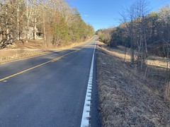
So, that helped keep me warm.
I also passed this interesting building on the way back. I'd seen it on the drive in.

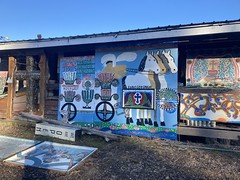
I mean, it looked like one big art project. Did someone just live there, or was it a shop of some kind? I couldn't immediately tell looking at it. While I was taking pictures, some guy came out though, and dumped a big pile of what looked like cut-off fence boards on the ground outside. We said hi to each other quickly, then he just went right back inside.
???
I moved on.
At some point, while riding up the Scenic Hwy, rock city was perfectly framed ahead of me. You know how they say "See Rock City!" I could See Rock City!

And that was it. Fairly uneventful, but everything I rode was great to ride, and there was more to explore. Success in my book.
And, the icing on the cake... Mountain Dew Livewire is my favorite drink, but they don't sell it around here. I usually run into it in Mississippi or Louisiana. It can also be found in the far northwest corner of Georgia, though, apparently!

Score!


No comments:
Post a Comment