Sunday, November 8, 2015

Noontootla-Winding Stair

It's been raining for over a week now. All day. Every single day. Actually, I think there was one day that it didn't rain the whole day, but I barely remember that day. I've been dying to get back on the mountain bike, and yesterday seemed as good an opportunity as I was going to get. The forecast called for rain, but it looked like it would be more of a sprinkle/drizzle than proper rain.

Good enough.

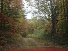
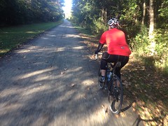
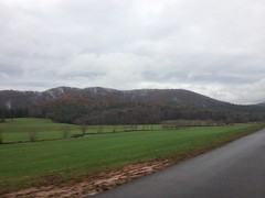
I parked at the Jake lot.

Jake Lot

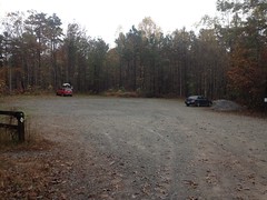
It seemed I was all but alone in my interest in the woods that day. There was one other car in the lot, from Missouri, no less. I imagined them having come down, hoping to get in some great riding, or hiking, or hunting, only to end up dealing with steady rain all week. Sorry guys. Welcome to Georgia.

It was actively raining when I left the lot, and I don't think it ever stopped altogether at any point. It did let up a good but at times, but when I left the lot, it had decidedly not let up. I even debated shoving off into it, but eventually decided that... a) I'd driven all the way up there. And... b) Getting wet is uncomfortable, but it's just the transition that's no fun, once you're all-the-way wet it's no big deal.

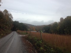
I headed up to the road, hung a right, and then hung another right on FS28-1.

FS28-1

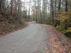
It was a slog. No other words effectively describe it, only slog.

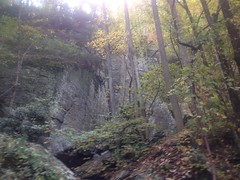
The ground was soft and wet. Every foot took two feet of effort. It reminded me of riding through melting snow.

But, just like rain, you get acclimated, and after a few minutes it doesn't seem wrong any more.

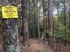
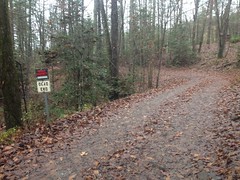
There were a bunch of slight differences since the last time I was up there. The Rangers had posted new yellow signs marking their routes. One set of signs counted up from 8 to 12, ending at Camp Merrill. I'm not sure what route it intended to mark though, as I'd only seen that chunk of it.

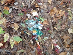
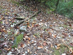
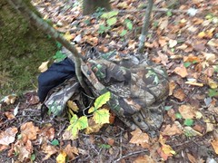
On some random this-used-to-be-a-road berm, off to the right, someone had planted a halloween ornament.

Halloween Ornament

It wasn't especially conspicuous though, and I don't remember it being near anything in particular, just randomly out there along the road.

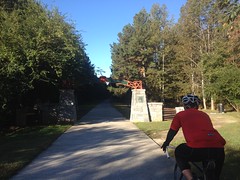
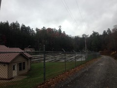
At Camp Merrill, the sewage treatment pond had been filled in completely, and replaced by a gigantic blue tank. There were also yellow signs marking Cooper Gap and Black Farms routes.

I ended up following the Cooper Gap route and it looked like the Forest Service had been out there recently, re-marking boundaries. There were new bearing trees, benchmarks, and red paint all along the left hand side of the road, until a half-mile or so up, where they crossed the road.

It looked like somebody had done a bit more development on Sassafras Mountain too. The last time I was up there, a new road had been cut and somebody had parked a tool trailer at the end of it. That trailer was still there. The road had been extended though, or another road had been cut leading almost all the way to the first turn too. There are several little roads up there now, but no new constructions yet. I wonder what they have planned.

Climbing Cooper Gap was less of a slog than 28-1 had been. The ground wasn't as soft, and it was a lot rockier. It wasn't easy though. I'd been off the mountain bike for a long time, and been out of the mountains for even longer.

At Cooper Gap, the Rangers had left one of their water tanks.

Water Tank at Cooper Gap

I'd seen that before, when they're out there, running around in the woods on some exercise. They were nowhere to be seen or heard from, but I hoped I run into them later.

There was one guy camping under a tarp on the east side of the gap, to the right of the water tank. He looked really cozy in there with a dry bag and the warm glow of a lamp. Mmmm... warm and dry.

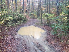
Up high, on the north side of the ridge, it was a little bit colder, and a lot muddier.

A Little Muddy on FS42

On every little downhill, I got sprayed relentlessly. It felt like water, but it was that fine, muddy mist that builds up, little by little, caking everything, especially one's legs, but most noticeably, one's glasses.

Ha! Adventure!

At Hightower Gap, I had the option of hanging a right and going for the long loop or staying straight and cutting it really short. I'd had such a difficult time already that I'd been mulling the options over in my mind. At the gap, I had to kind-of trick myself to keep going... "If I turn right, without stopping, then I'm committed to the long loop..." Something like that. So, I did, and tried not to think about it until I'd gone downhill long enough that the idea of turning around wasn't appealing.

I remember the first time John and I rode up there, that road was wet and soft, and we had to pedal constantly, while descending, to keep speed. It was much like that again yesterday.

The rain let up for a while though. You could tell it was raining if you were moving, but if you stood still, you'd have to wait a few seconds to be sure.

Rock Creek Lake smelled funny as I approached it. It smelled like wood. Like it smells near a wood chipper. I couldn't immediately determine why though. The only thing I could come up with was that the headwaters were flooded, and somehow that smells like wood. It was weird.

I passed the fish hatchery.

Fish Hatchery

Didn't look like much was going on there. Frank Gross was deserted. Almost every campsite was deserted along the road. There were a few people out fishing though, and a few more out driving around. Seemed I wasn't the only one.

Rather than even attempt FS308 up at the north end, I kept going out to Hwy 60.

There's a road there called Totem Pole Road. It also has some FS designation, but I forget it now. Maybe 656?

At any rate, I'd driven down it eons ago and there was, at that time, an intact logging truck from a bygone era, abandoned on the side of the road, complete with the load of logs it was carrying at the time. It looked similar in vintage to the truck up on Bull Mountain, but in infinitely better condition. For some reason, I hadn't taken a picture when I first saw it, and it occurred to me that in 10 years I'd hadn't been near enough to that location to do so. As fate would have it though, I was right there, the road isn't too long, and it seemed like the perfect opportunity.

The road was short and shallow, as I'd remembered it, but as I approached the houses at the end, almost within sight of the truck...

Totem Pole Road

Private property. No trespassing.

Dangit! I mean, I was within maybe 100 yards of the old truck, but I couldn't see it, it was around that corner somewhere, assuming it's still there. That sign hadn't been there ten years ago, and I guess the residents got tired of people (like me) driving around back there and turning around in their driveways.

Dangit again!

Hey, extra miles though, right?

Got to look on the bright side.

Back on the road, I crossed the Toccoa...

Toccoa River

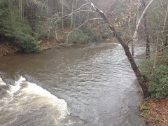
...which also smelled like wood, as Rock Creek Lake had.

Weird.

On Hwy 60 I passed the "community" of Margret - 2 people, 1 dog. I also had to climb over Tooni Gap too, which is the one down side to that route option. It's not terrible, but it's there, and I'd forgotten about it. There were a half dozen cars parked at the gap. No doubt Benton MacKaye hikers. I hoped the rain hadn't ruined their day.

Come to think of it, the last time I hiked the Benton MacKaye on Tooni it was raining too. And, I remember telling the folks at work about it later and one of them was super incredulous. Like she didn't believe that I'd done it, much less enjoyed it. Everything about it sounded either terrible or impossible to her. I had photos to prove that I'd done it though, and GPS data, and I did have a good time, as crazy as that sounds.

On Doublehead Gap Road the rain set in again.

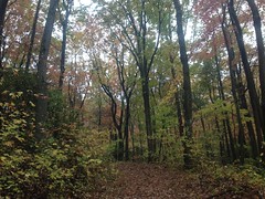
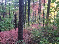
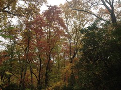
The trees aren't sure whether it means to be summer, fall, or winter though. Leaves were green, yellow, red, brown and gone. All at the same time.

Doublehead Gap Road

Further on, the fog on top of the mountains looked ominous. I didn't have to climb those exact mountains, but the clouds looked big enough to cover the ones I did have to climb.

I crossed the Toccoa again, and passed my favoritely-named road "Nellie's Big Fish Drive".

Up the road a bit, there were two guys out collecting a big chunk of quartz or marble or something.

Collecting Rock

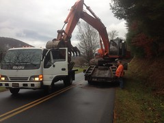
The guy in the excavator had picked it up off of the side of the road and was busy positioning on the flatbed truck when I rode up. The rock was so huge and heavy that it didn't slide easily, and nudging it to the side a made the whole truck twist like it was going to slide on the pavement before the rock finally gave, and then it was in danger of moving too far. The guy running the excavator really seemed to know what he was doing with that though. As soon as the rock started to move, he'd back off and then nudge it again. It seemed like an impossibly delicate operation to pull off with such huge and presumably imprecise equipment, but they really had it down.

I think of FS58 as "the climb" on the Noontootla loop, but Doublehead Gap Road is a net climb too. It ascends along Laurel Creek to some little gap near Peter Knob and then after a short drop, ascends again to Doublehead Gap. I don't usually notice it, but I did yesterday.

I passed a small group of deer, 5 or 6, taking advantage of someone's not-so-well-mown field. And somewhere in there, there was a line of decorative cedar trees and about 20 turkeys on the other side. I stopped to try to take a photo, but they kept running away and I didn't get anything clear. With the trees, they didn't seem too scared of me, so they never flew away but they just kept running back and forth like mad and eventually I had to give up.

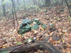
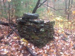
A lot of the properties along that road have changed over the years too. Several old log cabin-looking structures are completely gone now. Others have collapsed. One or two newer properties appear to have been abandoned. The one with the lake and the spillways with the cairns is up for sale. I want to say cheap too, like $240,000. Though my foggy mind may have missed a decimal place or two in that figure.

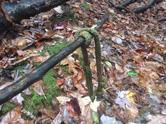
At the foot of FS58, there was a memorial stone that I'm not sure whether I'd seen before or not.

Memorial

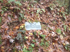
What, exactly are they memorializing? Was there a school there at some point?

For a while, the climb up along Noontootla seemed less difficult than the climb along Doublehead Gap Road.

Somebody had chucked a deer off to one side near the bottom.
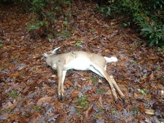
Deer

Ewww.

It started getting foggy before long, and then it started getting noticeably darker.

Ohhhh... That's right. I'd forgotten entirely about the time change, once again.

My original plan had been to get back to the car around 5:30, get home by 7 and get to my brother's house in time to catch the LSU-Alabama game at 8. I'd been keeping an eye on the time and I wasn't running terribly far behind schedule, maybe half an hour, but I'd completely forgotten that it would be full-on dark at 6, dark in the woods by 5:30, and probably even functionally dark earlier than that, given the weather.

Dangit, a third time!

I did not have the strength to push much harder. I had plenty of cardio but very little in the legs. As I have said: no amount of not climbing in the mountains gets you in shape for climbing in the mountains. That adage reasserted itself as, after what seemed a very long time, I passed three forks, the halfway point of the climb.

It wasn't dark yet though, just getting dark, and really foggy. Ahead of me in the fog, I spotted a huge buck. I mean, huge. Not just Georgia-huge, but Mississippi-huge, or Florida-huge. It looked toward me, but didn't seem to have as good an idea of what I was as I did of it, so it just stood there gawking at me. I stopped and very carefully pulled out my camera, but it took off as soon as I held it up to my face.

Come on!

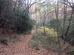
I tried to take a photo of the road to demonstrate the fogginess, but this was all I got.

FS58

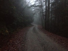
The heck? Why is fog so hard to capture? Kathryn and I discussed this later. Do iPhones have a polarizing lens or something? Would that decrease the fogginess in a photo? If so, why don't I have such lenses on my glassses? Seems like that would be really handy.

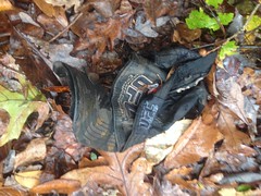
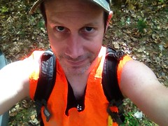
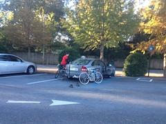
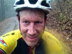
All day I'd been pelted and sprayed and it seemed I might be a little dirtier than earlier, so I took a photo for comparison.

A Little Muddy on FS58

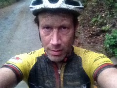
Yes, a little dirtier to be sure.

At Winding Stair Gap I saw the water tank again.

Water Tank at Winding Stair Gap

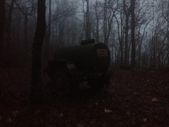
They'd either moved it, or they have more than one of them.

I hadn't seen or heard the Rangers all day, but that's not that unusual. It's more unusual to have seen them, even when they're nearby.

The descent down Winding Stair was Adventure at its finest.

I needed the glasses to keep the water out of my eyes, but they were certain to become opaque within seconds. I ended up putting them on, pulling them way down my nose, angling them down a bit, and looking over the top of them. This worked really well, as they got hammered steadily, but kept about 90% of the water out of my eyes. The limited visibility was still a challenge though. My instinct was to try to look through the lenses and it was hard to override. After the very first little drop off of the ridge, it was a lot darker too, and just generally difficult to see.

I made it down though, without incident.

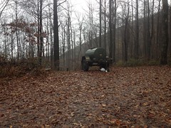
About halfway down I saw two little glow-sticks hanging on a tree, and a humvee parked just down the road. The driver was running up to collect them and didn't seem to have time to return my salutations. Or, maybe he just didn't see me until I was right on him.

About 3/4ths of the way down I heard barrage after barrage of automatic weapons fire off to the west, in the general direction of Jones Creek and the PR Gap Trail. So that's where they are...

At FS877 it was super, super dark. I couldn't make out any detail in the woods and the road was just a whiteish field in front of me with only subtle variations to distinguish ruts, potholes, and mud. It was still raining too, harder than it had all day even.

As I was heading out, several cars passed me, all heading into the woods. One was a truck, with a hitch rack, no less, but no bikes on it. The others were all nice cars. One was a BMW. They didn't seem like ideal vehicles for rough, muddy roads, in the dark, and in the rain. I wonder what they thought of me.

At the Jake lot, someone was pulling out right as I turned in. Could have been the Missiorians. The lights were so bright and the rain made such glare that I couldn't make out what they were driving.

I was beat. It was 6:30. I spent 7 minutes changing and putting up my bike. The drive back took an hour and 45 minutes. I met my family at Siracusa's, the local pizza place, where we watched the first half of the game. I showed up even dirtier than in that picture above. Kathryn, Sophie, and Dave, the owner, were shocked by just how dirty I was. It was bad. I had to wash up in the bathroom, which took like 10 minutes.

At halftime we drove over to my brother's place to watch the rest of the game. His mother and father in-law were both in town, and Carrie had made some really good gumbo. I mean it was really, really good. It might be the best gumbo I've ever had. John had mentioned it earlier, I saved some room for it, and man was I glad that I had. It almost made up for the devastating punishment Alabama crushed us with.

Not quite, but almost.

Monday, November 2, 2015

White Oak Mountain

White Oak Mountain again...

I wanted to ride the Noontootla-Winding Stair loop, or the Continental Divide Loop, or some other long gravel grinder, but the weather forecast called for a 100% chance of rain, all day, for the next two days, and I couldn't bring myself to ride in it.

However, as it appeared to be a 100% chance of drizzle, as opposed to proper rain, I could easily bring myself to hike in it.

I felt like I'd just scratched the surface of the White Oak Mountain system last week, so I made my way back up that way again. This time though, from the other side.

The Kellum Valley side.

Kellum Valley

Though nestled into the National Forest, at first glance, the Kellum Valley seems almost devoid of public access to it. The Logan Turnpike trail leads from the end of Kellum Valley Road up to Tesnatee Gap, but you have to correctly interpret some ambiguous and imposing-looking private property signs to get to it. There's also FS57 which leads off to the east, but it just looks like somebody's driveway. Unless you know it's there, you could easily miss it.

It is there though, I knew about it, and that's where I went.

I did spend a while figuring out where to park though. FS57 itself had a deep mud hole almost immediately, people's properties tightly lined the main road, and north of the NF boundary, the road leading to Logan Turnpike was a mess. I'd have braved it in the Durango or the Subaru, but I had less confidence in the Saturn VUE. I ended up parking along an unposted stretch of road with infrequently-used-looking trailers to either side, and hoping for the best.

It was a bit of a jaunt to FS57, and then a bit more of a jaunt to the end of it. On the way out, I checked out several little side trails that just led up or down to flat-ish spots. It seemed like there might have been properties back up in there at some point. I could imagine that along that road, it might once have looked much like it looked along the roads of the valley below - houses notched into the hill with fields and pastures beneath them.

One of the side-trails looked like a popular spot to gather firewood, and somebody appeared to have lost their hat during one such gathering.

Lost UFC Hat

I hope it wasn't the same guy that lost that jacket that I found last week. If it was... poor guy.

Side trails and mud holes. That's FS57 for you.

FS57 Mud Hole

Each mud hole bigger than the last.

And down at the end of the road, the Forest Service made sure that you knew that it was the end.

You Shall Not Pass

There was a big set of berms too, and the culvert had been ripped out of the stream that crossed the road there.

You shall not pass!

Well, except on foot.

It's funny, when I first went exploring back there, way, way back, there were no berms, no downed trees, and the culvert was intact. There was no indication that the road was supposed to end there, and I drove all the way to the next ripped-out culvert, figuring that was the end. It wasn't until I compared my GPS data with the USFS's official GIS data that I realized where the real end was supposed to be. There's no question now though.

It's still trying hard to be fall up there, and the trees were changing colors. The oaks are still holding out, but everything else is turning red and yellow.

Fall on FS57

I explored several more side trails, one of which turned out to go and go.

Actually, it appeared to be 3 separate trails, all old roadbeds, with little connectors between them. Together they conspired to sidehill along Pinnacle and White Oak Mountains to a bit of a flat spot with a bunch of rock piles all over the place.

Rock Piles on White Oak Mountain

Natural occurrence? Indian graves? Did people just move the rocks to clear the path when building the road? I want to know!

From there a well-worn trail led on, for like a mile. It was clearly not an old road, not an ATV trail, and not just a pig trail. This was either foot, horse, or both.

White Oak Mountain Trail

It's not unusual to see short little trails leading off the end of an old road. Hunters seem to end up making little short ones off the end before they start off cross-country. I've seen a few get longer and longer over the years, and they're more distinct mid-deer season. But, it's unusual to see one go for more than a few hundred yards. This one was over a mile. It was clearly there on purpose, but it didn't look built, just worn in over the years.

It eventually teed into a familar trail and I took it to White Oak Gap.

I was getting pretty hungry at that point, so I grabbed a bite to eat. There were no logs to be found, and few rocks, so I settled down on a 3-inch tall block of quartz, barely wide enough to call a seat, and ate the remainder of some Skittles from the previous week, and half a beef stick. It was in the low 60's and the rain was light, but fairly steady at that point. I remember sitting there, thinking: "I'd bet that on paper this wouldn't sound like a good time..." but it was. My clothes and shoes aren't uncomfortable when they get wet, and I'd been moving all day so I was done eating before I started to feel cool.

Yep, good times.

I explored the general White Oak Gap area, and found this disgusting old rope tied around a limb there.

Disgusting Old Rope

There was an actual gnarly old White Oak there at the gap, from whence it gets it's name, I presume, but the old oak has seen better days, and a significant amount of it had come crashing down across a little spur to the southwest, a while ago. The rope was tied to one of those limbs, way up in the tangle. This begged the question: "Was it tied there before, or after the tree fell all apart." It looked really old, and given its position in the tangle, it seemed like before. If before though, then what was its purpose, way up in the tree?

These are the questions that weird old artifacts raise. Somebody knows the answers, but it's likely I never will.

Speaking of old artifacts, I ran into this old chimney ruin in the Turner Creek draw, below Big Gap.

Homestead Ruins Near Turner Creek Below Big Gap

Somebody lived up there, some time ago.

I spent the rest of the day following dotted lines on my map - trails that I'd seen before and supposed went somewhere. They did, mostly, but none were as interesting as the long one I'd found earlier, and I didn't find any more old artifacts or ruins.

The time change is a heck of a thing too. It was officially dark well before I emerged from the woods. It was pitch black as I walked along the main road back to the truck. Two cars passed me on that road. I gave them the nod-and-wave. Hopefully the fact that I was jogging, wearing dorky clothes, a camelback, and an orange vest made it look like I knew what I was doing, and that what I was doing wasn't something untoward like robbing their houses or something. It seemed to, as they kept moving. No questions, no threats.

Fine by me.

Another heck-of-a-thing that the time change does is get me out of the woods fairly early. All summer I'd been getting home between 11 and midnight. I managed to drive a good bit further east to Helen for some enchiladas and still get home before 9:30.

Heck of a thing.

I'd been thinking about enchiladas for a couple of weeks, ever since me and Clark and Suzy went wandering around Raven Cliffs. Sadly, they didn't live up to my expectations, though I think that has more to do with my inflated expectations than the quality of the actual enchiladas. I do know where to find good enchiladas though: La Fonda or Across The Street, both in Atlanta proper.

I think I'll be paying one or the other a visit, as soon as possible.

Allatoona Creek

It's been just under two months since The Accident and I'm finally back on the mountain bike.

I'd have been on it a week ago but I've been waiting on a tire. During the crash, I herniated the tire I had on there so badly that it rubbed the fork on the ride out. I love the Continental Race Kings, but they, in particular, have that problem. Too much sideways pressure rips fibers in the sidewall. The tire looks fine until you spin the wheel, and then it looks like you tacoed your rim. Such was the case with mine. I was glad to just have needed a tire though. The rim was fine.

As I am wont to do, I spun a lap at Allatoona this past Halloween afternoon. In fact, I headed directly to Mo-Flo to "get back on the horse" as they say.

Sadly, the horse was closed.

Closed Mo-Flo

Which, kind of makes sense, it was really leafy and a little slick. I wasn't the only one disappointed though. Four other riders had come up the hill behind me, just to have to turn around as well.

No problem though, there were plenty more miles out there. Unfortunately, I felt like I'd been off the bike for 2 months. It seemed the road hadn't kept me in off-road shape as well as I'd hoped. No problem there either though, off-road shape seems to come back quickly.

Aside from having roadie-brain and roadie-legs, I felt pretty good. I noticed whenever I had to absorb a decent hit, my left shoulder blade and the ribs on the left side felt funny. They didn't hurt, they just felt weird and uncomfortable.

I was a little pressed for time so I only rode for about an hour and a half, but it was a good ride. I felt good on the bike and good in the woods.

Good all-around.

Wednesday, October 28, 2015

White Oak Mountain

Where the heck is White Oak Mountain?

It's a mountain, in North Georgia. It's hard to describe where it is though, exactly. Northwest of Horse Range, assuming that's not an equally obscure name... South of Pinnacle?... Go like you're going to the Raven Cliffs trail, and instead of parking in the lot, just keep going all the way up the road until it says you're not allowed to go any more. The mountain above and to the right is White Oak Mountain.

Why wander off to such a nondescript location?

I do that.

There's this Chattahoochee WMA Map that I found years ago, from 1980, and it shows the woods looking a bit different than it looks today. I'd already gone out in search of some of the other details, but the one that had my attention this past Sunday was how FS244 is shown leading all the way up to White Oak Gap. It's also shown as gated there, as if it might keep going. I'd been up 244 before, years ago, and it stopped well short of the gap. This past Sunday, I was going all the way.

I parked at the last little campsite, way up at the top of FS244.

It was about 11 o'clock when I got started, but you never know. Firearms season started October 17th, so I pulled out the orange vest.

Hunter Orange

There was a maze of little roads up there. It seemed likely that continuing straight, in the most well-travelled-looking direction, and in the direction with the signs that specifically say don't-drive-here-but-it's-cool-to-walk-here, would be a good idea, so I tried that first.

There were indications that people go that way, at times. Right away I noticed this little makeshift shelter.

Shelter

Funny how many of those I've seen in the last year.

And it looked like despite the signs to the contrary, somebody had driven up that way not terribly long ago. The trail was open, free of overgrowth and deadfall, and easy to follow. It seemed somewhat popular and even looked like it might be making a shape similar to the one on that old map.

But then it hung a left and ran directly up one of the spines of whatever unnamed knob that is between Windy and Walnut Gaps, to the very top of the knob. There was a little campsite there, and evidence of a trail leading north. I realized I wasn't at White Oak Gap, but for all I knew, the road went over the back, hung a right, and wound around to the gap. It didn't make all that much sense, I mean who would think to route the road like that? But I've seen stranger things, so I went with it.

Oh, how terribly wrong I was. The trail just bombed directly down another spine on the other side. A firebreak? Perhaps. It ended abruptly at Pleasant Branch (or Pheasant Branch depending on which map you read) and that was that.

Though the trail was uncomfortably steep and sketchy due to it being fall, with the leaves and all, it was also distractingly beautiful up there, what with it being fall, with the leaves and all.

Fall Underbrush

I mean, look at that! And that's even with my iPhone washing the color out.

It was ironic that I'd ended up on Pleasant Branch because that morning, I'd debated whether to go for White Oak Gap or see if there was an old rail leading up Pleasant Branch. I'd opted for the former for some variety, but ended up on Pleasant Branch, just the same. What are the odds?

Across the creek there was what looked like an old skid. It looked like it ought to lead to FS240 and it did. I took the road and rummaged around Allison Ridge for a while without finding anything especially interesting.

I needed to get back up top though, and opted for what looked like a second firebreak, leading uphill from Pleasant Gap.

Somewhere in there I found the first mylar balloon of the day.

First Mylar Balloon

The firebreak turned out to be the WMA boundary as well.

WMA Boundary

It looked like someone or something goes that way with some regularity too. The firebreak itself was old, unmaintained, sometimes overgrown, and occasionally choked with deadfall, but there was a clear path along or to either side of it, all the way up to the ridge.

The signs appeared to follow that path too, rather than adhering directly to the firebreak. In a few places, like in that photo above, it looked like somebody had maybe not seen a sign in a while, and hammered up a new one, not realizing that he was just standing behind the tree that the sign was on. There were at least two locations where signs were posted, one directly behind another.

At Slater Gap, the woods was really wide open and relatively free of underbrush. It was easy going for a while, but as I approached Double Head, the brush got super, super dense, and I sidehilled around to the north rather than push over the top.

It looked like I wasn't alone in that either. I kept finding game trails, all along the side there, that would run for a few hundred feet before petering out. Pigs? From the rooting, and the droppings, it appeared so. Huge, huge pigs.

Dropping down to White Oak Gap from Double Head was substantially more difficult than I expected. I emerged from the underbrush into a thicket of surprisingly tall Rhododendron. Not that ground-choking mangrove rhodo, but the kind with trunk-like branches that you can walk under. Fortunately, you can walk under it. Unfortunately, it blocks out all sunlight and nothing grows down there. The hillside was super steep, and super sketchy. I slipped once, kind-of sat down onto one hip to save it, but then kept sliding, and started picking up speed. Fortunately the rhodo was dense enough to grab on to, but that's what I had to do to keep from accelerating downhill. Sketchy, sketchy, sketchy.

There was just that once incident though. Other than that, everything went well, and I found the gap without any trouble.

White Oak Stamp

There was some kind of trash up there. Toilet paper, I think. It looked like a popular place.

It was a 4-way intersection too. There were trails leading in every direction. I knew that the one to the east would get me back to the car, so I figured I'd save that for later. It was the one to the west that held my interest. I had an idea where it would wind up, but there was only one way to find out.

The trail was wide open and the canopy was clear way above my head. One good way to tell who uses a trail is by the height and width of the canopy. Hikers like at least 7 feet of clearance and about three feet of width. Mountain bikers like the a little more height clearance but don't mind a little less width, as long as the brush is low enough for the bars to clear. Riders on horseback like a little more height still, and a little more width too. It felt like a horse trail but I didn't see a single track by man, machine or beast though, all the way down the mountain.

I did find a muffler though.

Muffler

Really old one. If my brother hadn't had a muffler like that on his bike back in the day, I'm not sure I'd have known what it was. So, I guess that's another user. I hadn't actually considered motorcycles, so it was funny that the only evidence I found was from one of them.

It looked like somebody had once maintained the trail too, as a trail, not a road. There were really well constructed (though also very old and backfilled) water bars all over the place.

Really Old Water Bar

Hard to tell in that photo, but they were constructed of large chunks of rock. It reminded me of the ones up on Wagon Train.

I did eventually find two hoof prints too, and some droppings. One print in sand and another in mud. They looked pretty old though. The droppings looked equally old. Whoever rides up there hasn't in a while, and doesn't appear to very often.

The one trail eventually gave way to a maze of them, all equally well traveled and maintained. I didn't have time to explore them all, but I gave it a shot.

Someone had lost their jacket out there too.

Missing Jacket

Man, what a drag. I hope they find it.

The topography was fairly complex down in there. More than once I realized that I wasn't where I thought I was, but eventually I figured it out, and when I saw this, it confirmed my suspicions.

Extracted Culvert

Back in the early 2000's, before USFS published its GIS data, before you could download a map of the forest, I'd find out where things were by driving around with the kids, then riding what I couldn't drive, and then hiking what I couldn't ride. Half the time, with the kids in tow. On one of those excursions, we ended up down FS57 as far as we could go. To that exact spot, in fact.

I recognized the extracted culvert.

I recognized the extraction site.

Extraction Site

All right, I was on one of the lines that I already had on my map, right about where I thought I was.

I wandered around a bit down there, checking out the side trails in the immediate vicinity.

The weather was great. The trails were clean and open. The treetops were all bright and colorful.

Fall Treetops

The only problem I had was hunger. Oh, man, it was definitely lunch time. That culvert from earlier seemed like a good spot to kick back on, so I sat up on it and had a bite to eat.

Lunch

Yeah. That's Skittles and a beef stick, that I'd left in my pack from weeks earlier when I'd brought them along, but never got hungry. Good old sugar and preservatives. Do candy and processed beef even have expiration dates? At the time, I was betting on no.

Hunger sated, I pushed back up over the gap. The trail to the north must lead to FS244. I had a decent idea where even.

Somewhere up there I found the second mylar balloon of the day.

Second Mylar Balloon

The trail was just as clear and the fall colors were just as spectacular on the east side of the ridge. Maple was red, hickory was yellow, and the oaks were still green.

Fall Trail

I found the road, just slightly downhill from my truck. Long ago, I'd drawn a little dotted line on my map. Turns out that dotted line was the route up to the gap.

I'd been keeping an eye on the time all day. I needed to get back to the truck by 4 so I could get home by 6, shower up for 6:30 and get to dinner by 7ish. The 24th was our anniversary, but there was a lot going on that evening, so it worked out better to go out for dinner and a movie on the 25th. To do this, I had to stay on schedule. I'd kept an eye on the time, didn't take any risks, timed everything perfectly, arrived back at the truck just prior to 4:00, got changed, jumped in the car, turned on the ignition, and read 5:04 on the clock.

FIVE o-four.

What the hell?

The hell is... My GPS is so old that it predates the 2005 daylight savings time changes. It had already fallen back. All day long, it had been an hour later than my GPS thought it was. I'd never looked at the time on my iPhone because I only pull it out to take pictures. If I'm on-trail, the GPS is almost always in my hand, set on the compass screen, and I'm constantly marking side trails. It seemed like the logical choice as a timepiece.

Damnit.

I could barely enjoy the still-gorgeous fall colors on the way down the mountain.

Fall Forest Road

And then, on the way home, I don't think I even went within 10 miles an hour of the speed limit until I hit Highway 400 near Cumming.

Everybody heads home at the same time, on Sunday, it would seem.

Traffic

I'm usually getting out of the woods between 8 and 9, grabbing some dinner and getting home by 11 or 12. There's almost no traffic at that time of night.

Goodness!

It turned out all right though. I was home by 7. The Italian Oven is open 'til 10. We were eating by 8, and the movie didn't start until 9:30. It didn't go exactly as planned, but we ended up having plenty of time.

Ok! So! White Oak Mountain, I have discovered some of your secrets. It's likely that I will fix my mountain bike and ride it all over creation first, but I'm coming back! Eventually... to discover more.

Tuesday, October 27, 2015

Cedartown

This happened two weeks ago, so I hope I remember the details...

Me and Billy had planned on riding with some of his buddies, from Rockmart to the Alabama border and back. Of that I am fairly certain. These were the same guys we'd tried to get together to ride from Smyrna to Rockmart with two weeks prior. Between rain and unexpectedly cold temperatures though, that ride hadn't worked out any way close to the way we'd expected.

This one didn't work out all that much closer.

The night before, one of Billy's buddies reminded him that we were meeting at the Cedartown Depot. Hmmm... "I thought we were starting in Rockmart. Well, maybe Cedartown is only a mile or two past Rockmart." thought Billy and I simultaneously as we read that email. But it runs out Cedartown is about 15 miles past Rockmart, and only about 10 miles from the Alabama border. And, they were planning on riding all the way to Anniston, which is like 40 miles further into Alabama. And, one of the guys had already started 30 minutes before we arrived, figuring we'd catch him. And, the other guy was going to get a head start too, for the same reason, so he was leaving as we arrived. AND, it was an unseasonably cold 36 degrees.

At least it wasn't raining.

We arrived at the Cedartown Depot at either 8:30 or 9, I can't remember now, just in time to see one of the guys off.

Cedartown Depot

It doesn't look all that miserable in the photo, but it was seriously cold and horrible standing around in the shadows.

To ward off the shivers, we got dressed in like 15 layers of gear...

Billy Getting Ready

(Or I did at least. Billy had no base layer and must have been pretty damned cold.)

...and headed west.

Rolling West

It was the first cold ride of the year, and I was not used to the cold, at all.

I was struggling too. I wasn't sure if it was too many miles during the week before or not enough miles during the week before, or whether I was coming down with something, or if it was just the cold, but it hurt. I had a really hard time maintaining any decent level of effort.

Billy didn't seem to be having an easy time either, so I chalked it up to the cold.

After 10 interminable miles we reached the border.

Alabama

Billy's buddy was there, though I guess he was hidden behind the arch when I took that photo.

Fortunately there was a circle of blazing sun right there and we got pretty warm standing around talking. The one guy that had left way earlier was somewhere closer to Anniston. The guy who'd left right as we'd gotten to the start had been there for 5 or ten minutes. It would seem that they had both overestimated our ability to catch them.

We chatted for a bit, then headed our separate ways. My and Billy's plan was to ride back past Cedartown, to Rockmart, grab some lunch and then ride back, thereby having ridden the entire Comet, both ways, in two rides.

At that point, the sun was coming up for real and it was probably in the low 40's. I could ride without my jacket, and whatever terribleness had been working on me earlier seemed to have decided I wasn't worth bothering any more.

The Silver Comet is a rail-trail, but between Rockmart and Cedartown, it diverges for a while because the rail is still in use through there. During this divergence, there are some seriously long and steep hills, unlike anywhere else on the trail. I remembered them from when the girls and I had ridden that section. It was the only time they'd had to drop their front ring. We were still reasonably fresh though, and made decent work of the hills. They seemed like they'd be tougher in the other direction though.

Beyond the hills lay the bustling metropolis of Rockmart.

Rockmart

And just off the square lay The Rock Cafe, promising delicious lunch and cozy accommodations.

The Rock Cafe

We grabbed some pizza, though we didn't go full-on meat-lovers this time, just pepperoni. And it was really, really good. In fact, thinking about it now, I'm actually getting a little hungry.

Sitting there in the restaurant, I honestly wasn't looking all that forward to the ride back. It was only 15 miles or so, and we were well rested, but those hills man... Those hills.

The hills weren't so bad though. It was in the high 40's by then too. The shoe covers were doing their job really well. I actually felt reasonably comfortable most of the way back.

When we got done we messed around with Billy's car for a while. It makes some CV-joint-sounding noise when it's cold and you turn right, but it can do it when you're not moving at all too, and it goes away with it warms up. So weird.

I remember it as a decent ride, but I also remember that at the time it seemed like a slog, so I'm not sure why it seems like it was a decent ride to me now. The mind is weird that way, I guess.

The ribs felt good the whole time, and I felt like I could actually breathe for the first time in a while. My shoulders and back were a little stiff, but nothing like they'd been before. Getting better for real, it seemed. At long last, getting better.

Monday, October 12, 2015

Raven Cliffs

This morning I had two ideas about where I wanted to go. They were both in the same general vicinity, but far enough apart that I really had to commit to one or the other. I actually left the house without deciding exactly which to tackle though, and I figured I'd make the decision on the drive.

Right about then, two unusual things happened.

First... 6 or more police cars passed me going the other way, lights and sirens on. Then, after I turned right and went a block or two, at least 6 more passed me, turned around and followed the first 6. Then, even more passed me and took a right, as if to approach from a different direction. Two things seemed wild about this. First: What the heck happened that "all units" needed to respond to. Second: Are there usually THAT many police cars in my general vicinity? I mean, at least 15 police cars were able to drive past me within 3 or 4 minutes. I've honestly never seen that many in such quick succession.

The second unusual thing that happened was Clark called me. Funny story there... My phone rang with a 229 area code on Friday. I answered, but the line was quiet. Clark and Suzy are the only folks that call me from the 229 these days, so I called them, figuring maybe I didn't have one of their numbers on file and there was a bad connection or something. I didn't get anybody though, and just left a voice mail. Well, Clark was calling me back because he'd just gotten the message. No, it wasn't them, no idea who it was, but they were on their way back up to Sautee and wondered if I was up to a little Adventure up that way.

I was. In fact, both of my prospective Adventures were in that vicinity. What luck!

They'd been in Atlanta Friday and Saturday cooking at the Atlanta Cheese Festival and Eggtoberfest on respective days. They were ahead of me though, and would probably be about finished unpacking up by the time I got there. Woohoo!

Everything worked out. I got to their place in good time. They were just about picked up. We relaxed for a half hour or so, but then decided to go for a hike up the Raven Cliffs Trail, which was one of my prospective Adventure plans.

It had been dry at my place, but had apparently rained up there some time earlier, and the trail was slick. Not exactly muddy, just slippery. Good old clay. Got to love it if you live in Georgia.

We survived the clay though, and made it to the cliffs.

Raven Cliffs

There's a bit of a clearing that seems like a logical place to stop when you get near the cliffs, but since there were a lot of people coming and going, we moved a bit to the side of it. Almost immediately after doing so, a guy started spitting and slapping himself and stamping like mad, off to my left. His unconventional tantrum raised my eyebrows, but my mind didn't immediately match those behaviors to any known pattern. I was unsure how to react. What was the meaning of this interpretive dance? Should I flee? Render aid? ??? ?????? But then I saw a small swarm of yellow jackets emerge from the ground at his feet, and it was clear. They were uncomfortably close, and he seemed to have an above-average fear of them.

I backed away, and we crossed to the other side of the creek on some rocks.

"Yellow jackets don't know how to cross water, right?"

People kept coming and going, stopping right there, and noticing the nest. Some had calm, measured responses. Others danced wildly. Then others stood idly by, oblivious until the swarm engulfed them. We motioned and pointed and shouted "Yellow Jackets", but the water was loud, and they were probably Bulldogs fans anyway. Go Dogs. Beat Tech.

I did walk over and get one lady's attention though, and it was lucky because she was allergic.

Everyone up there had selfie sticks. Like, literally everyone. Well, not literally. I didn't. Clark and Suzy didn't.

Clark and Suzy

I don't know what the kids are up to these days. Back in my day if you wanted to take a picture of yourself you had to do it with your own outstretched arm. Darned kids and their newfangled whatsits.

I guess technically it was adults with the selfie sticks though. Darned adults.

On the way back we took a couple of detours. Long ago I'd seen a side trail that appeared to switch back to the east. Raven Cliffs is an old rail bed too, and recently, with all the old rail beds I've been exploring, and all the switchbacks I've seen on them, I figured that's what this side trail was. I wanted to see if it took the trail up over the falls.

My memory was totally faulty though. We explored several little side trails, all of which turned out to be old skids. None of which were anywhere near where I'd remembered that one to be. In the end, we found the trail I'd been thinking of, but my mind had moved it much closer to the falls than it was, and it wasn't a switchback anyway.

Clark says I'm getting old.

On the way out we stopped at one of the smaller falls for a minute.

Falls on Dodd Creek

The recent rain made it really flow, but that same rain made the trail down to it really sketchy, so that was about the closest we got to it.

From that vantage though, one of the deep stacked-stone fills that once supported the rail bed was clearly visible.

Deep Fill

It's a familiar sight these days, but that's about the deepest one that I know of on any of those trails.

We took the old route out to the highway and then enjoyed diversity-of-trail-experience by taking the road back to the parking lot.

Diversity!

We also found where the old rail approached from the south. It looks like there might have been a pretty big trestle there at some point, spanning Dodd creek and most of what's now become a campground. Some day when it's cold and nobody's camping, I'll have to go back and see if I can figure out exactly where it crossed. It looks like it might have run along the east side of the creek too, rather than along the current route of the forest road. Might have to check that out too.

Someday though, not today.

We headed back to Casa del Neal to feed their dogs, then over to La Cabaña to feed ourselves. Next time I go there, I'm trying their enchiladas. Their Chile Colorado is good, but I'm developing a hankering for some enchiladas.

It's trying hard to be fall. The leaves will be turning soon and the weather will be just right. Ideal conditions for long hikes and long rides. Barring some disaster, I'll be doing as much of both as I can.

I don't think I'll be waiting long for those enchiladas.