It's rained for 2 weeks straight. I got dropped bad on the last 2 group rides. This weekend my wife's got stuff to do all day Saturday and it's supposed to rain Sunday. No ride for me unless the weatherman changes his mind.
I have feet though, and and so do my girls.
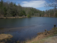
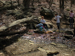
Lake Winfield Scott. We parked here.
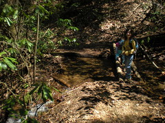
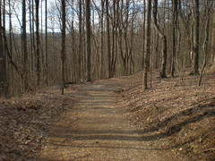
We began our trek climbing the Slaughter Creek Trail. Sophie had some serious trouble with a little bridge that seemed trivial to me and Iz.
She's little though.
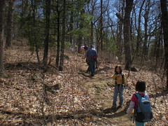
Up, up, up...
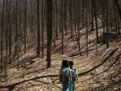
Into the wild...
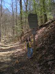
We planned to stop at the AT. Sophie was getting slow, tired and whiny and kept calling it the "Aggravation Trail". Where's the Aggravation Trail?
When we finally got there and recharged she was fine. The gnats, though, oh boy, ten billion gnats. The girls know the trick about putting your hand over your head, but they also figured out that if they stood close enough to me, almost all of the gnats would just go to my hand. Clever I guess. I still feel like they're crawling on me though.
Lots of groups came through and some of them had dogs.
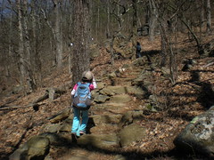
Next we climbed Blood Mountain. Along with dozens of other folks.
Sophie borrowed my hat for a while.
At the top, we poked around the shelter. Someone had sprayed bug spray and it smelled like carrots.
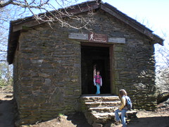
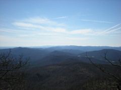
West.
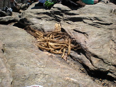
Someone had cut off their dreads up there. Neat, but really more just gross.
Sophie was way off-balance for some reason. She kept wanting to look over the edge, but kept stumbling around too. Eventually I just made her sit down. We ate, drank, recharged again. The girls had brought along cooler clothing and changed into it.
The trip back tested us all. We backtracked to the Slaughter Creek Trail intersection, but rather than descending there, we continued on the AT, over Turkey Stamp, over Gaddis Mountain, to Jarrard Gap. Those extra few knobs really put it to us. Everyone we passed was starting to set up camp for the night. Even I was getting tired. We planned on descending the Jarrard Gap Trail, but ended up on Jarrard Gap Road instead.
Jarrard Gap Trail is blue-blazed. But, AT "get-water-here" trails are also blue-blazed, and there was a sign saying "Water ->" at the Jarrard Gap Trail, because you can, in fact, get water along it. So, seeing "Jarrard Gap Trail ->" pointing down the road, and both "Water -> " and a blue-blaze pointing down the trail, I figured that the trail was just the AT water trail and kept following the road, figuring it was the Jarrard Gap Trail. We only discovered out my mistake when we got to the intersection of Slaughter Creek Road and found the lower trailhead. Woohoo!
No big deal though, we still got back to the car, maybe faster even.
I like hiking and all, but these days I barely even feel like I'm a cyclist any more. Hopefully I can ride my bike tomorrow. If not, I'll be back on foot, somewhere else.


No comments:
Post a Comment