Yesterday, the family and I went hiking at Keown Falls and John's Mountain.
We actually left the house at like 2:30 in the afternoon, but since both of the girls are teenagers, that counts as "early" on the weekend, and both slept for like half the trip.

I guess that's better than the alternative of complaining that it's taking a long time though, so I wasn't upset about it at all.
Boy, did it take a while too. I forget how far north is is to Resaca. It seems like it's just past Red Top Mountain, but no. It's much further north than that.
I guess it's been a while.
The roads made Kathryn pretty happy though. No protracted twisting and turning. There was a bit at the north end of Pocket Road, but no worse than our neighborhood. Even the forest road up to the trailhead was easy on her.
We parked, changed, got geared up, and hit the trail by 4:30 or 4:45, I think.
Actually, wait, there was something else I did first. My left achilles tendon has been killing me for weeks and weeks. Whatever damage I did to it has mostly healed and normal shoes don't bother it, but after putting on my hiking shoes, I could tell right away that they were going to be a problem. What the heck? Well, after looking closely, the left shoe had more of a lump in it where it holds on to your foot than the right shoe did, and the lump in the shoe sat directly on the spot that my heel hurt. I remember whacking my heel, so I know the shoe didn't cause the problem to begin with, but it sure wasn't helping. Enough taping up my heel though, I cut open my shoe, picked all the foam out of it, and taped up the shoe. Success! Now the left and the right shoe are exactly the same thickness and neither bother either foot. Ha! I fixed it.
So, after resolving that, we hit the trail for real.
Right away I spotted this Shagbark Hickory, though at the time I wasn't sure what it was.
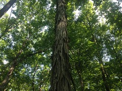
I mean, it makes sense to call that Shagbark, for sure, but I think, in the past, I may have misidentified some other kind of hickory as Shagbark. I think of it as having normal-looking bark that grows really, really thick. I have a photo of John on Cold Mountain demonstrating the depth of the bark on what I thought was Shagbark. I'm going to have to do a little more research though. Maybe it does have thick, deep bark at the base, which turns into those strips further up, or something.
The Keown Falls Trail is a lasso, or lollipop, and most people only hike half of it, out to the falls and back, on the right hand side of the loop part. I wanted to hike the whole trail though, so we hung a left where the stick (of the lollipop) hits the loop.
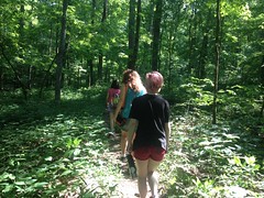
It was definitely the road less travelled. The trail was clear, but it wasn't possible to walk down it without constantly brushing against leaves and grass. Through some miracle of genetics, neither Sophie nor I are allergic to Poison Ivy or Oak, but Kathryn and Iz have a normal, terrible, reaction to it, and it was freaking everywhere down in the flats. Between that and worrying about picking up ticks, neither of them wanted to be there, at all.
Fortunately we climbed up out of that garbage pretty quickly.
Unfortunately, the climb was rough and we had to take a break after the first set of switchbacks.
While we sat there though, a couple came down the trail from above and we talked to them for a few minutes. They were hiking the Pinhoti in sections and were on that section that day. I think it reassured my family a bit that we weren't completely alone in going that way.
The overgrowth slacked a bit as we climbed, and there was way less Poison Ivy and Oak, and though Kathryn and Iz weren't exactly happy, they could just walk, for the most part, without having to carefully twist around crap hanging out into the trail.
Before long we arrived at the first set of cliffs.
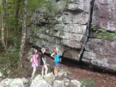
The rocks below the cliffs were a really cool color of lavender. Me and Sophie climbed all over them but I failed to take a photo.
A little trickle of water that runs over the cliffs themselves, but you can't really see it in this photo.
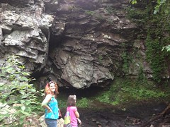
Sophie and I played in the water, but Kathryn and Iz were uninterested in such shenanigans.
We stayed there until I was sure everyone had recovered from the climb. Kathryn had pretty much warmed up at that point too, and didn't have any trouble from there on.
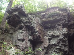
For the next half mile or so, the trail ran along the bottom of a set of cliffs. Lego Cliffs, I like to call them because they look like they're made out of Lego.
They look rusty, and must have a high iron content. The mud at the base of these is all yellow too, and people have graffitied the rock with it for ages.
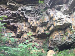
Before long we arrived at Keown Falls proper.
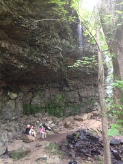
It's really more of a cave with a bit of a trickle running over it. I've only seen it pouring when it is actively raining. Fortunately you can actually see it in the photo though.
We climbed all over the rocks. Kathryn and Iz have tons of pictures of that.
I stood directly under the stream and got thoroughly drenched. I don't think it was even in the '90's, but it was still warm enough for the water to feel great, and to be completely dry 15 minutes later, just standing around.
But we didn't stand around for long though. We'd gotten a late start, had a ways to go, and didn't want to do it in the dark.
The trail becomes a set of stairs that lead up the cliffs nearby, and there's a viewing platform up there. I'm not sure what you're supposed to view though. You can't really see the valley, and the falls is actually tough to see from it too.
Up to the rocks to right though, is the real deal. From that vantage, you can see a huge swath of the Furnace Valley.
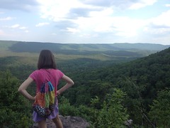
Sophie wanted to know what that mountain on the other side was, and I wasn't actually sure. I used to know... I kept thinking it was John's Mountain, but I knew John's Mountain was behind us. Middle Mountain? That didn't seem right either. Dangit! I had to look it up later when I got home. Horn Mountain! The "Dalton Pinhoti" climbs over Dug Mountain, Hurricane Mountain, Middle Mountain, Mill (Creek) Mountain, Horn Mountain, and John's Mountain. There was a time when I could have recalled that effortlessly... :(
Warning!
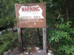
Don't fall over the cliff. Actually, these days it's pretty well overgrown behind the sign, but I can imagine it wasn't always.
We picked up the well-marked John's Mountain Trail just past the overlook and took it south.
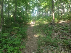
It was fairly clear for a while, but eventually, it started looking more like the Keown Falls Trail had earlier. It wasn't overgrown in the sense that I usually think, but things were always touching you.
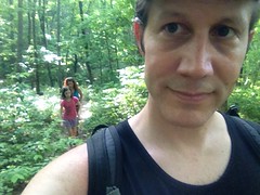
Isabel was especially dissatisfied with things touching her.
On the upside though, there were interesting things to see. You pass lots of rock formations up there.
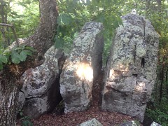
Just past the south end, the trail leads up over some too.
There's an unusual amount of Chestnut Oak up there, if you're into trees. Blueberry bushes crowd the trail too, but the fruit wasn't ready yet. I only saw one berry that was slightly purple.
Some kind of grass grows all along the trail. I remembered it from the TNGA. It grows these spear-like seed-pods that jab into your socks and after a while you accumulate so many that they start to hurt and you have to pick them off. Then they do it again. I wasn't wearing any socks or other clothes that they could jab into though, so ha! Kathryn liked them, and kept picking them open. She said the inside smelled like wheat. I'm not sure I know what wheat smells like well enough to have identified them that way!
There was this raspberry-looking thing up there too, that I couldn't immediately identify.
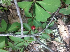
Under-ripe dewberry? Whatever it was, it tasted underripe.
The trail got a bit more clear after a while and we eventually ran into this little building at the base of an antenna.
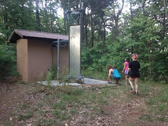
The building was covered in graffiti, and Evan Martin seemed to be the principal author.
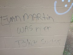
Evan Martin needs to stay in school though. He should especially consider paying attention in Grammar.
Just past the blockhouse we passed a leaky propane tank.
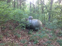
Someone really needs to take a look at that tank. It's definitely leaking.
Past all of that, the trail connected up with whatever that road is on top of John's Mountain.
There was a brand new Kiosk up there. So new it didn't have any signage on it yet.
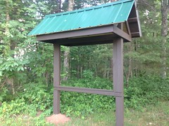
To the left was another observation deck.
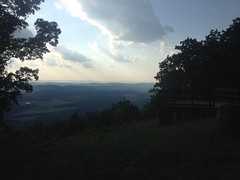
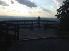
But this one actually afforded legitimately amazing views of Taylor Ridge, Pigeon Mountain, and Lookout Mountain beyond that.
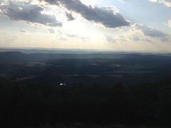
Geographically, this part of Georgia is called the Ridge and Valley Region, and it's certainly clear why it's called that from overlooks like this.
We hung out there for a while until everyone was feeling good again. When we got going again, the trail was an old roadbed, wide open, and well travelled. This made Kathryn and Iz much happier. Especially Iz. With no little sprigs constantly touching her she seemed to actually enjoy our little walk rather than just enduring it.
The trail led directly to the top of the falls, and it made me wonder again whether the cave and those cliffs were natural or man-made.
I guess they could have formed naturally. Ice likes to split that kind of rock into blocks like that. I've seen it all broken up on its own all over the place, just not to such an extent. Also, rock is usually quarried in concave faces, directly off of a road. Plus, you usually see signs of blasting and drilling. Though, that's what a semi-modern quarry looks like. Who knows how they did it 100 years ago. They mined iron ore on nearby Pigeon Mountain 100 years ago with mules and a light gauge rail. I could imagine a similar rail running along the ridge where the road is today and the rest of the work done with donkeys and mules. The Alum Cave in the Smokeys is an old alum mine. It was mined by man, beast, and rail, and all that remains of it is a similarly undercut cliff. I know the falls is named after George Keown who surveyed the area for the Berry family (or something like that), but I've never read anything about the history of the area itself. Hmmm....
Stairs lead down the cliff to well below the falls. Below that, I remembered the trail being a set of switchbacks, so badly cross-cut that the trail itself slopes down into the cross-cuts and given the crumbly surface, it's easy to slip. Sophie actually did slip the first time we were there.
But!
The cross-cuts appeared to be completely overgrown, and someone had recently rerouted the switchbacks into a single, long, light-dozer-cut switch.
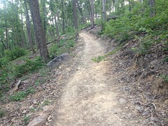
It looked really new. Like less-than-6-months new. I guess that's some of the work that came out of the co-trails assessment. The work looked good - grade reversals and rolling dips. I'll have to come back in a year or two and see if it looks a little more natural then.
The new trail teed into the old trail at the creek and a little further down we ran into this box turtle.
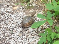
Just sitting there on the trail.
And that was about it. We got out before dark and the drive back was easy. We stopped at Shoneys off Hwy 140 for dinner. I hadn't eaten at Shoneys since pigging out on the breakfast bar every week in college, and I was surprised how good their hamburger was. I didn't remember their food being all that good, just cheap, thus not going there, but it was, good and cheap.
Hmm.
I might have to start eating at Shoneys again.


No comments:
Post a Comment