Oh, goodness, again the backlog grows...
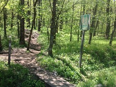
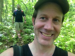
Lets see... A few weeks ago Billy suggested that we do some hiking together. This was an odd request as though we have known each other for like 15 years, we have almost exclusively ridden bikes together, and never once walked in the woods, except on the rare occasion that we could not ride some particular thing.
Sounded good to me though, and as Billy is generally down for High Adventure, I knew just the place.
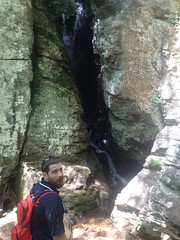
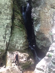
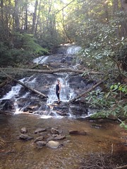
Those who know North Georgia will most likely think something along the lines of "I recognize that as Raven Cliffs Falls, one of the most popular and easiest hikes there is. What is this High Adventure, of which you speak?"
Well, it started with an ascent of the cliffs themselves, via the old root system dangling down the far side. The last time I made that ascent was probably 6 or 8 years ago, and it was decidedly easier back then. I think next time I'll try a different route. We wandered around the top of the falls for a while and I guess I was caught up in the moment, because I failed to take a photo of the upper (and far more spectacular) cascade.
There's an old skid road up there that ends abruptly and once made me wonder if there had been some kind of flume or other contraption in operation back in the logging days. Looking at it again just made me even more curious, but no clear evidence remained, one way or the other.
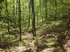
Following the skid upstream involved a great deal of work. Judging from the abundance of downed trees, density of the underbrush, and absence of limbs from the trees that were still standing, it appeared that a tornado had touched down in the vicinity, some years ago. We had a very difficult time following the old road, and when it ended, making further progress upstream was even more difficult. Downed trees crisscrossed the creek. There were several small cascades. The hillsides were dense with the same thorny underbrush and even more downed trees.
Billy's triumphant Canadian beard defended his face, while my pathetic stubble actually seemed to attract injury. I ended up getting several little wounds that I didn't notice at the time, but looked pretty bad in the mirror the next day. I'm pretty sure some people I know wondered just what the hell I'd been up to all weekend.
It took over an hour to push less than a quarter of a mile. But, then, suddenly, the woods opened up and we walked through it along the side of the creek without touching a single bit of brush for at least a mile. There was even a fresh campsite along the creek. I doubt whoever camped there came in the way we did though.
Eventually the woods got a little more dense, but it was still very easy going.
Uphill was Hogpen Gap Road, and I was aiming for an overlook near the gap.
A bit southeast of our destination, I found this frisbee, lying on the forest floor.
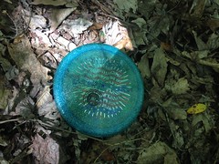
There was even a name on the back of it: Andy Taylor, and a local phone number. Well, local to North Georgia, at least. I imagined the Andy's jerk brother standing at the overlook thinking something like "It would go for miles..." and giving in to the urge to find out. Then Andy, realizing that it was HIS frisbee his brother had thrown, tackling him to the ground and wailing on him. Ha! Served him right. I called the number twice and left a message. Nobody ever called back. Andy Taylor, if you happen to read this, email me or something, I'd be happy to mail you your frisbee.
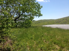
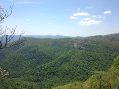
We hit the overlook, right on target.
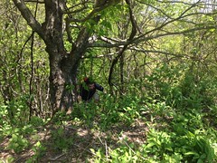
Here's billy scrambling up the last little kick of rocks.
And look at that glorious view.
That's Mount Yonah way back in the distance.
I bet a frisbee would go for miles...
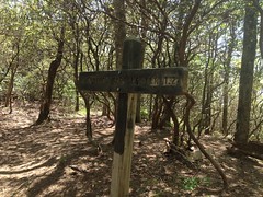
The AT was just a little ways up the road.
We arrived at the intersection at exactly the same time as a lady hiking up from the nearby water trail arrived. She looked like she had a long way to go but she also looked like she was feeling pretty good about it. No blank, vacuous stare, at least.
It's a steep climb up to the ridge that divides Hogpen and Tesnatee Gaps. Fortunately there are switchbacks, but it looked like that hadn't always been the case. If I remember correctly, there are a ton of steps on the other side, and it's much more difficult.
A trail runs along the ridge, out to the Whitley Gap Shelter, and beyond.
The last time I was up there was when I hiked the Logan Turnpike and had to run full speed toward the shelter to keep from getting struck by lightning on the exposed granite. This time the weather was a lot nicer.
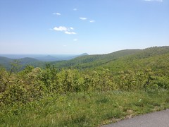
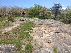
We took a little side trail down to a granite outcropping...
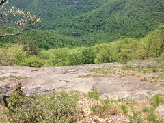
...and you could actually see the next ridge over, Cowrock Ridge, I think.
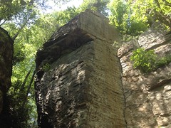
I don't think of North Georgia has having much in the way of cliffs, except on Mount Yonah, but I could see several from that little outcropping alone. Hmmm...
Further on there was even more exposed rock.
And eventually we got to the shelter.
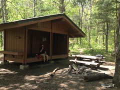
I had plenty of Clif Blocks, but I'd apparently forgotten to bring the Skittles and Beef Stick that I'd bought on the way up. Dangit! I'd been thinking about those delicious snacks for the past hour, and I didn't even have them. Fortunately Billy didn't forget to bring some kind of peanut, M&M, and raisin mix and shared some of it with me. It wasn't the super sugary and salty goodness that I'd been craving, but it was a lot better than just eating a bunch of Clif Blocks.
Our break lasted a half hour or so. I lay on my back most of that time, and It's not impossible that I slept for a few seconds at some point. Nothing better than relaxing in the woods.
Ahhh.
But, we were only about halfway done and needed to start making some progress lest we get caught out in the dark.
A trail led south along the ridge. I'd once read, in a really old book that had once been part of the Knoxville Public Library collection, but that had made it into my hands via a most circuitous route, that the trail led up to Adams Bald. The book described it as a "fairy land" up there (no kidding) where all the trees looked like miniature versions of themselves.
Sounded interesting.
Unfortunately the trail, decidedly, did not lead up to Adams Bald. Rather it sidehilled below it and eventually petered out along the ridge that led away to the east. It's not impossible that an older branch of the trail once led up to the top though. There were a few downed trees, and if one had fallen at an intersection, we might have missed it. I might go back to look for it in the future, but there was no fairy land that day.
Along that ridge, I made the standard mylar baloon find.
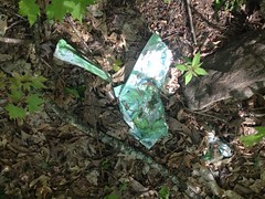
Which, at the time, seemed overdue.
The trail ran and ran.
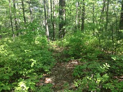
Someone clearly used it.
But it eventually disappeared into the underbrush and we were resigned to just follow the ridge for a while.
The terrain there was fairly easy to follow. We dropped off of the ridge down to a creek, which apparently falls over some more exposed rock, in what must be a fairly spectacular display. I only noticed this later though, looking at our GPS data on top of some aerial photos. At the time, we could see that the creek dropped off to the right, but we couldn't see the cliffs themselves from above. Dangit again! I know how to get to the bottom of the cliffs though. I'll have to go check that out some day.
On the other side of the creek we picked up an old skid which led to an old road, which led to another old road that I knew from finding it a few weeks earlier, and that led back to FS244.
Woohoo! "Civilization"
Across the street, we took some trails down to the Upper Cascade of Davis Creek Falls. A very-tattooed couple with a pair of cute dogs were hiking out as we were hiking in.
I was telling Billy how the trail in the other direction was the 2nd sketchiest thing I'd ever done, but then we found another trail that might be even sketchier. I'm not sure how I missed it the last time I was up there, but it appears to lead down the same rocky face that the falls cascades over. We didn't have the time or inclination to find out for sure though. Maybe next time. Or maybe not :)
I also noticed some interesting "tree art" that I hadn't seen the previous time either.
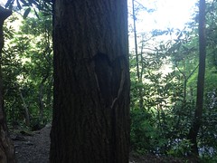
There are actually 2 different hearts, in two different trees, in that same area. The other one is on the Raven Cliffs Trail, just after it joins the old railbed for the first time. I always assumed that one had formed naturally when a branch broke off, but this one was clearly man-made, so maybe the other one was too.
At any rate, that was our Adventure. It seemed Billy had a reasonably good time of it. My left Achilles Tendon was freakin' killing me near the end, but other than that, I had a good time too.
I don't think I've eaten with Billy once after a ride (or now hike) since he got married. He always wants to get home to eat with Megan, which is admirable, actually. I was starving though, and had to roll up on the Big Zack Snack in Dawsonville. Mmmm, Big Zack Snack. Ideal recovery.


No comments:
Post a Comment