Last Friday I took the day off. I'd been working extra, extra hard for weeks and my fitness and sanity were both suffering. The last few months had been really tough, I'd been pulling hard, but things were just starting to improve. We might have turned the corner, it seemed like I might be able to sit up for a second. A day off seemed appropriate.
Unfortunately, despite the cycling analogies, no cycling was involved in that particular day off. The brakes on my mountain bike need some tending-to and the big ring on my road bike is just worn completely out. I guess I can find the cash to fix them, but the time is more difficult to find. It ends up just being easier and more immediately satisfying to go for a hike, especially when it's been raining, which it had been.
So, that was again the case this past Friday, but I didn't feel like I was settling for a hike because I had a very specific destination in mind, In fact, I was kind of excited about it.
I'd been trying to follow the old (circa 1882 and maybe before) route from modern-day Nimblewill (near Bull Mountain) to Stock Hill (at the bottom of Noontootla Creek Road/FS58) and so far, I'd explored everything from Nimblewill Church to the Hickory Flats Cemetery. There was still a long section from Hickory Flats to Stock Hill though, that I'd barely ever been on. I'd seen maybe a quarter mile of it, 8 or 9 years ago.
So I headed up to Hickory Flats to try to knock out as much of that section as I could.
I kind-of went up the dumb way though. I wanted to approach from the Noontootla side, but I auto-piloted up 400 because that's just how I usually go to get up there. This error added like 30 minutes to my trip, but it wasn't all bad, as it also added a stop at the Dutch Monkey, where I ran into Chris from Reality Bikes, whom I hadn't seen in like 5 years!
Eventually, I made it to Noontootla, but I stopped near the Friendship Church to get a photo of a historical marker nearby.
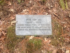
I guess there was a school there, at the bottom of Noontootla. It doesn't specifically say, just mentions a teaching job. Also, I'm guessing that the Fannin County Heritage Foundation put it there, but it doesn't say that either. I'd actually seen the marker before, but I couldn't remember if I had a photo of it. I definitely didn't have a GPS marker for the location, so I got that too.
Speaking of markers... As I drove up to the cemetery, I noticed yet another marker, kind-of across the street from it.
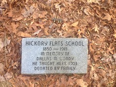
Apparently there was a school there too!
I had, in the past, assumed that the community of Hickory Flats was confined to the actual flats down along Long Creek, and that the cemetery was located on the hill overlooking the community. Historical topo maps suggest the same, and do not show a school anywhere in the vicinity. It would seem that the maps are incomplete though. I wonder if the Fannin County Heritage Foundation has better maps...
As I pondered this, I parked at the cemetery.
There is an actual cemetery there, but the area is more like a campground. There's a pavillion with tables and chairs, and I've never seen fewer than a dozen gallons of water put out for whoever needs it.
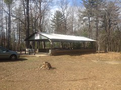
There's also a bath house, with luxurious facilities.

I love the red carpet that leads to the throne.
There's always paper. It is funny though, there's a curtain that you can draw, but if you do, then the draft slowly pushes the bottom of it toward you until its wraps up around your calves and knees. Good luck trying to hold it away from you, it'll just slowly wrap around your hand too.
There's also a "shower", with a drain, where you can hang a bag of water and bathe. It's typically stocked with soap and shampoo.
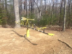
Outside there's a weird merry-go-round/see-saw thing that I swear was there a long time ago, then was gone for a while, and is now back.
There's a fire ring to the left of the pavillion, and the cemetery itself is behind it.
The whole place is kind of the last maintained remnant of the Hickory Flats community. We can thank the New Bethel Baptist Church for that. I believe they own the property and maintain it.
In antiquity, there was a road leading down the hill behind the cemetery to Long Creek where it allegedly teed into another road leading up and down the creek, and that's where the community of Hickory Flats proper was. I'd been down that road once before, but only once, like 10 years ago.
I took it again that day, and really noticed how braided it was. There were at least 2 former routes off to the right. Maybe more even. They all coalesced at the creek though.
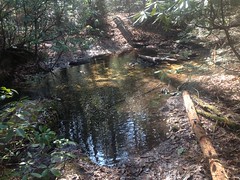
Whoo! The water was cold. It was in the high 30's outside.
My phone didn't like that too much either. The battery works really badly if it gets cold. It was at 100% in the car, but it was at 49% not 10 minutes later. I ended up taking it out of the case and tucking it between my running tights and my left hip so my body heat would keep it reasonably warm. This actually worked, and hours later it hadn't dropped below 47%.
Just past Long Creek, the old road leads to a food plot.
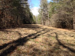
But, legend had it that there's an old road leading up the adjacent ridge. In fact, there was! But it was pretty overgrown and it took quite a bit of meandering just to go the first 100 yards. Fortunately though, after the first 100 yards, it cleared up nicely.
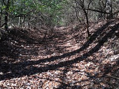
It looked like I'd been on a "former route" and the most current route came in from the right at that point.
For the next mile or so, the trail was reasonably clear. You'd probably struggle to get a horse or a bike down it, but on foot, it was no problem.
Eventually, it seemed like I was getting close to FS251B. I think I crossed a Kelly Hump or something. And, looking for the road, I almost missed this stake in the ground, off to my right.
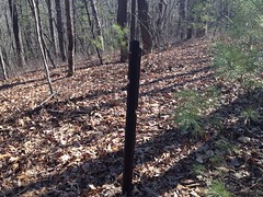
I figured it was one of the orienteering markers for the Rangers at Camp Merrill. Maybe one day they'd quit using it and taken down the actual marker, but left the stake in case they wanted to use it again.
But something else caught my eye as I walked over to get a photo of the stake. Just over the hill...

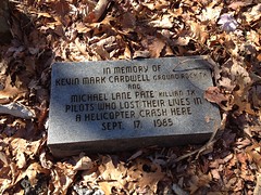

Wow!
I ran into a bigfoot legend about this crash ages ago. The story was so full of inaccuracies though, that I assumed it was completely made up. I hadn't seen the AJC article about it at the time. I never thought I'd randomly discover the crash site.
I was surprised, intrigued, and sad all at the same time.
Adventure!
The biggest irony, is that I'd actually been on that particular section of the old road before and not seen any of it. Like 10 years or more ago, I rode my bike out that way, parked it, and went walking down the old road until it got too overgrown. I used to do a lot of that. Apparently I had lower standards for "too overgrown" way back though, because these days I wouldn't call it that.
The old road kept going on the north side of FS251B and I kept following it. That side was substantially more overgrown. I was glad it was winter. Before long it started looking a lot more like a creekbed than a road.
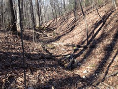
Hard to believe _that_ was the main drag at one point.
There was a reasonably large poplar down in there too.

The astute observer may notice a weird black X floating in the air in front of the tree.
I have no idea what the purpose of this weirdness was, but black cordage was tangled all over the tree and nearby saplings, and it seemed to have been put there, intentionally, as it was knotted around all kinds of stuff nearby.
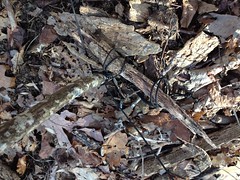
Maybe that's where the Rangers had been trained to make a last, desperate stand against a Predator, or maybe against bigfoot.
The old road descended the left side of the draw, and continued along a ridge to the north. It was a bit of a geographcal oddity, actually; a draw that funnels down to a ridge. I can't think of anywhere I'd ever seen that before. The creek was rather dry that day, but appeared to flow downhill to that point, and then alternately drop off to one side or the other depending on the century. It looked like it currently dropped off to the east. From the west, a newer looking road joined in, and for a while, the trail ahead was clean and clear. You could have driven a truck down it.
It looked like a modern logging road had been built down to that ridge from FS251B and then bulldozed over top of the old road. I actually expected to run into something like that though, because in the old black and white USGS DOQ images (aerial photos) of the area, that were taken in the 80's (I think), and which were once available online, you can see where the ridge had been logged and started to regrow, but still looked different than the surrounding woods. The ridge to the east appeared to have experienced the same fate. In those old photos you could even make out much of the logging road. When I'd seen those photos, I figured it was just another random logging road. I had no idea about its historical significance.
Oddly, there wasn't much logging along the road at first. No stumps, fairly old-looking growth. No "dirty jungle". But that changed eventually. The border of the clear-cut was pronounced, and the road beyond was the longest stretch of overgrowth that I'd ever pushed through. This photo sums up the experience:
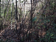
Yeah, push through that.
It wasn't like rhododendron hell though. I didn't have to climb over and under and around. I mostly just had to put my forearms up a few inches in front of my face and walk forward. My forearms bent the little branches out of the way as I walked. I swear though, 1 in 5 was short enough to spring back and whip me in the face, which I reasoned was better than just pushing them out of the way with my face, and also better than taking hours to duck under and in between every branch.
Toward the end, conditions improved rather suddenly.
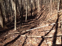
It looked like maybe a controlled burn had eaten up a lot of the undergrowth. Hog rooting was fairly prevalent as well. Between the two, the trail was much easier to get down.
In the first few hundred feet, I found the day's balloon.

It was black and gold. I could make out any writing, but maybe it had flown in from New Orleans.
Go Saints.
I was looking forward to enjoying the rest of the trail, but I was out of luck. Suddenly, and definitively, it came to an end.
This was discouraging. I'd hoped that the modern road would follow the route of the old one all the way down to Mill Creek, but instead, it must have diverged from the old route at some not-so-obvious point.
Goodness...
I spent the next 30 minutes trying to figure out where. This was made difficult by several factors: 1) The various knobs of the adjacent John Dick Mountains look really similar from that angle. 2) The trail was super overgrown. 3) I had marked the route of the old road on my map by eyeballing the map from 1914 and doing my best to match up features between the two. The route that I had marked was by no means definitive. 4) I wasn't super confident in the accuracy of the 1914 map. I'd discovered a few errors in it already.
After about 30 minutes, I was very confident about where I was on the map, but I couldn't find any old road descending the ridge where it should be. Either the map was wrong, or I had transcribed it wrong, or the new road had obliterated the intersection so well that I couldn't find it, or it was just so freaking overgrown that there was just no way.
Eventually I backed up, dropped down about 50 yards and sidehilled until I crossed something that looked like a trail. I took it uphill to see where it hit the logging road, and then downhill into the valley. Unfortunately it disappeared into the backslope almost immediately. It probably wasn't the right trail. Or, if it was then it's seen better days.
Screw it! Off-trail! I'll find it again down in the flats.
Almost immediately I stepped into a good bit of old growth, and I made really good time through it.
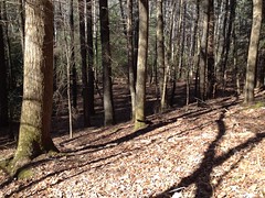
There was a reasonably large pine down in there.

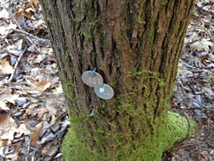
And as middle-of-nowhere as it seemed, someone had been back in there treating hemlocks.
I did find an old road, but I wasn't sure if it was the one I was looking for. I followed it east to see if it joined up with a trail I'd found years earlier, but I eventually gave up when it became rhododendron hell.
I did find a waterfall though.
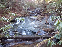
Too bad I didn't have anyone to stand in front of it for scale.
Being "Mill Creek", I half-expected to find some evidence of a dam and/or mill nearby, but no luck there.
To the west, well upstream, I did find some ruins. Not a mill though.
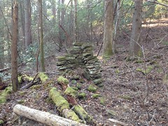
The map from 1914 alleged a structure near where I found that chimney, so I wasn't too surprised to find it. Later though, when I compared the location to the old map, what I found was a bit north of where it was alleged to be. So, either the map is wrong, or there might be another ruin back in there somewhere.
Also, is it just me, or do those old chimneys seem way too durable? This one had been hit by two different trees, but was still mostly upright. I'd think they'd be like Jenga. Touch them wrong and the whole thing comes down. But, no, the building they're attached to can collapse and rot into nothing, but the chimney will stand there like nothing happened. Maybe a little moss will grow on it.
I guess it's a testament to that good old-timey mortar.
The road continued behind the ruin and passed in front of whatever the heck this is:

It's hard to tell in the photo, and it doesn't help that it's out of focus, but after walking up in there and looking around, it really looked like a collapsed mine shaft. I've seen a bunch of old rail tunnels on Pigeon Mountain, some of which have collapsed, and a few mine shafts on Sawnee Mountain, which haven't collapsed. It just struck me as similar to those. Plus, the giant piles of dirt nearby looked like way more than could have come directly out of the hole that remained. And, there was an even older road that led up to a spot near the top of the hole.
I guess it could also have been an archaeological excavation of some kind. Either way, really interesting.
The old road kept going, but it had the wrong bearing. An adjacent dry branch had the right bearing but no sign of an old road. Maybe the "road" was just the floor of the draw. I'd seen that twice before. The Logan Turnpike trail is kind of like that.
Blah!
I committed to the roadless draw.
Through this crap.
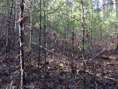
And there was no road. No nothing. Dangit!
Screw it, bushwhack up to the ridge, take that up to the trail that I knew was above me.
But then the ridge was just as difficult to push through!
When it finally cleared, I walked right by this:
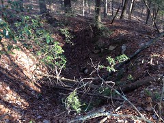
Which is hard to make out in the photo. It's a big hole in the ground. Really big. A pit mine, maybe? It lay on the same ridge as the thing I'd found earlier. It struck me that they both may have been shafts leading into the same mine. I had no idea how likely that was though.
There was a campsite nearby though, and a bit of a trail leading from it up the ridge, so I guess it's a minor point of interest to someone, or maybe it was just a coincidence. Who knows?
I picked up Old No-Name Ridge Road up the ridge, and took that to Watkins Branch Gap where I could clearly see the road that I had been looking for dive down into the valley below. It existed, but I'd have to follow it down from there, if I wanted to see where it goes.
I wanted to, but it was getting late. Not late in the absolute sense, but I was like 6 miles from the car and it would take a few hours to get back to it, like 2 or 3 hours. #planningahead.
I bumped up to the Benton MacKaye and headed back south.
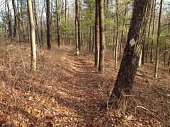
Oh, man, quick progress on an actual trail! It was a joy I had hardly experienced all day.
I ran into another blank stake, I think at the gap uphill of whatever creek Noontootla Falls is on.
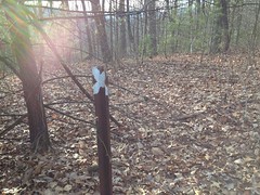
There was no memorial nearby, but there was a bit of a hole in the ground, and then another downhill to the southwest, and another beyond that. Maybe it was a really old firebreak. Maybe it was nothing at all, just where trees had fallen down and the fact that they lined up was coincidental.
If the stake was a former orienteering marker then it was the furthest one I'd ever seen from Camp Merrill.
No telling.
There were at least a half dozen rock piles up there on the next knob.
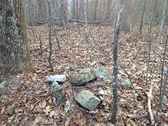
Indian graves?
As I crested the knob south of the rock piles, I noticed a new-looking double-blaze and some trail leading off to the right. It turned out to be a set of switchbacks that I hadn't hiked before. I don't know how new they were, but they were new to me. They looked pretty good too, with that IMBA flow.
They crossed the spurs that trail off of the end of the No Name Ridge Road. I don't know if that was intentional, but it couldn't have been better executed if it was. They managed to cross the ONLY other trails in the area.
At the next gap... Oh, the irony.
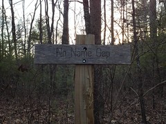
It reminded me of a photo I once saw of a road sign that said: "This sign has no purpose."
This gap has no name.
There are lots of unnamed gaps, but I guess the distinction here is that the name of this gap IS "No-Name Gap", which is perfect, as it lies along No-Name Ridge.
The sun was getting low when I hit the food plot, but I felt good about the progress I was making so I spent a few minutes taking in the general serenity.
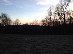
From there, the BMT dropped down to Long Creek, and took on a very different character.
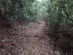
There were 2 dudes down there setting up a tarp shelter with a blazing fire so warm that I could feel it from across the little creek between us. More folks were camping down by Long Creek Falls too.
It was darkish when I turned onto the AT, and officially dark when I got to the road by the cemetery.
It was also officially cold - mid 20's. I was wearing running tights, barefoot shoes, a base layer and a wind shell. I had warm gear in my pack, but I hadn't gotten cold enough to change into any of it. It was only after changing back into my street clothes that I wished I'd changed into them instead.
Brrrrr.
My phone was feeling it too. I'd had it on my hip all day, but I'd put it in my car while changing in the bath house and it had gotten cold. I had signal, and the battery had been at 47%, so I figured I'd give Kathryn a call, but as soon as I unlocked it, it went to 20% and gave me the low-battery warning. As soon as I acknowledged that, it gave me the 10% warning. When I acknowledged that, it showed 3% and turned itself off a second later.
Ha!
When the car got warm, I warmed the phone back up, and when I turned it back on, it was back to 47%.
Keep your batteries warm, kids.
As had been the case on the previous hike, I had forgotten that I'd left myself a doughnut in the car, and was elated upon remembering. I was a bit too aggressive in eating it though, and had to stop twice on the road out, to put the doughnut down and drive more precisely, lest I put the car in the wrong rut.
I grabbed some dinner in Ellijay. Shanes Rib Shack, again, and it really hit the spot.
This time, I did have that good, whole-body tired going, but unfortunately I got a little sleepy on the way home and had to stop in Jasper just to walk around a bit and wake up.
So, I'm not sure if this particular hike counts as the ultimate in weekend Adventure, but on paper, it looks pretty good. 8+ hour day? Check. Significant diversity of trail experience? Check. Discovery of historically significant points of interest? Check. Discovery of a waterfall that's not on the map? Getting a little bit lost? Off-trail navigation? Discovery of new trail? Hiking out in the dark? Whole-body tired? Check, check, check, check, check, check!
I don't know, it's a pretty good candidate.
On the drive home though, I passed not just one, but two horrific accidents, neither of which looked survivable, and it took a few hours to get over how bad I felt after seeing them.
So, maybe not such a good candidate after all.
What a way to end the day.


Fascinating narrative! I have visited Hickory Flatts Cemetery a few times and always wondered about what life there must have been like! Thanks!
ReplyDeleteRespect and I have a swell offer you: Whole House Reno house renovation contractors
ReplyDelete