What the heck is Randa?
It can't be found on any modern map. And by modern, I mean any map which was current at any point in the past 140 years.
Before Nimblewill was Nimblewill, it was apparently called "Randa", or so say the historical topo maps of the general Bull Mountain area from the 1880's.
Since discovering those old maps, I've been exploring the old route from Nimblewill (AKA Randa) to Stock Hill (AKA that church at the bottom of Noontootla Creek Road), which includes many roads and trails still in use today, but which also has long sections that I would never have guessed were there.
During this particular adventure, which I now realize was weeks ago, dang time files, I explored the route from Nimblewill Church to Bull Mountain, and then some, and had a pretty great time of it.
The bridge over the Etowah River on Hwy 136 is set to be demolished and (presumably) replaced between February and August of 2017, but it was still a few days before the start date advertised on the blinking road sign, so I took Hwy 400 up to the Bull Mountain area.
...And since I was heading up 400, and had not eaten yet, a stop to the Dutch Monkey seemed in order.

That's one pre-Adventure doughnut, and one post-Adventure doughnut, right there.
I parked at Nimblewill Church and puzzled over how to find the road I was looking for. The map alleged that it ran up a ridge behind the church and eventually teed in to the existing Bull Mountain trail. I couldn't see the ridge from the road though, and it looked like private property in every direction. The road I was looking for must just be part of somebody's driveway these days, and its generally a bad idea to go walking up driveways in North Georgia without good reason.
(BTW "I'm exploring" doesn't count as good reason.)
After a bit of wandering around in the church parking lot, I eventually noticed bearing trees and WMA boundary signs in the woods behind it. A sliver of the National Forest apparently extended out to that point, and it became my access point.
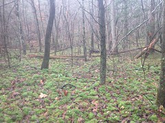
The woods was initially dense, but quickly opened up.
Before long I found the little creek that had formed the valley below the ridge and I followed it for a while.
To my right, I spotted a big, unnatural-looking pile of dirt, and upon investigation, realized it had been dug out of what appeared to be a pond.
Or maybe a pit mine?
At a glance, it looked more like a pond though, maybe for watering cows. It wouldn't surprise me if that whole valley had been a pasture at one point. Sadly, the old maps don't show what land was woods and what land was cleared so I may never know for sure.
At a point I figured I ought to try to get up on the ridge, and the particular spur I picked to take me up there had a couple of interesting features.
This struck me as a well.
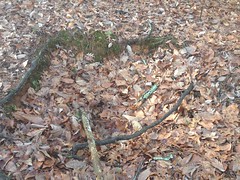
It might not have been, but it was definitely an old hole in the ground, and old holes of that size are often old wells, but it was still a dubious conclusion.
This struck me as a tree stand.
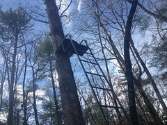
A far less dubious conclusion.
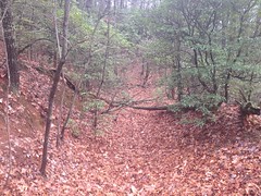
Then, I found the road, right on top of the ridge, as advertised.
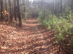
It was clear as a bell at that point, as far as the eye could see in either direction.
I followed it down toward Nimblewill Gap Road, to see if I could figure out where it teed in. I eventually found a forest service style pipe gate and I could see that hundred feet or so further down it teed into a gravelly road. I could kind of make out a house through the woods to the right as well, so I figured that it was probably someone's driveway. I'd have to check the GPS data later to see exactly who's.
Taking the road the other way, I found that it climbed up along the ridge, exactly as alleged on the old map. It was easy to follow too. It clearly gets plenty of use by the locals. I'm sure in the summer time it's a singletrack tunnel through tall grass, but in winter it's wide open. And it was winter, so it was wide open.
...For a while.
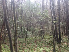
Eventually it got a bit tight.
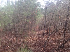
All that brush has thorns, BTW. Every bit of it.
There were 2 old clearings along the road. Both thoroughly overgrown with thorns. The old map alleged a structure of some kind up on the ridge, in the general vicinity of the first clearing, but the brush was so dense and thorny that there was just no way I was going to go poking around trying to find if there was anything left of it. For all I knew, the building on the map was just Nimblewill Church and somebody screwed up and put it in the wrong place.
Past the second old clearing, the old road was a lot more overgrown and clearly got a lot less traffic.
Somebody else had been up there though.
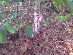
I'd never seen polka dot ribbon before!
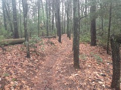
For a while, the old road was overgrown, but the overgrowth cleared eventually and I just had to deal with a deadfall, below-grade trail, and a lot of braiding. I expected to find all of that though, so I wasn't disappointed.
I did find an old side road (and a few former routes of it) that led over to FS83, right at the gap where the 83 bypass tees in. I'm guessing that the trail that leads down to the Bull Mountain Parking lot was once part of that same road. Someone may have lived down there at some point. Or maybe the lot was one of their fields or something.
I eventually hit the Bull Mountain Trail, right where I expected to - about halfway into the old "Bull Mountain Spur", which is that section that used to only be closed to horses, if anyone remembers that.
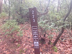
There was a trail marker a bit uphill from there, and it looked like somebody had lost their chain nearby, at some point.
So, having confirmed the existence of the Old Randa Road, I had accomplished my primary mission, and with plenty of daylight left, I figured I'd try to get some older questions answered.
Question 1: Modern topo maps show a very different route for the Bull Mountain Trail, and Steve Houghton et al alleged that when they first tried to find the Bull Mountain Trail, they took that route, rather than the current route. I'd ridden past the alleged intersection literally hundreds of times and never seen it. But, once, while specifically looking for it, I thought I saw it. Does it really exist, and does it go where the map says it does?
Turns out yes.
And it leads down to this weird gap that looks like a fill at first glance, but upon further examination appears to have legitimately occurred naturally.
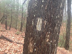
Across the gap there's a bearing tree with an old sign on it.

I had a vague recollection of Steve mentioning that sign once, but it could be a false memory. Who knows what it used to say? But, given the bearing trees, and the WMA Boundary sign lying on the ground nearby...
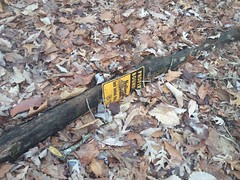
...I was guessing something like "stay on that side of this sign".
When I got home, I looked up "upside down, triangular road sign." Turns out they are universally warning signs, and I felt good that I had taken it as such.
Ok, question 1 answered.
From there, I took the Bull Mountain trail down to the Jones Creek Dam Road.
Ha! Who knew that the trail was yellow-blazed.
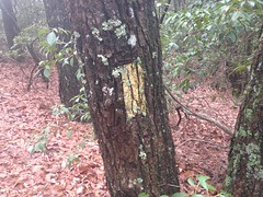
Apparently it is. I wonder how old those blazes are, and if there are more of them.
There is also a Christmas Tree on the side of the trail.
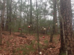
I'd actually seen that once before, I think when Walt and I were flagging a reroute way back.
Question 2: What's the deal with the various food plots between FS83 and Jones Creek Proper?
They might have been pastures or fields way back. If so, ruins may be found in their vicinities.
I hiked down to the first plot on the south side of the road and poked around there for a while. No trace of habitation remained, but I did find an very old road leading down along the creek nearby which basically led to someone's backyard. There's an inholding there along FS28, and it must have been the yard of someone who lives back in there. I think the name of the road that runs up through the inholding is Troutman Trace, but I'm not 100% sure, I've never been down it.
Along that old road, I found what may have been an old chimney.
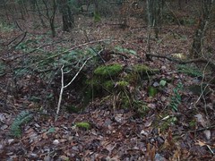
A "chimney pile" I sometimes call that. It was in a decent looking spot for a house, and it might have been a chimney, but it was hard to say just looking at it.
Not relishing the idea of whacking back up along that old road, I whacked uphill to the Jones Creek Dam Road instead.
Or, actually, into another one of the food plots along the road. Again, it seemed really likely that this might have been someone's property at some point. The field was divided by hedges, some of which appeared to contain apple trees.
As I walked along one of the hedges, I noticed a trail cam tied to one of the trees.
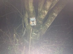
I bet it has a photo of me taking a photo of it.
Whooo, it was getting dark. Time to skeedattle.
I'd have liked to have explored the heck out of that field, but that's no so effective in the dark, so I figured I'd better start heading out.
I took the roads back to the church. As I walked however many miles out that was, I remembered the first time I rode at Bull. On the drive in I thought that it would be epically miserable have to ride out on that road. Since then I've ridden in and out on that road dozens, maybe 100 times, and I never considered it miserable. That night I was walking out on it. The full length of it. In the dark. I laughed about the disparity between that first impression and what I was then voluntarily doing. I may even have laughed out loud.
I love walking out in the dark. I wish I knew why. I'd guess the novelty of it, if it wasn't such a regular occurrence. Maybe it still is the novelty. It's new every time. That kind of thing.
As I approached my car, a guy was driving out of the driveway to the east of the church, on the south side of the road. I crossed the drive when he was like 60 feet away. I imagine that I must have seemed quite suspicious - some random dude walking down the road in front of your place an hour and a half after dark. He spun a loop through the church parking lot to check me out and I gave him the nod and wave as I unlocked my car. I guess my demeanor was sufficiently reassuring though, because he didn't even pause, just drove calmly away to the east.
What a day. I didn't have that good whole-body tired, but I felt good and the day had most of the elements of a good Adventure.
The best part though, was the post-Adventure doughnut that I'd forgotten I had left myself in the car!
It was like finding $5 in the pocket of your jeans, except that the $5 is a doughnut.


No comments:
Post a Comment