A little over a week ago I finally got my bike out of the shop but it rained and rained and by Saturday morning it was still wet and cold, and though I've ridden in those conditions before, I really didn't feel like doing it that day. There was still a short little chunk of the Randa-to-Stock-Hill route that I hadn't yet explored too, so I ended up doing that (again) instead of riding.
I parked off of FS58E and began the semi-tedious march up it.
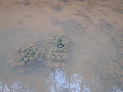
All the ruts in the road were filled with water, frog eggs, and, this week, with tadpoles.
In antiquity, a road dove down from Watkins Branch Gap, along Watkins Branch itself, sidehilled over to the gap between Alec Mountain and Big John Dick Mountain, then dove down along one of the branches, or maybe along some little spur, down into the cove cut by Alec Branch, eventually becoming modern day Angel Drive. Modern FS58E starts at FS58, sidehills up along the south face of Alec Mountain, tees into that old road, follows it for a while, then eventually wanders off to the north on its own. I didn't know exactly where it began wandering off though, and the last time I was up there, I saw several old roads leading down into the cove. I had no idea which was the right one to take, and the old map I had that showed the route wasn't super accurate.
It might be a bit of a challenge.
To make matters worse, I'd forgotten to print out a map of the area before I left home that morning. I didn't realized this though, until I was about an hour away from the house. If I'd gone back and printed a map, there wouldn't be enough time left in the day to get back up into the woods. I reasoned that I knew the area well enough to do what I wanted to do though, and though the map would be helpful, I didn't really need it. I guess I'd see if I was right or not.
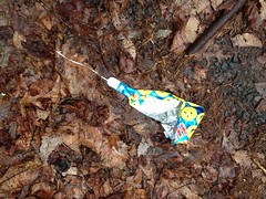
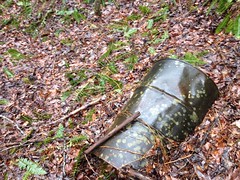
I made it up to the gap in good time, and soon discovered the day's mylar ballon, lying in the middle of the road.
There was no shortage of old roads leading down into the cove. I quickly discovered at least 7, many of which appeared to predate FSS8E, as they came up from below the road and appeared to continue up the mountain above it, but the intersection had been obliterated when FS58E was built.
Any one of those old roads could be the one I was looking for. There was just no telling. I eventually made it out to a campsite that I knew was relatively close to the modern end of the road. The last time I was there (like 10+ years earlier) it looked like maybe a trail led down the spur past the campsite. I was on my bike at the time though, and the trail didn't look too bike-friendly. I knew for sure that the trail I was looking for either led down that spur, or was one of the old roads south of it, so I eventually decided to follow the spur down to Alec Branch, follow that as far downstream as I could, and then try to figure out which of the old roads leading back up the branch looked like the right one.
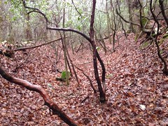
There was, in fact, an old road leading down the spur. I knew right away it wasn't the one I was looking for though. I didn't have the right character. Given the pitch of the slope, the old roadbed ought to have been cut deep below grade by teams of horses struggling to pull laden wagons uphill. There ought to be piles of small boulders to either side, removed from the road as they were exposed and eventually became too difficult to climb over. No, this particular trail looked like nothing of the sort. In fact, I wasn't sure it was a old "road" at all. It was basically just a series of humps and dips with less woods between them than to either side. It may well have once been a firebreak.
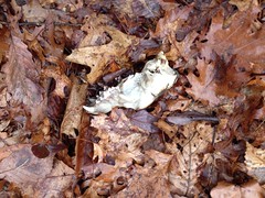
I found the disarticulated skeleton of what I guess is a coyote or maybe just a dog somewhere in there.
And I was sure that I was going the right way, or at least going the way that someone else used to, because the length of whatever I was following was marked with old orange ribbons.
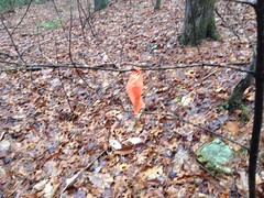
The ribbons looked pretty old though and whoever once followed them didn't seem to do so much any more, except maybe on foot. There was a bit more undisturbed deadfall than you'd typically see on a horse trail, ATV, or bike trail.
Toward the bottom end, it started looking more and more like a road than a firebreak. It was a bit below grade, and there was a worn-out and abandoned former-route off to the left. So weird.
The orange ribbons appeared to end there too, at first, but looking carefully I could see one about 100 yards ahead of me, directly through the woods. If there had been a trail from where I stood to that ribbon, I couldn't discern it. But, I was down in the flats at that point, and trails come and go quickly in places like that.
I appeared to have teed into some other trail which led north and south. To the north, it led up along what I assumed to be Alec Branch proper. I followed it south and it crossed some little feeder creek before depositing me in the middle of one of the most enigmatic places I'd ever been in the national forest.
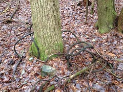
There were random piles of dirt everywhere. Different shapes and sizes. Some partially buried trees. Others had trees growing out of them. Many were partially eroded. Others were covered in grass. There were cables and barrels buried all over. Some partially exposed.
A road appeared to generally lead north-south through all of it. The trail I'd come in on appeared to predate the piles, but also appeared to have been "recovered" after them.
The piles appeared to extend up the adjacent hillside as well. They weren't just down there to either side of the road. Were they mine tailings? If so, I couldn't find the hole they could have come out of. Maybe they were excavated further downstream and dumped there because it was "back in the woods". But why would they have dumped them up the hillside too? The cables and barrels suggested logging, but I'd never seen that much dirt piled up in association with a logging effort.
I puzzled over it for a while, and really wanted to explore the area to try to make some sense of it, but I had other objectives and I didn't want to get stuck out in the dark, so I followed the old road downstream.
I could tell right away that it too wasn't the road I was looking for. It felt very modern - a neat sidehill. No, the road I was looking for must be off to the north, somewhere down in those flats closer to the creek. Pondering that, I wondered if I'd be able to find it at all.
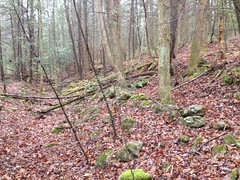
As I pushed downstream, up the hill to my left, I noticed a bunch of rock piles.
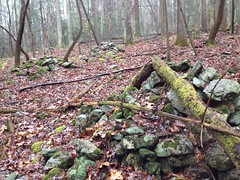
Clearly man-made. Some of the piles lined up with other piles, but some of them didn't line up with anything. If they were the footings for a structure, it was a very large structure. And I couldn't imagine what someone would have built right there, at that particular spot.
No idea.
Further on I discovered the NF's most well marked property boundary.
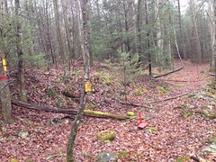
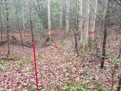
Ha! They used the lid of the paint can as part of a the painted pile surrounding one of the boundary markers.
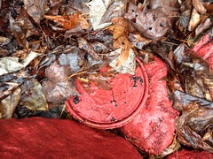
I'd once discovered an old red paint can up on East Mountaintown, with no lid. Now I've found a lid with no can.
As well-marked as the boundary was intended to be, since it was kind-of a corner, it was still a little difficult to figure out which side I was supposed to be on. After figuring that out, I felt kind of silly that it hadn't been obvious, but I'm telling you, go down there and look, and you'll see what I mean. I'll bet it will be equally confusing to you.
I pushed downstream from there and the road I was on got a lot clearer. There was also a former-route below it with all the character I'd expect from a 150+ year old main-road. Hmm... I might have found what I was looking for. It diverged from the road I was on though, which got even clearer and more well-travelled the further down it I went.
That is, until a point, where it abruptly became a solid wall of saplings. A bit of singletrack led around them to the left, but something caught my eye to the right, and I didn't follow the trail.
Through the woods, I could clearly make out this old rock wall.
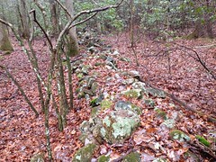
It turned out to be the southern border of the old road I'd been looking for.
As I mentioned before, it's not uncommon to find rocks semi-piled up on either side of an old road, dug out of the same as they became to difficult to get over. In this case, this had been done to such an extent that it had formed a wall. There was a bit of a wall on the other side, too, but it was much more pronounced on the south side.
I could see an open field and a structure of some kind to the north. I could see a line of red-blazed trees following just to the north of the old road too.
I followed the old road west until It became rhododendron hell. Underfoot it was nothing but little boulders and a small amount of dirt clinging to them. It was easy to see why the wall had formed. There were plenty of rocks to build it.
It looked like if I pushed through the hell, I'd end up in the same field I could see to the north, so I didn't bother. After getting home and crunching the data though, I'm not so sure. There may yet be some amount of NF property down there that I haven't seen. Dangit! I may have to go back up and explore that last little piece someday.
I was pretty confident that I'd found the old road I was looking for though. It was in the right place, it had the right character.
I followed it east and it just looked more and more correct the further I went.
At a point, the old road had gotten so deep that it was below the level of the adjacent creek, which then diverted itself into the road for a ways and there were several sections of plastic pipe down in there.
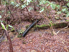
At first glance it looked like maybe someone had made some effort to channel the water with the pipe, rather than let it continue to eat into the old road. But looking at it more, I couldn't imagine what they'd tried to do. The pipe just lay scattered about, some bits partially buried. That's some modern-looking pipe too. I wondered if it had really just washed down from above. Like it had been used as a culvert up by all those dirt piles and eventually got rejected, or dug up and abandoned, and then ended up there.
Eh, who knows?
I ended up back in the middle of all those dirt piles soon after, and looked around a bit more while I was there.
I found another old cable too.
From there, the trail improved somewhat. There were rolling dips and multiple reroutes.
What appeared to be the oldest route led by this big rocky outcropping.
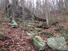
I imagined it might have been a landmark way back. A "getting close to the top now" kind of thing.
In fact, it was pretty close to the top, or at least close to modern FS58E, where the road flattens out a great deal. The actual intersection with FS58E was difficult to discern. It had been partially destroyed by the construction of 58E, and there was a culvert dumping directly onto the old road, which had partially buried it. And, if that didn't make it difficult enough to discern, a reroute cut directly across the old road just below the output of the culvert, making it seem like maybe I needed to turn left.
Whoo!
When I got home and compared the route I had taken to the route shown on the old map, they didn't match up exactly. It seemed like the route on the map went more directly up to the gap between Alec and Big John Dick Mountains. I didn't see anything going that way, but I easily could have missed it. Or the map might not be so accurate. Hard to tell. I can't definitively confirm that the route I took was the route on the map, but it sure seemed to be the oldest route out there. There were plenty of re-routes, but they all looked more modern than the route I'd taken. There were a few spurs too, but they looked a lot less well-travelled.
I may have to get back up there at some point and try descending down from the gap.
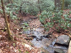
At the time though, I was pretty satisfied. On the march out, I heard what must have been several waterfalls along Watkins Branch, though I couldn't see them through the woods and there was no discernible trail to any of them. From the road, though, the woods looked remarkably clear though, down towards the creek, and I had plenty of daylight left, so when I got back down to FS58, I just followed the creek upstream as far as the open woods would allow me to go.
The magnolia eventually closed in though, and I ended up following a pig trail up some hillside until it teed into another old road. In one direction it just sidehilled off into nowhere, maybe eventually teeing into FS58. In the other direction it eventually led back to and crossed 58E. It appeared to predate FS58E, but it was really pretty hard to tell.
Unfortunately I never happened upon any of the waterfalls I'd heard.
Now it was getting dark, and I made tracks back to the car.
Like I said, at the time, I felt rather satisfied, but when I got home and crunched the data I was far less so. I may not have really found the road I was trying to find. Some of the spurs I did find look like they line up with other trails I found years ago, so now I want to go see if they do. There appears to be more NF land down in the Alec Branch flats that I could conceivably explore. And there are uncharted waterfalls on Watkins Branch.
Isn't that how it is though? Seeking answers, you generate three times as many new questions.


No comments:
Post a Comment