Goodness, I want to ride my mountain bike. I did manage to get it into the shop this past Thursday, so I guess that's a good first step. I also picked up a new big ring for the road bike, but I'm not sure it'll actually work. It advertises itself as a 10/11 speed, and I'm (still) running 9 speed.
How embarrassing.
Maybe some day...
This past Friday I was thinking ahead to the weekend, which would almost certainly be dominated by fixing vehicles and building Billy's fence, so if I wanted to get in any Adventure it would have to be done on Friday. I'd gotten much of what I'd wanted to get done all week, work-wise too, except for a bunch of work for my guys in Brazil, but one day wasn't going to fix that... Yeah, it seemed like a good idea to get in what I could on Friday.
I knew just what I wanted to do too. Last time I'd managed to follow the old route from Hickory Flats to upper Mill Creek, but for the life of me, I could not find the road up to Watkins Branch Gap. This time I'd hit it from the other side though and maybe my luck would be better.
To that end, I drove up to Noontootla and paused for a moment at the cemetery across from the Friendship Baptist Church.
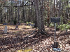
From the road, I thought I noticed a now-familiar granite marker...
Yep. Indeed.
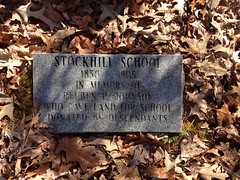
Apparently there was a school at that location too!
The Fannin County Heritage Foundation really likes to mark where there used to be schools, it seems.
I parked just up the road from FS58E..
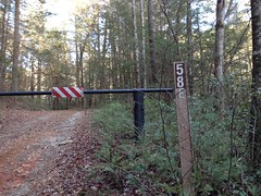
(which I've only ever seen open once in 17 years)
... and right away, checked out what appeared to be a former route of FS58 itself. The old route was marked with the triple-blue-blazes that I've seen all over the place.
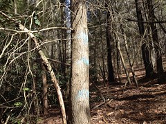
Still can't divine their exact meaning though.
It looked like the Rangers had a party back there recently and there were all kinds of little bits left over: strips of tape, glow sticks, and a crumpled up index card with notes on it.
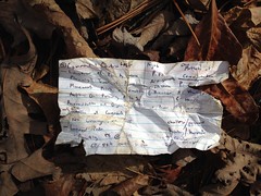
"Humbug!"
"Humbug damnit or we will fire!"
"Harvest!"
I imagined something like that might have gone down during that particular exercise.
From there I hiked up 58E...
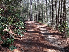
...which had a dozen or more little side trails off of it. Almost all to the left. Their main purpose appeared to be logging, as the hillside above the road was covered in old stumps and general dirty-jungle while the woods below looked like much older growth.
58E joins an older road at a campsite and bends back around to the left. I took a right though, and followed the old, closed road in that direction. At Watkins Branch, it split and followed both sides of the creek. The far side looked like a more modern route so I followed the older route on the near side.
There were more of those blue blazes back in there.
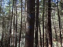
Some were on relatively young looking trees. Either those trees are older than they look or the blazes are a lot newer. The mystery deepens.
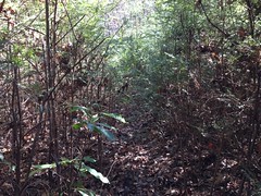
The road/trail there is garbage. It alternates between overgrown:
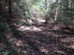
And less overgrown:
But there are long sections of each and I can't imagine how awful they would be during the summer.
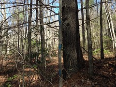
There are lots of side trails back in there too, but none appear to go very far and few appear to sidehill. I wondered if homes had lined the road at some point. There was one spot where it looked like maybe an old crumbling rock wall had been built up against the road. Old enough maps allege a house back there somewhere in the vicinity of that wall, but I didn't find any definitive sign of it.
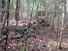
During one less overgrown section, I was glancing off to the right and noticed this, a ways off.
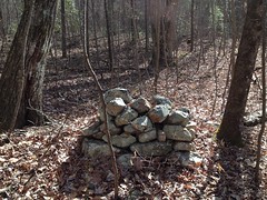
I'd guess it was an old chimney, but it had an "I was just built" kind of a feel about it. The rocks looked clean. No moss covered them. There was no sign of old mortar. The interior wasn't partially filled with dirt. I didn't see any of the rest of the chimney scattered about. I wondered, for a second, if someone wasn't playing an elaborate joke on me. Like they knew I'd be up that way soon and built that little structure to fool me.
Ha! Wouldn't that be funny.
It seemed really unlikely, but I laughed about it to myself, a bit.
The old road let up to the gap above Watkins Branch, just as I expected, and on the other side it bombed down along the middle prong of Mill Creek, as I'd seen before. The other side was a lot more overgrown though, and briefly became rhododendron hell, or I guess, more precisely, magnolia hell.
In the midst of this hell, I heard noises ahead of me that sounded much like the noises I was making, and as unlikely as it seemed, I fully expected to encounter another human shortly. In fact, I could see another black shape pushing through the overgrowth ahead of me, a ways off, to the left. It didn't look or act like a bear, so I wasn't too worried about that, but it wasn't clearly human either so I worked my way up onto the backslope to get a better view. I still couldn't tell what it was though, until I'd worked my way out of all the magnolia and down to a clear spot on the trail.
Heh. Pigs.
"I see you pigs!"
One of them took off grunting when it heard me. The other just stared at me.
That's why I don't like pigs. They're huge, and they're not necessarily scared of you.
I took the opportunity to get my out my phone and start recording though. I can't remember what else I said, but I said more stuff to the pig and then, suddenly, it was scared of me and took off after the first one.
I never saw either of them again, but I saw a lot of rooting further down. Way more than 2 pigs could have done on their own.
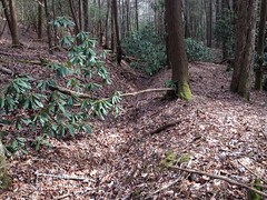
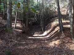
The old road followed the creek more closely as it dropped down into the valley. There were several really trenched out chunks:
And several spots where the creek had gotten diverted down the old road so they had to reroute the road.
The surrounding woods was idyllic though.

I wish I had a sure fire way of looking at a map and telling whether the forest will be idyllic glade or rhodo-hell. Both are found down in or near flats and bottoms, but the rhodo-hell seems to be the predominant feature, 10-to-1 or more over idyllic glade.
The old road led right by another chimney ruin.
This one had fallen more like I expect them to fall though.
Like Jenga.
I couldn't tell that the road kept going, so I backtracked and took a spur I'd seen earlier which led directly to the ruin I'd discovered last time, and to the mine (or whatever it is) nearby.
Ha! This time, my photo is in-focus.
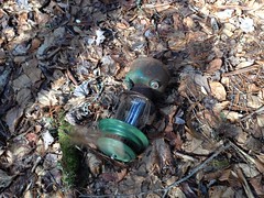
So, I'd basically figured out how to get from Watkins Branch Gap to the old Mill Creek Road, but there was still, allegedly, some way to connect all of that up with the road leading over from Hickory Flats, but that road was still nowhere to be found.
I spent the next half hour scouring the flats for some indication of it, but all I found was this old lantern.
At great length, I pushed directly up the south prong of Mill Creek, through more super-dense magnolia and rhododendron, until I was able to get up on the hill that the road should have been on, and then just followed the hillside upstream until I did, eventually, hit the old road.
There it was, plain as day, and not especially overgrown even.
I followed it uphill until I found where it teed in to the road along the ridge. On the way up there was a really badly trenched and braided section.
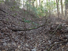
So much of that. It's really clear why that particular route had fallen out of favor.
Up near the ridge, it was terribly overgrown and it was no wonder that I hadn't seen in last time.
But! Success!
I'd discovered the road, definitively.
In the other direction, it led down to the creek, crossed it, and led right by those ruins I'd found earlier. It was a lot more obvious from that side.
I found the day's mylar balloon too.
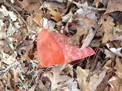
I'd started to think that I was going to go a whole day without one.
Ok! Enough of the Mill Creek Valley for one day. I pushed back up to Watkins Branch Gap. Actually, on the way up I did explore two little side trails. One petered out and the other appeared to be a more modern reroute of the original road. It was also abandoned though, and even more overgrown than the road it appeared to replace. Funny how that happens.
On the Watkins Branch side, I found where the road that led up the other side of the creek teed into the one I'd taken up and took it back down. It also appeared to be a more modern reroute, but was also much more overgrown than the original route.
There is only 1 chunk of the entire route that I haven't looked into yet. The bit that leads down from FS58E to Angel Dr. I was right there too, I really wanted to just go knock it out, but I was also a bit pressed for time. I wanted to get back in time to eat dinner with the family so I put it off and marched out instead.
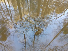
Actually, there was a water puddle full of clusters of frog eggs, so I did check that out for a minute.
But then I marched out.
I called Iz as soon as I had service and told her to tell Kathryn that I was going to be back for 6:30. Then, as I approached town, at about 6:15, I called them again and they were in line at the McDonalds drive-thru and had already ordered.
Seriously!?
I had apparently woken Iz up when I called her, and she had no memory of the conversation. She swore she hadn't talked to me. I had to get her to look at her phone's call log to prove it to her.
Teenagers.
Fine, if you guys are going to eat without me, I'm getting Mexican food which you guys don't like. Ha!
So, there's 1 little segment left of the Randa-to-Stock-Hill Route. Just 1 little segment and I'm done. Maybe I can knock it out this upcoming weekend. Of course, if my bike's out of the shop, then I'll probably want to ride that. Hmm...
Decisions, decisions.


No comments:
Post a Comment