Last Saturday night I finally felt like I was legitimately over the flu. Not 100%, but well enough to get in some real exercise - something that I wouldn't just describe as "light hiking". Where to go, though? What to do? Always the big questions. Well, I was updating some of the Blanket's Creek/Rope Mill data on my trails site and when I zoomed out I noticed a trailhead icon to the northwest that I didn't immediately recognize. What's up that way?... Oh, that's right, Pine Log.
I'd last been there years ago with Eddie, Nam, and Travis and I basically just followed them around with no idea where I was going until I got home and sifted through the GPS data. I'm not sure why I never went back, but I guess there was always something more important to do.
At any rate, noticing how close Pine Log was to Blanket's Creek made me wonder if there was a short bit of road between them. That led to a lot of research, a lot of new dotted lines on my map, and the urge to get out and explore the WMA for real.
So, Sunday afternoon I drove up and did just that.
On the way up, I drove some of the roads that I'd considered using to get over from Blankets. Ha! It's like 16.5 miles from Blanket's to Pine Log. Not exactly the short bit of road I'd hoped for.
The Pine Log lot was busy. There were several cars. There were lots of people walking back and forth to Stamp Creek with various trout rigs. It looked like the same destination had come to everyone's mind.
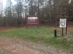
I geared up and spun over to the game check station for a minute...
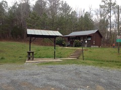
...and noticed that there was a turkey hunt going on. All the roads were open to vehicles.
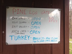
Ha! That only happens a few times a year, and I picked one of the days.
That's cool though. I had no plans to ride anything but roads today, so it ought to work out just fine.
Oh, I almost forgot... Right before I left the lot, a guy came walking up to me and asked me what kind of riding there was back in there. Turned out his name was Rob, he lived in Cartersville, rode Blankets and Rope Mill often, but had never even considered riding in the WMA, despite being right next door. I felt bad because I didn't have a ton of info for him, but after we finished talking about riding, I complimented him on his Corrosion of Conformity tee shirt, and we talked about the various times we saw them for probably the same amount of time that we'd spent talking about riding.
But, I digress...
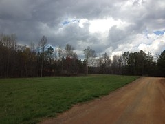
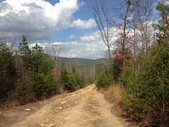
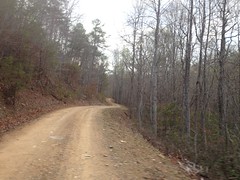
I headed up the aptly named Main Road, passing meadow after meadow...
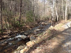
...and ultimately running up along Stamp Creek for a while...
...before bending around to the left and climbing a rather steep and unmaintained section of road up to a little knob. It looked like a trail continued, probably all the way up to Hanging Mountain, but I left it alone for the time being and, instead, bombed back down through all the ruts...
...(which somehow look like nothing at all in the photo), passed more people fishing where the road crosses Stamp Creek, and hung a left on Grassy Hollow Road.
Shortly, to my left, I noticed a well-maintained looking road and thought it might lead up to what I call "Shut-In Ridge" - the ridge on which Shut-In Creek originates. All right! I'd been looking for that road, and I felt good that I'd reached it so quickly.
But the feeling was short lived. I wasn't where I thought I was. I was looking for the WMA boundary, and before long I'd ridden much farther than it seemed like I ought to have to to hit it. Yeah, I was just off on some little spur.
The spur appeared to have been clear-cut recently.
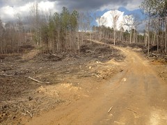
Near the top I could see 360 degrees, and confirm my location.
Dangit.
Well, better luck next time...
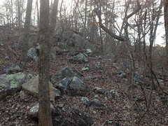
Actually, while I was up there, a moss-covered boulder field caught my eye and I climbed all over it.
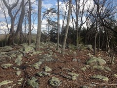
I did slip a bit though, in my bike shoes. I used to ditch the bike and go hiking all over the place, all the time, but it had clearly been a while.
Ok, back on track...
As I climbed, I noticed patch after patch of butterflies. Little black ones just sitting on the road, in groups of 10 or 12. They'd flutter up when I passed, then settle back down. I must have passed 100 little bunches of them. I'd never seen black ones like that before. It's not uncommon to see packs of light blue or purple ones up in the National Forest, usually crowded around a recent campfire or sometimes just sitting on the road, but never black.
Neat.
When I was in the vicinity of Grassy Hollow proper, I heard a vehicle approaching. The road was steep, and the driver was spinning the tires almost constantly. It sounded like he was bouncing his truck up the hill wildly, and I expected to be overtaken any second. This did not happen though. He just sat back there screeching away for like 5 minutes before he finally got past me.
The driver was a young guy, probably in his early 20's. His passenger was probably his brother, of similar age. Their 8 or 9 year old sister was riding in the bed of the truck, tumbling around as he struggled to keep the truck going kind-of straight. At first I thought maybe he was playing around, but I soon realized he just had bald tires, 2-wheel drive, and a standard differential. It was all he could do to keep it on the road, moving forward. I guess I should give him credit for commitment. If I'd had that much trouble, I'd have turned around a lot earlier.
I did find the connector to Shut-In Ridge, but the mood to explore it had passed and I pushed on.
About 2/3rds of the way around there was a nice view of the whole Stamp Creek valley.
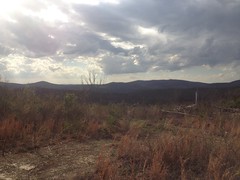
I think that's Little Pine Log Mountain in the distance. I'd be over that way later.
When I reached Rock Quarry Road, I hung a left. According to the map, it ought to run out to the WMA border, and there should be one spur leading south too. Ha! The main road forks and the correct way to go is not the obvious way. And, there are like 6 spurs leading south. They all put me at a power line cut, and a bunch of them kept going. I didn't have time to check them all out though, and the one I did follow to the end later turned out to be the wrong one.
Goodness.
I took Rock Quarry Road out to the paved road I'd driven in on. There was a WMA sign there.
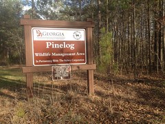
Hmm... Aubrey Corporation. Apparently that's the landowner. I looked them up later. They don't appear to have a website. They do, however, appear to be into everything from real estate to farm transportation. A quick look at a map of the area shows an Aubrey Road and two different Aubrey Lakes. They appear to be a pretty big fish in the Cartersville pond. Thanks for sharing your space, guys.
As I headed back towards the lot, I passed the Stamp Creek Church.
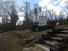
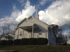
The lot was full, and an older gentleman and his wife were arriving late as I stopped to take those photos. When he opened the door, I could hear the choir singing some lively tune that I didn't recognize: "something, something, something, when I doo-ooo..." It made me happy. Made me want to go inside and sing with them. Sadly, I was a bit under-dressed, and quite a bit over-dirty.
Instead, I headed back to the lot and back up the Main Road, where I eventually hung a left and proceeded up Pine Log Gap Road.
It was actually getting somewhat late, so I kind of pushed it a bit. I felt "well" in the sense that I no longer felt like I had the flu. But I also felt like I'd been lying on the couch for two weeks. Oof. Maybe not so well, after all.
It was really rocky up near the gap itself.
And on the way up, I could also see a rock wall running up along one of the spurs to the right of the road. I suspect it's the border of an older road, where the rock was cleared to one side when they built it. I'll have to go check that out someday.
The road bombed down off the north side of the gap, hung a quick right, and flattened out. At that point, the character of the mountain changed dramatically. Dozens of little spurs ran, haphazardly, up and down the backslope, and they were all terribly eroded. There were cliffs and ledges... "Oh! I bet this was a mine! And this kind of feels like I'm on a railbed here..." I was so excited that I actually said that out loud.
A little further down the road some massive excavations confirmed the mine theory. A couple of deep cuts for the road seemed to confirm that I was, indeed, on a railbed too.
A long meadow drew out to my right. It appeared to have a creek running through it. It was mostly grass, but I thought I saw some flowers were starting to bloom. I bet it'll be spectacular next weekend.
At a point, the old rail appeared to keep going straight, through a gate, while the road dropped down to the right and crossed a creek. The creek was deeper than I expected and I ended up dunking my feet and eventually stepping off. Dangit, I'd almost managed to stay dry all day.
To my right, things looked post-apocalyptic. It took me a few seconds to sort it out. The creek tumbled down through a great rift in the hillside. At the base of the rift were the exposed ruins of a stacked stone wall. Some creation of mankind, buried by disaster, now exposed again by erosion. What was I looking at? Like I said, it took me a few seconds. All I could come up with, and it seemed unlikely, was that I was looking at the ruins of a dam, and that the meadow behind it was once a lake, that has since filled itself in. When the creek overtopped the dam, it began creating The Great Rift, which has been growing ever since.
It was pretty amazing. I know, academically, that this can happen, but I'd never seen it in action before. That is, of course, if I was right about it.
On the way out, I passed Neel Lake.
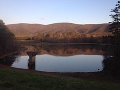
Or Floodwater Retarding Lake No. 25.
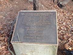
Whichever is more fun to call it.
The north entrance was just down the road.
As I approached it, 3 girls wearing shirts from some UGA sorority came tear-assing toward me in a golf cart, smiling and laughing, and having a heck of a time with the gravel. I'm pretty sure I saw both passenger-side wheels come off of the ground at the same time, but the driver saved it. It looked like they either really knew what they were doing, or REALLY didn't know what they were doing. I hope it worked out, cause I remember an episode of Jackass where it didn't, and it kind of reminded me of that.
So, at that point I had a dilemma. There's another chunk of road in the WMA called, of all things, Oak Street. I hoped to find a legal way of accessing it from that end of the world, but that would require some exploring, and it was getting pretty late. I could still see the sun, but it was low enough to blind me as I rode west. I worried that it would blind drivers coming up behind me too, so I flicked on my red blinky light, just in case it might give me that extra little bit of protection.
Nobody hit me, so I guess it worked.
Oak Street starts in the town of White and runs all the way down the west side of Little Pine Log Mountain. On topo maps, it looks like it bends around the north side of the mountain and tees in to the road I was on. But, the road had a dozen spurs and I wasn't sure which one would eventually lead me to Oak Street. Also, the bending-around was all outside of the WMA. For all I knew it was entirely on private property. Hard to say though, it might be on county land. The map made it look like there were a few access points at the back of various neighborhoods. I was optimistic, but I proceeded with caution.
The first neighborhood was called East Heritage. No luck. On one side it was posted, and on the other I'd have had to have ridden about 15 feet down some guy's driveway to get to the trail. It looked like he used the trail though, as there were 2 ATV's parked directly on it.
I bailed on the next 3 neighborhoods. The sun was down. I was getting tired, and it was like 6 miles back to the car no matter how I did it.
So, I punted, took 411 to White and Stamp Creek Road back to the car. It was officially dark as I rode into White. My blinky light was invaluable on Stamp Creek Road. It was pitch-freakin'-black. On the upside, both roads had excellent shoulders.
When I got home, I did some research. Yes, the north end of the WMA was once the Sugar Hill Iron Mine and apparently, there's a bunch of really cool stuff to see there. There appears to be some disagreement about exactly when it was in operation though. The mine was apparently worked by convict laborers who were housed on site. I can only imagine the hell that must have been. If nobody called it "Sugar Hell" at the time, they really missed an opportunity. Also, all of Oak Street, the streets at the back of that neighborhood I piddled around in, and part of Pine Log Gap Road were once part of The Iron Belt Railroad which basically ran from Cartersville up to the Sugar Hill mine, with a few stops at some other mines to the south. A topo map from 1906 shows the mine, the railroad, and everything. It also appears, in fact, that the meadow that I saw was once a lake, as was another meadow above it. Ha! Amazing.
At the south end of the WMA, there are apparently various stone furnaces and the ruins of a sawmill on Stamp Creek. The furnaces were operated pre-Civil War by Jacob and Moses Stroub as the Etowah Bloomery and the sawmill was operated post-Civil War by R. H. Jones, who made carriages, furniture, and caskets. John W. Lewis apparently owned the property at some point too, for some purpose. I guess I should have sorted all of this info out before repeating it... Don't take my word for any of this.
One funny thing... I recently added historical topo maps to my trails site, covering most of North Georgia. I should have seen everything that was on that 1906 map before setting foot on site. But! I didn't. Why not??? Well, I got all of my maps from the awesome ArcGIS USGS Historical Topo Map Explorer, and it appears to be missing that particular map! The University of Alabama Map Collection has it though, and a lot more. I may have to raid their data at some point. Though, I'm not sure that I should, on principal. You know, because it's Alabama.
Geaux Tigers.


Thanks for all this Dave. I've spent a couple mornings exploring out there and didn't see half of what you did. That, plus the researched historical info made this a real good read.
ReplyDeletealmost forgot. Thanks for the TNGA. That damn thing changed my life.
ReplyDeleteHa ha! My pleasure.
ReplyDelete