There's some weirdness on the map at the east end of the trail. I wasn't sure what I'd see when I got there. Turns out there's a private drive there. Actually, it looks like there's almost no easy way to enter that particular wilderness area unless you own property backing up to it. To get to that particular trail, it looks like I'll have to wait until they open up Rich Mountain Road for the season, walk for like 5 miles or bushwhack for farther than that. Not today.
I'd also been wanting to check out Cold Mountain. It used to be an 4WD playground, but the forest service shut all that down a few years back. What would it be like now?
I parked at the end of FS338 (Rich Mountain Road) up by Stanley Gap and jogged over to Brownlow. The last time I was there, it looked like there was a trail leading up the knob to the right, and the low-res topo maps show a trail leading from there up over Cold Mountain. There was a trail, for about 20 feet, then nothing.
I whacked and nav'ed until I ran into an old trail that led down to Brownlow Gap Road. I'd been wondering about that trail. Cross that one off the list. More whack, more nav. Found another trail I'd also been wondering about. More whack, more nav, and finally, I found the trail I'd been looking for.
It was a tough climb, but not too tough. Kind of overgrown, but not too bad. There was a lot of brush on the roadbed, but you didn't have to push through it except every now and then.
I took one wrong turn and was reminded that I wasn't the only one in the woods. Bear sign...
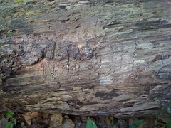
There were large scars on the hill where it climbed up off of the road, but I couldn't get a good picture of them. Gnarly.
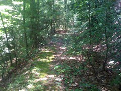
It was more difficult than I thought it would be to keep track of where I was. The trail was really twisty; back and forth across the ridge and a couple of switchbacks. I could kind of match it up to the terrain, but really there were always a couple of different places I could be. Nothing visible to sight on. Finally I got to a rock that at one time must have been a sweet overlook, and I could see a peak. I thought it was Big Bald, but it was actually Horsepen. That really threw me off.
Cold Mountain has two peaks. When I got near the top of the northern peak I finally got straight on my location. The trail didn't go over the top, so I made a quick side trip.
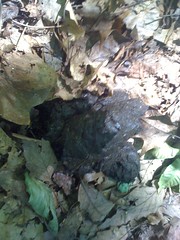
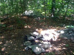
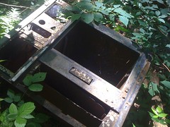
Looks like a popular place...
The fire looked like it might have been burning the night before.
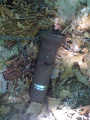
There was also this ancient flashlight. Garbage or artifact?
The trail kept going toward the southern peak, but apparently that's a less popular attraction. I kept debating with myself whether to mark it "overgrown" in my GPS. And then it just ended.
There were vague trailish things leading on. Game trails I think. I saw deer tracks on them. I followed those around to the ridge on the south side of the southern peak. The peak was covered in thorns, poison oak and ivy and other crap I didn't feel like pushing through. Screw the southern peak. The ridge south was easy to follow and before long I was kind of on a trail. It was clear that people went that way at least and the trail got more well defined as I went.
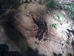
And then I saw this...
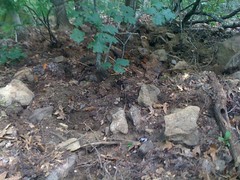
That's a hole, about 5 feet in diameter and about a foot deep. It looked like what you see when a tree falls over and the roots tear the ground up, but there was no tree. Just the hole. I guess this is pig rooting, but those rocks are like 20 to 30 pounds each. I imagined the pig that could just casually nose those around. One of those 600 pound Pig Bomb pigs. Not something I want to run into. As I walked on, I found myself keeping track of which trees I could climb.
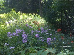
The trail teed into an old road, which led to Rich Mountain Road and a bouquet of flowers.
I was close to that Tickanetley Bald trail, but I really didn't feel like it. I guess it should have occurred to me that I'd be tired of walking after all that theme park action last week. Why didn't I think of that this morning?
The old road looked like it might lead down along upper Stanley Creek. That would be way better than walking back on Rich Mountain Road. I gave it a shot.
Yay, more craters...
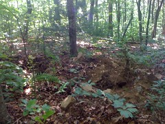
and even more!
Pig Bomb.
Maybe something else digs those. If anybody knows for sure, let me know. I kept imagining killer monster pigs.
The old road was a reasonably clean trail. I'd say about like the Hickory Nut the last time I was up there. I'd bet that before this past Spring's storms, it would have even been really nice.
Apparently it was rideable in the past, by folks who can't hop logs even.
And before that you could drive on it I guess...
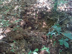
There was this weird hole too. It looked like the den of some animal.
The hole was about a foot deep with a small cave at the bottom, clearly excavated by a small mammal, per the claw marks. It looked like there were bees inside the little cave. I tapped at it with a long stick, hoping whatever was in there would pop it's head out, but all I managed to do was make the bees fly out.
Then I realized it could be a skunk's den and got right out of there.
Down near the creek, I found this 100 gallon barrel, another 55 gallon drum and some scraps of metal.
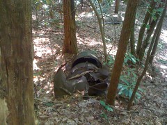
An old still? I keep wanting to find the definitive ruins of an old moonshine still.
The trail came out on Rich Mountain Road where I expected it to. There were a couple of trails and campsites down near the road too. Next time maybe.
I jogged back to Brownlow Gap and walked out from there. This single semi-ripe blackberry was the only wild edible I saw all day.
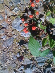
I guess technically I could have made gumbo file or sassafrass tea. I'm not talking about that. Basically fruit. That's the only fruit I saw. It tasted OK.
Ehh, that's how the whole day was. OK. On paper it was great, but really, I'm burned out on walking and riding, even fishing. I need a few nights of good sleep.


No comments:
Post a Comment